


Below is the uncorrected machine-read text of this chapter, intended to provide our own search engines and external engines with highly rich, chapter-representative searchable text of each book. Because it is UNCORRECTED material, please consider the following text as a useful but insufficient proxy for the authoritative book pages.
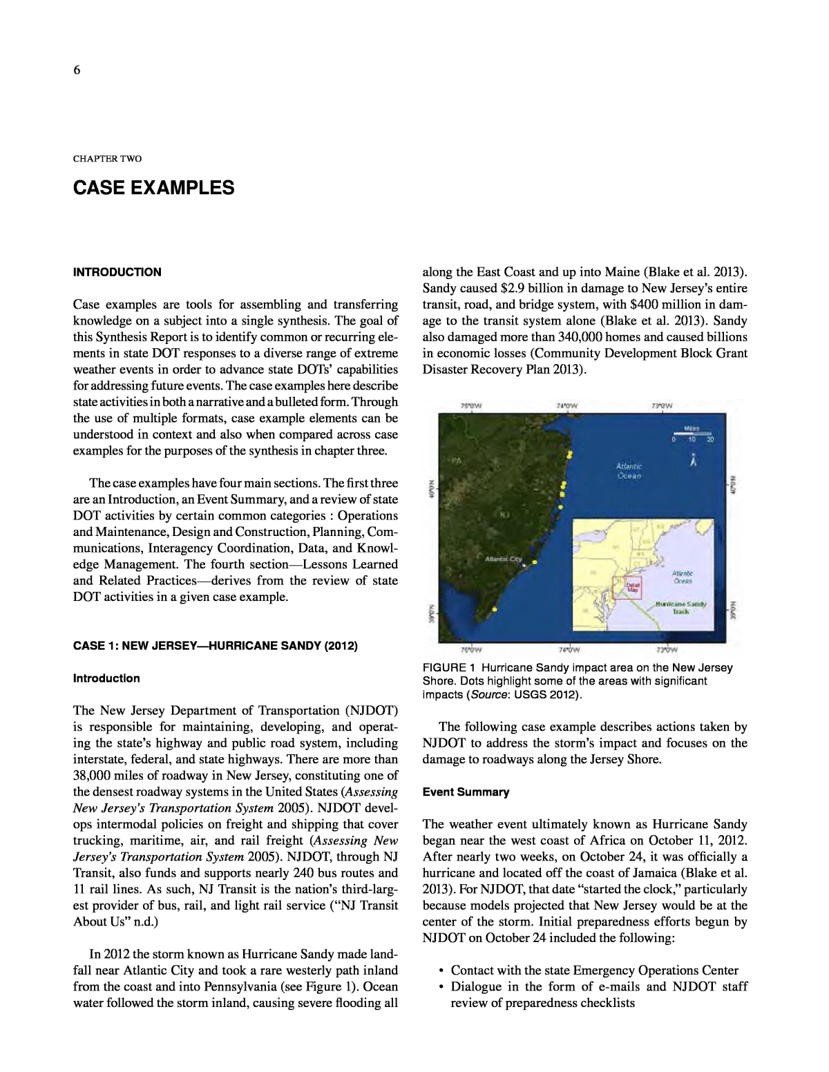
6 CHAPTER TWO CASE EXAMPLES INTRODUCTION Case examples are tools for assembling and transferring knowledge on a subject into a single synthesis. The goal of this Synthesis Report is to identify common or recurring ele- ments in state DOT responses to a diverse range of extreme weather events in order to advance state DOTsâ capabilities for addressing future events. The case examples here describe state activities in both a narrative and a bulleted form. Through the use of multiple formats, case example elements can be understood in context and also when compared across case examples for the purposes of the synthesis in chapter three. The case examples have four main sections. The first three are an Introduction, an Event Summary, and a review of state DOT activities by certain common categories : Operations and Maintenance, Design and Construction, Planning, Com- munications, Interagency Coordination, Data, and Knowl- edge Management. The fourth sectionâLessons Learned and Related Practicesâderives from the review of state DOT activities in a given case example. CASE 1: NEW JERSEYâHURRICANE SANDY (2012) Introduction The New Jersey Department of Transportation (NJDOT) is responsible for maintaining, developing, and operat- ing the stateâs highway and public road system, including interstate, federal, and state highways. There are more than 38,000 miles of roadway in New Jersey, constituting one of the densest roadway systems in the United States (Assessing New Jerseyâs Transportation System 2005). NJDOT devel- ops intermodal policies on freight and shipping that cover trucking, maritime, air, and rail freight (Assessing New Jerseyâs Transportation System 2005). NJDOT, through NJ Transit, also funds and supports nearly 240 bus routes and 11 rail lines. As such, NJ Transit is the nationâs third-larg- est provider of bus, rail, and light rail service (âNJ Transit About Usâ n.d.) In 2012 the storm known as Hurricane Sandy made land- fall near Atlantic City and took a rare westerly path inland from the coast and into Pennsylvania (see Figure 1). Ocean water followed the storm inland, causing severe flooding all along the East Coast and up into Maine (Blake et al. 2013). Sandy caused $2.9 billion in damage to New Jerseyâs entire transit, road, and bridge system, with $400 million in dam- age to the transit system alone (Blake et al. 2013). Sandy also damaged more than 340,000 homes and caused billions in economic losses (Community Development Block Grant Disaster Recovery Plan 2013). FIGURE 1 Hurricane Sandy impact area on the New Jersey Shore. Dots highlight some of the areas with significant impacts (Source: USGS 2012). The following case example describes actions taken by NJDOT to address the stormâs impact and focuses on the damage to roadways along the Jersey Shore. Event Summary The weather event ultimately known as Hurricane Sandy began near the west coast of Africa on October 11, 2012. After nearly two weeks, on October 24, it was officially a hurricane and located off the coast of Jamaica (Blake et al. 2013). For NJDOT, that date âstarted the clock,â particularly because models projected that New Jersey would be at the center of the storm. Initial preparedness efforts begun by NJDOT on October 24 included the following: ⢠Contact with the state Emergency Operations Center ⢠Dialogue in the form of e-mails and NJDOT staff review of preparedness checklists
7 ⢠Tree cutting and weed removal to minimize debris and sewer pipe cleaning to optimize drainage by mainte- nance crews ⢠Staff checks of communications systems, flashlights, and other backup equipment, as well as checks of bulk fuel tanks and vehicles, which were topped off, as appropriate. ⢠Development of evacuation plans, including consid- eration of contraflow plan in consultation with state police. On the morning October 26, the stateâs Office of Emer- gency Management increased alerts from Level 1 to 2. The State Emergency Operations Center facility in West Trenton, on the eastern side of the state, along the Penn- sylvania border, was readied to go to the next level. At that point NJDOT created a job number for tracking the depart- mentâs costs related to Hurricane Sandy, which was then in the Bahamas. In the afternoon of October 26, the state Office of Emer- gency Management increased alerts to Level 3 and held two statewide teleconferences. In these calls, each state agency of relevance in a major weather event, includ- ing NJDOT, reported on their preparedness efforts and heard forecasts and projections from the National Weather Service (NWS). Those on the line included other state agencies, county offices of emergency management, and municipalities. The business rule for the meeting was to listen in for situational awareness purposes, and any feed- back was directed through the state police. In addition to other preparations, Level 3 triggered NJDOT activities for locking down its 17 drawbridges, actions that included the evacuation of drawbridge operators and notification of the Coast Guard. On October 26, officials in Cape May County advised residents on barrier islands to evacuate (âChristie Declares State of Emergency . . .â 2012). There was also a volun- tary evacuation for Mantoloking, Bay Head, Barnegat Bay, Barnegat Light, Beach Haven, Harvey Cedars, Long Beach, Ship Bottom, and Stafford in Ocean County (âOcean County Towns Issue Voluntary Evacuationsâ 2012). The Governor ordered all residents of barrier islands from Sandy Hook to Cape May to evacuate (âHurricane Sandy: N.J. County by County Evacuations, Flooding, Closingsâ 2012). This area included Atlantic City, where the Governor also closed down the casinos (âChristie Declares State of Emergency . . .â 2012). During this time, NWS declared the storm no longer a hurricane and projected that it would be a tropical cyclone at landfall. Sandy was becoming extra-tropical, which meant it could easily connect with nearby fronts and troughs and thereby increase in size. Sandy was, in fact, growing. Also, some models included the possibility of a rare westerly course rather than a coastal path, though many other models showed a coastal or seaward path (Blake et al. 2013). Because Sandy was extra-tropical, the NWS National Hurricane Center and the local offices of the NWS did not release a hurricane warning. A warning would have set in motion extensive processes for the dissemination of informa- tion to the public, but NWS was concerned about confusion by the public over NWS terminology and its significance. As a result, the information products available from the NWS were largely forecasts indicating severe weather and a âdowngradedâ hurricane (Henson 2012; Blake et al. 2013). NJDOT emergency management personnel paid close attention to weather forecasts and supplemented what they heard with their own analysis. For example, NJDOT staff assessed the storm surge risk from Sandy with NOAAâs Sea, Lake, and Overland Surges from Hurricanes model, known commonly as the SLOSH model, and determined the range of storm surge possible from the magnitude of the storm projected. Based on their in-house analysis, NJDOT pulled crews from two maintenance yards, including one to the south near Cape May. At the end of day on Friday, October 26, NJDOT had set its activation times for the coming weekend, including estab- lishment of an âH-Hour.â âH-Hourâ was the time Sandyâs winds were expected to be greater than 39 mph, which was projected to be Sunday night/Monday morning at 2 a.m. The activation timeline meant all three NJDOT regions were on alert, and the activities at the Statewide Traffic Management Center in Woodbridge, were increased beyond their usual 24/7 readiness. The systemâs 511 resources were increased. A key goal also was to ensure state workers were pre- positioned and hunkered down when top winds came. By October 27, preparedness activities were fully under way, and NJDOT was âwaiting for Sunday,â October 28, the day when the stormâs early effects were expected to arrive. By 6:00 p.m. on Sunday, October 28, the state was at Level 4, and NJDOT crews were reporting to maintenance yards as a pre-positioning measure. NJ Transit suspended operations, and ferry service was shut down. On Monday, October 29, rain and winds hit New Jersey, and the storm made landfall at 8:00 p.m. that night. Hurricane Sandy sent a flood of ocean water over coastal seawalls and inland through inlets and rivers. According to a report by the National Hurricane Center: Sandy spared few parts of the central and northern New Jersey coast. The damage in the community of Mantoloking highlights the severity of the storm surge and waves across this region. A majority of structures there were flooded, badly damaged, or destroyed. The surge even carved a path through the barrier island, creating two new inlets. . . . In Seaside Heights, the iconic Casino Pier and Funtown Pier were destroyed; the loss of the latter caused the destruction of the local amusement
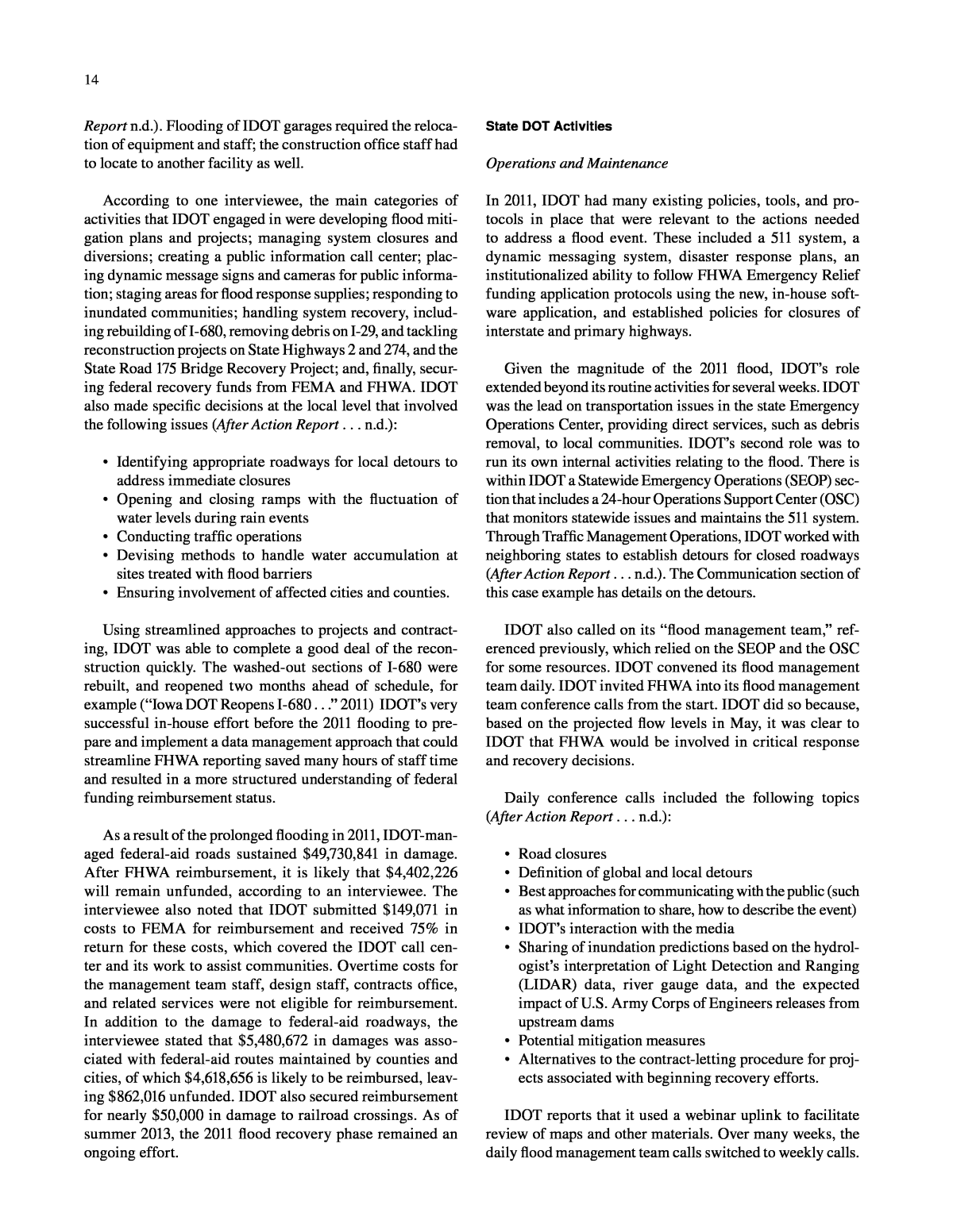
8 park. . . . Long Beach Island, a barrier island offshore of the central New Jersey coast, suffered catastrophic damage with nearly every house on the seaside shore extensively damaged. The communities of Union Beach and Sea Bright witnessed similar devastation. The storm surge also pushed water into New York Bay and up the Hudson River, causing massive flooding in Jersey City. The surge into Raritan Bay forced water up the Raritan River that resulted in flooding in nearby Sayreville. Rescue efforts by the National Guard were required to save residents stranded in the town. About half of the city of Hoboken was reportedly flooded, and at least 20,000 of its residents were surrounded by water at the peak of the surge. . . . The rail operations center of the New Jersey Transit Authority in Kearny was flooded by up to 7 ft of water, damaging as many as 74 locomotives and 294 rail cars, and several weeks passed before rail services resumed (Blake et al. 2013). More than 116,000 people were under mandatory evacua- tion order and displaced at the height of the storm (Blake et al. 2013). In some places, storm surge deposited 4 ft of sand onto roadways (Hutchins 2012). During and immediately after the storm hit on October 29, telephones landlines were down or broken. As a result, the NJDOT Chief of Operations Support, who was on site at the Statewide Traffic Manage- ment Center, could not communicate with NJDOTâs regional operations centers around the state. Cell phone networks were overloaded and unreliable. One-third to half of NJDOT had no power and the rest was relying on emergency generators. NJDOTâs Information Technology system had few, if any, problems, while NJDOT facilities in several parts of the state had wind and flood damage, as seen in the Kearny example cited by NOAA. NJ Transit was shut down entirely, and every rail line experienced damage of some kind (Community Development Block Grant Disaster Recovery Plan 2013). NJDOT officials developed their initial characterization of key issues when there were few communication channels, little power, and extensive physical damage. They determined the most immediate concerns for NJDOT operations were col- lecting debris from rights-of-way, addressing road closures (then totaling 588, including those closed as a result of downed power lines), and managing a major highway wash-out at Mantoloking. Fuel shortages, another major issue, emerged within a day of the storm passing through. To address this mat- ter, NJDOT, in coordination with law enforcement, opened up five of its maintenance fuel facilities to private citizens in the medical and emergency response professions. NJDOT also addressed the 1,100 traffic signals downed by power outages or wind. Much of this coordination was overseen by the Chief of Operations Support, still in the Statewide Traffic Management Center facility in Woodbridge, during a time when telecom- munication lines were still poor. When NJDOT had stabilized the services under its responsibility, it began its recovery phase. Clearing and reconstruction by NJDOT occurred at a steady pace, even as a November 7 snowstorm came through the region and required evacuation of NJDOT resources as well as others from the barrier islands. Despite this and other challenges, working 12-hour shifts back to back, day after day, NJDOT was able to remove its crews from shore communities by Christmas 2012. Across the state, recovery from Hurricane Sandy was ongoing when this report went to press. State DOT Activities Operations and Maintenance As the threat from Sandy became apparent, NJDOT quickly shifted into its emergency preparedness mode. Management defined key activation times for the weekend of October 27â28, which helped drive decisions before those mile- stones. One such decision was the go/no-go decision on whether to institute contraflow for east-to-west evacuations. Because the shore population was not as high as it is dur- ing the tourist season, the New Jersey Office of Emergency Management and NJDOT did not initiate contraflow; work- ing with the New Jersey Turnpike Authority, of which the Commissioner of NJDOT is the Chief Executive Officer, it did suspend tolls on the northbound Garden State Parkway and the westbound Atlantic City Parkway, starting at 6:00 a.m. on October 28 (âChristie Declares State of Emergency . . .â 2012). Other preparedness was as described earlier: clearing existing debris and pre-positioning resources based on projected storm impacts. After the storm hit, management sought to create a 24/7 âbattle rhythm,â with calls in the early morning and a recon- vening in the eveningâso that everyone knew what was expected and when, despite downed communications and other disruptive events. NJDOT reported up to the Office of Emergency Management in West Trenton and commu- nicated developments back down the chain (see Figure 2). FIGURE 2 Aerial view of Hurricane Sandy damage to the New Jersey coast, including loss of highway in upper right-hand corner, October 30, 2012 (Source: Flickr Commons, DVIDSHUB). NJDOT crews were supported by the Safety Service Patrol. The Safety Service Patrol normally patrols 225 miles
9 of the stateâs most heavily traveled roads in 8-hour shifts in 53 trucks, helping to address obstructions to traffic, includ- ing breakdowns and debris (Stanley 2013). When the NJDOT emergency response plan is activated, patrol workers take on 12-hour shifts and otherwise prepare for the event, such as securing additional fuel, protective gear, and towing straps and hooks; some trucks are fitted with plows to push expected debris (Stanley 2013). After the event, the Safety Service Patrols focused on reopening those 225 miles of highway and assisting crews in other parts of the state (Stanley 2013). Immediately after the storm passed, NJDOT sought to establish a physical presence in the hardest hit areas on the shore. They mobilized an emergency operations bus to enter the area in conjunction with the police command post at Sea- side Heights. A key decision was to break down the massive damage into workable pieces. NJDOT dedicated specific people to each of the barrier island segments remaining after the storm and made them responsible for addressing issues in those areas. For example, one person handled Route 36, another person handled the segment from Point Pleasant to Mantolok- ing, two people handled Route 35 at Seaside Heights, one per- son handled Long Beach Island, and one managed Route 152 at Atlantic City. One person was dedicated to the Route 71 Bridge, whose electrical and mechanical systems were dam- aged by wind and water during Sandy. Dividing peopleâs geo- graphical scope of responsibility according to the damaged segments made for a clear demarcation and reinforced among locals the temporary nature of NJDOTâs presence there. The NJDOT Chief of Operations Support managed the NJDOT presence at the Mantoloking site. With the objective to get roads open, he organized contractors into a âdump truck trainâ for the temporary disposal of debris, which included trees, cars, parts of homes, and thousands of per- sonal possessions. In total, NJDOT would supervise the collection and disposal of 4,425 truckloads of debris. In the course of this exercise, NJDOT set up three debris staging sites: a local traffic circle, NJDOT land to the north, and a local sewage authority lot. Use of the local lot was secured with verbal approval. At this point, it was 3 to 5 days after the storm and emergency responders still needed to get into the affected communities. Homes had burned in Brick Township, for example, where roads were blocked by debris. NJDOTâs objective was to clear the main streets for first responder access and make progress on debris removal so that communities could reopen and start their efforts to return to normal. However, in such places as Seaside Heights and Lavallette, for example, it was apparent that side streets had similar needs, and the stateâs crews, contrac- tors, and trucks were already on hand there. The question of whether the state agency could conduct the work of clear- ing side streets, which typically the local government would do, was quickly elevated to the NJDOT Assistant Commis- sioner and Deputy Commissioner; approval was secured to go off the state right-of-way to assist. This allowed residents to return sooner and engage in the self-help needed for recovery to progress. The NJDOT Chief of Operations Support brought in the agencyâs environmental unit and the Department of Envi- ronment Protection to manage the piles of debris. At that time, he also made a decision to separate out sand from the debris and vice versa, setting up a sand âcleaningâ operation that resulted in 4,330 truckloads of sand set aside for reuse on the Jerseyâs Shoreâs devastated beaches. Also during recovery, a new risk emerged: sinkholes would appear unexpectedly. NJDOT counted 80 of them between two main highways, Routes 36 and 35, for example. NJDOT needed more contractors to address this concern and had to manage pressure from local leaders to do so. Accord- ing to the NJDOT Chief of Operations Support, there was an âhour-by-hourâ balancing of what traffic control measures would be considered safe for the community. To support the agency in this and other work, NJDOT made the decision to use both in-house engineers as well as outside consultant engineers to conduct these assessments, with NJDOT mak- ing final decisions. As noted, NJDOT was in the midst of collecting debris, assessing sinkholes, and managing the reentry effort when a Norâeaster struck in the form of a snowstorm a week later, requiring the evacuation of the barrier islands to the main- land. Crews had to switch from emergency operations to routine snow-fighting operations. After the snowstorm, NJDOT went back to the recovery effort. Residents continued to return to the area. Their return made management of the projects more complex. During this time, NJDOT worked on restoring signage, making permanent patches to pavement, and other small and large recovery projects. NJDOT adopted an important manage- ment approach by setting a clear goal of accomplishing its work and leaving the area by Christmas. Managers stuck to this schedule, maintaining cohesion and morale in the pro- cess. By December 21, they had erected 1,250 new signs, oversaw major rebuilding projects, and kept the promise that crews would leave in the set time frame. As noted earlier in this case example, NJDOT established a job number for the Sandy weather event on October 26, well before damages were incurred, anticipating that the Federal Emergency Management Agency (FEMA) might reimburse preparedness activities, such as cleaning inlets and clearing trees from power lines. When President Obama later signed an emergency declaration for New Jersey on October 30, the declaration allowed the state to request federal funding and other assistance for actions taken before Sandyâs landfall and before the Presidential declaration (The Presidentâs Climate Action Plan 2012).
10 NJDOT used a lesson learned from 2011 in the aftermath of Hurricane Irene, which had caused $1 billion in damage in the state. After Irene, NJDOT staff developed âstorm kits,â which NJDOT required Hurricane Sandy crews to bring with them as they assessed damage. These storm kits walk the user through what is needed for an assessment and for substantiating federal reimbursement applications, such as taking photos before, during, and after, and noting the exact location of the site by longitude and latitude. Portions of the storm kit are in a PowerPoint presentation used by NJDOT, which is included in this report as web-only Appen- dix C. This approach streamlined the process for developing applications to FHWA and FEMA, as evidenced by the fact that in April 2013, NJDOT stated that it was completing the application process for a $2.9 billion extreme weather event from less than 6 months before. Due in part to the storm kits, NJDOT was better prepared to manage the amount of work and documentation needed to address FHWA and FEMA reimbursement issues. Design and Construction NJDOT repaired the breach at Mantoloking in 53 days, com- pleting work on December 21. Everythingâtraffic lights, curbing, and so forth.âwas returned to its pre-storm state. Also, the Route 71 bridge was fully repaired by December 19. NJDOTâs Operations staff accomplished these acceler- ated repairs by using their emergency construction contrac- tors as well as design consultants from the Capital Program Management arm of the construction unit of NJDOT. The departmentâs Operations unit teamed up with the Construc- tion unit, with Operations in lead, to oversee this rapid emer- gency construction. Planning and Related Activities During the post-Sandy process of assessment and in the development of the applications for federal reimbursement, NJDOT prepared a list of resiliency projects it believes will ensure protection of roadways and transit systems from future weather events. The resiliency projects total $2.3 bil- lion (Community Development Block Grant Disaster Recov- ery Plan 2013). Work by NJDOT, NJ Transit, and other state agencies under an FHWA climate change vulnerability grant project informed analysis and development of this sum and the project profiles. Communications Before, during, and after the storm, NJDOT followed the stateâs Incident Command System approach for emergen- cies. The Emergency Operations Center spoke for the state, including with respect to transportation issues. In many cases, the Governorâs office spoke for the state. The timing and clarity of statements made by the New Jersey Gover- nor are an example of how important leadership from the executive office can be, with the NJDOT interviewee believ- ing it was especially critical in making decisions over fuel shortages immediately after the storm. The concept of using NJDOT fuel facilities to supply fuel to first responders and medical professionals was not the first alternative in the state Continuity of Operations Plan. NJDOT credits the successful execution of this ad hoc but effective plan to clear commu- nication and leadership from the Governorâs office on down, with media and other channels getting the message out. Interagency Coordination Coordination was vital to road closures and clean-up after Sandy hit. NJDOT coordinated with local law enforcement to prioritize the roads for clearing. Previous coordination with the state police yielded a key communication and coor- dination tool during the storm In the years just prior to 2012, NJDOT had decided to âpiggybackâ on a police contract to buy P25 digital radios. These radios proved the most reliable form of communication during Sandy, facilitating coordina- tion with the state police on road closures and other issues. Road closures from downed power lines were a special cir- cumstance requiring added coordination with the power com- panies. For safety purposes, NJDOT would not let its workers go in where a power line was draped over a tree, for example. Protocol required NJDOT crews to wait for the power com- pany to determine whether the power line was alive or dead. The two entitiesâNJDOT and the power companiesâhad two different missions: one to clear the roads and the other to bring power back to the most customers. These aims were at odds with each other in many instances on the ground. NJDOT anticipates such issues and seeks to ameliorate them with each major storm, starting with underscoring with employees the safety message to wait for utility crews. As NJDOT worked street by street to open access for the public along the Jersey Shore, it coordinated with law enforcement. First, NJDOT sought to ensure that its employ- ees and contractors followed police directives. In the bar- rier islands and other shore areas, NJDOT followed the daily curfews imposed by law enforcement, just as all citizens had to do. This practice required leaving the storm zone by 4:00 p.m. every day, before nightfall, to address safety con- cerns over looting. Second, NJDOT had to manage gover- nance issues regarding who was in charge. For example, as each section opened and energy, water, and other utilities were brought on line, residents returned, many with their own contractors. The return of the populous demanded the management of additional, diverse interests; local authori- ties often very strongly represented the concerns of local residents. For example, at the Mantoloking site, there were nine municipalities in an 8-mile stretch of road, each with different ideas on security and looting. There were questions around the desirability of contractors, for example, and what authority decides what person can be allowed into the area.
11 It was a âbalancing act,â but NJDOT found ways to seek consensus. NJDOT also made incremental, executive deci- sions on governance to progress recovery, such as making a âpermanentâ traffic control change on a temporary basis: painting a double yellow line down the southbound lane of Route 35 to clearly allow north- and southbound traffic and covering any signs that indicated otherwise. Data and Knowledge Management Between pre-storm road closures for safety and the closures resulting from debris and damage to roadways, Hurricane Sandy impeded the interstate movement of freight and other private sector resources (All Hazards Consortium 2013). Typically, operators need permits to cross into the state with their goods and services. During Sandy, fleets from out of state faced permitting challenges when crossing the state line to help (All Hazards Consortium 2013). Accord- ing to NJDOTâs Manager of Freight and Planning Services, NJDOT is developing an online permitting system to issue emergency permits in advance of an extreme weather event based on such information as type of vehicle, weight, size, and cargo (All Hazards Consortium 2013). This informa- tion would be used to analyze transportation options for the driver. Regarding toll roads and their impact on traffic flow, the state worked with various groups to address toll- ing barriers right after Sandy hit (All Hazards Consortium 2013). New Jerseyâs Office of Information Technology is also working to move interstate truck traffic through tolls more quickly in such events (All Hazards Consortium 2013). Since Sandy, NJDOT has managed its knowledge base about the event in several ways. NJDOT is having its plan- ning office prepare a report on Sandy, for example. NJDOT engaged in working groups and workshops to record and trans- fer knowledge on managing impacts from extreme weather, such as those put on by the All Hazard Consortium, TRB, and AASHTO (All Hazards Consortium 2013; Shaw 2013). Also, more generally, a NJDOT Safety Service Patrol keeps records of exchanges made during response efforts, including communications with the Transportation Opera- tions Coordinating Committee, known as TRANSCOM, and the I-95 Corridor Coalition (Stanley 2013). Its post- disaster practice is to hold regular meetings with state police and to collect feedback from supervisors, with the purpose of refining response plans as needed (Stanley 2013). Lessons Learned and Related Practices The following list summarizes key practices identified in this case example by mission-related and crosscutting functions. Practices by Mission-Related Function OperationsâInitial preparedness efforts included: ⢠Contact with the state Emergency Operations Center ⢠E-mail dialogue ⢠Review of preparedness checklists by state DOT staff ⢠Checks for needed tree cutting and weed removal to minimize debris and cleaning of sewer pipes to opti- mize drainage, by maintenance crews ⢠Checking of communications systems, flashlights, and other backup equipment, and checking of bulk fuel tanks and vehicles, topping them off as appropriate ⢠Development of evacuation plans, including consideration of contraflow plan in consultation with the state police. ⢠When alerts went higher, mapping out of activation times leading up to the âH-Hour,â which is when hur- ricane winds would be 39 mph or higher, and referring to these activation times to drive later decision making, such as the go/no-go on whether to institute contraflow for the shore evacuation. ⢠Operations ICS adopting a 24/7 battle rhythm with set calls in the morning and evening ⢠Usage of Safety Service Patrol, which added supplies of fuel, protective gear, and towing line, plus plows in some cases to move debris ⢠After the event, state DOT maintaining a physical pres- ence at the most affected areas ⢠Division of the area (where recovery would take place) by the site of physical impacts, rather than agency boundaries, to make boundaries clear and temporary ⢠Seeking and facilitating high-level approval to clear side streets off the state right-of-way because state DOT equipment was already on site and clearing side streets would speed the return of residents ⢠Prior development of âstorm kitsâ and the requirement that crews bring them along on assessments, including the information needed to substantiate federal reim- bursement claims, such as photos and the exact loca- tion of damage sites ⢠Creating a job code when state Emergency Operations Center increased the alert from Level 1 to 2 ⢠Creating the code before damage was incurred, includ- ing retroactive Presidential disaster declaration, cap- turing prior activity under that code ⢠Setting a well-understood target time frame (Christmas time) for state DOT departure from recovery area. Maintenance: ⢠Deciding to have separate sites for debris and sand removed from streets, in order to clean and reuse the sand ⢠Addressing sinkhole-related issues regarding their proper assessment and over the most appropriate traf- fic control measures at the local level. Design: ⢠At the location of the major, now iconic, barrier island breach, the decision to rebuild transportation infra-
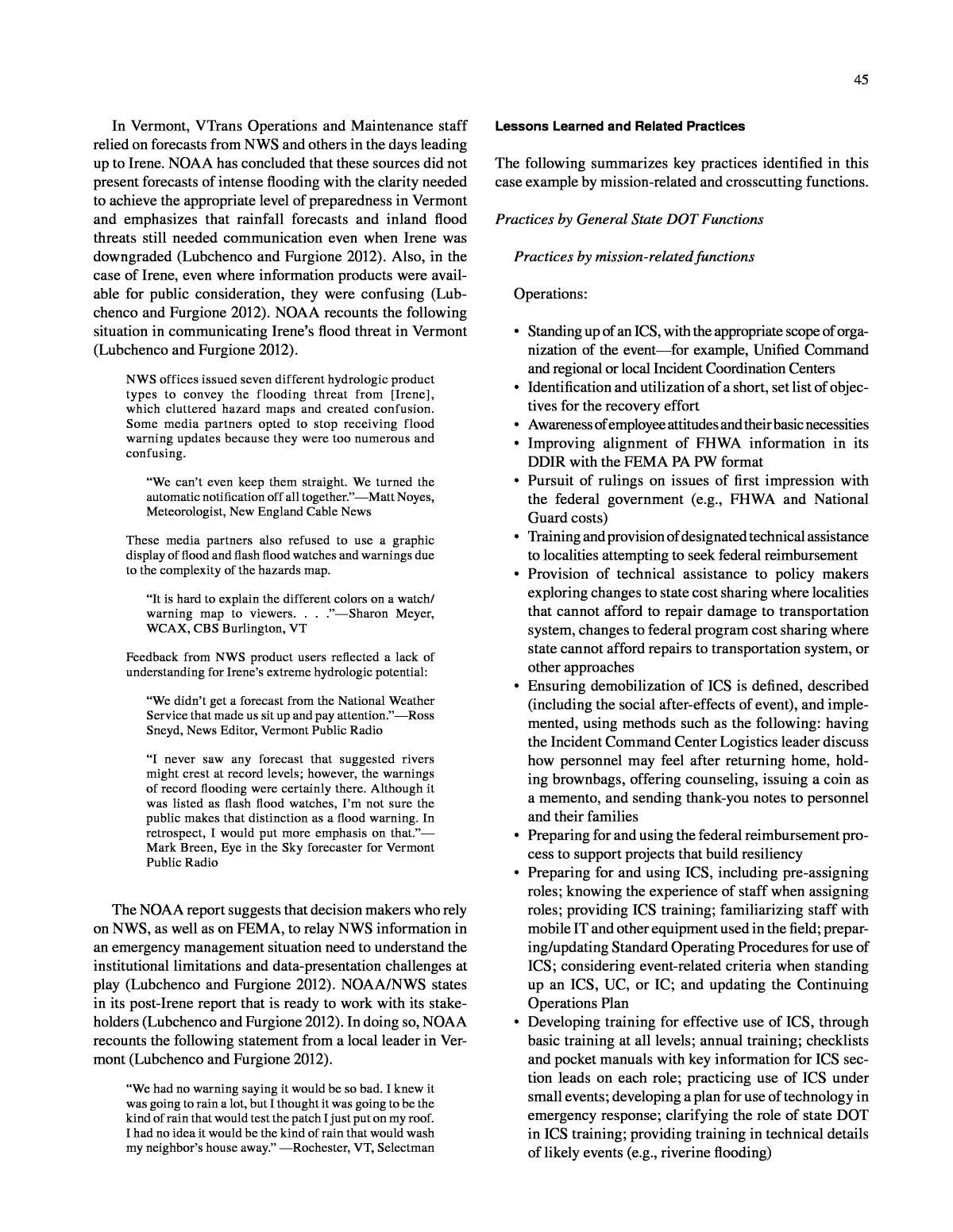
12 structure back to its original design and pre-disaster appearance under a fixed and aggressive time frame. Construction: ⢠Full repair of key areas, using emergency contractors and working with the planning side of the house for on-call design contracts. Planning: ⢠Decision to develop $2 billion in resiliency projects and make strategic choices about building back the right infrastructure, as informed by prior climate change planning funded by FHWA. Practices by Crosscutting Function Communications: ⢠Leveraging the clear communication by the Governorâs office. Interagency Coordination: ⢠Coordinating with the state police on common com- munication devices, P25 digital radios ⢠Where state DOT and power companies have conflict- ing missions and therefore challenges on the ground, reinforcing safety issues and complying with power company rules when power lines cross a roadway dur- ing recovery from an extreme weather event ⢠Resolving local traffic control issues by contracting out what appeared to be permanent traffic control changes on a temporary basis. Data and Knowledge Management: ⢠To facilitate the flow of interstate freight and other traf- fic during an extreme weather event, development of an online permitting system to issue emergency permits in advance of the event ⢠Engaging in post-event workshops and other activi- ties to share and record knowledge and lessons learned from the event. CASE 2 : IOWAâRIVERINE FLOODING (2011) Introduction The Iowa DOT (IDOT) manages road, rail, transit, aviation, and other forms of transportation. The majority of Iowaâs public roads, constituting nearly 90,000 miles, are county owned, whereas IDOT owns and manages 9,000 miles of roadway (About the DOT . . . n.d.). The state also owns more than 4,000 of the nearly 25,000 bridges in the state and main- tains 15 railroad bridges crossing Iowaâs state and interstate routes (About the DOT . . . n.d.). In May 2011, the Upper Missouri River basin experienced an entire yearâs worth of rain, and the late melt from the Rockies snowpack was 200% its normal size for the basin. These two conditions combined to cause in northwest Iowa a once-in-500-years flood, which began May 27 and lasted to October 4, when the waters receded. Among many other consequences and disruptions, damage to federal-aid high- ways totaled $55 million. This case example describes how IDOT used lessons learned from previous floods, key data sets, and communica- tion and coordination to address a prolonged flood event that, among other challenges, shut down interstates for months. Event Summary In 2011, runoff from heavy May rains and a late spring melt filled the Missouri River and the six main reservoirs in the basin. Dam operators began to plan controlled releases of the water in order to avoid catastrophic flooding in heavily pop- ulated areas (Missouri River Flood Coordination Task Force Report n.d.). In late May, the Governor of Iowa asked the U.S. Army Corps of Engineers for assistance in preparing rural communities located downstream from the proposed dam releases. He formally declared a disaster emergency and directed the stateâs emergency management infrastruc- ture to prepare for a sustained flood event (Missouri River Flood Coordination Task Force Report n.d.). IDOT immediately convened its flood management team and used the time before dam releases to develop flood miti- gation projects. IDOT interviewees reported that, as the situation developed in late May, IDOT maintenance par- ticipated in daily updates from the internal team. Given the lead time before the dam releases, maintenance staff could be pre-positioned in coordination with other districts. The staff watched for damage to the system on the ground, such as blocked culverts. Key preparedness activities included setting up these pre-determined staging areas, confirming disaster response staffing, and deploying the Intelligent Transportation System (ITS) capabilities of IDOT, includ- ing cameras for public views of inundated roads. When the dam releases began, they led to flooding that closed downstream sections of Interstate 29, which is a northâ south artery that runs along the Iowa side of the Missouri River, across from Nebraska (see Figure 3). By mid-June, the U.S. Army Corps was releasing water at twice the previous record; other parts of I-29 flooded, and four miles of Inter- state 680 washed away (see Figure 4). Railroad tracks also flooded, and a change in the Missouri River channel damaged the IA-175 bridge between Iowa and Nebraska (see Figure 5).
13 as a result of closed roads (Missouri River Flood Coordina- tion Task Force Report n.d.). Nearly one-fifth of these extra miles were add-ons to worker commutes (Missouri River Flood Coordination Task Force Report n.d. ). IDOT itself suffered impacts to maintenance garages, rest areas, and weigh stations, as well as to its Regional Weather Informa- tion System (Missouri River Flood Coordination Task Force FIGURE 3 Map of the flooding-affected area in Iowa, as delineated by the multiple-month interstate detour (2011). In total, 60 miles of the primary highway system in Iowa were closed down, requiring detours hundreds of miles long. Soon, a 75-mile stretch of the Mississippi had no river cross- ings for vehicles (After Action Report . . . n.d.). In the case of I-680, the closure from the washout lasted 4 months. The out-of-distance travel had a cost to system users, with IDOT calculating that people had to travel an extra 1 million miles FIGURE 4 Flooding of the Missouri River in Iowa, with Interstate 29 inundated in proximity to Omaha, Nebraska, which is in the upper right-hand corner, August 3, 2011 (Flickr Commons, OMA STEVE). FIGURE 5 Crews at work on the IA-175 Missouri River bridge at Decatur, Nebraska, 2011 (IDOT).
14 Report n.d.). Flooding of IDOT garages required the reloca- tion of equipment and staff; the construction office staff had to locate to another facility as well. According to one interviewee, the main categories of activities that IDOT engaged in were developing flood miti- gation plans and projects; managing system closures and diversions; creating a public information call center; plac- ing dynamic message signs and cameras for public informa- tion; staging areas for flood response supplies; responding to inundated communities; handling system recovery, includ- ing rebuilding of I-680, removing debris on I-29, and tackling reconstruction projects on State Highways 2 and 274, and the State Road 175 Bridge Recovery Project; and, finally, secur- ing federal recovery funds from FEMA and FHWA. IDOT also made specific decisions at the local level that involved the following issues (After Action Report . . . n.d.): ⢠Identifying appropriate roadways for local detours to address immediate closures ⢠Opening and closing ramps with the fluctuation of water levels during rain events ⢠Conducting traffic operations ⢠Devising methods to handle water accumulation at sites treated with flood barriers ⢠Ensuring involvement of affected cities and counties. Using streamlined approaches to projects and contract- ing, IDOT was able to complete a good deal of the recon- struction quickly. The washed-out sections of I-680 were rebuilt, and reopened two months ahead of schedule, for example (âIowa DOT Reopens I-680 . . .â 2011) IDOTâs very successful in-house effort before the 2011 flooding to pre- pare and implement a data management approach that could streamline FHWA reporting saved many hours of staff time and resulted in a more structured understanding of federal funding reimbursement status. As a result of the prolonged flooding in 2011, IDOT-man- aged federal-aid roads sustained $49,730,841 in damage. After FHWA reimbursement, it is likely that $4,402,226 will remain unfunded, according to an interviewee. The interviewee also noted that IDOT submitted $149,071 in costs to FEMA for reimbursement and received 75% in return for these costs, which covered the IDOT call cen- ter and its work to assist communities. Overtime costs for the management team staff, design staff, contracts office, and related services were not eligible for reimbursement. In addition to the damage to federal-aid roadways, the interviewee stated that $5,480,672 in damages was asso- ciated with federal-aid routes maintained by counties and cities, of which $4,618,656 is likely to be reimbursed, leav- ing $862,016 unfunded. IDOT also secured reimbursement for nearly $50,000 in damage to railroad crossings. As of summer 2013, the 2011 flood recovery phase remained an ongoing effort. State DOT Activities Operations and Maintenance In 2011, IDOT had many existing policies, tools, and pro- tocols in place that were relevant to the actions needed to address a flood event. These included a 511 system, a dynamic messaging system, disaster response plans, an institutionalized ability to follow FHWA Emergency Relief funding application protocols using the new, in-house soft- ware application, and established policies for closures of interstate and primary highways. Given the magnitude of the 2011 flood, IDOTâs role extended beyond its routine activities for several weeks. IDOT was the lead on transportation issues in the state Emergency Operations Center, providing direct services, such as debris removal, to local communities. IDOTâs second role was to run its own internal activities relating to the flood. There is within IDOT a Statewide Emergency Operations (SEOP) sec- tion that includes a 24-hour Operations Support Center (OSC) that monitors statewide issues and maintains the 511 system. Through Traffic Management Operations, IDOT worked with neighboring states to establish detours for closed roadways (After Action Report . . . n.d.). The Communication section of this case example has details on the detours. IDOT also called on its âflood management team,â ref- erenced previously, which relied on the SEOP and the OSC for some resources. IDOT convened its flood management team daily. IDOT invited FHWA into its flood management team conference calls from the start. IDOT did so because, based on the projected flow levels in May, it was clear to IDOT that FHWA would be involved in critical response and recovery decisions. Daily conference calls included the following topics (After Action Report . . . n.d.): ⢠Road closures ⢠Definition of global and local detours ⢠Best approaches for communicating with the public (such as what information to share, how to describe the event) ⢠IDOTâs interaction with the media ⢠Sharing of inundation predictions based on the hydrol- ogistâs interpretation of Light Detection and Ranging (LIDAR) data, river gauge data, and the expected impact of U.S. Army Corps of Engineers releases from upstream dams ⢠Potential mitigation measures ⢠Alternatives to the contract-letting procedure for proj- ects associated with beginning recovery efforts. IDOT reports that it used a webinar uplink to facilitate review of maps and other materials. Over many weeks, the daily flood management team calls switched to weekly calls.
15 issues a DDIR report number. When the submitter completes the form, the system generates an e-mail notification to the administrator. The administrator can approve or reject the DDIR. If approved, the DDIR is then forwarded through the system to FHWA. In doing so, the system generates an e-mail to FHWA and various offices, including Accounting, Environ- mental, Contracts, and any other office selected on the DDIR. FHWA then opens the DDIR in the system and has the ability to approve, approve with changes, or reject. The system saves all information from the form into a database and also sends the form with attachments to the Electronic Records Manage- ment System. As may be necessary in some instances, the system allows users to revise or cancel the DDIR. IDOT used its electronic DDIR for the first time during the 2011 flood. It was a very successful implementation that saved many staff hours, according to the IDOT interviewee. After the flood receded, IDOT participated in the Gov- ernorâs Missouri River Recovery Coordination Task Force, which oversaw the stateâs recovery efforts. The task force was a temporary group of state agency representatives and interested stakeholders that analyzed and shared damage assessment data, coordinated assistance across various stakeholders, monitored progress, and ultimately captured effective practices and lessons learned. It produced a report that included a statewide After Action Report (AAR) in its appendices (Missouri River Flood Coordination Task Force Report n.d.). The Governorâs task force exercise took place in the fall of 2011 while recovery and reconstruction efforts were under way. In 2012, when major recovery efforts were complete, IDOT produced an AAR at the department level. The IDOT AAR used surveys and structured interviews to record best practices, and IDOT hired a private consultant to support this work (After Action Report . . . n.d. ). An AAR is a com- mon practice for recording an agencyâs response to a major event. The IDOT department-level AAR is included in this report as web-only Appendix D. The IDOT AAR organized findings around five key ele- ments from the IDOT response to the 2011 flood. These five elements are Information Sharing and Communication, Staffing, Decision Making, Data and Technology, and Miti- gation Measures (After Action Report . . . n.d.). It is useful to this Synthesis Report to align these five elements in the IDOT AAR with the functional categories used in each case example here. As a result, this case example reports on each IDOT AAR category with the following approach. ⢠The AARâs summary of Information Sharing and Communication is covered in the Communications section of this case example. ⢠The AARâs summary of Data and Technology is cov- ered in the Data and Knowledge Management section of this case example. IDOT included in its flood management team participants from across IDOT, including purchasing, contracts, environ- mental, design, maintenance, IT, the Public Information Offi- cer, communications, geographic information system (GIS) staff, and bridges and structures staff. Other state agencies and federal agencies were also included. IDOT had managed a major flood in 2008, and a key lesson learned was to focus on more than the eventâs response phase right at the start and to begin recovery work (After Action Report . . . n.d.). IDOT officials believe the effort to include a broad range of divisions early on was effective in many ways. IDOT utilized an in-house hydrologist whose contributions to the preparedness activities in May and early June 2011 mitigated the impacts of the dam releases when they finally came. IDOT also maximized the IT specialists under its purview, using them for Internet communications and GIS activities. Early coordination also was effective with respect to IDOTâs responsibility to secure reimbursement from federal funding sources. IDOT draws on many units and experts to assess damage, estimate costs, conduct recovery work, and seek reimbursement. Because of its prior preparation, IDOT had on hand trained staff who could act as project officers on the federal program reimbursement process in disaster situations such as this. Additionally, the IDOT Contracts and Accounting Offices had designated staff trained in the Emergency Relief program process, and each district had a local system engineer to assist in that process as well. Coor- dination and pre-designation of trained staff also helped in debris removal. As the flood event played out, IDOT was able to put contracts in place for debris removal before the water levels went down. Ultimately, IDOT received 100% federal reimbursement for debris removal. An IDOT interviewee reports that prior experience with disasters spurred the agency to use its own internal resources to improve applications for FHWA reimbursement; it devel- oped an âelectronic DDIR.â As noted elsewhere in this report, DDIRs (Detailed Damage Inspection Reports) are the FHWA forms through which states provide certain data on infrastructure damage in application to the FHWA Emer- gency Relief program. The electronic DDIR application was developed to allow IDOT employees, counties, cities, and Iowa Department of Natural Resources and Iowa Office of Rail Transportation locations to initiate the DDIR process in the same way. At the start of the electronic DDIR process, a person accesses the required DDIR form. Along with the form, the system generates the required map and allows documents and pictures to be attached. The system allows the user to select certain information from drop-down menus (such as event number), generates messages to the user if certain fields are not correct, and
16 â Expediting decision making with a small-group structure for project-level decisions and confiden- tial matters â Ensuring that staff is trained and coordinating an agency wide implementation of a formal ICS â When possible, using established vendors or resources already under contract to control spend- ing and avoid duplicating efforts. ⢠Managing the transition from response to recovery (while the response is ongoing): â Establishing a separate working group that begins work on recovery early in the event while others manage the flood response â Requesting advice from contractorsâ associations about how the agency can work more effectively with contractors in initiating a prompt and effective recovery effort â Avoiding seeking the âperfectâ solution when pre- paring designs for emergency repairs â Applying innovative contracting practices such as lump-sum, limited-design contracts, and no-excuse bonuses to expedite reconstruction projects â Employing a debriefing process at the onset of the recovery efforts to document successes and chal- lenges as the projects move forward. Regarding mitigation measures, the IDOT AAR high- lighted certain lessons learned and related practices, sum- marized as follows: ⢠Selecting a mitigation measure that fits the circum- stances of the site. Consider length, location, available resources, and the time available before overtopping becomes a significant concern. â Considering the impact of mitigation measures on adjacent land uses â Conducting a costâbenefit analysis to compare measures â Using inundation predictions to assign mitigation resources to locations where they are most likely to help. ⢠Keeping abreast of new mitigation technologies. Enter new products as they are identified in the IDOT purchas- ing system to expedite their use during an emergency. ⢠Considering the following practices when using large flood-barrier systems: â Install on roadways with paved shoulders â Lower traffic speeds â Delineate the barriers using striping or another method â Establish width limits for treated areas â Identify alternate routes for trucks hauling material. ⢠Using sandbags and pumps for smaller, more confined locations when the water will not rise above 2 ft. ⢠Being prepared to develop innovations that address unintended consequences of mitigation measures (e.g., ⢠The AARâs summary of Staffing, Decision Making, and Mitigation Measures are addressed directly here because they pertain mostly to Operations and Maintenance. Regarding staffing practices, the IDOT AAR highlighted certain lessons learned and related practices, summarized as follows: ⢠Using the eventâs staffing practices as a starting point to create a template for future events ⢠Involving at the outset all DOT offices affected by the event or with expertise that could aid in managing the event ⢠For events of long duration: â Seeking the assistance of vendors, contractors, or other outside resources, as needed, to ensure the timely completion of response-related activities â Designating a small group to focus on recovery as response efforts continue. ⢠Involving state agencies with responsibility for permit- ting or other related issues earlier in the event ⢠Adapting the current process/responsibility for man- aging vendor contacts so it can be more flexible and take less time ⢠Making arrangements to engage consultants, if needed, to assist with damage assessments and other recovery work while DOT staff is still engaged in the flood response ⢠On a case-by-case basis, weighing two factors of the consistency achieved through uniform control of con- sultants against the benefits gained through the appli- cation of local knowledge from internal staff members. Regarding decision-making practices, the IDOT AAR highlighted certain lessons learned and related practices, summarized as follows: ⢠Involving the right people â Erring on the side of inclusion when developing the list of participants in the event response. Consider involving support services that handle equipment, signs, purchasing, and traffic and safety, as well as research and technology. â Ensuring the early and effective engagement of the Iowa DOT management, SEOP staff, and regional partners. Use the circumstances of each event to guide the extent of ongoing management participation. â Identifying critical connections and clearance requirements with resource agencies (FHWA, Iowa DNR, and the U.S. Army Corps of Engineers) early on, while considering the impacts to and involve- ment of local agencies. â Encouraging the active engagement of district staff in decision making and identifying innovative solutions. ⢠Structuring the decision-making process â Providing clear direction on the goals for response and preliminary recovery, and clarifying responsi- bilities for carrying out these related efforts
17 water accumulating because of a lack of drainage on the roadway). ⢠Tracking the areas that were overtopped during the current event and considering them for reconstruc- tion projects that raise the mainline to prevent future problems. Design and Construction According to IDOT, recovery of Iowaâs transportation sys- tem involved five major reconstruction projects at the state level, some of which were noted earlier in this case example. Two involved state roads, two were interstates, and one was a bridge to Nebraska. Under the rules existing at the time, in order to get 100% reimbursement from FHWA, IDOT had to complete con- struction within 180 days from the start of the emergency. The start of the emergency is typically the day of the disas- ter declaration, which in this case example was May 25, 2011. The 180-day time frame meant the deadline for 100% reimbursement was November 20, 2011; however, the flood waters did not recede until mid-October, confounding the reconstruction schedule (After Action Report . . . n.d.). IDOT developed ways to accelerate both the contract pro- cess and construction. The IDOT AAR describes the following practices used to expedite project procurement and delivery. First, IDOT was able to shorten the letting schedule commonly prescribed by state rules based on the emergency circumstances. IDOT also worked with its federal partners and secured an exemp- tion from federal rules that required a 21-day time frame for advertising projects that are not emergency repairs. With this special exemption, IDOT was able to advertise projects in a 10-day time frame. Next, IDOT created a set cycle for letting contracts. Information on proposed projects was due internally each Wednesday afternoon, and those approved were placed on the IDOT website on Friday for bidding. By the following Wednesday, bids on the project subject to the shortened state schedule were accepted, whereas those using the 10-day federal advertising time frame were accepted at the end of that deadline. IDOT also used incentive clauses in contracts to encour- age quicker delivery. A âno-excuse bonusâ tied payment of a bonus to delivery by a set date, which may or may not be the delivery date. IDOT ensured that the contract for the recon- struction of the damaged segment of I-680 included a âno- excuse bonusâ date of November 20, which was the last day IDOT could receive 100% reimbursement. The contractor would get $2 million if it delivered by November 20. Also, each day before November 20 that the project was delivered would yield an $82,000 incentive. If the contractor went past the overall project due date of December 23, the contractor would be charged $82,000 per day for late delivery. With respect to design, the I-680 reconstruction also pro- vides an example of success in IDOTâs management of the recovery phase. As noted, the flood washed away the inter- state in the summertime, and IDOT needed to design the replacement before the winter season and before the 180-day period ended. To accelerate work, IDOT determined that a limited designâbuild approach was feasible. IDOTâs deter- mination was based on the availability of original plans from the interstateâs development in the 1960s and on the fact that the footprint of the rebuild could be the same. IDOT initiated the design process even before the water levels had fallen. To do so, IDOT broke from its usual practice and used a consul- tant, rather than an in-house resource, to conduct the inspec- tion of the project. IDOT interviewees considered this type of flexibility an effective practice under these circumstances. Planning and Related Activities As noted earlier, the 2011 flood event response drew from experts across IDOT. Because the dam releases were con- trolled, there was a window in which IDOT staff could pre- pare for the eventual inundation. For example, the IDOT planning team was brought in to support mitigation efforts. They first identified 21 locations as flood mitigation sites, and this number was later narrowed to 14. Of these, seven were eventually closed. Two sites did not need mitigation; however, five could remain open because of the mitigation measures IDOT was able to put in place (Missouri River Flood Coordination Task Force Report n.d.). Ultimately, the IDOT planning team was able to design mitigation projects to keep major stretches of I-29 open, along with a key IowaâNebraska road, Highway 30 (Mis- souri River Flood Coordination Task Force Report n.d.). The team relied on geospatial data (e.g., GIS and LIDAR) in decisions on mitigation projects, as described by the Gov- ernorâs Missouri River Recovery Coordination Task Force: Using LIDAR information, the entire preliminary bridge staff worked countless hours to more precisely pinpoint areas of potential impacts so that Iowa DOT management could coordinate possible detour routes with the districts and neighboring states. Without this data, Iowa DOT would not have been able to assess and predict the risks to infrastructure and identify potential mitigation opportunities. IDOT planners also supported the flood recovery effort by determining the impact of various road closures that had been put in place. Road closures required detours, and IDOT used a computer-based travel model to determine the increase in the number of miles people had to travel in western Iowa because of the detours. The model compared total vehicle miles trav- eled before and after the roads were closed owing to flooding. It showed possible rerouting around road closures and antici- pated the next most likely route a driver may choose. Based on the model, IDOT could understand the social and eco-
18 nomic impacts its stakeholders may have been experiencing. For example, travel to and from work accounted for approxi- mately 18% of the increased miles traveled under the detours (Missouri River Flood Coordination Task Force Report n.d.). Another planning issue relates to training and readi- ness. Based on prior flood experiences, IDOT had made sure its staff received training in the essentials of an Inci- dent Command System. According to an interviewee, field staff received ICS training in 2006â2007; and after the 2008 flood, division directors and construction leads also received the training. Although a mature ICS approach was not in place completely in 2011, when the flooding event began (After Action Report . . . n.d.), there was support for the ICS approach during the event âfrom the manage- ment level down to the garage-level staff,â according to an interviewee. IDOT has implemented further ICS training, and it also is advancing its approach to Emergency Trans- portation Operations (ETO; After Action Report . . . n.d.). ETO seeks to prepare states departments of transportation for nonrecurring events that require the support or involve- ment of nontraditional transportation stakeholders, such as law enforcement and emergency management communities (Emergency Transportation Operations 2013). This demar- cation of roles and responsibilities helps elevate and accel- erate preparedness activities to a higher priority. IDOT is working with the Iowa State Patrol to incorporate ETO into its standard ICS structure (After Action Report . . . n.d.). According to one interviewee, IDOT is considering possi- ble performance metrics for extreme weather events under an ETO. Communications According to IDOT, forms of public communications included traditional press releases and media contact by the department Public Information Officer. For the 2011 flood- ing event, IDOT also adopted new ways to communicate with the public, such as a 24-hour call center and a web page devoted to the flood. IDOT also directed ITS cameras along flood corridors so the public could see road impacts. In its AAR, IDOT presents an analysis of the varied func- tionality seen across the ongoing 511 website, the flood web- site in place for 5 months, and the call center put in place for 5 weeks right after the flood. The After Action Report (n.d.) also notes that increased smart-phone use by the public sug- gested more use of the 511 website and the flood website than might have been seen in the past. During the 2011 flood event, incoming requests to IDOT from communities arrived through the statewide EOC (After Action Report n.d.). IDOT picked up the queries and ensured the interests of particular groups and transportation stake- holders were handled by the relevant IDOT office. For exam- ple, according to an interviewee, IDOT worked directly with the Iowa Motor Truck Association to address the concerns of freight haulers seeking exceptions to permits and the sus- pension of certain regulatory provisions. Another communications issue relates to detours. The prolonged detour of traffic was a major communication challenge to explain to a broad and diverse audience. IDOT decided between two different approaches. One school of thought was to encourage the use of global detours that utilize interstate highways and inform the public of closed routes. Another approach was to provide travelers with cus- tomized routes using local primary roads that limit out-of- distance travel (After Action Report n.d.). Regarding information sharing and communication prac- tices, the IDOT AAR highlighted certain lessons learned and related practices, summarized as follows: ⢠Identifying the participants â Considering the early engagement of DOT divi- sions or offices that may assist in the flood response, including front-line support services that handle equipment, signs, purchasing, and traffic and safety, as well as research and technology â Establishing a core group that expands as needed with the staff required to address the issues at hand that day â Engaging neighboring states immediately if it appears that a regional detour will be required â Ensuring that all communication with regard to regional or local detours is provided in a timely manner. ⢠Structuring the meetings â Setting a goal and purpose for project team meetings â Carefully structuring meeting agendas to move from general information sharing to more detailed discussions. ⢠Crafting and delivering the public message â Establishing consensus on the nature and extent of the public message and ensuring delivery of a con- sistent message â Designating one individual within the DOT as the party responsible for managing information flow â Implementing a policy that identifies the agencyâs philosophy with regard to detoursâregional or localizedâand describes how information about detours will be disseminated â Clarifying the DOTâs position on the primacy of the stateâs 511 website as the source for traveler information â Regularly prompting those contributing informa- tion to an event-specific website to ensure that the siteâs information is accurate and current â Evaluating the need for a call center to respond to public inquiries, taking into consideration the extent and nature of an event and available resources
19 â Placing the call center team in one room with a cubi- cle design to enhance privacy â Considering the use of a software program that pro- vides statistics on caller volume. Other forms of public communication associated with the 2011 flood include use of the âTurn Around Donât Drownâ public service messaging. The National Weather Service has promoted use of the phrase as a cautionary message to the driving public in order to warn of the dangers of driving into water on a roadway (âTurn Around Donât Drown Suc- cess Storiesâ 2011). In September 2011, IDOT posted on its website a âTurn Around, Donât Drownâ message alongside footage of a car abandoned in high water by its driver. The IDOT website described how the driver had been diverted by road closures from flooding, only to dangerously (and unsuccessfully) attempt to drive across a flooded roadway (âTurn Around Donât Drown Success Storiesâ 2011). Interagency Coordination Interviewees from IDOT provided a long list of the agen- cies and entities it relied on: Nebraska Department of Roads (NDOR), Missouri Department of Transportation (MoDOT), FHWA, the Iowa Homeland Security and Emer- gency Management Division (IHSEMD), Iowa State Patrol (ISP), Department of Corrections, U.S. Army Corps of Engi- neers (Army Corps), contractors, and consultants. IDOT also included the following agencies in ongoing planning and briefing meetings: department management and staff, district management and staff, the Motor Vehicle Division, ISP, HSEMD, NDOR, Kansas Department of Transporta- tion, MODOT, Army Corps, NWS, and FHWA. As noted, IDOT held daily and, later, weekly flood webinar planning meetings. It also participated in NWS briefings, Army Corps phone calls, state homeland security activations, and confer- ence calls. IDOT addressed multimodal impacts through strong interagency coordination. A critical impact was damage to the railways. One illustration of the problem is described in the Governorâs task force report and is summarized in this paragraph (Missouri River Flood Coordination Task Force Report n.d.). Two major railroad companies whose operations were threatened had rail lines that together car- ried as many as 75 to 85 trains per day across the Missouri River. These are key routes for carrying coal from the west- ern mines to eastern power plants. Because of the potential economic consequences of the closures from the flooding, both railroads brought in the labor, equipment, and supplies needed to keep the lines open. They raised the track structure up to 7 ft for several miles. They also raised bridges, added culverts, and built dikes to avoid track damage. IDOT coor- dinated with the railroad companies in several ways. IDOT facilitated better access for repair materials by suspending an IDOT construction project. It also facilitated dialogue among railroad employees, state and county highway officials, and emergency management personnel during the repairs (Mis- souri River Flood Coordination Task Force Report n.d.). Strong and sustained coordination with several stake- holders was also needed to secure agreement on rebuilding the Iowa state highway 175 bridge, according to IDOT inter- viewees. The following entities and their respective legal departments had a say in the project and its proposed fund- ing sources: IDOT, the toll bridge authority, FHWA, and the state of Nebraska. IDOT believes it was a lesson learned that it should anticipate how to avoid or better manage such a complex negotiation among multiple organizations and dur- ing a limited window for reconstruction. Data and Knowledge Management IDOT had multiple sources of information that could aid in addressing the flood. Staff had to analyze the quality of each source for use in decision support (After Action Report n.d.). Data sets included federal water management data, LIDAR, GIS, aerial photography, and photogrammetry combined with over-flight data. Technologies for presenting informa- tion included the Internet; dynamic message signs, including overhead, side-mount, and portable signs; portable and fixed cameras for monitoring risk areas; Highway Advisory Radio to supplement cellular networks; and cellular communica- tion, including technology permitting callers to access other networks when one provider failed. The variety of data and technologies delivering them proved useful. IDOT determined that the Army Corps flood- inundation projections were useful generally but had some limitations. As a result, IDOT turned to the stateâs LIDAR data sets to make key asset management decisions, accord- ing to an interviewee. An example is detailed by the Mis- souri River Recovery Coordination Task Force: Iowa DOT was able to determine a worst-case flooding scenario that revealed that [a key maintenance] garage sat on high ground and would not be inundated. This allowed Iowa DOT to leave materials and equipment in place. Typically, Iowa DOT would have moved the resources as a precautionary measure, but because of LIDAR, it was determined that the movement of materials from this garage was unnecessary. IDOT used LIDAR to identify areas of likely inundation where water was rising or if there were levee failure, supple- menting aerial shots. It should be noted that IDOT invested in LIDAR data sets after a major 2008 flood, and its experts estimate that the superior coverage from these data sets puts the state among the top five states in this country with respect to this resource (After Action Report n.d.). IDOT brought focus and attention to the role of geospatial information in flood response and recovery. For example, it
20 convened sit-downs after its daily flood planning meetings specifically to review data and information in the form of the flood projections, LIDAR, real-time elevations, and aerial photography. Geospatial experts also received daily reports from district staff and supported the development of infor- mation used in Damage Survey Summary Reports submit- ted to FHWA, according to IDOT. Regarding Data and Technology practices, the IDOT AAR highlighted certain lessons learned and related prac- tices, summarized as follows: ⢠Establishing and maintaining lines of communication for effective collaboration and information sharing between the U.S. Army Corps of Engineers and IDOT to ensure early notice of the potential for flooding. ⢠Continuing to make effective use of LIDAR to prepare inundation predictions. â Consider investment in a 2-D hydraulic model of the Missouri River that shows inundation areas and auto- mates the process used during this event that applied LIDAR data to develop inundation predictions. ⢠Making effective use of aerial photography and updating photogrammetry early in the event to gain a better under- standing of the scope of the upcoming recovery efforts. ⢠Making effective use of Intelligent Transportation System components. â Placing portable cameras to monitor water levels at ramps and intersections prone to flooding during heavy rain events. â Using DMSs to notify travelers of detour routes. Supplement this signage with static signs to trail- blaze the detour route. â Ensuring timely and effective management of mes- saging for DMSs. â Employing Highway Advisory Radio when cellular communications are interrupted. ⢠Evaluating opportunities to expand the development and use of GIS-related data. ⢠Considering gathering traffic data to aid in managing traffic flows during the event. In addition to capitalizing on diverse data sets, IDOT engaged in important Knowledge Management practices. The creation of the IDOT AAR is a Knowledge Management practice. As may be observed in the preceding discussion, IDOTâs AAR includes information and many insights sup- porting the case example presented here; for that reason, it is included as web-only Appendix D, as noted earlier. Similarly, the content and format of the Iowa Governorâs task force report, which included the Iowa Homeland Secu- rity and Emergency Management Division AAR, are use- ful as a reference for those not involved in the 2011 flood event. The statewide perspective in the Governorâs task force After Action Report emphasized the utility of IDOT assets for staging disaster response activities, such as the strategic use of IDOT garages (Iowa 2011 Missouri River Floods After Action Report 2011). Further, the Iowa Home- land Security and Emergency Management Division notes in its AAR that it has identified the use of such facilities as staging areas as a candidate âLesson Learnedâ for entry into the U.S. Department of Homeland Securityâs Lessons Learned Information Sharing (LLIS.gov) system (Iowa 2011 Missouri River Floods After Action Report 2011). In another Knowledge Management effort, IDOT pres- ents the story of the 2011 flood through an online âstorifyâ project released in May 2012 (âIowa DOT Captures Story . . .â 2012). On its web page, IDOT describes the flood and its impacts on transportation. IDOT also encourages members of the public to submit their own stories via the IDOT Face- book page (âIowa DOT Captures Story . . .â 2012). Lessons Learned and Related Practices The following summarizes the key practices identified in this case example by mission-related and crosscutting functions. Practices by Mission-related Functions Operations: ⢠After the state Emergency Management was stood up, putting in place an internal flood management team and using group phone calls for cohesion ⢠Utilization of webinar uplink on group calls, for maps, and so forth ⢠Having a multiagency team and having FHWA and neighboring states join it ⢠Ensuring enterprise-wide understanding of ICS âfrom management to the garage levelâ ⢠Investment in ICS training ahead of time ⢠Development of a disaster response plan ⢠Training for staff to be project officers on federal programs ⢠Debris-removal contracts in place before flood waters had receded ⢠Mobilization of all staff through an Operations Support Center, including purchasing, contracts, environmen- tal, design, materials, GIS staff, and bridges and struc- tures staff ⢠Utilizing IT staff, especially with respect to Internet communications and GIS ⢠Development of global detours for interstate travelers. Identifying staffing issues, such as the following: ⢠Using the staffing practices from the event as the start- ing point for a template for future events ⢠Involvement of all state DOT offices affected by the event or with expertise that could aid in managing the event from the outset
21 ⢠For events of long duration: â Seeking the assistance of vendors, contractors, or other outside resources, as needed, to ensure the timely completion of response-related activities â Designating a small group to focus on recovery as response efforts continue. ⢠Involving state agencies with responsibility for permit- ting or other related issues earlier in the event ⢠Adapting the current process for managing vendor contacts so it can be more flexible and take less time ⢠Making arrangements to engage consultants, if needed, to assist with damage assessments and other recovery work while state DOT staff is still engaged in the flood response ⢠On a case-by-case basis, weighing two factors of the consistency achieved through uniform use of consul- tants against the benefits gained through the applica- tion of local knowledge from internal staff members. Identifying decision-making issues, such as the following: ⢠Involving the right people â Erring on the side of inclusion when developing the list of participants in the event response. Consider involving support services that handle equipment, signs, purchasing, and traffic and safety, as well as research and technology. â Ensuring the early and effective engagement of the state DOT management, state emergency opera- tions staff, and regional partners. Use the circum- stances of each event to guide the extent of ongoing management participation. â Identifying critical connections and clearances with resource agencies (FHWA, the state natu- ral resource agency, and the U.S. Army Corps of Engineers) early on, considering the impacts to and involvement of local agencies. â Encouraging the active engagement of district staff in making decisions and identifying innovative solutions. ⢠Structuring the decision-making process â Providing clear direction on the goals for response and preliminary recovery, clarifying responsibili- ties for carrying out these related efforts. â Expediting decision making with a small-group struc- ture for project-level decisions and confidential matters. â Ensuring that staff is trained and coordinating an agencywide implementation of a formal ICS. â When possible, using established vendors or resources already under contract to control spend- ing and avoid duplication of effort. ⢠Managing the transition from response to recovery (while the response is ongoing): â Establishing a separate working group that begins work on recovery early in the event while others manage the flood response. â Requesting advice from contractorsâ associations about how the agency can work more effectively with contractors in initiating a prompt and effective recovery effort. â Avoiding seeking the âperfectâ solution when pre- paring designs for emergency repairs. â Applying innovative contracting practices such as lump-sum, limited-design contracts, and no-excuse bonuses to expedite reconstruction projects. â Employing a debriefing process at the onset of the recovery efforts to document successes and chal- lenges as the projects move forward. Identifying mitigation measures, such as the following: ⢠Selecting a mitigation measure that fits the circum- stances of the site. ⢠Keeping abreast of new mitigation technologies. Enter new products in the state DOT purchasing system as they are identified to expedite their use during an emergency. ⢠Considering certain practices when using large flood- barrier systems and others for smaller sites. ⢠Being prepared to address unintended consequences of mitigation measures. ⢠Recording areas that were affected so they can be con- sidered for projects to prevent future problems. ⢠Developing an in-house automated process for federal reimbursement when a commercial product could not be found. Maintenance: ⢠Conducting preparedness activities before a controlled release of water from dams, including checking for blocked culverts, defining the disaster response stag- ing areas, and deploying ITS, such as traffic cameras that could provide a view of inundated roads. Design: ⢠To rebuild 4 miles of a washed-out interstate, starting the design process before water levels had fallen, and adopting a design-build approach given the availability of the original plans. Construction: ⢠To rebuild 4 miles of a washed-out interstate, using predetermined contract rates, incentive clauses, and utilized contracted inspection services. Planning: ⢠Using lead time before waters rose to develop flood mitigation projects, as identified through use of GIS and LIDAR.
22 ⢠Considering the use of a software program that pro- vides statistics on caller volume ⢠Utilizing âTurn Around Donât Drownâ public service messaging from a multistate initiative. Interagency Coordination: ⢠Including FHWA on the team from the start ⢠Coordinating with multiple state and federal agencies, including other states, through daily webinars and briefings by other agencies, such as NWS and the U.S. Army Corps of Engineers ⢠Clarifying whether the purpose of interagency meet- ings was for information sharing or decisions ⢠Interacting on multimodal issues directly with affected parties, supporting their efforts by standing down on nearby projects, and facilitating communications with local agency representatives ⢠Understanding the resources (e.g., time and staff) needed to address the complexities of working with another state linked by a heavily used toll bridge where such state had experienced less severe impacts and the toll bridge governing body had its own interests to assert in negotiations. Data and Knowledge Management: ⢠Participating the Governorâs task force and state-level After Action Report, conducting a state DOT After Action Report, and hiring a consultant or other exter- nal facilitator to run the exercise ⢠Supporting the communication of state DOT-related les- sons learned to U.S. Department of Homeland Security ⢠Providing a forum for the public to tell stories about transportation issues from the event, under a web- based âstorifyâ project ⢠Investing in LIDAR data sets and using them to deter- mine at-risk sites and to identify places that would be safe and not require investment of precious time for protection ⢠Using aerial images of the event early on for situational awareness ⢠Convening a daily sit-down regarding GIS data along- side the state DOTâs daily flood-management team call ⢠Maximizing the use of GIS staff available to contribute to damage survey reports. CASE 3 : TENNESSEEâHIGH-INTENSITY RAIN AND TORNADOES (2010) Introduction The Tennessee Department of Transportation (TDOT) is a multimodal agency that builds and maintains 14,000 miles of state and interstate roadways (TDOT 2010a). ⢠After road closures are made for safety, using planner expertise to determine and communicate the impact of road closures. ⢠Development of an Emergency Transportation Operations plan with the Iowa State Patrol. Practices by Crosscutting Functions Communications: ⢠Engaging directly with constituencies; for example, the freight haulers, through associations such as Iowa Motor Truck Association ⢠Using 511 system to communicate road status ⢠Directing ITS cameras toward vulnerable areas ⢠Using 24-hour public information call center ⢠Using dynamic messaging signs ⢠Using public website dedicated to the flood ⢠Using Highway Advisory Radio. Identifying notable communications practices to include, such as: ⢠Considering the early engagement of DOT divisions or offices that may assist in the flood response, includ- ing front-line support services that handle equipment, signs, purchasing, and traffic and safety, as well as research and technology ⢠Establishing a core group that expands, as needed, with the staff required to address the issues at hand that day ⢠Engaging neighboring states immediately if it appears that a regional detour will be required ⢠Ensuring that all communication with regard to regional or local detours is provided in a timely manner ⢠Setting a goal and purpose for project team meetings ⢠Carefully structuring meeting agendas to move from general information sharing to more detailed discussions ⢠Establishing consensus on the nature and extent of the public message and ensuring delivery of a consistent message ⢠Designating one individual within the DOT as the party responsible for managing information flow ⢠Implementing a policy that identifies the agencyâs philosophy with regard to detoursâregional or local- izedâand describes how information about detours will be disseminated ⢠Clarifying the DOTâs position on the primacy of the stateâs 511 site as the source for traveler information ⢠Instituting regular prompting to those contributing information to an event-specific website to ensure that the siteâs information is accurate and current ⢠Evaluating the need for a call center to respond to pub- lic inquiries, taking into consideration the extent and nature of an event and available resources ⢠Placing the call center team in one room with a cubicle design to enhance privacy
23 In May 2010, heavy precipitation in parts of Tennessee exceeded a 1,000-year, 48-hour storm event (Degges 2010). Flooding took 24 lives within the state, shut down portions of three interstates, heavily damaged roadways, and closed railway operations in the western part of the state for more than a week. It took approximately 83,000 TDOT mainte- nance hours to assess damage and recover, with $45 million in repairs estimated and 100 routes affected (Burbank 2011). This case example describes how TDOT managed this extreme weather event at a statewide level. Event Summary On Friday, April 30, 2010, weather forecasts for both western and middle Tennessee projected 2 to 4 in. of rain and flash flooding of low-lying areas (Response to May 2010 Flood- ing . . . 2010). On Saturday, May 1, nearly 3 in. fell before noon (Record Floods of Greater Nashville . . . 2010). The state Emergency Operations Center and its Emergency Ser- vices Coordinators were activated at 12:30 p.m. More than 3 additional inches of rain fell by 6:00 p.m. (Record Floods of Greater Nashville . . . 2010). At that time, TDOT des- ignated its Regional Maintenance Supervisors as Incident Commanders. For the rest of May 1, TDOT crews, working through the night, operated in cooperation with law enforce- ment to close ramps, roadways, and interstates. The storm system included at least 12 tornadoes (Degges 2010). One tornado tracked for 25 miles in the early morning hours of May 2, causing a fatality in Hardeman County (2010 Tor- nado Fatality Information n.d.), in the town of Pocahontas (Ascensio 2010). On Sunday, May 2, the rain was just as heavy as it was May 1 (Record Floods of Greater Nashville . . . 2010). TDOT sustained damage to its Intelligent Transportation System, and the volume and intensity of the rain suggested that the regional TDOT office in Nashville would be at risk of flash flooding (âMay Storms and Flooding of 2010â n.d.; Response to May 2010 Flooding . . . 2010). TDOT man- agement called in staff to address the risk to the facilities and other property, such as agency vehicles. TDOT began developing detours for I-40, the major East Coast to West Coast interstate that runs across Tennessee from the Great FIGURE 6 High-intensity rain and its impact area as seen on a map of western and central Tennessee, May 1â2, 2010 (NOAA 2010).
24 Smoky Mountains to the Mississippi River. FHWA decided to station staff at the State Emergency Operations Center, given the scope of the impacts, to help in reporting up to the U.S.DOT in Washington, D.C. (Response to May 2010 Flooding . . . 2010). During the event, TDOT kept mainte- nance crews and management tied in through regular con- ference calls. By the end of May 2, Tennessee hit a new 2-day rainfall record of 13.57 in. (Record Floods of Greater Nashville . . . 2010). Rain gauges in several areas recorded 20 in. for that 2-day period (Record Floods of Greater Nashville . . . 2010; see Figure 6). By this time, a 65-mile stretch of I-40 was closed because of high water. The initial detour routes for I-40 were inundated as well. TDOT discussed detour plans with Kentucky and Alabama for 2 days, anticipating use of alternate interstates I-24 or I-65. On Monday, May 3, the weather was clear, but flood waters would still rise for the next day or so. TDOT removed IT equipment from at-risk locations. On May 3, to assist in the evaluation of structures when waters receded, TDOT brought in inspection crews from the agencyâs two unaf- fected regions in the east (Response to May 2010 Flooding . . . 2010). Using these and other headquarters resources, TDOT headquarters formed five additional assessment teams. These teams would assist the regions in perform- ing damage assessments as part of the FHWA Emergency Relief (ER) process (âTDOT Awards Emergency Contracts for Flood Repairâ 2010). Each team reported to an Incident Commander/Regional Maintenance Supervisor (Response to May 2010 Flooding . . . 2010). TDOT also embedded its staff with FEMA field crews. These organizational efforts took place during flooding and required some managers to work remotely. According to the TDOT interviewee, one regional maintenance director was rescued from his home by inspection crews before he could join the effort. A TDOT maintenance engineer lost his own house but kept work- ing. As the flood waters receded, TDOT was responsible for opening the roads. This responsibility included removing debris, including lost and deserted vehicles no longer driv- able (see Figure 7). TDOT chose a Regional Maintenance Engineer in the affected region to be the Incident Manager, given that indi- vidualâs experience with ICS under a 2008 tornado event in Tennessee. To ready the assessment teams, TDOT used a simple diagram of the Incident Command System to train or refresh previous instruction, relying on standard formsâ for example, FEMA Form 201âto brief participants. TDOT also ensured that each team had a designated person at the Incident Management Office tasked with ensuring that the needed documentation for each assessment was completed. TDOT used teleconferences to maintain situational aware- ness among management and the public information officer (Response to May 2010 Flooding . . . 2010). FIGURE 7 Trucks backed up on I-40 in Tennessee due to flash flooding, May 2012 (prior use by TRB in Research Circular E-C152, 2011). TDOT worked in consultation with FHWA to draft, let, and award on-call contracts to assist regional maintenance crews in repairing roadways damaged by the flood (Response to May 2010 Flooding . . . 2010). There was urgency to the assessments because the sooner localities knew whether FHWA would approve the ER, the sooner they could approach FEMA (Response to May 2010 Flooding . . . 2010). TDOT quickly coordinated its divisionsâEnvironment, Structures, Design, Public Information, Construction, and Mainte- nanceâto work with FHWA and to ensure projects got under contract quickly (Response to May 2010 Flooding . . . 2010). Also, TDOT was quick to begin working with counties to assist them in their own damage assessment (âTDOT Awards Emergency Contracts for Flood Repairâ 2010). On May 4, TDOT sent to FHWA a letter of intent to request ER funds (Degges 2010). By May 5, TDOT was ready to let contracts covering the needed recovery projects. Later on, contracts were let for more specific projects (Response to May 2010 Flooding . . . 2010). According to the TDOT Com- missioner, when interviewed on that date, âWith the contracts approved, we can begin to fully implement repairs just as soon as the inspection process has been completedâ (âTDOT Awards Emergency Contracts for Flood Repairâ 2010). FHWA ultimately funded $39 million in Emergency Repair projects (Degges 2010), including $1.8 million that went to local- ities (âPortion of State Route 7 Damaged . . .â 2011). Through FEMAâs cost share program, a total of $178 million for local, state, and federal funds was used on 5,600 recovery projects, of which more than $75 million went to repair bridges, roads, and public buildings (âFact Sheet, One Year Later . . .â 2011). State DOT Activities Operations and Maintenance Like many states, Tennessee utilizes an all-hazards approach and has disaster planning in place. Its disaster planning
25 includes earthquake drills, given the stateâs location in the New Madrid seismic zone. In addition to this preparation, TDOT also drew from actual disaster responses, such as a 2008 tornado and more recent winter ice storms. Accord- ing to an interviewee, for the 2008 tornado event TDOT had regional maintenance directors take over response and recovery modes. Therefore, in the case of the 2010 flash floods, TDOT leveraged the known experience of key staff in order to quickly stand up ICS internally. According to an interviewee, prior professional relation- ships also facilitated trust and confidence in designating leads. Similarly, management could anticipate which staff did not have sufficient training. As a result, TDOT ensured ICS materials were on hand and used to train staff in the approach. Management called in staff from less-affected regions. Because each unit has a small travel budget, there was flexibility that permitted inspection crews from east- ern regions to stay and support their colleagues for a week. Management also provided hands-on leadership early, which sharpened focus and impressed upon managers the signifi- cance of the event. For example, when a staff person stated on May 2âa Sundayâthat âthe TV says only to go out if it is an emergency,â a TDOT manager clarified that the situ- ation was an emergency that required the worker to leave his house and help prepare for the flood. Management also encouraged their crews to âthink upstreamâ with respect to traffic flow and to close off ramps a distance before the most affected areas in order to prevent worse pileups on roadways. Even with limited ICS training, TDOT staff knew to âtake the lead on their stuffâ in the highway right-of-way. They were aware that they had to seek clearance from man- agement to go beyond their scope to support others (such as first responders). An interviewee provided an illustration of this defined role when describing the TDOT response to the stormâs many tornadoes. He stated that during a tornado, staff would be expected to focus on transportation-related problems, as with any other event. Despite the wreckage they create, tornadoes typically do not present as large a problem for a state DOT as a flood does, because tornadoes will cut across a roadway at a single narrow point. In the event that they cut through a denser set of roadways, that sit- uation is typically in a city, which brings its own resources to bear. The primary focus of TDOT in a tornado situation is to ensure workers know to shelter in place or know the detour from the tornadoâs path may have flooding issues. The focus is on conditions within the highway right-of-way and public safety there. In the intervieweeâs view, âall emer- gencies are localâ and first responders lead on emergencies at the local level. TDOT, with its regional and headquarters staff, devel- oped a post-action report to determine lessons learned, such as what worked and what would need improvement dur- ing disaster operations (Response to May 2010 Flooding . . . 2010). This exercise included FHWA staff. Some key recommendations included refinement of the Continuity of Operations Plan to outline how critical duties would be per- formed during these events; creation of an operations center within the headquarters building to facilitate the rapid deci- sion-making process required during emergency operations (especially those occurring in off-hours); designation of an assessment team prior to an emergency event and within each region and headquarters; and proper training (includ- ing ICS training) and equipment for future events (Response to May 2010 Flooding . . . 2010). The TDOT interviewee viewed this exercise as an effective practice. Design and Construction During the 2010 flood recovery period, TDOT expedited critical decisions on which activities would be done by in- house experts versus emergency contractors. Also, TDOTâs decision to include design professionals on assessment teams and to include FHWA in the response effort from the start yielded important, timely collaboration on design issues. One example regards TDOTâs handling of a heavily dam- aged road at Route 7 in Maury. TDOT determined that con- structing a bridge over the damaged road would be more cost-effective than reconstructing the road and its environs. This solution was not straightforward, however, because it involved buying a right-of-way. Because reimbursement for reconstruction would be available at a higher percentage the sooner rebuilding began, TDOT had to make a judgment call early into the recovery period on whether to rebuild the road or construct the bridge. Ultimately, the future resiliency of the bridge won out over a road rebuild. TDOTâs coordina- tion with FHWA facilitated decision making on this âbetter- mentâ project. As noted, TDOT was quick to use on-call contracts, for example, leveraging existing maintenance contracts. The Construction division, in particular, reacted quickly to the event despite the many compliance issues it needed to con- sider. The division approved letting 11 on-call contracts, one for each district, by May 5 (âTDOT Awards Emer- gency Contracts for Flood Repairâ 2010), just a few days after the event. Information on the contract scope and details on procurement were posted on a dedicated website to pro- vide access and transparency on the governmentâs recovery efforts. TDOT determined where services went beyond the scope of on-call contracts (Response to May 2010 Flooding . . . 2010) and developed new contractual arrangements, such as for geotechnical engineers, and planners. Since the 2010 flood, TDOT is looking into developing contract specifica- tions and proposal documentation for emergency manage- ment situations so TDOT might be able to take them right âoff the shelfââready to go (Response to May 2010 Flood- ing . . . 2010). TDOTâs proposed approach is expected to help implement emergency contracting authority more quickly during similar events.
26 Planning and Related Activities As a consequence of the 2010 flood, TDOT created an Emergency Management Steering Committee under the Assistant Chief of Operations. The steering committee was designed to address cross-functional issues surrounding the departmentâs various roles in emergencies and included the Directors of Human Resources, Community Relations, Cen- tral Services, Maintenance, and representatives from each region. This effort has spurred better coordination: instead of disbanding, the Steering Committee continues to meet nearly 2 years later. The TDOT interviewee states that after the 2010 flooding event, he initiated a dialogue with a research group, the I-95 Coalition, in order to secure instruction for TDOT managers on using GIS for freight rerouting. Communications During the 2010 flood event, communications were central- ized under the state emergency operations center so that formal communications to the public were consistent. The TDOT interviewee reported that at this level, the main mes- sage concerned search and rescue and the death toll, rather than the road closures. According to the interviewee, with the exception of interstate detours decision making, road closures were largely a local issue managed by TDOT and law enforcement at the local level. TDOT lost the public website the during the intense rainstorm. Soon, however, it had a traffic map available on a website to get information out to the public. A recent upgrade to TDOTâs 511 system also enhanced the delivery of information to the public. In 2009 TDOT upgraded its 511 system to include an automated voice response system that allows travelers to name any location in Tennessee and receive information about incidents involving lane closures (âTelvent SmartMobility Interactive Voice Responseâ n.d.). Designed to handle 60 calls simultaneously, up to 85,000 in a month, the system contributed to storm response (âTelvent SmartMobility Interactive Voice Responseâ n.d.). At peak, the system processed 45,000 calls in a day, with nearly 180 simultaneous calls, and 180,000 for the month of May (âTel- vent SmartMobility Interactive Voice Responseâ n.d.). Interagency Coordination As noted, TDOT embedded staff in FEMA crews and included FHWA in meetings early on. TDOT reported that during the 2010 flood recovery period, it also sought to bet- ter understand the relationship between FHWA and FEMA decision making. TDOT observed that FEMA often waited for FHWA to render a decision before picking up a reim- bursement issue (Response to May 2010 Flooding . . . 2010). TDOT sees opportunity for more collaboration to make stakeholdersâ interactions with both agencies more efficient. It is supplying more training to its staff on the assessment processes that support later claims for federal reimburse- ment. Such training was recommended after the 2010 event by the new TDOT Emergency Management Steering Com- mittee (Response to May 2010 Flooding . . . 2010). Data and Knowledge Management TDOT developed an After Action Report with diverse partici- pants after the 2010 flood event. A key recommendation was the formation of the Emergency Management Steering Com- mittee mentioned earlier in this case example. Both support Knowledge Management, including information sharing. The 2010 flood event highlighted to TDOT the utility of having diverse data sets. During the flood in 2010, TDOT used its own aerial photography and GoogleEarth topologi- cal maps to try to predict the elevation of facilities under threat of flooding. The results were mixed. Even with the collected data, the topographical information available was still imprecise. For example, the TDOT interviewee noted that there remained so much concern over the possible fate of a milling machine that TDOT staff considered building a kind of moat around the facility in which it was housed. In response, by 2011, the state had secured LIDAR maps, which have improved the precision of the spatial informa- tion and allowed better decision making. Data are now better for the areas TDOT anticipates as potential trouble spots in known vulnerable areas. Based on prior experiences during floods, TDOT is engaged in optimizing the data resources it has; it is currently determining how its LIDAR results can integrate with the way the U.S. Army Corps of Engineers describes water levels. Lessons Learned and Related Practices The following summarizes key practices identified in this case example by mission-related and crosscutting functions. Lessons Learned and Related Practices Practices by mission-related functions Operations: ⢠Including FHWA in state DOT headquarters team so it could keep U.S.DOT updated ⢠Assessing risks to department assets and communicat- ing that employee safety was paramount ⢠Maintaining regularly scheduled conference calls ⢠Drawing on prior experience to âthink upstreamâ (up from the affected area) in conducting road closures ⢠Leveraging the small travel budget in each region to bring in resources from less-affected regions to support timely assessments critical to federal reimbursement
27 ⢠Placing a design professional on assessment teams ⢠Supplying brief ICS training during the event ⢠Refining Continuity of Operations plan to outline how critical duties will be performed during these types of events ⢠Giving consideration to creating an operations center within the headquarters building to facilitate rapid decisions, especially in off-hours ⢠Designating assessment teams prior to these events, in each region and at headquarters ⢠Conducting trainingâfor example, ICS trainingâand equipping for future extreme weather events. Maintenance: ⢠Managing tornadoes occurring during larger storm as (1) an employee safety issue and (2) a right-of-way debris removal issue. Design: ⢠Leveraging the FHWA âbettermentâ option to build a more resilient replacement structure. Construction: ⢠Accelerating the drafting and letting of contracts for repair work so that repairs could begin as soon as inspections were completed ⢠Ensuring all relevant units were working with FHWA as contracts and the formal letter of intent to request Emergency Relief funds were developed ⢠Giving consideration to developing âoff-the-shelfâ contractual terms for emergency situations ⢠Posting the contracts let under exigent circumstances on website for transparency. Planning: ⢠Using associations such as I-95 Coalition to find ways to improve interstate coordination under an extreme weather event ⢠Supplying training in GIS for freight rerouting, using the resources of the I-95 Coalition. Practices by crosscutting functions Communications: ⢠Using 511 system, given public familiarity with it ⢠Developing public-facing traffic map for the website to deliver up-to-date information on closures ⢠Using new, enhanced 511 call-in system that permits travelers to name any location in the state and receive information on lane or road closures. Interagency Coordination: ⢠Embedding of staff in FEMA field crews to enable bet- ter collaboration on the federal reimbursement process ⢠Including FHWA in ICS ⢠After the event and in response to a recommendation in the After Action Report, creating an Emergency Management Steering Committee to ensure a cross- functional approach to the state DOTâs various roles in an emergency, including Human Resources, Community Relations, Central Services, Maintenance, and representation from regional agencies ⢠Providing additional training to staff on the assessment process to support federal reimbursement applications. Data and Knowledge Management: ⢠In absence of preassigned staff, leveraging of person- nel known to have ICS experience from a previous disaster to lead the operation, educating crews using standard ICS forms, and ensuring there is a dedicated person for each crew in the central office (UC) ⢠Developing an After Action Report that records effec- tive practices, lessons learned, and new approaches going forward ⢠Upgrading geospatial data sets to include GoogleEarth, the stateâs aerial photography, and LIDAR maps ⢠Working with other agencies well ahead of extreme weather events to optimize each otherâs data sets and methods used. CASE 4 : WASHINGTONâHIGH-INTENSITY RAIN (2007) Introduction The Washington State Department of Transportation (WSDOT) manages 18,600 miles of highway and 3,600 bridge structures (âWho We Are and What We Doâ n.d.). Its 23 ferry vessels and 20 ferry terminals make up the largest ferry sys- tem in the nation (âWho We Are and What We Doâ n.d.). It is responsible for supporting transportation-related emergency management activities in nearly 40, largely rural, counties. During The Great Coastal Gale of December 1â3, 2007, a sequence of snow, wind, and rainstorms and a tempera- ture swing from frigid to warm led to flooding that affected many communities in western Washington. In addition to general flooding, there were other dangerous impacts in sev- eral locations. A major sinkhole appeared in King County near Seattle. Hurricane strength winds hit the coast. A land- slide closed a state road for a month. State and interstate highways saw $23 million in damage, while city and county roads experienced $39 million in damage (Preparing for a Climate Change . . . 2012).
28 Among the most severe impacts was flooding in the Che- halis River Basin. After 15 in. of rain in one 24-hour period, the Chehalis River Basin experienced a one-in-100-year flood that inundated and ultimately closed a 20-mile stretch of Interstate 5 (I-5), the major road connecting Portland, Oregon, to the Seattle area. This case example focuses on the 4-day closure of I-5, a major northâsouth corridor. The flooding led to delayed or rerouted freight and a lost eco- nomic output totaling $47 million (Preparing for a Climate Change . . . 2012). Event Summary On the morning of Friday, November 30, a large storm was forecast for western Washington state, and WSDOT staff at the headquarters and regional level studied projections FIGURE 8 Regional view of The Great Coastal Gale of December 1â3, 2007, including wind speeds in Chehalis, which saw severe flooding caused, in part, by extreme temperature swings in nearby mountain areas that has just experienced snowstorms (Reed 2007).
29 and took several preparedness steps (WSDOT 2008). These actions included setting the times at which to activate the Emergency Operations Centers (EOCs) and developing staffing plans to ensure 24/7 operations would be available as long as necessary. They also engaged in a call with the NWS, which confirmed previous weather information and introduced the likelihood of heavy snowfall in the moun- tains; WSDOT then addressed this snowfall in planning. Communications staff prepared a plan that outlined risks, messaging, and communications tactics for the event. On Saturday, December 1, heavy snow fell in the Cas- cades under Arctic conditions; then, 12 hours later, the tem- perature warmed to the 50s. The recent snow melted that Sunday and could not be absorbed by the saturated ground, creating conditions for a major flood. On the morning of Monday, December 3, WSDOT staff examined weather data from the NWS and commercial sources, and concluded that the storm arriving off the ocean would be substantial. There- fore, WSDOT continued preparedness efforts. WSDOT began planning the closure of I-5 even before the storm hit. Typically, I-5 sees 10,000 commercial vehicles a day (WSDOT 2008); however, in 2007, there was no viable, well- defined detour. When the extreme weather hit in December 2007, WSDOT developed a detour for traffic from Portland to Seattle, which relied on interstates and added an estimated 440 miles and 7 hours to the typical I-5 trip between Portland and Seattle (WSDOT 2008). Shorter detours were identified but were to be for local traffic only. The preference was to hold commercial traffic, including freight, in safe, fixed loca- tions until the projected flood waters subsided. Anticipating the need for assistance in enforcing the detour, WSDOT made a Request for Assistance through the state EOC for National Guard support. Communications staff refined their messag- ing in collaboration with executives and operations personnel, and WSDOT also planned to hand out maps to commercial vehicles at the rest areas before the I-5 detour. On December 3, the storm, which was the remnant of a Western Pacific typhoon (WSDOT 2008), hit western Wash- ington with high-intensity rain and powerful winds (see Fig- ure 8). The Chehalis River reached flood stage by 4:00 p.m., December 3, and was a record 9 ft higher in less than 12 hours (WSDOT 2008). At headquarters, the WSDOT Secu- rity and Emergency Operations Manager, who in 2007 was just one year on the job, quickly activated the EOCs. He and others set up âan abbreviatedâ EOC in the office of the State Maintenance Engineer (WSDOT 2008) and worked through WSDOTâs six maintenance regions to link to the field. While keeping the safety of its crews and the public the priority, WSDOT began managing recovery during the response phase. The main priority of recovery was to reopen state highways. Through the efforts of WSDOT staff, some of whom spent overnight hours in the cabs of their trucks (WSDOT 2008), many roads were reopened soon after the storm was over, allowing emergency responders and utility crews to travel. The same day, December 3, WSDOT implemented the planned closure of I-5 because of flooding, landslides, and downed trees and power lines (see Figure 9). When the waters crested on December 4, there were approximately 3 miles of I-5 under 10 ft of water (âResidents of Washington, Oregon Dig Outâ 2007). WSDOT engaged in recovery activities at the same time it was managing its response, seeking to safely open up I-5 to passenger and commercial vehicles. WSDOT assessed the viability of opening the interstate through use of a camera at the I-5 worksite and with other GIS support. I-5âs closure FIGURE 9 Location of the Interstate 5 inundation in the Chehalis River basin, between Olympia, Washington, and Portland, Oregon (WSDOT 2007).
30 increased calls from the public at WSDOT headquarters and two regional offices. Calls at headquarters were so heavy that three people were needed to answer them continually until just before the end of the closure. After more than 3 days of the I-5 closure, on the evening of December 6, WSDOT allowed certain commercial traffic through I-5. The inter- state opened completely at noon on December 7. State DOT Activities Operations and Maintenance During the 2007 storm event and flood response, WSDOT maintenance staff, as noted earlier, focused on reopen- ing roads across the affected part of the state. There is an understanding that WSDOT âwrites offâ its costs in sup- porting rural areas, such as those affected so severely by the 2007 event. Maintenance staff logged their hours to a work order and focused on the activities needed to be done. Collaboration sites helped document activities. For example, to manage road closures and reopening tactics, road closure reports from the field went to the correspond- ing regionâs EOC. The EOCs used WebEOC to record and maintain the status of road and bridge closures and to doc- ument actions taken. Later, as part of its emergency management approach, WSDOT developed an After Action Report, which is typi- cally called for under the EM model. Through the process of summarizing the preparedness, response, and recovery activities it undertook, WSDOT identified and defined the lessons learned from its operations and other activities dur- ing the event (WSDOT 2008). One finding was that the three to four people devoted to WSDOT emergency management were not enough (WSDOT 2008). Regarding the I-5 closure in particular, lessons learned included the following (WSDOT 2008): ⢠Engaging air assets provided helpful information on the scope of the flooding. ⢠Use of the National Guard was effective, but the chain of command needs clarity from the start. ⢠Information sharing through SharePoint, WebEOC, and conference calls enabled a quicker, more coordi- nated response. ⢠GIS support for the event in headquarters helped to create a visual scope of the incident. A lesson learned relating to the I-5 closure was detailed by the WSDOT interviewee. He noted that the issues and techniques associated with addressing freight traffic were sometimes very different from those relating to passen- ger traffic. In the case of the December 2007 storms, the impact of shutting down freight traffic on the I-5 was far reaching: Gas stations lost fuel and the supply chain to nearly all of Alaska was under threat of a shutdown, for example (see Figure 10). To aid the situation, WSDOT established State Road 7 as a detour for commercial and passenger vehicles, but the local roads could not handle a large amount of traffic, so WSDOT did not post it as a detour. Passenger vehicles alone had another alterna- tive route, State Road 12, but it was at risk for flooding (WSDOT 2008). FIGURE 10 Flooding on Interstate 5 in Chehalis, Washington, December 4, 2007 (Flickr Commons, WSDOT).
31 To enforce the I-5 detour, WSDOT planned 24/7 traffic control points at a southerly junction in Morton, Washington, and one near Eatonville, Washington, farther to the north. Exits could become entry points, so exits were manned 24/7 as well (see Figure 11). Commercial and other traffic that did not take the 400-mile I-5 detour stayed at either Morton or Eatonville, with the Morton site in the south having to manage a substantial amount of activity and traveler needs. WSDOT appreciated having armed members of the National Guard for a simple show of authority; however, WSDOT soon learned that certain freight simply had to get through by means of the non-interstate detours. WSDOT developed a list of criteria (WSDOT 2008) to decide which commercial vehicles could go through. These criteria were the following: ⢠Loads related to disaster relief in affected communities ⢠Supplies for hospitals, medical centers, and pharmacies ⢠Perishable loads that would not survive the longer detour ⢠Food and other goods destined for grocery stores, schools, and institutions ⢠Supplies of fuel ⢠Local deliveries to certain counties. Shipments to ports, with the exception of commodities listed earlier, were specifically excluded. From this experience in 2007, the WSDOT interviewee reports, WSDOT has since created a Commercial Vehicle Path System with a section on freight and handling detours through rural routes. Tools include a mobile message board, cameras, and pre-signage. Under this system, a trucking company seeking to move through a restricted area applies for a pass depending on its level of priority: A, B, or C. The WSDOT, National Guard, and local law enforcement at the traffic control point are to ensure only certain freight haulers go through. It was an internal WSDOT decision to develop the Commercial Vehicle Path System, and it is designed to work anywhere in the state, not just in the I-5 corridor. Another change in Operations since 2007 has been WSDOTâs expansion to include a wholly new function. WSDOT added an Aviation Division to support disaster relief, including both search and rescue and remote sensing of images for decision support. The WSDOT interviewee reports that this new division has conducted 300 rescues since its inception, accomplished through coordination of a multiagency force. WSDOT considers this a significant change that it has managed since the 2007 floods. Design and Construction The major detours required in the 2007 Chehalis River Basin flood underscored that detours implicate long-term design issues. When more projects are moved onto side roads, more assessments are needed of slope stability and the robustness of the road surface. In the absence of such FIGURE 11 Aerial view of inundated Interstate 5, showing the freeway overpass in center of photo, Chehalis, Washington, December 4, 2007 (Flickr Commons, WSDOT).
32 assessments, there is a strong disincentive to send traffic to unprepared roads, because WSDOT has to pay for damages to local roads. Policy makers moved quickly after the December 2007 event to address the flooding issue in particular. By early 2008, the legislature had called for $50 million to be appro- priated to WSDOT for a flood-control project (Flood in the Chehalis River Basin 2008). The risk of flooding also has moved several projects up in priority within the state budget. WSDOT reports it is trying to get out the message that doing mitigation work now will help later. Separately, the Wash- ington State government has used the Chehalis River Basin flooding in 2007 to illustrate risks to infrastructure from climate changes (Preparing for a Changing Climate 2012). Planning and Related Activities WSDOTâs Emergency and Security Operations Manager states that the 2007 flood was a triggering event in the devel- opment of WSDOTâs emergency management program. At the time of the 2007 flood, the emergency management arm of WSDOT had a staff of three to four people. As noted else- where in this case example, WSDOT identified low staffing in the headquarters of EOC as a barrier to its ability to ensure all actions were accomplished. Six years later, WSDOT has an Emergency Operations Center with 45 staffers. WSDOT staff engaged in the FHWA-funded climate-change vulner- ability study that has identified at-risk areas of the state, and this information supports planning activities. Communications With respect to external communications, WSDOT believed conducting communications planning in advance helped get the right messages to the public during the December 2007 event (WSDOT 2008). External communications relied, in turn, on strong internal communications, and WSDOT believed having conference calls at the same time each day was important, as did coordinating the timing of calls around maintenance calls. WSDOT âcommunicatorsâ sta- tioned at the regional operation center took the information delivered internally and created and distributed WSDOT Highway Alerts (WSDOT 2008). WSDOT communicators also used press releases to direct the media (and through the media, the public) to the stateâs 511 dial up or web information system. In summary, WSDOT communicators in each office did the following: ⢠Responded to media calls for updates ⢠Facilitated media interviews with key WSDOT personnel ⢠Updated WSDOTâs traffic web pages ⢠Posted closure information on web pages ⢠Updated Highway Advisory Radio messages ⢠Crafted alert messages for the 511 Traveler Information System ⢠Monitored media coverage of the storm. As a result of this broad plan of action for communica- tions, the WSDOT status of roads and bridges was in nearly every news story and broadcast (WSDOT 2008). The Road and Bridge Closure List was in the ânews tickerâ at the bot- tom of every television stationâs screen. WSDOTâs web- site was also a resource to the public (WSDOT 2008). For example, although there were an average of 4 million page views per day in November, there were 11,084,998 views on December 3, at the height of the storm (WSDOT 2008). The WSDOT After Action Report describes how the agency also took phone calls directly from the general public. This task, unfortunately, overwhelmed the staffâs ability to address questions, especially when the website and 511 reporting sys- tem crashed or they did not have up-to-date closure reports. As a result of the AAR process, a key recommendation within WSDOT was to create a call center during these types of events and to have a phone system that allows for easy and rapid trans- fer of calls. Another issue that surfaced was ensuring up-to- date information for those on the front lines answering calls. With respect to the I-5 closure specifically, WSDOT reports innovative communications strategies to manage the situation in 2007 (WSDOT 2008), including the following: ⢠Direct mail postcards to truckers about the closure ⢠Portable cameras at the I-5 closure point ⢠Listserv messages ⢠Graphic communications for non-English-speaking public ⢠Having a front-line spokesperson providing informa- tion on the larger picture ⢠Use of Incident Response Team truck signs while cruising up and down the truck holding area ⢠Getting photos to tell stories and posting them on Flickr, an online photo-sharing site. WSDOT reports that it has developed freight alerts since 2007. Individuals can sign up to receive an e-mail on the status of closures and other activities affecting freight, and 30,000 people have signed up so far. The alert system has been an effective practice for enhancing communications within this distinct and important sector. Interagency Coordination As noted earlier, WSDOT engaged with NWS early and directly, thereby securing up-to-date and actionable infor- mation rather than simply relying on general NWS reports. Another important area of interagency coordination was the interaction with the National Guard at the I-5 clo-
33 sure. WSDOT staff expended considerable time managing the I-5 detour for several reasons, which follow (WSDOT 2008). First, after I-5 closed, there were many truckers holding in the town of Morton, where the detour began in the south. The situation required attention as the truck- ers engaged with local authorities. Second, the National Guard members did not understand that they were to report to WSDOT staff. Communications were hindered further by lack of equipment interoperability between WSDOT and the National Guard. Third, it became clear that some classes of commercial vehicles needed to use the State Road 7 detour. As a result, WSDOT had to develop criteria and render decisions on which commercial traffic could go through checkpoints manned, in part, by the National Guard. These guidelines, detailed elsewhere in this case example, were implemented by WSDOTâs traffic-control points in the north and south, with the help of local law enforcement and the National Guard. Data and Knowledge Management During the event, WSDOT used SharePoint, WebEOC, as well as teleconferences to coordinate information. WSDOT engaged in the AAR exercise noted earlier and had all regions supply input. WSDOT had those regions not directly affected by the storm (or the I-5 closure) submit reports as well, creating an enterprise view of an event (WSDOT 2008). As part of the AAR process, WSDOT concluded that during a disaster situation, better information needs to be collected. For example, the AAR suggested that the roads report link on the WSDOT website should have had all state roads listed. Also, from a laypersonâs perspective, more site- specific information is needed to describe a road; for exam- ple, it is not sufficient to simply name the milepost (WSDOT 2008). A milepost number is not immediately useful to most motorists, who require landmarks or other evidence of where it is actually located. Also, since 2007, WSDOT has expanded the use of GIS among its maintenance crews. WSDOT is also now supply- ing its maintenance staff with handheld GPS so they can enter the exact coordinates of mitigation activities for a database; therefore, the agency will not have to rely on insti- tutional knowledge. Also, there are GPS units in 50% of the WSDOT fleet so that WSDOT can track where resources are at any time and especially during an emergency. With respect to the I-5 closure in particular, when the event was over, WSDOT sought to collect and synthesize rel- evant information on the Chehalis River Basin flood issues (Flooding in the Chehalis River Basin 2008). More infor- mation would support more effective transportation plan- ning and perhaps prevent the shutdown of I-5. As a result, the WSDOT Environmental and Engineering Programs Director, the Southwest Region Administrator, and the Deputy State Design Engineer all submitted requests for a Transportation Synthesis Report from the Washington State Transportation Center, a cooperative transportation research partnership whose members include University of Washing- ton, Washington State University, and WSDOT (Flooding in the Chehalis River Basin 2008). The resulting synthesis document provided a timeline of Chehalis Basin studies and flood, and a list of official publications, including those devel- oped after two other âonce-in-100-year floodsâ that occurred in 1990 and 1996. These documents describe a long history of WSDOT, the U.S. Army Corps of Engineers, and other agencies grappling with the flood risk. At about the same time, the Washington legislature, as noted earlier, called for $50 million to be appropriated to WSDOT for a flood-control project in the basin, based on their understanding of the prob- lem and the capabilities of WSDOT to address it (Flooding in the Chehalis River Basin 2008). Lessons Learned and Related Practices The following summarizing key practices identified in this case example by mission-related and crosscutting functions. Practices by Mission-Related Functions Operations: ⢠Setting times to activate emergency operations and developing a staffing plan for 24/7 operations ⢠Engaging air assets to provide helpful information on the scope of the flood ⢠Utilizing real-time geospatial information at the site of the flooding to create a visual scope of impacts ⢠Taking road closure reports from the field for recording in WebEOC ⢠Detour planning to address needs of local traffic, with guidance on allowing exceptions that serve local com- munities, such as â Loads related to disaster relief in affected communities â Supplies for hospitals, medical centers, and pharmacies â Perishable loads that would not survive the longer detour â Food and other goods destined for grocery stores, schools, and institutions â Supplies of fuel â Local deliveries to certain counties â Shipments to ports, but only for above items. ⢠Addressing freight as a distinct issue in a detour, including developing procedures for implementing access for certain freight haulers through a permit system; using tools such as pre-signage, cameras, and messaging boards; enforcing restrictions in collabora- tion with local law enforcement or the National Guard; and communicating relevant information through âfreight alertâ e-mails to people who have signed up to receive such alerts
34 ⢠Developing a Commercial Vehicle Path System so that a statewide process is in place for diverting commer- cial traffic for future extreme weather events. Maintenance: ⢠Beginning the recovery phase during the response phase, with the priority to get transportation moving again ⢠Maintaining flexibility in determining what to ask from localities in the way of reimbursement for state DOT services provided during extreme weather events. Design: ⢠Considering the impacts of increased detours on second- ary roadsâfor example, slope stabilityâand consider- ing these in design of roads and in design of detours. Construction: ⢠Not available. Planning: ⢠Linking to and supporting information transfer to climate-change vulnerability assessments and related planning efforts ⢠Preparation for growth in program and responsibilities, given increased awareness of extreme weather. Practices by Crosscutting Functions Communications: ⢠Stationing âcommunicatorsâ at regional emergency operations centers to allow for efficient knowledge transfer and approvals through such activities as â Responding to media calls for updates â Facilitating media interviews with key personnel â Updating traffic web pages â Posting closure information on web pages â Updating Highway Advisory Radio messages â Crafting alert messages for the 511 Traveler Information System â Monitoring media coverage of the storm. ⢠Maintaining a set of metrics for website activity to sub- stantiate site utility and level of interest from the public ⢠Developing a detour and the methods for enforc- ing closures and maintaining flow of through-traffic; addressing entry points, including exits; and notifying the public and key sectors through the following com- munication tools: â Direct mail postcards to truckers about the closure â Portable cameras at the I-5 closure point â Listserv messages â Graphic communications for non-English-speaking public â Having a front-line spokesperson providing infor- mation on larger picture â Use of Incident Response Team truck signs while cruising up and down the truck holding area â Getting photos to tell stories and posting them on Flickr, an online photo-sharing site. Interagency Coordination: ⢠Engaging in direct calls with NWS before the weather event hits ⢠Convening a conference call at regular times, coordi- nated around other standing meetings with common attendees, such as maintenance calls ⢠Ensuring the National Guard leaders and troops are aware of the chain of command on the ground before their use at a detour requiring their show of authority ⢠Coordinating on the potential mismatch of communi- cation devices on the ground. Data and Knowledge Management: ⢠Sharing information through SharePoint, WebEOC, and conference calls enabling a quick response ⢠Developing an After Action Report to assess the agency response, with contributions from all regions, not just those affected ⢠Using state academic resources to research informa- tion on key issues related to impacts from extreme weather events of concern (e.g. flooding) and develop- ing synthesis of the body of knowledge ⢠Increasing use of GISâfor example, so that 50% of the state DOT fleet has GIS in its vehicles so they can be located during an extreme weather event. CASE 5 : VERMONTâTROPICAL STORM IRENE AND RIVERINE FLOODING (2011) Introduction The Vermont Agency of Transportation (VTrans) is respon- sible for building and maintaining more than 14,000 miles of roadway (VTrans 2012 Fact Book 2012). VTrans also over- sees 451 miles of state-owned railway and 10 state-owned airports (VTrans 2012 Fact Book 2012). On August 28, 2011, Tropical Storm Irene hit Vermont with strong winds and heavy rain. Because the ground was already saturated from previous rains, run-off in streams and rivers led to extensive flooding across the middle and southern parts of the state, and lives were lost. More than 220 of the stateâs 251 towns and villages sustained damage (Lessons Learned from Irene. . . 2012). More than 500 miles
35 of highway and 200 state-owned bridges sustained damage (Irene Recovery Report: A Stronger Future 2012), leading to closures including the shutdown of the stateâs primary eastâwest highway (see Figure 12). More than 200 miles of state-owned railway were impassible, and six rail bridges were badly damaged (Irene Recovery Report: A Stronger Future 2012). The enormity of the flooding and its impacts overwhelmed preparedness efforts, and ultimately recovery is expected to cost $175 to $250 million (Lessons Learned from Irene. . . 2012). This case example describes the stateâs approach to man- aging the unforeseen scope of this event and instituting new practices to address similar hazards in the future. FIGURE 12 Vermont highway and bridge closures after flooding caused by Tropical Storm Irene (2011).
36 Event Summary In late August 2011, states in the eastern United States tracked Hurricane Irene as it moved through the Caribbean and toward the East Coast. In Vermont at that time, as a result of prior storm events, soil moisture ranked well into the 90th percentile compared with long-term averages (Lubchenco and Furgione 2012), which created conditions for rapid run- off and uprooting of trees. VTrans interviewees report that the agency studied NWS projections and prepared for flash flooding. VTrans expected impacts across a large part of the state and prepared equipment and resources. With respect to evacuation, authorities reported to the media that the tall mountains of Vermont can confound preparedness efforts because no one can predict down which side of a mountain any expected rainfall will flow (Reston 2011). Before Ireneâs arrival, the NWS worked directly with the Governorâs office (Lubchenco and Furgione 2012). On August 27, the Gover- nor proactively declared a state of emergency, and the Ver- mont state government initiated emergency management procedures (Lubchenco and Furgione 2012). By August 28, Irene had lost its tropical characteristics (Lubchenco and Furgione 2012), in that it remained a strong storm but its core was no longer thrusting it forward. A strong storm, when pushing up against high mountains, such as those in Vermont, creates an uplift wherein air is forced to rise against the mountains; as a result, as NOAA states, âtropical moisture is wrung out much like a sponge, bringing even more rainfallâ (Lubchenco and Furgione 2012). Beginning in the early morning of August 28, the âdown- gradedâ Irene sent a foot of torrential rain to the already saturated Vermont landscape. Rivers forged new courses, and 11 communities were cut off from the transportation network entirely (ReGeneration Resources 2012). The NWSâ Burlington, Vermont, field office had its fiber-optic cable severed by the storm and came close to transferring its forecast operations to another office in either Maine or New York (Lubchenco and Furgione 2012). As noted previously, more than 500 miles of highway sustained damage, leading to widespread closures (VTrans 2012 Fact Book 2012). For half a day, the VTrans Operations Division Director sought to establish the facts and conditions that the state would address. Although radio contact was available with eight of the nine maintenance districts, there was initial difficulty in estab- lishing contact with some employees. Some crews spent the night in their trucks, and one employee hiked 5 miles through the woods to get to a location where he could contact his super- visor. Meanwhile, anecdotal reports of the stormâs severity made their way to the stateâs Secretary of Transportation, who, in turn, reached out to VTrans staff for information. At about this time, the Director of the Program Develop- ment Divisionâwhich handles Design, Construction, Envi- ronmental Permitting, and other program areasâreached out to the Operations Director. He had previous experience with an Incident Command System (ICS), and he provided a helpful analysis from that perspective. Working with that approach, the two directors together came up with ICS archi- tecture for VTrans, which had not used this approach with prior weather events. The two framed the ongoing impacts from Irene and VTransâ response in ICS terms. It was a âspan of controlâ problem: Simply put, the event was at a scale never experienced, expected, or planned for at VTrans, and the personnel it needed were too many and too scattered to provide a meaningful foundation for delivery of services. The State Emergency Operations Center, which normally houses representatives from relevant agencies in a coordi- nated disaster response, had flooded and evacuated early in the emergency. It would later regroup at the FEMA Joint Field Office. Unlike other state agencies, VTrans does not have a statewide 24/7 Transportation Management Center, so it was important that VTrans took an extra step and stood up an ICS, with a Unified Command (UC) at Montpelier, the capital. The UC deployed volunteers from across the agency for staffing Incident Command Centers (ICCs) at Rutland, Dummerston, and Berlin. One VTRANS interviewee understood at the time that ICC personnel may have to be changed out quickly as more facts about impacts and needs were received. He accepted that it may be disruptive; he also anticipated that people in some locations might resist the ICS approach. VTrans developed a 30-to-60-minute presentation on ICS that it could present âon a momentâs noticeâ in order to familiarize community leaders with ICS and its purpose. VTrans also outlined a fixed set of primary objectives in storm response and recovery (TS Irene . . . n.d.) that interviewees believed proved very useful to maintaining focus: ⢠Establish emergency access to cut-off/isolated towns and locations within communities. ⢠Establish access for utility companies to restore power to areas that are still cut off. ⢠Establish mobility (public access) to towns that cur- rently have emergency access only. ⢠Establish mobility along eastâwest corridors (to include truck traffic/commerce). ⢠Inspect all bridges of concern. ⢠Prepare state roads for winter operations. Irene entered the state in the summertime; in a few months, VTrans would be making final preparations over the equipment and material stockpiles needed for winter snows and related maintenance requirements. The same equipment was used to respond to Irene and as a result was subjected to the stormâs flash flooding and was pounded by rocks when
37 hauling road-building materials in the stormâs aftermath.. Also, Vermont businesses were planning for two key tourist seasons: fall leaf-peeping and winter skiing. Transportation is key to these activities, yet, one by one, the stormâs impacts forced local authorities to close roads and bridges. Addition- ally, the VTrans 511 transportation information system had been âbrought to its knees.â Interviewees emphasized that sticking to the six primary objectives was very important in response and recovery. With the 511 system down, Google reached out to VTrans on August 30 to set up jointly a system for real-time map- ping of closed roads, with public updates twice daily. By this time, the storm had passed and communities were stabiliz- ing and assessing impacts. The service was widely used, with the 1-800-Vermont call center referring to this map when counseling travelers to the state, for example. At about the same time, the VTrans website began to list daily the release times for âIrene Storm Event Information.â VTrans also used a mobile phone microsite to allow for easy access to information and used social media to communicate con- ditions. Media outlets followed VTrans Facebook and Twit- ter accounts; at one point, VTrans had five administrators updating the Facebook page. A 20-line call center and dedi- cated Irene e-mail address for inquiries were established as well. VTrans also began supporting national and local media visits to damaged locations and provided agency personnel for interviews (ReGeneration Resources 2012). Recovery extended into September and beyond. As many as 700 VTrans employees from across the state (as well as transportation workers from New Hampshire and Maine, National Guard troops from eight different states, scores of volunteers, and approximately 1,800 private-sector workers) were rebuilding roads (TS Irene . . . n.d.), some with holes as deep as 100 feet, according to one interviewee. To man- age the sustained recovery effort, VTrans maintained a clear, updated roster of personnel and sought to ensure they were fed, in touch, and rested throughout the recovery. Traditionally, VTrans would have been working hand in hand with the local governments in assessing their damages. Owing to the overwhelming need at the state level, there were no resources remaining to assist the towns in this capacity. Therefore, to assess damages in the field at the municipal level, VTrans tapped the stateâs 11 Regional Planning Com- mittees, which developed a standard assessment form; iden- tified damage to roads, bridges, culverts, and other assets; provided input into road opening decisions; and performed other key services, including support for the reconstituted state EOC (Lessons Learned from Irene . . . 2012). Right after Irene hit on August 28, there were 500 miles of state highways closed, 34 state bridges closed, 6 railroad bridges damaged, and 200 miles of impassable railroad (VTrans 2012 Fact Book 2012; see Figure 13). Within 1 month of the storm, 28 of the 34 closed bridges had reopened, and more than 96% of the 531 miles of state highway road seg- ments had been reopened (ReGeneration Resources 2012). By late December, all of these state assets were service- able again (ReGeneration Resources 2012). Town bridges, culverts, and highway segments had a substantial recovery in the 4-month period from late August to late December 2011. To accomplish this, VTrans expedited and stream- lined procedures, which resulted in a reduction in the initial estimate of transportation system damages, from $700 mil- lion to $175â$250 million (Lessons Learned from Irene . . . 2012). In 2012, VTransâ Irene storm recovery accomplish- ments won an award from AASHTO in its âAhead of Sched- uleâ category (âVermont Agency of Transportation Wins National Honor for Irene Recoveryâ 2012). As of summer 2013, VTrans continued to close out certain federal reim- bursement issues, plan and design permanent repairs, and watch for sinkholes and riverbank landslides (VTrans 2012 Fact Book 2012). FIGURE 13 Tropical Storm Irene roadway damage and debris, Killington, Vermont, August 29, 2011 (Flickr Commons, Ashly Hauck). State DOT Activities Operations and Maintenance As noted, VTrans formed an ICS internally when it realized the flooding from Irene was beyond its usual response capac- ity. Adoption of ICS for internal efforts is viewed as an effec- tive practice at VTrans, and this section details the lessons learned from building an ICS âfrom scratch.â After the decision to use ICS, VTrans established, as noted, a Unified Command in Montpelier, the capital, which received direction from the office of the state Secretary of Transportation and was co-led by the Directors of Opera- tions and Program Development. The UC set priorities, pro- vided overall management through directives, and took the lead on communication and public information. Under the UC were Incident Command Centers in three regions of the state, each of which had an incident commander and clearly
38 identified sections, including operations, planning, logistics, and administration (TS Irene . . . n.d.). The ICC in Rutland oversaw 52 towns in southwest Ver- mont and the ICC in Dummerston oversaw 56 towns in Vermontâs southeast (VTrans 2012 Fact Book 2012). These two regions had the most severe impacts. All Irene-related activity in the north was overseen by an ICC in Berlin, near Montpelier. At the most active time of the recovery, the Rut- land and Dummerston ICCs each were home to 200 VTrans employees plus hundreds of National Guard and contract employees (VTrans 2012 Fact Book 2012). This was the case despite the fact that in the first day or so after the storm, VTrans officials were aware of only four of their staff having ICS training. One lesson learned by VTrans in standing up its own ICS was that a couple daysâ delay limited the ICS effectiveness (ReGeneration Resources 2012). On the other hand, VTrans enmeshed FHWA in the ICS as soon as it could, and this was an important part of the very good interaction VTrans experienced with that agency. The Director of Operations adds an important, intangible point for standing up an ICS in a crisis situation: Egos need to be kept at home. Both he and the VTrans Director of Program Development believe that if there had been other personalities or behavior at this critical juncture in the response, things might not have gone as well. These interviewees also reported that an important issue for the ICS to address, in both the command center or in remote areas, was keeping people fed. More generally, VTrans employees had hastened to support storm response and recovery despite road and bridge closures and other physical barriers, but in doing so they had not packed for what turned out to be, in some cases, a 3-month separation from their homes. As more and more roads opened and rebuilding pro- gressed, VTrans made sure there was a clear-cut demobi- lization of staff. A VTrans interviewee noted that as they closed out the ICS and people returned to their usual jobs, the ICS Logistics Section made a point to tell employees about the typical feelings experienced after a traumatic event. Subsequently, VTrans held brown bags and offered a counseling program. The state of Vermont created a coin to commemorate the assistance of major stakeholders, and the coin went to everyone, including those who had kept on with day-to-day activities (âNatural Disasters and State Transportation Lessons Learned: The Northeastern Opera- tional Experienceâ n.d.). VTrans also sent thank-you letters to everyone involved, including their families (âNatural Disasters and State Transportation Lessons Learned, State/ FHWA/FEMA Coordination Process Improvement,â 2012). The demobilization phase is sometimes referred to as the âforgotten phaseâ in emergency management (Natural Disasters and State Transportation Lessons Learned, State/ FHWA/FEMA Coordination Process Improvementâ n.d.), and Vermontâs practices after Irene were important for closure for many involved. An effective practice is to set procedures to identify when demobilization will occurâ for example, after a certain time limit or when money is received (âNatural Disasters and State Transportation Les- sons Learned, State/FHWA/FEMA Coordination Process Improvementâ n.d.). Many practices, observations, and recommendations emerged from post-Irene studies that VTrans initiated or participated in, in order to review and improve upon its response to Irene. In addition to usual debriefs and reports from various entities, two major activities are particularly noteworthy: 1. VTransâ own Irene Innovation Task Force 2. An initiative titled âA Regional Conversation: Natu- ral Disasters and State-Regional Transportationâ Insights, Lessons Learned, and Future Directionsâ convened by the Coalition of Northeastern Gover- norsâ (CONEG) Transportation Lead, Vermont Gov- ernor Shumlin The following subsection summarizes the work product of these two activities. The VTrans Irene Innovation Task Force is addressed first. The VTrans Irene Innovation Task Force separated lessons learned in emergency managementâfor example, under an ICS approachâfrom those in ongoing operations. This distinction is useful when reviewing and analyzing practices for possible adoption. Practices used under emer- gency management procedures can have different drivers and context than those used for more routine activities. The Irene Innovation Task Force identified several areas where VTrans might improve processes and delivery of ser- vices when under the ICS framework and identified many practices for potential adoption (ReGeneration Resources 2012). The following is a sample. Regarding ICS governance, the following practices were noted as potentially helpful in the future (ReGeneration Resources 2012). ⢠Pre-assignment of personnel to be Incident Commanders and section chiefs for emergency situations ⢠More formal ICS training for those personnel pre- assigned to ICS duties ⢠Adequate resources for emergency response, which could include a review of communication equipment, ensuring adequate shift coverage for critical positions, determining which roles need to be backfilled during an emergency response, giving key people in the ICCs administrative support to monitor e-mails and other
39 communication, and considering emergency fleet capacity when purchasing new vehicles ⢠Identification and training of key personnel for future ICC duties in state-of-the-art technology (iPads, iPhones, etc.) through use on a daily basis so they will be familiar with them in an emergency ⢠Standard Operating Procedure for the ICS, which may include standardizing financial processes, clarifying the role of planning, formalizing the role of IT, for- malizing communication processes, ensuring that the Unified Command fully utilizes the ICS, and develop- ing a three-tiered system because different disasters demand varying levels of resources and governance ⢠Recording of the background and experience of all appointed staff team leaders to better understand their talents and ensure that the right people are in appropri- ate positions in ICS ⢠Analysis of physical and geographic issues, including identifying the best locations for ICCs around the state, taking into account that those furthest from the ICCs tend to experience the most isolation ⢠Understanding of the significance to the effort of where the UC is established ⢠A Continuity of Operations Plan that reflects the ICC structure. Regarding training to support the effective use of ICS, the following practices were noted as potentially helpful in the future (ReGeneration Resources 2012): ⢠Annual training in disaster response for staff at all levels ⢠Training for the pre-identified leaders and people on the front lines ⢠Checklists and emergency Standard Operating Procedures, especially with regard to how finances are handled, and a manual with clear information on FHWA DDIRs ⢠Pocket manuals for ICC units, especially the heads of the Logistics, Planning, Operation, Finance sections; the manuals might note which documents are needed, who responds, what they do, where they go, and when they do it, as well as FAQs addressing ICC operations ⢠Use of âmini-disastersâ as a chance to practice and evaluate the skills of potential leaders ⢠A plan for technology use in emergency response ⢠Clear roles on who trains stakeholders, including con- tractors, towns, other departments, and subcontractors ⢠Use of VTrans Operationâs training institute to institution- alize river engineering into infrastructure engineering. Regarding Contract Administration conducted under an ICS structure, the following practices were noted as poten- tially helpful in the future (ReGeneration Resources 2012): ⢠A âContractor Registryâ database ⢠A standardized electronic contract-processing system ⢠An electronically available emergency administra- tive packet for use by ICC and UC administrative teams that covers invoicing, contracting, DDIR requirements, the levels of emergency, safety pro- tocols, and the different funding sources for emer- gency work ⢠A contractorâs emergency packet, with common forms and instructions; some how-tos on insurance guide- lines, the Davis-Bacon Act, and other federal require- ments, instructions, and steps for compliance; and instructions for accessing electronic information, such as maps, traffic, and road information ⢠An âEmergency Waiverâ process for when certain emergency declarations are in place ⢠A standardized process for paying contractors to ensure more prompt payment ⢠Alternative emergency contracting processes. Regarding Information Technology in an ICS environ- ment, the following practices were noted as potentially help- ful in the future (ReGeneration Resources 2012): ⢠A master distribution list for cell phone users ⢠Expanded training in the stateâs maintenance tracking systems beyond the Operations division ⢠Cloud technology that can facilitate real-time views of contractor agreements and environmental permits for emergency responders in the field ⢠Use of Google Maps during emergencies ⢠Central location for human resources documents, maps, and other ICC information designated for emergencies ⢠Locating response data on a single, internal, shared drive from âday oneâ of an emergency. Regarding Work Flow in an ICS environment, the follow- ing practices were noted as potentially helpful in the future (ReGeneration Resources 2012): ⢠Processes to keep track of equipment lent to contractors ⢠Processes to improve tracking of materials received from contractors used on sites ⢠Clarification of DDIR process on â Ownership of the DDIR process under ICSâfor example, UC or ICC â Training on DDIR work, including capacity to train others in DDIR writing Regarding the Operations function in an ICS environ- ment, the following practices were noted as potentially help- ful in the future (ReGeneration Resources 2012): ⢠A âEmergency Design Manualâ for reestablishing slide slopes for riverbanks in an emergency ⢠Clarification and standardization across ICCs of civil- engineer testing and documentation levels in emer- gency response efforts
40 ⢠Better use of technology for gathering and sharing information immediately after the emergency, such as reliance on remote sensing in addition to scouts, including live video from a helicopter, satellite imag- ery, and LIDAR. Regarding Communications under an ICS, the follow- ing practices were noted as potentially helpful in the future (ReGeneration Resources 2012): ⢠Use of neutral observers who visit the ICCs to check for communication problems ⢠Internal emergency communication systems and pro- tocols to minimize communication overload among the UC, ICC, and localities ⢠Assessment of the right equipment to have on hand in emergencies, such as portable cell towers, radios and cell phones, and emergency software ⢠External communication protocols that clarify com- munications among localities and the Emergency Operations Center ⢠Identification of communication contingencies under a loss of power and cell reception for long periods of time. The items listed previously from the Irene Innovation Task Force Report are pertinent to this synthesis of prac- tices. The entire report is in web-only Appendix E, which contains additional information on potential use (ReGenera- tion Resources 2012). The CONEG (Coalition of Northeastern Governors) ini- tiative occurring post-Irene is addressed in the following paragraphs. The Governor of Vermont was the CONEG Transportation Lead at a time when this organization could be called on to address the impacts of Irene. He led an ini- tiative under which member states met and reviewed their experiences, lessons learned, and needed actions in disas- ters, largely in relation to Hurricanes Irene and Lee, which occurred in the same year (Anne Stubbs, memorandum, Disaster Transportation Planning Group, Dec. 5, 2011). Through workshops and other reviews, member states selected the following items for action in 2012, with a report due the following year (âNatural Disasters and State Transportation Lessons Learned, The Operational Experience, Next Steps/Recommendations, Group report outâ n.d.). ⢠Alignment of FHWA information in the Detailed Damage Inspection Report (DDIR) with the FEMA Public Assistance Project Worksheet (PW) format ⢠Development of common FHWA/FEMA debris- removal guidance, with âcradle to graveâ procedures ⢠Investment by member states in providing more com- munication/information to state staff and local govern- ment officials ⢠Development of a FEMA/FHWA âtool kitâ for emer- gency managers, Departments of Transportation and municipalities, such as â Standard forms â National GIS -based maps of federal highway sys- tems, with pointer system to states â Pocket guides. ⢠Development by member states of standardized Emergency Management Assistance Compact costs, fee schedules, and so forth. With respect to the first bullet, VTrans volunteered to do a âdry runâ of the FHWA/FEMA forms alignment, including review of the DDIR that is critical to reimburse- ment. This exercise stems partly from the fact VTrans has observed inconsistencies in the FHWA manual and knows how it sometimes does not mesh well with the local govern- ment structure found in New England states, where towns have primacy over counties (âNatural Disasters and State Transportation Lessons Learned, State/FHWA/FEMA Coordination Process Improvementâ 2012). As of the sum- mer of 2013, this effort is under development, according to an interviewee. Financial Support to Localities As noted earlier in this case example, VTrans Operations led the effort to rebuild and reopen roads in the immedi- ate aftermath of the storm. The philosophy was to rebuild and actively address reimbursement issues, not wait on them (Irene Recovery Report: A Stronger Future 2012). As a result, recovery from Irene entered 2012 with open roads and federal reimbursement efforts under way (Irene Recov- ery Report: A Stronger Future 2012). The FHWA Emergency Relief funding that supports state- and local-system collector roads totaled $175 to $250 million, including state and federal funds (Lessons Learned from Irene . . . 2012). The state also decided to pay half of the town match (half of the requisite 20%) required to receive FHWA payments (Update on Vermontâs Recovery . . . n.d.). Additionally, after several appeals, Vermont also secured a ruling from FHWA that permitted $4.4 million in FHWA funds to be used for work performed by National Guard troops during response and recovery (Vermont Recovering Stronger Irene Recovery Status Report 2012). Irene damaged 963 town culverts and damaged or destroyed 277 town bridges (Update on Vermontâs Recovery . . . n.d.), and more than 200 towns had to rebuild damaged roads, bridges, and culverts (Vermont Recovering Stronger Irene Recovery Status Report 2012). FEMA was a primary source of funding pursued. VTrans designated district tech- nicians as well as contractors to support the towns in these efforts, including completing the proper paperwork (Ver- mont Recovering Stronger Irene Recovery Status Report
41 2012). Towns developed Project Worksheets for the FEMA Public Assistance process, administered by VTrans (Lessons Learned from Irene . . . 2012). By June 2012, 9 months after the event, 2,231 Project Worksheets had been processed for payment by FEMA, representing more than 75% in line for reimbursement (Vermont Recovering Stronger Irene Recov- ery Status Report 2012). VTrans also supported efforts to change existing rules to ease the financial burden to towns and villages, and the state now provides added assistance at a certain threshold: Where FEMA-funded repairs increase the townâs tax rate by more than $0.03 per dollar, the state now covers the nonfederal share of the cost above $0.03 (Vermont Recovering Stronger Irene Recovery Status Report n.d.). The stateâs congressional delegation was active in facili- tating recovery, by identifying possible federal administra- tive and legislative fixes to reduce the financial burden to the state and localities (Kinzel 2011). Ultimately, it secured a provision that allows FHWA to cover 90% of the cost of road repair in states recovering from extreme natural disasters (Vermont Recovering Stronger Irene Recovery Status Report 2012). That provision translates to up to $10 million in addi- tional funds for Vermontâs Irene recovery efforts (Vermont Recovering Stronger Irene Recovery Status Report 2012). Maintenance As Irene advanced on Vermont, VTrans used its usual approach for addressing severe weather events. Specifi- cally, because Vermont covers a small land area, VTrans believes with its nine districts and 65 facilities distributed across the state, its staff can quickly respond to any affected area. Effectively, under the VTrans model, crews preparing for a major event at these locations are âdeployed already.â The VTrans interviewee states that with Irene bearing down, crews readied equipment and other resources, and he believes that distributing resources even farther would have made the situation worse. As it stands, radio contact was lost with only one district, and eight of nine districts were in contact and interacting with the chain of command despite storm impacts. All repairs made during recovery from Irene required inspection as well as stabilization, as necessary. In spring 2012, VTrans conducted what it referred to as a âScan Tour.â VTrans collected a cross-section of state and federal part- ners (VTrans, Agency for Natural Resources, FHWA, and U.S. Army Corps of Engineers) and traveled the state to closely inspect and evaluate the stability of existing repairs, as well as to determine how permanent repairs will be made (Vermont Recovering Stronger Irene Recovery Status Report 2012b). As part of the more formal Emergency Response plan being developed since Irene, VTrans is staging key equip- mentâsuch as cones, message boards, and portable traffic lightsâin specific areas. To VTrans, the storm reinforced the role of its central garage, and the VTrans interviewee reports that the central garage has experienced more activ- ity in the tracking of equipment wear and performance. Additionally, the VTrans Operations Director states that crews are paying more attention to equipment breakdowns and maintenance needs, partly because breakdowns were anticipated after the battering the equipment received dur- ing the storm and recovery. By coincidence, when Irene struck, VTrans was already considering ways to better track maintenance, and the storm made crews more vigi- lant. VTrans is also creating a statewide inventory so that VTrans can know what its resources are and where they are, and regions can âshopâ from the inventory in an extreme weather situation. Design and Construction VTransâ approach to rebuilding its own roads was to get in and get the entire job done, not put in temporary measures in the cases that VTrans would have to pay for anyway and where they had control over the entire segment of roadway. In this way, it reduced an initial estimate for post-Irene repairs from $700 million to $175â$250 million (Lessons Learned from Irene . . . 2012). One interviewee also noted that with VTrans making storm recovery the agencyâs pri- ority, it found ways to accomplish recovery sooner, by, for example, extending the completion date for other construc- tion so that resources could leave a site and work on the new recovery projects in the areas affected. VTrans administered the stateâs FEMA Public Assistance program, and after Irene it sought to ensure more resilient infrastructure (Vermont Recovering Stronger Irene Recov- ery Status Report 2012). The state has been working with and âchallenging FEMA when necessaryâ to institute haz- ard mitigation measures wherever possible (Vermont Recov- ering Stronger Irene Recovery Status Report 2012). In May 2012, for example, VTrans contested a FEMA ruling that stated that the Vermont Agency of Natural Resourcesâ per- mit requirements for replacement of damaged bridges and culverts are not uniformly applied across the state and there- fore do not constitute standards, as the term is defined in FEMAâs regulations. As a result of this ruling, FEMA denied public assistance costs associated with upgrading damaged or destroyed bridges and culverts to Agency of Natural Resourceâ requirements (âElection 2012: Issue Paper No. 1: Transportationâ 2012). For towns that had already con- ducted substantial infrastructure repairs (often through lines of credit) and expected FEMA to fully reimburse their work expenses, there would be a risk of a financial shortfall if the FEMA ruling were to stand (âElection 2012: Issue Paper No. 1: Transportationâ 2012). As a result, an interviewee states that VTrans was rewriting its hydraulics manual to ensure the standards that it uses are codified âfor everyone to see, including FEMA.â
42 VTrans is seeking to understand the most resilient approach to building or rebuilding its infrastructure. It is focusing on the influence of fluvial geomorphology on the behavior of rainfall. Irene changed river flows and channels across the state. According to an interviewee, VTrans under- stands it may take 20 years before these waterways âsettleâ into equilibrium, thereby creating a design challenge. One lesson learned, according to the Irene Innovation Task Force Report, is that design processes for everyday capital con- struction projects, not just those developed in response to extreme weather damage, could be improved (ReGeneration Resources 2012). Regarding Construction, the following practices were noted in the Irene Innovation Task Force as potentially help- ful in the future (ReGeneration Resources 2012): ⢠Bridge design criteria addressing the structureâs ability to withstand flooding ⢠Review of riverbank design methodologies and increas- ing the use of riprap ⢠Route logs as a resource for design engineers in identi- fying structures and their locations ⢠Simplification of design plans, including minimization of repetitive information. During Irene recovery, VTrans insisted on complete road and bridge closures in order to finish repair work more quickly and safely. Post-Irene, VTrans is mainstreaming this approach into its construction program, starting with a provision in the stateâs 2012 transportation bill that provides an incentive to replicate that success. Towns will see their local match requirement cut in half if they take the tradi- tional approach in a rebuild and keep some level of access. If a town closes a bridge completely without erecting a tem- porary bridge, they will get the entire local match because closure reduces total project costs and saves both state and town funds (Vermont Recovering Stronger Irene Recovery Status Report 2012). This approach is one part of an Accelerated Bridge Con- struction program, a VTrans initiative begun in 2007 and spurred forward by the Irene experience (2012 Report to the Legislatureâs House and Senator Transportation Commit- tees 2012). The incentive for road and bridge closures works in conjunction with new construction techniques, such as prefabricating structure components, utilizing advanced new materials, and using new contracting/management tech- niques (2012 Report to the Legislatureâs House and Senator Transportation Committees 2012). Together, these strate- gies realized savings in repairing the damage from Irene. To keep momentum, VTrans has prepared performance mea- sures that include limiting the time from design to âshovel readyâ to 2 years (2012 Report to the Legislatureâs House and Senator Transportation Committees 2012). The intent in 2012 was, over the short term, to have 30% of all bridge construction and rehabilitation projects developed under this program (2012 Report to the Legislatureâs House and Sena- tor Transportation Committees 2012). Planning and Related Activities In describing VTransâ preparedness for Ireneâs massive impact, the Operations Director states, âHad the talent; didnât have the plan to respond.â For example, one inter- viewee noted that, pre-Irene, VTransâ most notable evacu- ation procedure was the drill for the stateâs nuclear plant. He notes that VTrans will fold lessons learned into an Emergency Response Plan. A more formal role of Regional Planning Committees is being incorporated into the plan (Lessons Learned from Irene . . . 2012). A VTrans inter- viewee also noted that in response to the impacts of Irene, VTrans developed three types of training: 1. Web-based ICS awareness training for all staff; 2. Hands-on, classroom, and field-based river manage- ment training, to include âknees in the brookâ experi- ences; and 3. Subject-matter expert-level training, in conjunc- tion with the Vermont Agency of Natural Resources (ANR), in river management so that hydraulics engi- neers and other can anticipate design issues. The Tier One training module can be accessed through the fol- lowing link: http://wsmd.vt.gov/rivers/roadstraining/. In addition to supporting ANR river management goals, VTrans is also encouraging a more holistic view of highway and other infrastructure planning, such as considering the watershed rather than a narrow valley and, as mentioned pre- viously, examining the role of fluvial geomorphology in such planning (ReGeneration Resources 2012). Communications VTrans considers its adoption of Google Maps during Irene response and recovery as a key communication tool and important success. First, the decision to integrate this tool into its response and recovery effort was made quickly (âVTranâs Irene Google Map Transitions to 511â 2011). Although Google offered the service for free, VTrans had to weigh the investment of critical GIS staff resources into time spent with Google on developing and populating the map. Googleâs head of community affairs, who reached out to VTrans, was a former state senator, so there was an existing rapport and understanding during an emergency situation. Second, VTrans staff worked âthrough the night,â August 30 and 31, and published at the end of the day on August 31 easy to use maps of real-time bridge and road closures. This timely and significant level of effort aided success. Third, these maps became an accepted source of information for
43 the State Command Center. VTrans would work with map- pers routinely to update them. Fourth, the maps also were quickly adopted by other agencies, such as the Vermont Tourism and Marketing Commissionâs information cen- ters, and supported the message that Vermont was âopen for businessâ as the important fall tourist season approached. Finally, VTrans coordinated the termination of Googleâs service with the transition back to VTransâ longstanding 511 travel website and the transition of its official web page back to its normal messaging, with a simple link to an Irene Recovery page (âVTranâs Irene Google Map Transitions to 511â 2011). VTrans also used social media during Irene, and an inter- viewee notes this is effective because it allows a single point of entry for a user. Facebook and Twitter users received the same information as on the 511 site and Google maps. The five staff manning the Facebook account, noted earlier, made it more interactive (TS Irene . . . n.d.). Ireneâs timing created a communications challenge involving two broad sets of stakeholders: (1) the tourists who came to Vermont to view the leaves in the fall or to ski in the winter; and (2) the businesses that cater to them. Interviewees noted that the message VTrans had to form for tourists was not simple: There were closures, but travelers should enjoy what the state had to offer. In other words, the state had to discourage tourists from taking certain roads but not to signal that Vermontâs borders were closed. VTrans then had to convince businesses that complete clo- sure of a road or bridge was preferable to partial road or bridge closures. VTransâ rationale was that although clo- sure inhibited business in fall leaf season, it would mean completed repairs by the ski season. The messaging was complex because VTrans had to let some traffic through in some instances. Vermontâs Agency of Commerce and Com- munity Developmentâs Department of Tourism and Market- ing helped VTrans reach out to visitors, supplying roadway information, in part, from Google Maps (Irene Recovery Report: A Stronger Future 2012). A final point on communication relates to pre-event pre- paredness. The publicâs primary sources of weather infor- mation were news reports that rely on NWS information. In the case of Irene, NOAA suggests that word choice may have affected public behavior, because the reporting on the stormâs weakening could have sounded like less risk to the public (Lubchenco and Furgione 2012). As NOAA reported (Lubchenco and Furgione 2012, p. 49), Communicating a well-crafted message to the public requires a nuanced understanding of how people interpret specific words in the context of a forecast. NHC, WFOs, and the media used the phrases âweakened into a Tropical Stormâ and âdowngradedâ when describing changes in the meteorological conditions during the progress of Irene, with unintended and unanticipated consequences. âI think that what I needed to hear was that the downgrade to a tropical storm does not mean that this is no longer a threat.â âCentral Vermont resident âI mean they said âThereâs this huge, huge hurricane, oh my God . . . and then it was like âOh itâs downgrading, Oh, itâs downgrading, and now itâs just a tropical storm,â right, and thatâs what we heard! And so it was like âOh, itâs not really that big of a deal now . . .â âCentral Vermont resident VTrans leadership tracked NWS reports and prepared for the flood event as they understood the event would present itself. River levels peaked and crested by the time the storm passed through August 28â29; during that time and after- ward, VTrans adjusted, moving to an ICS approach to com- munication and adopting the other tools described earlier. Interagency Coordination During Irene response and recovery, VTrans coordinated with more than 1,800 people in total (TS Irene . . . n.d.), including the following: ⢠The Emergency Operations Center, including state agencies represented and the Regional Planning Committees set up pursuant to federal transportation funding requirements. ⢠700 VTrans employees, who were assigned to Irene recovery tasks. ⢠Other state agencies. ⢠The Vermont National Guard, which added approxi- mately 200 troops. ⢠National Guard troops from other states, which included 220 from Maine, eight from New Hampshire, 145 from Illinois, 93 from Ohio, 51 from South Carolina, 30 from West Virginia, and 16 from Virginia. These con- tingents variously brought equipment, vehicles, and aircraft. Maine National Guard Members provided the Command and Control function for out-of-state troops. ⢠State DOT partners, including Maine, which supplied 150 people and 145 pieces of equipment, and New Hampshire, which supplied 75 people and 60 pieces of equipment. ⢠Medical professionals from Maine, Louisiana, New Hampshire, Arkansas, Missouri, Idaho, and Florida. ⢠Red Cross, church groups, and fraternal organizations. ⢠More than 200 private contractors and consultants. A VTrans interviewee notes that the National Guard required added coordination efforts because troops simply are not trained to address this type of flood event. For exam- ple, they did not know to be sensitive to stream health when stabilizing stream banks. VTrans included them in briefings every day to maintain clear lines of communication and rapport (âNatural Disasters and State Transportation Les- sons Learned: The Northeastern Operational Experienceâ 2012). VTrans also coordinated internally. For example, so
44 that material haulers from Maine and New Hampshire could pass into the state easily, the VTrans Operations Director worked with the VTrans DMV to secure weight and time of operation waivers (âNatural Disasters and State Trans- portation Lessons Learned: The Northeastern Operational Experienceâ 2012). After the initial recovery efforts ended, the Governor appointed the VTrans Deputy Secretary for Transportation as the Irene Recovery Officer. With respect to mitigation efforts after Irene, the Irene Recovery Office is distributing informa- tion about many useful state and federal programs supporting recovery and mitigation of future hazards. These programs very appropriately extend beyond the transportation sector, but they maintain transportation as a key focal point. For example, the literature explains how the FEMA Hazard Mitigation Pro- gram is available for road and culvert upgrades under certain conditions (Update on Vermont Recovery . . . n.d.). Vermontâs Irene Recovery Officer cites interagency coordination as a key piece of a state strategy to address a disaster as well as to adapt and prepare for future flooding (Vermont Recovering Stronger . . . 2012). According to a VTrans interviewee, closer collaboration between VTrans and the Agency of Natural Resources has become a regular part of doing business post-Irene. VTrans views this rela- tionship as âthe beginning of a resilient infrastructure stan- dardâ (Vermont Recovering Stronger . . . 2012). Regarding Interagency Coordination, the following prac- tices were noted in the Irene Innovation Task Force as poten- tially helpful in the future (ReGeneration Resources 2012): ⢠Including a VTrans environmental liaison in planning at the ICC level ⢠Stewardship agreements and memoranda of under- standing with key agencies to accommodate emergency response efforts, such as defining agency responsibili- ties and protocols for state personnel to identify them- selves in the field during an emergency ⢠Convening a meeting within a year of a major weather event to allow discussion of the âwhoâs and whatâsâ of responsibility and contacts for any future events ⢠Incorporating Regional Planning Committees, Vermont ANR, FEMA, and FHWA into ICC planning ⢠Working to ensure that all key agencies are engaged from day one ⢠Improved integration of rail and state airports into the emergency operations ⢠Working to ensure that all state agencies use the same districts in an emergency ⢠Assigning a full-time attorney general to work with FEMA ⢠Working with FEMA and FHWA to better align the FEMA Public Assistance (PA) and FHWA Emergency Relief requirements. Data and Knowledge Management The recovery phase from the August 2011 tropical storm ended with the completion of the last mile of rebuilt highway on December 29, 2011 (TS Irene . . . n.d.). As noted, VTrans soon after established the Irene Innovation Task Force team to identify lessons learned. VTrans also supported the Ver- mont Governor in the Coalition of Northeastern Governors/ CONEG initiative on disasters and transportation. To collect information on the VTrans response, the Irene Innovation Task Force team conducted a survey, led eight focus groups, and interviewed 60 participants in the response effort. The team also reviewed debriefing surveys, meeting notes, and AARs prepared by others. They synthesized their conclusions and developed a report. It also appended a summary of the comments they did not agree with but wished to present for the readerâs information. The report, found in web-only Appendix E of this report, divided the lessons learned, as noted earlier in this case example, into those relating to emergency manage- ment and those that can be integrated into ongoing operations (ReGeneration Resources 2012). Many of the lessons learned from this exercise are referenced in the case example. Both the specific lessons learned and the act of convening a task force itself are practices of potential value in other situations. A theme seen in the Irene Innovation Task Force Report is access to technical information. During the Irene response, detailed, routine bridge inspection information was not read- ily available and was not always provided to contractors before their site visits. A lesson learned was to consider the use of a bridge information database so that such information can be obtained online by anyone who has prior approval from VTrans. Another approach is to have a custodian for record drawings so that there is a designated point of contact, rather than having this function as a peripheral duty for program managers. Succession planning can also keep technical infor- mation visible and transferable to other skilled individuals. Another practice that surfaced at the CONEG workshops was allowing, in times of emergency, the rehire of former state employees who are otherwise barred (âNatural Disasters and State Transportation Lessons Learned, State/FHWA/FEMA Coordination Process Improvementâ n.d.). Appropriate and relevant weather information is impor- tant for state DOTs. For example, one lesson learned recorded during the CONEG initiative was increased data sharing, such as ways states can share weather informa- tion so that neighboring states understand âwhatâs coming at themâ (âNatural Disasters and State Transportation Les- sons Learned, State/FHWA/FEMA Coordination Process Improvementâ n.d.). Preparedness involves collection and assessment of information pertaining to the extreme weather event, and typically this function is the purview of opera- tions because even a low-impact change in environmental conditions implicates the maintenance division.
45 In Vermont, VTrans Operations and Maintenance staff relied on forecasts from NWS and others in the days leading up to Irene. NOAA has concluded that these sources did not present forecasts of intense flooding with the clarity needed to achieve the appropriate level of preparedness in Vermont and emphasizes that rainfall forecasts and inland flood threats still needed communication even when Irene was downgraded (Lubchenco and Furgione 2012). Also, in the case of Irene, even where information products were avail- able for public consideration, they were confusing (Lub- chenco and Furgione 2012). NOAA recounts the following situation in communicating Ireneâs flood threat in Vermont (Lubchenco and Furgione 2012). NWS offices issued seven different hydrologic product types to convey the f looding threat from [Irene], which cluttered hazard maps and created confusion. Some media partners opted to stop receiving f lood warning updates because they were too numerous and confusing. âWe canât even keep them straight. We turned the automatic notification off all together.ââMatt Noyes, Meteorologist, New England Cable News These media partners also refused to use a graphic display of flood and flash flood watches and warnings due to the complexity of the hazards map. âIt is hard to explain the different colors on a watch/ warning map to viewers. . . .ââSharon Meyer, WCAX, CBS Burlington, VT Feedback from NWS product users reflected a lack of understanding for Ireneâs extreme hydrologic potential: âWe didnât get a forecast from the National Weather Service that made us sit up and pay attention.ââRoss Sneyd, News Editor, Vermont Public Radio âI never saw any forecast that suggested rivers might crest at record levels; however, the warnings of record flooding were certainly there. Although it was listed as flash flood watches, Iâm not sure the public makes that distinction as a flood warning. In retrospect, I would put more emphasis on that.ââ Mark Breen, Eye in the Sky forecaster for Vermont Public Radio The NOAA report suggests that decision makers who rely on NWS, as well as on FEMA, to relay NWS information in an emergency management situation need to understand the institutional limitations and data-presentation challenges at play (Lubchenco and Furgione 2012). NOAA/NWS states in its post-Irene report that is ready to work with its stake- holders (Lubchenco and Furgione 2012). In doing so, NOAA recounts the following statement from a local leader in Ver- mont (Lubchenco and Furgione 2012). âWe had no warning saying it would be so bad. I knew it was going to rain a lot, but I thought it was going to be the kind of rain that would test the patch I just put on my roof. I had no idea it would be the kind of rain that would wash my neighborâs house away.â âRochester, VT, Selectman Lessons Learned and Related Practices The following summarizes key practices identified in this case example by mission-related and crosscutting functions. Practices by General State DOT Functions Practices by mission-related functions Operations: ⢠Standing up of an ICS, with the appropriate scope of orga- nization of the eventâfor example, Unified Command and regional or local Incident Coordination Centers ⢠Identification and utilization of a short, set list of objec- tives for the recovery effort ⢠Awareness of employee attitudes and their basic necessities ⢠Improving alignment of FHWA information in its DDIR with the FEMA PA PW format ⢠Pursuit of rulings on issues of first impression with the federal government (e.g., FHWA and National Guard costs) ⢠Training and provision of designated technical assistance to localities attempting to seek federal reimbursement ⢠Provision of technical assistance to policy makers exploring changes to state cost sharing where localities that cannot afford to repair damage to transportation system, changes to federal program cost sharing where state cannot afford repairs to transportation system, or other approaches ⢠Ensuring demobilization of ICS is defined, described (including the social after-effects of event), and imple- mented, using methods such as the following: having the Incident Command Center Logistics leader discuss how personnel may feel after returning home, hold- ing brownbags, offering counseling, issuing a coin as a memento, and sending thank-you notes to personnel and their families ⢠Preparing for and using the federal reimbursement pro- cess to support projects that build resiliency ⢠Preparing for and using ICS, including pre-assigning roles; knowing the experience of staff when assigning roles; providing ICS training; familiarizing staff with mobile IT and other equipment used in the field; prepar- ing/updating Standard Operating Procedures for use of ICS; considering event-related criteria when standing up an ICS, UC, or IC; and updating the Continuing Operations Plan ⢠Developing training for effective use of ICS, through basic training at all levels; annual training; checklists and pocket manuals with key information for ICS sec- tion leads on each role; practicing use of ICS under small events; developing a plan for use of technology in emergency response; clarifying the role of state DOT in ICS training; providing training in technical details of likely events (e.g., riverine flooding)
46 ⢠Addressing contracts administration under ICS by hav- ing contractors register; electronic invoicing and con- tracts processing system; developing administrative packet on invoicing, federal forms, emergency man- agement levels, state and federal compliance issues, for state and for contractor staff; developing an emergency waiver process; standardizing the process for paying contractors under an ICS ⢠Enhancing the use of technology when using ICS, including having a master list of cell and smart-phone contacts, expanding training in the stateâs maintenance tracking system, exploring use of cloud technology to enable robust use of mobile applications, continuing use of Google Maps, storing information needed in an emergency situation in one place, and enabling a single internal location for sharing data during an event ⢠Improving workflow under ICS, including develop- ing a process to track equipment lent to contractors, developing process for tracking materials supplied by contractors, and improving internal data collection for federal reimbursement by defining roles and supplying training, including training the trainers ⢠Preparing for Operations role under ICS, including devel- oping an âEmergency Design Manualâ for use when rees- tablishing structural elements in an emergency, clarifying the level of civil engineer testing and documentation expected under response, and improving collection and use of geospatial data immediately after the event ⢠Improving communications under ICS, including devel- oping/updating internal processes for communications in ICS, developing/updating with stakeholdersâ external pro- cesses for communications in ICS, ensuring proper equip- ment will be on hand (including portable cell towers), inspecting radios and cell phones, assessing emergency management software ahead of time, and developing alternatives for when power or cell reception is down. Maintenance: ⢠Staging equipment in specific areas, including cones, message boards, portable traffic lights ⢠Identifying a central storage location or garage for equipment needed in a major event ⢠Tracking maintenance needs with a view to statewide events ⢠Coordinating and running a multiagency âScan Tourâ with relevant state and federal agencies to assess together existing repairs and determine how perma- nent repairs will be made ⢠Developing an equipment inventory, including what and where the resources are. Design: ⢠Developing new design criteria in order to meet projected risksâfor example, bridge height for flooding, use of riprap ⢠Using existing data setsâfor example, route logsâto support design process in emergency response scenario ⢠Simplifying the design plan process. Construction: ⢠Enabling shifts in construction schedules to accommo- date new priorities ⢠Adopting an approach to rebuilding that completely closes a road or bridge for safer and faster construction (rather than partial closure that maintains access dur- ing construction) ⢠Articulating the existing technical and policy foundation for projects that support better resiliency (e.g., rewriting hydraulic manual to underscore existing practices) ⢠Exploring new construction techniquesâfor example, prefabrication of structure components, advanced new materials, and new contract/management techniques ⢠Taking advantage of change management after an extreme weather event to mainstream new con- struction practicesâfor example, by developing an Accelerated Bridge Construction program initiative, staggering its implementation, and providing metrics for success. Planning: ⢠Creating an Emergency Response Plan, including the express identification of the role of nongovernmental resources, such as the Regional Planning Committees set up under federal transportation laws ⢠Developing training and related content to educate employees to better address flooding events, including general ICS awareness, instruction in river manage- ment, and in-depth technical training for engineers ⢠Articulating a holistic, watershed-based approach to siting and building transportation infrastructure. Practices by Crosscutting Functions Communications: ⢠Supplementing 511 system with a call-in center dedi- cated to the event, Google Maps, social media, mobile phone micro-site, and website with regular updates ⢠Where adopting web-based tool, such as Google Maps, making timely decision on investing staff time, encour- aging and facilitating adoption by others, and planning for its maturity into an ongoing tool ⢠Considering the staffing and protocols needed to ensure the social media site has desired effect ⢠Tying in transportation information to existing agency communications linesâfor example, 1-800 numbers for tourist information ⢠Transporting media to the site and providing agency personnel for interviews.
47 Interagency Coordination: ⢠Embedding FHWA in state DOT activities related to the extreme weather eventâfor example, in the ICS ⢠Understanding the management requirements for using the National Guard ⢠Accelerating approvals for weight and time waiver for trucks through internal coordination ⢠Better integrating air and rail into emergency operations ⢠Maintaining key role and place at the table in broader recovery effort, by taking responsibility for its early management ⢠Including an environmental liaison in the ICS ⢠Developing agreements and memoranda of under- standing to define/update roles of agencies under Emergency Response situations ⢠Meeting annually to check in on âwho is whoâ at each agency and confirming contacts for future events ⢠Defining roles in a state DOT ICS of Regional Planning Committees, which are congressionally required bod- ies of potential use in emergency response ⢠Ensuring early engagement by all relevant agencies ⢠Using same district boundary for all agencies in Emergency Response, noting state DOT maintenance districts may not be the most effective ⢠Assigning or dedicating a state attorney to federal program reimbursement and other emergency response issues. Data and Knowledge Management: ⢠Distinguishing Emergency Management processes from day-to-day processes in post-event assessment of a state DOT response to extreme weather event ⢠Providing a structured forum and process for devel- oping lessons learned from extreme weather events to capture practices and ideas for improvement, dedicat- ing resources to hire a contractor ⢠Identifying the data sets (e.g., information on bridges, record drawings) that benefit decision making and the ways to enable better collection or access to the data ⢠Developing succession planning to maintain continu- ity and a knowledge base ⢠Understanding the limitations of weather information products and seeking to develop expertise to better assess weather events. CASE 6 : ALASKAâSOUTH CENTRAL SNOWSTORMS (2011â2012) Introduction The Alaska Department of Transportation and Public Facili- ties (ADOT&PF) is responsible for 5,600 paved and gravel highways, 245 airports, 43 small harbors, and a ferry system covering 3,500 nautical miles (âAbout Alaska DOT&PFâ n.d.). Much of this infrastructure lies within vast, remote areas with significant temperature extremes on a land mass one-fifth the size of the continental United States. In the winter of 2011â2012, a series of storms hit Alaska. Weather conditions did not allow for snowmelt between storms, so snow accumulated, becoming deep and heavy on roads and buildings. The severity of the snow hazard in the coastal town of Cordova, for example, triggered a local disaster declaration by the Governor and later expanded to a regional disaster declaration (âPrince William Sound Storm Declared Disasterâ 2012). The storms affected trans- portation across the state; to keep roads open, maintenance crews recorded nearly 61,000 hours of overtime that cost $2,710,000 (Grass 2012). This case example focuses on the snow- and rainstorms in south central Alaska, a land area roughly the size of Virginia that stretches from Anchorage down to the Kenai Peninsula and across to Valdez, Cordova, Yakutat, and Haines. Cor- dovaâs situation, in particular, illustrates the stateâs role in handling impacts from this type of extreme weather event. Event Summary Cordova is a coastal city of 2,200 that is accessible only by air or marine transportation. Beginning in mid-December 2011 and continuing through January 2012, Cordova received snowfall that put it on a pace to meet or break record precipi- tation accumulations for the winter season (âPrince William Sound Storm Declared Disasterâ 2012). Typically, breaks between winter snowstorms in Cordova offer snowmelt con- ditions (Rosen 2012), but not in this case. Any warming dur- ing this period led to rain that made the snow heavier and more of a hazard (Anderson 2012). On December 12, after this series of heavy snowstorms, Cordova went into emergency snow removal status (see Figure 14). Several roofs collapsed during this time. Side streets were closed off and used as snow dumps (Incident Overview 2012âPrince William Sound Winter Storm 2012). In the end, the city spent more than $500,000 on its snow emergency (Grass 2012). The primary focus in snow removal was public safety, including provision for at least a single passable lane for emergency response vehicles and the removal of snow from some rooftops. When the city of Cordova could not keep lanes open into subdivisions, the mayor declared a local disaster emergency in December 2011 (Memmott 2012). By early January, there had been 18 ft of snow (Memmott 2012). At about that time, Cordovaâs snow dumps filled up and the state of Alaska then declared an emergency for Cor- dova (Campbell 2012). The declaration permitted use of additional state resources. These state resources included more than 50 members of the National Guard for snow clear-
48 ing; more heavy equipment, such as loaders, dump trucks, graders, and snow-melters from ADOT&PF (in collabora- tion with the private sector); and additional employees from the ADOT&PF to operate the equipment (Situation Report 12-012âJanuary 12, 2012 2012). At the same time, an ava- lanche blocked access to the airport from the state-owned Copper River Highway, triggering formal engagement by the ADOT&PF leadership to prioritize snow and ice removal from that location (Anderson 2012). The ADOT&PFâs District Superintendent feels the overall response in Cordova âgot behindâ in mid-January. Then, the community saw no break in the storms into the first part of February 2012. To manage the night shift for ice and snow removal in February, the ADOT&PF interviewee reports, the agency brought in four people from other areas of the state to support local crews. ADOT&PF interviewees reported that by the end of March 2012, Cordova had received more than 320 in. (26 ft) of snow, with 280 in. (23 ft) at the airport, more than twice what it typically sees in a winterâwhich is âonlyâ 120 in. (10 ft)âand the total cost to ADOT&PF for support- ing Cordova during this event was $117,000. As noted, the city itself estimated snow-removal costs of more than $500,000. State DOT Activities Operations and Maintenance The Statewide Maintenance and Operations Chief stated that he has to be a âprofessional weather watcherâ to do his job. He receives daily briefings on weather across the state that will affect the agencyâs infrastructure and mission. He also relies on NOAA staff to report on ice conditions that will affect transportation. ADOT&PF knew of the 2011â2012 south central storm from its beginnings. In late 2011, when the first set of storms was identified, the Chief of Statewide Maintenance and Operations increased communication with his district and local staff as well as with other agencies that supply infor- mation. Increased communication helped with identifying supplemental resources in advance of what looked like a major weather event. At the field level, the relevant district superintendent for Cordova reports that he reviewed the daily weather chart and made an estimate of what resources would be needed to remove the snow. Key issues included a possible deploymentâs timing and duration. These factors are important because most Alaska towns are many miles apart and not on the road system, requiring fly-ins. As a result, in that region of the country, a single dayâs deployment may not justify the cost of the flight, and the timing of a flight has to be accurate or a crew may arrive too late to be of assistance (see Figure 15). ADOT&PFâs express policy is to take proactive steps to position maintenance resources (ADOT&PF Winter Maintenance Coordination 2012). This policy was in place informally before the 2011â2012 storms; it was then for- mally promulgated during the storms. When the policy was simply an unwritten practice, employees understood its FIGURE 14 Map of the city of Cordova, Alaska, and sites for priority snow removal (January 2012).
49 general features; however, a separate winter storm event in another part of the state had precipitated the agency writing it down. The triggering event was a severe weather incident on Kodiak Island that required extended overtime work by crews. The overtime wore the crews out, yet relief was not requested. To avoid any hesitation in the future, ADOT&PF codified what it informally refers to as its âno boundariesâ maintenance coordination policy: Maintenance and Opera- tions Directive 2012-2 (ADOT&PF Winter Maintenance Coordination 2012). FIGURE 15 Map showing the locations of the city of Cordova, Alaska, and its remote administrative areas during the 2011â2012 snow emergency, within the Prince William Sound area of South Central Alaska (January 2012). Also referred to as the âWinter Maintenance Coordina- tionâ policy, Directive 2012-2 states it is the responsibility of the Chief of Statewide Maintenance and Operations and the Regional Maintenance Directors to ensure the appropri- ate resources are allocated to winter operations, particularly during major weather events. Also, âpersonnel, equipment and materials from any and all maintenance stations can be dispatched to any area of the State at the discretion of the Chiefâ and his superiors. Primary consideration is to be given to coordinating with adjacent areas in order to ensure that continuous sections of roads crossing jurisdictions receive the same level of service. Stations must consider requesting assistance from stations in the same region. Above the dis- trict level, the regional manager must look across his juris- diction for available resources as well, in order to support a district requiring a resource. Where a region cannot meet its own resource needs, it must go to the chief before contacting another region so that coordination is ensured (ADOT&PF Winter Maintenance Coordination 2012). When Cordova was in an âemergency snow removal sta- tusâ and staff was working 7 days a week to keep one lane of traffic open in town and out to the airport, ADOT&PF, consistent with Maintenance and Operations Directive 2012-2, brought in staff from other districts to support Cordova. The ADOT&PF employees were assigned to the city of Cordovaâs emergency operations, as were the National Guard troops also brought to Cordova (Incident Overview 2013âPrince William Sound Winter Storm 2012; see Figure 16). According to an interviewee, pay- ment was arranged through a preexisting Reimbursable Services Agreement. FIGURE 16 Alaska National Guard clears snow, Cordova, Alaska, January 11, 2012 (Flickr Commons, U.S. Department of Defense). In Prince Williams Sound area where Cordova is located, and elsewhere in the field, maintenance crews rely on Road Weather Information Systems in 55 locations around the state to provide real-time weather data for get- ting crews into the field at the right time (Situation Report 12-012âJanuary 12, 2012 2012). ADOT&PF is also test- ing a Maintenance Decision Support System (MDSS) that will provide crews with route-specific weather forecast information and road condition forecasts and treatment recommendations relating to the materials and timing of the application (Situation Report 12-012âJanuary 12, 2012 2012). The MDSS will combine weather data from multiple sources, including the National Weather Service, Road Weather Information Systems, mobile temperature
50 and moisture sensors on department equipment in the field, and other sources (Situation Report 12-012âJanuary 12, 2012 2012). Regarding financial procedures supporting the manage- ment of extreme weather events, the ADOT&PF had a mature set of processes in place to meet the financial demands of the 2011â2012 winter storms. First, ADOT&PF finance staff routinely subjects cost-collection to a clearly defined set of procedures that provide an early indication of what costs will and will not get approved (Schram 2012). The decision over whether to create a distinct code for a new event, however, is not overcomplicated by âprocess.â According to the Chief of Statewide Maintenance and Operations and the Regional Maintenance, it is acceptable that âlots of little things donât go anywhere.â In other words, job codes are created for weather events that do not materialize and this not an admin- istrative problem. ADOT&PF staff reports that the key is to permit flexibility under uncertain conditions. Second, ADOT&PF developed a set of documents and educational materials as âhow-toâ resources. These resources include a February 2012 presentation, developed before statutory changes in late 2012, used to instruct state staff. It details key issues for developing documentation for FHWA and FEMA applications (Schram 2012). Consider- ations and activities include identifying FHWA and FEMA thresholds for reimbursement of damage, listing the allow- able and unallowed costs under each program, document- ing damage and costs by site, detailing the kinds of photos needed, and explaining the retention schedule necessary for audits, which may occur well after the project is closed. The February 2012 ADOT&PF presentation also flags other issues relevant to recovery from an extreme weather event. It notes that reimbursement from FEMA and FHWA is only available if the site is restored to pre-disaster conditions, so, for example, if a recovery project creates a culvert when there was none before, there cannot be reimbursement for it. However, in these instances, FEMA and FHWA each allow a state DOT to seek prior approval for what was called a âbet- termentâ project before recent statutory changes. The pre- sentationâs instruction on betterment is an example of how ADOT&PF has flagged key issues for consideration early on in decision making at the recovery stage. Although the February 2012 presentation predates some recent statutory changes, it is included for informational purposes as web- only Appendix F to this report. Design and Construction In the case of Alaskaâs 2011â2012 south central region snow- storms, there was no rebuilding needed on state roads or on ADOT&PF buildings. An ADOT&PF interviewee states that had one of its 720 buildings caved in from the snow, there may have been a claim made. It is noteworthy that a key design feature of Cordovaâs infrastructure mitigated the stormsâ impact. Because of the large amounts of snow the region receives, local authorities had had utility lines buried over the prior 6 to 8 years. The burial of utility lines makes them much less vulnerable to the high winds and other hazards (Anderson 2012 ). ADOT&PF staff confirmed the agency supports this approach in that area, making rights- of-way available for the buried lines where needed. As dis- cussed in the Data and Knowledge Management section, design exercises will also need to consider changes to the freezeâthaw cycle. Planning and Related Activates In addition to checking weather forecasts, the Statewide Maintenance and Operations Chief keeps current on the work product of the Alaska Center for Climate Assessment and Policy (ACCAP), including ACCAPâs snow projections for Alaska that are based on its climate change models. ACCAP is located at the University of AlaskaâFairbanks and is funded, in part, by NOAAâs Regional Integrated Science Applications program, known commonly as the RISA program. Based on these and other climate products, the Statewide Maintenance and Operations Chief anticipates future storms as severe as those in 2011â2012. As a result, in Anchorage, for example, he is working to expand the land area available for snow dumps. The relevant analysis involves consider- ation of environmental issues and the cost effectiveness of remote sites that require added time and resources to reach. He also is seeking to acquire snow-melters for Anchorage, noting the environmental consequences of their run-off are a current concern. This project he is undertaking is one exam- ple of decisions ADOT&PF need to manage in the future. To broaden knowledge of these future trends and agency needs, the Statewide Maintenance and Operations Chief had ADOT&PF develop a document titled âEmerging Practices in Winter Highway Maintenance,â released in October 2012 (Emerging Practices in Winter Highway Maintenance 2012). This document notes several winter maintenance concerns, including, as ACCAP projects, âmore frequent, intense, and unpredictable weather events, including storms and win- ter warming periods.â Technical solutions being planned include improved de-icing formulas, which reduce the cor- rosiveness of the de-icer; the use of sensors at a major bridge to determine when de-icing should be applied remotely; and the use of smart snowplows, which use GPS to provide a vir- tual view of the highway in whiteout conditions (Emerging Practices in Winter Highway Maintenance 2012). Communications To address the impacts of weather conditions on transporta- tion, Alaska uses a 511 system that offers the public infor- mation on road conditions, closures, and construction. The public can also see road and weather conditions through the
51 Road Weather Information Systems cameras noted earlier. The 511 system provides information in multiple formats, including via the departmentâs web page, by telephoning 511, by means of an RSS feed, and via an iPhone application, Facebook, and Twitter (Emerging Practices in Winter High- way Maintenance 2012). The department also has snow- plowing hotlines for the areas of the state connected to the state road system (Emerging Practices in Winter Highway Maintenance 2012). ADOT&PF is supportive of its staff giv- ing interviews to the media but will follow the ICS model for centralized communications when appropriate. Interagency Coordination As noted in the Event Summary section of this case example, the National Guard deployed to Cordova in early January 2012. Owing to the closure of the Cordova airport, they had to journey from their muster site to Whittier, Alaska, which was at least a 2-hour trip. Then the troops took a 6-hour ferry trip on Alaska marine highway from Whittier to Cordova. To reduce the administrative burden to the National Guard troops, the Deputy Commissioner of Transportation and Public Facilities waived the near $100 fee for the ferry ride to Cordova, a potential value of $5,000. When they arrived in Cordova, the troops, along with ADOT&PF personnel, were integrated completely into the city crews, clearing such roads as the Copper River Highway. Other interagency coordination occurred with partners, including the federal government, and its timeliness was crit- ical to operations. To help clear the Copper River Highway and ensure airport access, for example, the FAA executed an emergency waiver to allow the use of airport snow-removal equipment off the premises of the Cordova airport. Data and Knowledge Management ADOT&PF uses various information sources and other materials to support planning decisions. As noted earlier, ADOT&PF has released a report on emerging winter mainte- nance issues and technical approaches to them, driven, in part, by the fact that winter weather will become less predictable. New practices being tested include sensors on bridges that can help determine when de-icer is needed, and more con- sideration is being given to the changing freezeâthaw cycle (Emerging Practices in Winter Highway Maintenance 2012). An ADOT&PF interviewee noted that information per- taining to extreme weather may include the reports from a given incident and the data collected to support applications for reimbursement requests to FEMA, FHWA, and other agencies. These applications record the conditions at a site and costs. The applications are stored in paper or scanned form, and are kept by ADOT&PF under a defined retention schedule that supports responses to auditing requests for a significant time into the future. Where there is no federal reimbursement being requested, there is no separate proj- ect file; however, the ADOT&PF accounting system enables quick itemization of costs, under a distinct code, for its sup- port to localities in these weather events. The ADOT&PF Statewide Maintenance and Opera- tions Chief states that he relies on the post-event reports developed by NOAA to understand past events and the possible reoccurrence of similar conditions and impacts in the future. In turn, he also has conducted an ACCAP webinar on ADOT&PF challenges under a changing cli- mate. He views the relationship ADOT&FP has pursued with NOAA and ACCAP, the in-state RISA entity NOAA funds, as an important collaboration activity in the effort to address extreme weather impacts from a multidisci- plinary perspective. Lessons Learned and Related Practices The following summarizes key practices identified in this case example by mission-related and crosscutting functions. Practices by General State DOT Function Practices by mission-related functions Operations: ⢠Familiarity with weather forecasting and relying on NOAA for specific reports, such as ice conditions ⢠Reliance of maintenance crews on the Road Weather Information System, with real-time information on weather data so crews can get to the field at the right time ⢠Consideration of an MDSS, which combines weather data from multiple sources ⢠A âno boundariesâ maintenance coordination policy that requires districts to seek assistance, as needed, and provides a framework for coordination with other districts, regional and statewide ⢠Assignment of codes to a weather event in order to advance decision making, with no concern about developing codes that âgo nowhereâ if the weather event does not become significant ⢠Development of detailed presentations on disaster response, including one setting out the requirements for federal and state reimbursement for damage and expenditures, including FHWA and FEMA thresholds as well as information on the âbettermentâ option to avoid rebuilding to the way state infrastructure was before, rather than improving it. Maintenance: ⢠Under a disaster declaration, providing assistance to municipalities in the form of staff and heavy equipment such as loaders, dump trucks, graders, and snow-melters
52 ⢠Considering several factors in deploying crews outside of their immediate geographic area, given the size of the state and limited transportation routes, such as the duration of the need and whether it is feasible to get the support there in time. Design: ⢠Consideration of more severe storms and unpredict- able weather that is expected and their implications on design; for example, the effects of the freezeâthaw cycle. Construction: ⢠Supporting the burial of utility lines to avoid downed utility poles on the highway right-of-way. Planning: ⢠Staying current on climate projections from the NOAA- funded entity intended to provide decision support for state and local entities and provision of briefings on state needs under more unpredictable weather ⢠Using snow and climate projections as a basis for seek- ing increased space for snow dumps, while addressing related environmental issues ⢠Researching and drafting a document outlining emerg- ing practices in winter highway maintenance, noting that drivers for the document include the more unpre- dictable weather that is expected. Practices by Crosscutting Functions Communications: ⢠To communicate weather impacts, use of the 511 sys- tem that shows road conditions, closures, and construc- tion, with camera views through the Road Weather Information System used by crews, and relaying infor- mation by means of the department web page, tele- phone, RSS feed, iPhone, Facebook, and Twitter ⢠Routine use of snow-plow hotlines ⢠Use of ICS communications protocol under an emer- gency but with support for interviews by staff. Interagency Coordination: ⢠Facilitating the deployment of the National Guard by waiv- ing substantial transportation fees for the long trip neces- sitated by the closure of airport at disaster declaration site ⢠Working with FAA to secure a waiver allowing use of FAA airport equipment off site to clear the state high- way leading to the airport and ensure airport access ⢠Supporting state DOT employees assigned to city emergency operations team, with effort paid for through preexisting reimbursable agreement. Data and Knowledge Management: ⢠Collecting and reporting on emerging winter mainte- nance practices in light of more severe and unpredict- able winter weather ⢠Using NOAA post-event reports and providing brief- ings on state needs under more unpredictable weather to the NOAA-funded entity designed to provide deci- sion support for state and local entities ⢠Storing applications for federal reimbursement in paper or scanned form, with defined retention schedule of projects searchable by event code. CASE 7 : TEXASâDROUGHT AND WILDFIRES (2011) Introduction The Texas Department of Transportation (TxDOT) is responsible for the construction and maintenance of the Texas highway system, the largest in the United States. Through a routine maintenance budget of $900 million per year, a workforce that includes 5,000 maintenance person- nel, and 254 maintenance stations across the state, TxDOT manages 193,000 miles of roadway. These roads include farm-to-market, ranch-to-market, state, U.S., and interstate highways (The Compass Project 2009). Many of these routes cross rural, remote counties. TxDOT also oversees aviation, ferry, rail, and public transportation systems in Texas. In 2011, Texas experienced the worst 1-year drought since its rainfall records began in 1895 (Kennedy 2011). The drought cost the state $5.2 billion in livestock and crop losses, and some communities simply ran out of water (Jer- vis 2011). Temperatures hit record highs. The prolonged heat also caused pavement distress that required vigilance from TxDOT maintenance crews and the public. Additionally, low moisture and high temperatures con- ditions catalyzed more than 30,000 wildfires throughout the state, which, according to an interviewee, burned in aggregate an area the size of Connecticut. TxDOT has a limited role in wildfires, supporting other agencies that have first responder, emergency management, or public land management respon- sibilities (Nash et al. 2012). During the 2011 wildfires, TxDOT protected and repaired assets within its rights-of-way and assisted state, local, and federal agencies in wildfire suppression. This case example reviews TxDOTâs response to these two risksâwildfire and pavement distressâthat arose in 2011 in extreme drought situations. TxDOT practices are described generally, and details from the ChildressâAma- rillo and Bastrop wildfires provide further illustration. This case example uses the term âwildfireâ; however, TxDOT employees involved in wildfire control on public land use the land management term âwildland fire.â
53 Event Summary In 2011, 80% of Texas experienced âexceptionalâ drought, the most severe ranking according to the National Oceanic and Atmospheric Administration (NOAA; Jervis 2011). The 2011 drought followed a wet summer in 2010, which had spurred vegetation growth. The high volume of vegetation made wildfire conditions more acute and widespread (see Figure 17). Two fires exemplify the disruption caused by the 30,000 wildfires that year. In February, a fast-moving blaze in west Texas near Childress and Amarillo forced evacua- tions and charred more than 120,000 acres (âTxDOT Crews Helped Battle West Texas Wildfiresâ 2011). In September, sparks from wind-damaged power lines caused a 6-week fire in Bastrop County in the south (George and OâRourke 2011), outside Austin, that burned more than 1,600 houses, killed two people, and caused $350 million in damage (Insurance Council of Texas 2011). The 2011 wildfires affected TxDOT directly as a land and asset manager. For example, in September 2011, the Bastrop County wildfire destroyed a TxDOT wildlife cor- ridor for endangered species as well as the wooden posts that secure guardrails, effectively decommissioning miles of TxDOT guardrails (see Figure 18). TxDOTâs other role in wildfires falls under the rubric of the stateâs emergency man- agement procedures. On request from the Texas Division of Emergency Management, TxDOT provides equipment and manpower to create fireguards along the state right-of-way, and again, if requested, off the state right-of-way. In 2011, TxDOT provided several services to agencies and entities responding to the wildfires, such as local volunteer fire departments. These activities included the supply of fuel, signage, and other forms of public information. TxDOT also allowed several counties to deploy burn bans signs on the state highway right-of-way. The 30,000-plus wildfires were a major focus for TxDOT in 2011 (Nash et al. 2012). Whereas TxDOT maintenance districts typically have one to six requests for assistance annually, in 2011 at least one district responded to 50 wildfires (Best Practices for TxDOT . . . 2012). TxDOTâs interviewee reports that fuel vehicles used primarily for hurricane evacuation and reentry were used for wildfires in 2011. TxDOT supplied these fuel resources to local volun- teer firemen when requested by the Department of Public FIGURE 17 Map of Texas, showing increased distribution and instances of wildfires in the state between 2010 and 2011 (2011).
54 Safetyâs (DPS) District Chairman to do so. And TxDOT was expected to come through in these instancesâwherever the fire was located in the state. For example, nearly all of the TxDOT Childress Districtâs 120 maintenance employ- ees worked in shifts for 3 days, transporting fuel, building fireguards, and carrying water to support suppression of fires on 120,000 acres (âTxDOT Crews Helped Battle West Texas Wildfiresâ 2011). They also provided motor graders and bulldozers to help extinguish and block the fires from spreading (âTxDOT Crews Helped Battle West Texas Wild- firesâ 2011). According to an interviewee, TxDOT expended a total of $5 million from its budget to assist with wildfire suppression activities in 2011. FIGURE 18 Smoke from wildfires nearing roadways in Bastrop County, near Austin, Texas, September 5, 2011 (Flickr Commons, jonl). Although TxDOT addressed the wildfires largely through its role in land management and the DPSâ emergency man- agement framework, the 2011 drought also affected the delivery of road maintenance important to the safety of the traveling public. For example, owing to 2011âs high tempera- tures, in some locations the armor joints on guardrails buck- led, popped up, and bent, lessening their strength and utility. Pavement distress, especially, was a maintenance issue exacerbated by the prolonged heat. TxDOT reports that it managed pavement distress quite actively in 2011. High heat and dry soils cause shrinkage under roadways. The result- ing cracks can be 4 to 6 in. wide and extend 4 to 5 ft into the soil. A TxDOT interviewee reported that local maintenance crews rode the roads every other day in 2011 and reported problems to the area engineer, who would tell the District Maintenance Director if the problem was outside the norm. In west Texas, because high heat is the norm, pavements are designed to handle related stresses. However, in 2011, the drought was so extreme that TxDOT began to identify and differentiate other drought conditions that cause increases in cracking. For example, growth of vegetation within the highway right-of-way during water-poor conditions affects pavement because root systems extract moisture from the soil, causing shrinkage that leads to cracking in the pave- ment. Also, in the southern part of the state where pavement is not designed for the high temperatures that can occur, for example, in west Texas, the high temperatures in 2011 led to road distress. Such road distress was worsened by truck rut- ting from energy development in that region. TxDOT sought to address rutting as soon as possible and took active steps to keep vegetation away from the pavement to prevent edge- cracking. Overall, pavement distress cost TxDOT $26 mil- lion in 2011. State DOT Activities Operations and Maintenance According to the TxDOT Emergency Manager Coordina- tor, wildfires are a year-round threat in Texas, and TxDOT districts keep equipment âpre-loadedâ and ready to deploy. Although TxDOT has no formal staging protocols, it seeks to pre-position resources so that TxDOT can respond quickly to a request for assistance during a hurricane, wildfire, or other disaster. TxDOT noted that Texas is different from many other states in that its transportation agency handles wildfire matters. For example, the neighboring state of New Mexico has similar geography but its state department of transportation does not engage as heavily as TxDOT does in wildfire activities. Under wildfires, TxDOT provides several services to agencies and entities, such as local volunteer fire depart- ments, including, as noted previously, the supply of fuel, signage, and other forms of public information. The TxDOT maintenance crews keep 700-gallon tanks (diesel or unleaded) mounted on the back of 6-yard dump trucks, and it maintains contracts for bulk fueling so it can activate the use of larger, 6,000-gallon transport with eight fuel pumpers on each side of the truck. On request from the State Division of Emergency Managementâs Disaster District Chairmen (DDC), TxDOT also provides equipment and manpower to create fireguards along the state right-of-way. Additionally, as noted, TxDOT will work with counties in advance of a wildfire to allow them to deploy burn bans on the state right- of-way if they meet TxDOTâs standards and policy. During wildfire events, TxDOT works with the Divi- sion of Emergency Managementâs State Operations Center (SOC) and DDC, and keeps abreast of daily operational fire conference calls. TxDOT districts typically coordinate with the DDCs, Department of Public Safety, Texas Forest Service, local governments, Texas Commission on Envi- ronmental Quality, and utility companies during a wildfire event, using ICS principles. To maintain a consistent chain of command, however, TxDOT and its crews do not respond to a wildfire until notified by the DDC, which gives official notice to the Director of Maintenance or TxDOT Director of
55 Operations, who, in turn, contacts the Maintenance Supervi- sor (see Figure 19). FIGURE 19 Controlling a wildfire along highway right-of-way near Highways 71 and 21, southeast of Austin, Texas, October 8, 2011 (Flickr Commons, MotleyPixel). TxDOT keeps strict adherence to its own transportation- focused mission when deployed, including use of equipment. The equipment typically requested are dozers, motor grad- ers, fuel trailers, water trailers, sign trailers, and traffic con- trol devices, and the policy is that only TxDOT personnel use TxDOT resources. Also, TxDOT will not engage in wildfire activities off its right-of-way until officially directed by the District Disaster Chairperson. Even where TxDOT acts as a first responder, which can be the case in very rural areas, TxDOT still cannot and will not go off the right-of-way to aid a community. There must first be an imminent threat to life or property, and even then TxDOTâs role will be to cre- ate firebreaks or reduce the threat of destruction until sup- port arrives. Additionally, TxDOT employees do not fight fires directly. As a result, while on duty for TxDOT in 2011, no TxDOT employee used fire safety equipment or personal protective equipment. However, where a TxDOT employee worked for a local volunteer fire department, they were very often granted personal leave for a wildfire event during 2011. TxDOTâs response may be immediate if the wildfire poses an imminent threat to life and property. TxDOT seeks reimbursement from FHWA for some wildfire activities, usually for major catastrophic fires, as described in the Interagency Coordination section of this case example. To collect data on events, the interviewee stated that many districts use Daily Activity Reports and Microsoft SharePoint. TxDOT tracks the cost of task for a particular event by giving it a task number and passing that task number on to the district. Using SharePoint, anyone helping in the development of the file or its related applica- tion to FHWA can see changes to the file and add to it. The interviewee stated that TxDOT talks to maintenance crews about drought practices in maintenance workshops. The TxDOT interviewee also reports that it is common for TxDOT to write off the costs of supporting wildfire suppres- sion work for rural communities, and the reimbursement documentation required by the federal government some- times outweighs the actual cost of the response. In 2011, few districts applied to FHWA or FEMA for reimbursement for wildfire fighting. Separately, where TxDOT has surplus material of poten- tial use to a locality, such as reclaimed asphalt, the materi- als may be offered to a local country government. TxDOT keeps the process transparent when providing such services to a rural county. Offers of assistance to counties are sent to the county judge, a position that in Texas has executive power. Requests for assistance from the county must be on the judgeâs letterhead. Abiding by these detailed procedures sees TxDOT maintenance personnel maintaining a clear line of communication and authority on resource decisions in the many localities across the state. Design and Construction TxDOT has established ways to address emerging issues relating to the condition of the stateâs highways, relying on in-house and outside support for research. To find trends, TxDOT will work with academic institutions, which advise on where they see recurring problems, and develop research methods to determine the cause. For example, there is a cur- rent TxDOT initiative to look at the effect on state roads of energy development and associated truck traffic. The TxDOT interviewee notes that the Texas Petroleum Producers wish to support TxDOT in addressing impacts. A study is under way with the Texas Transportation Institute to determine the costs for design and construction alternatives in order to progress discussions around this industry commitment. Planning and Related Activities After the 2011 drought, TxDOTâs emergency management role commanded the attention of planners and management, given the criticality of the TxDOT function as well as the many other agencies and stakeholders involved. As a result, TxDOT has made sure to focus on drought impacts in its maintenance workshops. TxDOT also is a participant in the State of Texas Drought Preparedness Council in order to help define and plan for its likely role in future years. The function of TxDOT in addressing drought will vary from emergency utility permits to hauling water, along with the functions detailed in this case example. The TxDOT interviewee reports that TxDOT has required staff to take FEMA Independent Study training online from the FEMA Emergency Management Institute. TxDOT also ensures employees are clear on the agencyâs responsibili- ties in a wildfire setting via training on TxDOTâs role and other approaches. A key message in training is âwe are not firemen,â which TxDOT management believes can be a life-
56 saver during a wildfire event. As noted, TxDOT employees do not fight fires, so while on duty for TxDOT in 2011, no TxDOT employee, as noted earlier, used fire safety equip- ment or personal protective equipment. However, to ensure TxDOT preparedness and safety, after 2011âs major wild- fires ended, TxDOT also invested in two response trailers. Response trailers are 30-ft-long mobile workspaces wherein local TxDOT crews (at one of the 254 TxDOT maintenance stations, for example) can receive information on wildfire characteristics and shelter deployment training. The trail- ers can be pre-positioned and are stocked with fire protec- tive suits, helmets, and fire shelters. In December 2012, for example, when the number of wildfires was low but still posed a threat, TxDOT was able to position the trailers and crews so that they could be nearest the at-risk locations. Communications For wildfires, TxDOT keeps to emergency management/ national incident management protocol wherein public com- munications are handled entirely by the public information officers of the state administration. If an event relates only to internal TxDOT activities, then the TxDOT Public Infor- mation Officer at the relevant district level will speak for the agency. In support of strong public communication, TxDOT provides updates to the public on highway conditions and road closures related to wildfires through the state High- way Condition Reporting System (TxDPS 2011). Districts are required to enter highway and weather conditions into a Highway Condition Report every workday morning by 8:10 a.m. and to update the information as needed (Manual Notice 2008-01 2008). Districts are required to report the following types of information (Manual Notice 2008-01 2008): ⢠Local NWS forecasts ⢠Highway conditions that close travel in one direction for more than 4 hours or that create hazardous travel, includ- ing construction or maintenance sites, roadway or right- of-way damage, major accidents, or hazardous spills ⢠Weather-related events that may cause unsafe driving conditions, such as ice, sleet, snow, floods, high winds, or hurricanes. Although TxDOT has no formal responsibility for pub- lic notification of wildfire events, wildfires are the type of weather-related event reported in Highway Condition Reports. The public, news media, public agencies, and desig- nated advisory services may access information in the state Highway Condition Reporting System by calling TxDOT or by accessing TxDOTâs web page. It also is TxDOTâs responsibility during wildfires to dis- play appropriate information on its network of dynamic mes- sage signs. TxDOT works with the Division of Emergency Managementâs State Operations Center to determine the best message content and where and when to display it. Sign mes- sages can be tailored to the situation in a given area, warn- ing of highway closings, burns bans, and wildfire danger. An effective practice, especially with wildfires, is not to keep the message up for too long because the public begins to ignore the same message over time. During the wildfire season, TxDOT alternates wildfire awareness messages with other messages. When there is a very specific message on wildfire, TxDOT can change the message quickly if asked by the SOC. After the 2011 events, TxDOT also needed to communi- cate and explain its role during the yearâs drought to various policy makers. For example, it provided the Texas state legis- lature with technical replies to inquiries about various pieces of legislation introduced in response to the 2011 drought. Interagency Coordination Where TxDOT knows a wildfire will be a major event that can contribute to the destruction of highway infrastruc- ture, it notifies FHWA and FEMA and brings them in on response and recovery early. In the case of the Septem- ber 2011 Bastrop County wildfire, for example, TxDOT estimated the cost of repair, reached out to FHWA (which concurred verbally), and then sent the paperwork over to FHWA for review and approval. Within a few days after the Bastrop County fire, TxDOT secured approval for reim- bursement from FHWA. The collaborative relationship with FHWA worked well for TxDOT in other ways. After the Bastrop County fire, through negotiation with FHWA, TxDOT secured reimbursement for the costs of removing scorched trees at risk of falling into the roadway. FHWA paid for the removal of the tree. TxDOT praised FHWA for its simple processes and the continuity in the staff with whom TxDOT interacts. TxDOT noted that other agencies, such as FEMA, may provide a different representative each timeâeach with the different message and each with a seemingly different interpretation of the FEMA public assistance manual. Data and Knowledge Management TxDOT supported the development of a recent work product from Texas researchers, a report on TxDOT Best Practices for Wildfires, which is included as web-only Appendix G to this report, along with two related presentations. That syn- thesis of TxDOT fire-control activities was commissioned after 2011âs devastating wildfire season. The TxDOT interviewee has observed that the larger the weather event, the more entities that may offer help, which creates data management issues. TxDOT came across a reim- bursement hurdle, for example, involving volunteers who came to Texas from out of state to lend help pursuant to Emergency Management Assistance Compact (EMAC). Under EMAC,
57 other states will offer up and quickly send resources to another state affected by a major disaster. Under EMAC and a related grant program, TxDOT may provide fuels to volunteer fire departments from other states supporting the Texas emergency management leadership on wildfires. TxDOT has developed and successfully used a fuel issue invoice to facilitate that activ- ity. On the other hand, TxDOT also has been denied the ability to process a Fire Management Assistance Grant because it had lacked documentation of an out-of-state emergency response vehicleâs license plate. Not knowing which state the non-Texan was from made it difficult for the grant administrator to deter- mine whether the out-of-state responder was asking for the same costs to be covered under his own stateâs application pro- cess. TxDOT views not having that level of documentation as a lesson learned. It was not a severe problem but a problem for consideration in future events. One aspect of Data and Knowledge Management implicates program definitions, their applicability, and use. The TxDOT interviewee noted the correct term to use for this case example concerning wildfires was âwildland fires.â He had this prefer- ence because the term âwildland fireâ is the one used by the land managers whose job it is to manage public land resources, including the fires on it. Although the term âwildfireâ is the more commonly known term and the one adopted by the spon- sors of this TRB research, it is distinct from the land manage- ment program terminology deliberately adopted by TxDOT personnel. TxDOTâs role in this area is still developing (Nash 2012), yet TxDOT is disciplined in defining the limited scope of its responsibilities, by adopting, for example, the terminol- ogy of sister agencies with direct responsibility for managing the fires, such as the Texas Forest Service. Lessons Learned and Related Practices The following summarizes key practices identified in this case example by mission-related and crosscutting functions. Practices by General State DOT Function Practices by mission-related functions Operations: ⢠Ensuring the state DOT role is defined as a supporting role to the primary agencies that respond to wildfires, using ICS principles and relying on express instruc- tions on actions to take ⢠Reaching out to FHWA to seek early buy-in on project for which state DOT would like see federal reimbursement ⢠Participating in daily operational calls during a wild- fire event ⢠Supporting the statewide emergency response to wild- fires by â Supplying fuel and water â Supplying traffic control â Supplying sign trailers and other signage, website information, and other information for the public â Creating firebreaks in part by supplying heavy equipment, such as graders and bulldozers, and employees to use them â Permitting countiesâ access to state rights-of-way for posting burn ban signs â Issuing emergency utility permits. ⢠Leveraging fuel vehicles used for hurricane evacua- tion and re-entry to support local volunteer fire depart- ments in fighting catastrophic fires ⢠Weighing the administrative and opportunity costs of seeking federal reimbursement for support to counties and other state agencies, with the benefit received ⢠Challenging FHWA on issues of first impression, including attempting reimbursement from FHWA for damage from wildfire for scenarios that have not been requested before but may become routine under increased wildfiresâfor example, payment for removal of scorched trees that may fall onto roadways. Maintenance: ⢠Keeping fire control-support resources âpre-loadedâ and ready to deploy throughout the state ⢠Ensuring primary message to employees involved in supporting wildfire-control is that the state DOT are not firemen ⢠In fire situations, having only state DOT employees use state DOT equipment ⢠Ensuring employee preparedness and safety through the acquisition and pre-positioning of two response trailers with protective gear where local crews can receive briefings on wildfire characteristics and shelter deployment training ⢠Discussing drought issues in maintenance workshops ⢠Patrolling for road cracks and other pavement degrada- tion from drought. Design: ⢠Determining the possible causes of road degradation under drought in order to assess the most appropriate response, through materials design or landscape approaches. Construction: ⢠Enlisting in-house and external resources to collect and record existing effective practices, as well as emerging stressors, such as increased highway degradation from energy development. Planning ⢠Participating in the stateâs Texas Drought Preparedness Council
58 ⢠Ensuring employees have both FEMA training and a clear understanding of the state DOTâs supporting role in wildfire control. Practices by Crosscutting Functions Communications: ⢠Using the stateâs general Highway Condition Reporting System to present information on wildfires ⢠Working with the state EOC to determine proper mes- saging for state DOT dynamic messaging signs in wildfire areas ⢠Supporting knowledge transfer by providing technical comments to state legislature draft documents. Interagency Coordination: ⢠Working with FHWA early on in estimating costs of repairs from wildfires to expedite approvals for reimbursement ⢠Using collaboration tools such as Daily Activity Reports and SharePoint to collect data on events. Data and Knowledge Management: ⢠Researching structural and operational issues arising under drought response ⢠When implementing a new or expanded role that sup- ports the primary mission of a sister agency, such as wildfire control, remaining very disciplined as to the state DOTâs exact role and own missionâfor example, by adopting the terminology of the lead agency ⢠With the increased need to use the EMAC system, con- sidering lessons learned from prior use of resources from out of state. CASE 8 : WISCONSINâPROLONGED HEAT EVENT (2012) Introduction The Wisconsin Department of Transportation (WisDOT) plans, builds, and maintains 11,750 miles of state highway, which carries 60% of the stateâs traffic (Bessert n.d.) There are also 103,000 miles of county highways and town and municipal streets in Wisconsin (Bessert n.d.). WisDOT also engages in planning for rail, public transit, waterborne freight, and air transport (Bessert n.d.). July 2012 was the hottest month on record for the contigu- ous United States (Samenow 2012; 2012 Wisconsin Yearly Weather Summary n.d.). In that month, Wisconsin had 12 deaths attributable to the heat (2012 Wisconsin Yearly Weather Summary n.d.), given the record-setting heat in the early part of the month followed by sustained high temperatures. In Wis- consin, a quick rise in temperature from late June into July created the conditions for road buckling. The heat buckling or âblow-upsâ appeared randomly (âRelief in Sight for Heat, and Why Roads Buckleâ 2012); according to the WisDOT inter- viewee, they were over a foot high in several instances, caus- ing traffic incidents that sent people to the hospital (âRelief in Sight for Heat, and Why Roads Buckleâ 2012). WisDOT responded by preparing maintenance crews and conducting risk communication. When the season was over, WisDOT initiated research to analyze trends, determine costs, and consider the proper data to collect for its mainte- nance tracking system for future heat events. This case example describes how WisDOT managed this extreme weather eventâs impacts and developed a structured response to future events of this kind. Event Summary In 2012, temperatures quickly spiked well into the 90s from July 2 through July 6, with some places hitting 100°F between July 4 and July 6. Heat bucklingâinduced incidents and lane closures arose quickly as a result. For example, on July 1, an SUV hit a blow-up on State High- way 29, launched off the pavement, landed on the roadway, crossed the median, managed to avoid opposing traffic, and stopped in a grassy area (âRelief in Sight for Heat, and Why Roads Buckleâ 2012). According to a WisDOT interviewee, other instances of blow-ups averaged 30 to 40 a day (see Figure 20). When the spike in temperature first occurred, WisDOT engineers closely tracked temperatures because they knew from experience that just a few days at 90°F would create risk conditions for Wisconsinâs concrete roadways. When high humidity was factored in, the heat indices ranged from 100°F to 115°F in the afternoon, so WisDOT and crews had a sense of how long blow-up activity might continue. WisDOT also was aware that blow-ups would occur after midday and worked with the assumption that maintenance crews had a fixed window of time to fix blow-ups before the evening peak hour. Based on temperature increases and this insight, WisDOT maintenance coordinators ensured county service providers were prepared by organizing crews and repair teams. Each crew had a set of equipment, and to ensure proper staffing decisions, WisDOT communicated to crews that blow-ups would occur in the afternoon when the pavement was hottest. According to the interviewee, WisDOT staff and county crews primarily learned about actual heat-buckling events through reports. Although there was an occasional patrol for heat buckling, WisDOT relied on 911 or the other reports made by the public or law enforcement to the WisDOT State Traffic Operations Center to learn of instances of
59 heat buckling. WisDOT mapped the blow-ups on a Google Map, inputting a âpinâ for each blow-up site. The State Traf- fic Operations Center provided hourly updates to WisDOT upper management and Operations leaders. FIGURE 20 Map of Wisconsin, showing heat-buckling incidents on roadways between June 9 and July 6, 2012 (2012).
60 The WisDOT response was conducted under its âAdverse Conditions Communications Plan.â A WisDOT interviewee stated that WisDOT had developed this plan largely for flood and winter storm events; however, by using its pro- cesses, the heat-buckling event could be treated as a major weather event. Although not Emergency Management, the planâs approach enabled clear lines of communication with state law enforcement on the ground, including, for example, timely deployment of Portable Changeable Message Sys- tems. The WisDOT Adverse Conditions Communications Plan and Emergency Transportation Operations Plan are in web-only Appendix H. When a blow-up was reported, WisDOT would contact a county maintenance crew. The crew would rush to the loca- tion, assess the problem, coordinate with law enforcement, and typically put in a temporary fix to get traffic moving again. Specifically, crews either cut or jackhammered away the affected materials and put in a temporary asphalt patch (âRelief in Sight for Heat, and Why Roads Buckleâ 2012). Depending on the bump-up, a repair can take from 30 minutes to 3 hours. Traffic-control toolsâsuch as arrow- boards, drums, and crash cushionsâdivert vehicles from the patched site. Crews used cold patch materials to do the temporary fill. As noted, these activities were done in coor- dination with law enforcement, which often arrived first in response to a 911 call or a report from the public. The Wis- DOT interviewee reported that, early in the event, WisDOT would ask a county maintenance service partner to create a separate âjob numberâ and document the exact location of the blow-up. WisDOT also conducted public communication efforts and outreach during the 2012 blow-ups. WisDOT uses a 511 system and directed the public to it; there, they could receive online updates of road conditions, incident alerts, and cau- tionary messages. WisDOT also uses Twitter to relay cau- tionary messages and incident alerts, but not traffic updates. The July 1 blow-up on Highway 29, mentioned earlier in this case example, was caught on video, and had gone viral on the Internet by the July 4 holiday. WisDOT responded to this incident and the broader problem with more press inter- views, including one with CNN, which also aired the video (Sperry 2012). WisDOT also issued the following warning on July 5 (WisDOT 2012): With most of the state under an excessive heat warning until Friday night, the risk of pavement buckling will be high today and tomorrow, according to Wisconsin Department of Transportation officials. During hot weather, pavement tends to expand. Where there are expansion joints, the slabs of pavement push against each other and if the pressure becomes high enough, the pavement may buckle. On July fourth, approximately 17 pavement buckles on major highways were reported to WisDOT. County maintenance crews were able to repair the highway buckling, on average, in about two to three hours. âWe are continuing to monitor the major highways and are coordinating with county highway maintenance crews in case of more buckling today and tomorrow,â says Rory Rhinesmith of WisDOT. âHowever, pavement bucklings typically are quite random and motorists need to be prepared.â WisDOT officials recommend the following safety tips for motorists in case of pavement buckling: ⢠Report pavement buckling by calling 911. ⢠Before your trip, check highway traffic conditions via the 511 Wisconsin Travel Info system by dialing 511 or visiting www.511wi.gov on the web. ⢠To protect highway crews as they repair buckled pavement, shift lanes or slow down as required by the stateâs Move Over law. ⢠And as always slow down, pay attention, buckle up, and be prepared to move over. In addition to the information in the earlier warning, Wis- DOT representatives took media interviews and asked driv- ers to âstay alert and be on the lookoutâ for blow-ups. Over a two-month span in 2012, WisDOT recorded 30 days in which pavement heat topped 115°F. For 2012, accord- ing to an interviewee, the estimated total cost of repairs was $800,000 to $1,000,000, counting temporary fixes and return trips to the site specifically for permanent repair of the blow-up. That figure does not reflect the cost of perma- nent repairs, which were later conducted during routine road maintenance and without the specific purpose of patching the blow-up site. As a result of the 2012 heat event, WisDOT is actively pursuing methods for anticipating heat buckling and improving highway design to mitigate it. State DOT Activities Operations and Maintenance WisDOTâs State Traffic Operations Center set up a map to record blow-ups and chose Google Maps because it was avail- able online, which helped in updating the WisDOT leadership. The Google Map was shared internally within WisDOT and the state Emergency Operations Center. WisDOT used the 511 website for external communications and included the loca- tions of pavement buckling that was relevant to the traveling public. The State Traffic Operations Center was responsible for keeping both the Google Map and the 511 website up to date. A temporary fix to the blow-up site might be replaced with a permanent fix fairly soon after the event, or it may remain in place for months. In the case of the July 2012 heat wave, some fixes were left in place until pre-winter main- tenance activities came through the area, providing oppor-
61 tunity for a more permanent fix. WisDOT is aware that it is not capturing the full cost of the blow-ups by folding the permanent repair into routine maintenance, but it believes efficiency is better served by making fewer trips to the rel- evant segment of roadway (see Figure 21). FIGURE 21 Vehicle goes airborne after hitting a heat-buckling site on State Highway 29 Chippewa Falls, Wisconsin, in 2012 (Courtesy: Theresa L. Reich). As noted, early in the July 2012 heat event, WisDOT asked county crews to create a separate job number for a blow- up and identify and document its exact location. Despite this level of reporting, WisDOT did not apply for FHWA funding for costs associated with this event because Wis- DOT determined that the roadwork from the extreme heat event did not meet the threshold for FHWA reimbursement. Also, WisDOT did not look to FEMA for funding because its funding is not available for state roadway damages of this kind, though it will pay for roadway debris removal and emergency protective measures. Design and Construction The WisDOT Chief Materials Engineer manages a state labo- ratory that reviews pavement and geotechnical issues, and also provides quality assurance in those areas. As such, he often is âthe tip of the spearâ on design issues. In response to the July 2012 heat-buckling event, the chief materials engineer is reviewing design criteria used in construction practices, and an initial focus is urban area roadway joints. To support this review, WisDOT created a database of heat-buckling locations in the state for 2012. Data were derived from the Google Maps developed at the time of the event, and the number of heat- buckling sites totaled 300. Unlike places where asphalt is used for pavement, such as the southwest United States, Wiscon- sinâs concrete roadways are stiffer and its joints more stressed from winter, increasing the risk of blow-ups under high heat conditions. Age of the concrete is another factor in whether it will heave. Data being collected in the WisDOT database include age and depth of the pavement, including the type and orientation of the joints. Joint factors describe whether spacing is consistent or random, skewed or non-skewed. This informa- tion will support analysis of what is occurring and where so that WisDOTâs construction office can understand how exist- ing agency assets and materials may be performing. Planning and Related Activities Wisconsin is one of 16 states that pooled money to purchase and share a Maintenance Decision Support System (MDSS). Until recently, WisDOTâs use of this tool had been geared to winter weather events. The 2012 event demanded more and more information from WisDOT staff, and WisDOT now intends to add heat-buckling forecasts into MDSS. Heat buckling occurs when pavement expands at a crack or weakened joint. When the expansion has no place to go, it goes up and over the pavement surface. Much of the road- ways in Wisconsin are concrete, which does not expand eas- ily, and the regionâs repeated freezeâthaw cycles deteriorate joints. Asphalt pavement can be more elastic, but where it lies over or adjacent to concrete, asphalt will heave as well. When a heat event comes on quickly, as it did in July 2012, WisDOT staff knew that there would be a âmuch higher fre- quencyâ of buckling. When Fahrenheit temperatures are in the upper 90s, the pavementâs heat can be 115°F, a point at which buckling can occur. In July 2012, there were readings of 135°F on the pavement. To better structure an enterprise response to these types of event, WisDOT is looking into configuring MDSS to provide e-mail and phone alerts for when pavement will be hot enough to trigger buckling in certain locations (see Figure 22). Communications WisDOTâs âAdverse Conditions Communications Planâ scaled the stateâs response to the 2012 heat-buckling inci- dents to the relevant sector involved: transportation. Its reporting structure enabled quick action but did not require the resources of emergency management. WisDOT reports that an emergency management approach may have been used under this heat event if there had been widespread heat illness and other public health conditions not controllable by behavior change. Interagency Coordination As noted earlier, the 2012 heat-buckling incidents in Wis- consin were managed as a traffic issue. WisDOT relies on strong ongoing relationships with county maintenance and law enforcement to manage the problem. Coordination with local law enforcement facilitated access to sites for tempo- rary fixes by county crews. WisDOT contracts all of its high- way maintenance to each county. The WisDOT interviewee states that the relationship is seamless and has been so âfor
62 100 years.â In short, if WisDOT says there is a blow-up, then county crews donât hesitate to go out and fix it. Data and Knowledge Management In 2012, WisDOT had awareness of the potential for heat- buckling impacts, based on events in prior summers. Past experiences include another video, from 2008, of a Madison, Wisconsin, off ramp blow-up that was shown nationally on The Weather Channel. In May 2010, buckling as high as 14 inches was reported after a quick rise in temperatures. In an interview from that time, David Veith, WisDOT Director, WisDOT Bureau of Highway Maintenance, Freight Opera- tions Section, emphasized the need for drivers to pay attention to road conditions in order to avoid incidents such as rear- end crashes (Flynt 2010). He warned that unreported blow- ups will not have a road sign nearby to warn drivers because road crews cannot anticipate the precise location of buckling (Flynt 2010). In July 2012, drawing on this previously expe- rienced risk of traffic backups, rear-ending, and the related safety issues, WisDOT communicated to maintenance crews the type of temperature conditions that precipitate blow-ups. This reflects organizational Knowledge Management in that prior insights were not lost but put to effective use in 2012. As noted previously, WisDOT collected data on the sites affected. WisDOT aggregated that and other information into a database to support decision making. As of spring 2013, Wis- DOT was using the MDSS system on a pilot basis to notify maintenance crews when pavement temperatures are predicted to be in excess of 115°F. At that time, the process was still being fine-tuned, with WisDOT looking to refine the tempera- ture thresholds and triggers for pavement buckling. Because it has built a database of heat-buckling site attributes, WisDOT is also able to analyze the issue, especially in urban areas, and consider changes to construction methods for concrete pave- ments, which may help to reduce pavement buckling. Lessons Learned and Related Practices The following summarizes key practices identified in this case example by mission-related and crosscutting functions. FIGURE 22 Screenshot of a pilot presentation of WisDOTâs Maintenance Decision Support System (MDSS) reconfiguration, which will provide alerts about roadways experiencing temperatures that can induce heat buckling, May 2013 (WisDOT).
63 Practices by General State DOT Function Practices by mission-related functions Operations: ⢠Activating the state DOTâs Adverse Conditions Communications Plan, developed for snow and ice events, to address heat-buckling risk during prolonged heat events ⢠Monitoring for impacts of an unusual weather event, leveraging prior experience ⢠Identifying and marking the location of each impacted site using GoogleMaps and maintaining the map as an internal resource ⢠Ensuring county maintenance crews are ready ⢠Providing hourly updates to management ⢠Asking the county partner to create a job code and to document the exact location of an event ⢠Using detailed knowledge of federal programs to determine whether to pursue for FHWA or FEMA reimbursement. Maintenance: ⢠Identifying and communicating the best time frame within a day for acting on heat buckling ⢠Using temporary patch to quickly address heat-buckling incident to keep traffic moving and returning for spe- cific patching or during routine maintenance ⢠Providing crews with set of equipment needed, includ- ing traffic control (drums, arrowboards, crash cush- ions) and cold patch kits. Design: ⢠The Construction Divisionâs materials engineer is con- sidering design changes, owing to projections of con- tinued and increased heat events, starting with urban pavement. Construction: ⢠Using the Construction Divisionâs research arm to understand how agency assets and materials are per- forming under certain kinds of extreme weather event. Planning: ⢠Configuring the state DOTâs MDSS, which is geared toward certain weather events (winter storms) to help forecast newly emerging extreme weather impact (heat buckling). Planning by crosscutting functions Communications: ⢠Use of 511 system to provide online updates of road conditions, derived from Google Maps ⢠Use of Twitter for cautionary messages and incident alerts ⢠Use of press release and interviews to convey the fol- lowing: risk of a road safety issue (heat buckling) is high, for a defined period; the technical reasons for the problem; the number of incidents and how long it takes crews to fix them; coordination with counties; the ran- domness of the incidents; the need for the public to be prepared; and safety tips. Interagency Coordination: ⢠Reliance on county crews to transition from traffic control by law enforcement personnel to traffic control by arrowboards, drums, and other equipment ⢠Contracting with each county for roadway mainte- nance and maintaining strong relationship such that the state DOT is always confident the county will not hesitate to answer a request from the state DOT to pro- vide maintenance at a site. Data and Knowledge Management: ⢠Reuse of data from Google Maps to populate a data- base for analyzing trends in heat-buckling sites ⢠Use of state DOT in-house staff resources to collect and analyze data on extreme weather event impacts in order to support configuration of an MDSS and future decision making.
