
Chapter 6
Synthesis and Integration
Individual restoration projects can be extremely valuable, but the cumulative effects of multiple ad hoc, small-scale efforts are unlikely to regain large ecosystem function without coordination (Manning et al., 2006). Indeed, much essential knowledge from Gulf restoration monitoring can only be gained by integrating disparate data and information from multiple sources into a cohesive interpretation of specific issues or topics. The committee refers to such activities as “synthesis” to distinguish them from data analysis and reporting activities that would be routinely performed to assess implementation and progress of local restoration projects. Examples of synthesis activities include
- Aggregation and analysis of monitoring data from multiple localities to assess resource-specific restoration progress over larger spatial scales and longer time periods;
- Compilation, integration, and analysis of local biological survey data and environmental monitoring data to evaluate restoration effects on wide-ranging organisms such as fish, birds, and marine mammals;
- Aggregation and analysis of physical and biological data over multiple projects and years to identify key ecological factors and interactions affecting restoration outcomes for specific species and habitat types; and
- Transdisciplinary analysis of integrated environmental monitoring data and socioeconomic data to determine ecosystem service benefits of environmental restoration to human communities.
Synthesis can thus serve many important purposes. Synthesis of monitoring data at both the project level and across multiple projects is needed to provide the Gulf states, Congress, and the public with regular, synoptic reports on restoration progress. Synthesis is also needed to inform better program management in terms of where to deploy resources, as well as opportunities for improved restoration design and management (see also Chapter 7). Synthesis activities will accelerate progress in the scientific understanding that underpins all Gulf restoration efforts. For these reasons, the committee concludes that synthesis and integration of restoration monitoring data are essential to guide restoration efforts in the Gulf of Mexico region toward achieving their high-level goals.
This chapter presents the rationale for incorporating synthesis as an integral component of Gulf restoration monitoring programs. Together with Chapters 4 and 5, this chapter addresses the committee’s task: “to augment current best practices that could increase effectiveness, reduce costs, ensure region-wide compatibility of restoration monitoring data, and advance the science and practice of restoration”; and “to identify options to ensure that project, or site-based, monitoring could be used cumulatively and comprehensively to provide region-wide insights and track effectiveness on larger spatial and longer temporal scales.” Special consideration is given to the issue of integrating and analyzing data across multiple spatial and temporal scales, or “scaling.”1 Some key methodological elements necessary to support effective synthesis using Gulf monitoring data are also discussed. The chapter concludes by considering possible organizational models to support synthesis for Gulf restoration.
RATIONALE FOR SYNTHESIS AND INTEGRATION
Ongoing and planned Gulf restoration projects span a wide range of space and time scales as well as ecosystem and habitat types, from local site restoration to restoration of multiple sites within a landscape or watershed or multiple restoration activities in a larger region. Some single restoration actions can affect entire habitats and regions, and may enhance or diminish the effects of other restoration activities
___________________
1 The term “scale” is often used to refer to spatial or temporal resolution (sometimes referred to as “grain” or “measurement scale”), for example, “fine scale” vs. “course scale.” But the term is also used to refer to spatial or temporal extent (or “domain”), for example “local scale” vs. “regional scale.” To further complicate matters, the term is often applied to levels of organization such as “ecosystem scale.” Scaling as used here refers to the analysis of data at different resolutions and/or over different domains than the original data.
(Allison and Meselhe, 2010; see Table 4.1). These potential project interactions make not just monitoring, but synthesis of monitoring data, critical to effective multi-faceted restoration. For Gulf restoration, a concerted effort will be needed to support synthesis both within large individual “projects” where multiple restoration activities are monitored by single organizations or collaborative entities, and for activities that integrate monitoring data from multiple smaller and possibly unrelated projects across several organizations. An example of an organization scaling up wide-ranging restoration monitoring activities is Louisiana’s Coastwide Reference Monitoring System2 (for wetlands) and System-Wide Assessment and Monitoring Program (for barrier islands and open water areas),3 which together ensure consistent monitoring parameters and provide reference sites (see Chapter 3) to evaluate individual project and overall program effectiveness, as well as to assess landscape change across the state (Hijuelos et al., 2013). Other relevant cases include the Saltmarsh Habitat and Avian Research Program4 collaboration that aims to advise management actions for tidal-marsh birds and their habitats across the northeast U.S. (and provides a potential model for monitoring the effects of sea-level rise and upland development in the Gulf; e.g., Elphick and Field, 2014; Elphick et al., 2015), and the Atlantic Marine Assessment Program for Protected Species5 (see Chapter 4). Examples of restoration data synthesis drawing from multiple monitoring projects and organizations across a region are rare, but framing synthesis in terms of ecosystem services may help provide restoration investment rationale and may feed back into better informed restoration design (Alexander et al., 2016). Some important lessons have been learned from efforts to synthesize across oyster restoration projects (Kennedy et al., 2011) and on river restoration projects (Palmer et al., 2014). The latter synthesis effort was conducted through the National Center for Ecological Analysis and Synthesis.
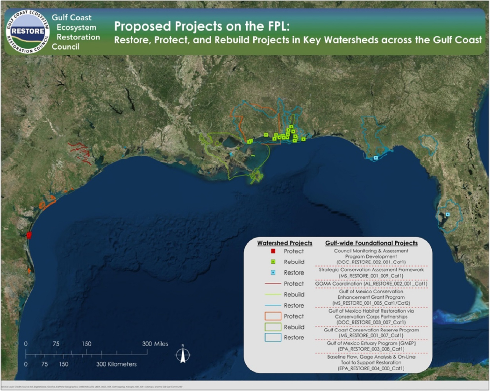
Large Gulf restoration projects will involve coordinated restoration of the same resource or habitat type at multiple sites in a landscape or watershed. For example, a single $3,750,000 oyster restoration project funded by the National Fish and Wildlife Foundation (NFWF) Gulf Environmental Benefit Fund aims to restore 600 acres of oyster reefs across multiple sites in Mobile Bay, Mississippi Sound, and Bon Secour Bay.6 Moreover, many if not most of the projects currently in planning or early implementation stages will be part of larger coordinated restoration programs. For instance, in the funded priorities list published by the Gulf Coast Ecosystem Restoration Council in December 2015,7 special consideration was given to large-scale projects that contribute to ongoing restoration programs in key watersheds and estuaries (Figure 6.1). As an example, the Jean Lafitte Canal Backfilling project in Louisiana will reclaim 16.5 miles of canals and spoil deposits to restore multiple habitats in an extensive freshwater wetland complex encompassing multiple habitat types. The key point is that monitoring both project-level data and data from multiple projects could require considerable cross-scale synthesis from individual sites to multiple sites in a landscape or watershed, and across multiple projects within a region or Gulf wide.
Furthermore, because affected areas and mobile species within U.S. jurisdiction are part of a larger ecosystem, coordinating efforts to share restoration information internationally is important. The International Union for Conservation of Nature’s Working Group on the Gulf of Mexico has cautioned that “without a means to coordinate information and policies amongst the three Gulf national principals—the United States (including the state governments), Mexico and Cuba—the long-term restoration of the ecological health of the Gulf of Mexico cannot be achieved effectively” (Edwards et al., 2011).
Regular integrated assessments of restoration performance have been undertaken for other large restoration programs such as the Comprehensive Everglades Restoration Plan
___________________
2 The Louisiana Coastwide Reference Monitoring System (CRMS): http://lacoast.gov/crms2/home.aspx.
3 The System-Wide Assessment and Monitoring Program (SWAMP) ensures a comprehensive network of coastal data collection activities to support coastal protection and restoration across Louisiana: http://cims.coastal.louisiana.gov/RecordDetail.aspx?Root=0andsid=11471.
4 The Saltmarsh Habitat and Avian Research Program (SHARP) is a collaboration among academic, governmental, and non-profit organizations: http://www.tidalmarshbirds.org.
5 Atlantic Marine Assessment Program for Protected Species (AMAPPS): http://www.nefsc.noaa.gov/psb/AMAPPS.
6 See http://www.nfwf.org/gulf/Pages/GEBFAlabama.aspx.
7 See https://www.restorethegulf.gov/council-selectedrestoration-component/funded-priorities-list.
(CERP).8 Since 2006, five CERP System Status Reports have been generated based on analysis and synthesis of data collected by the Restoration Coordination and Verification (RECOVER) Monitoring and Assessment Plan program (CERP, 2006, 2007, 2009, 2012b, 2014). These reports are intended to explicitly link science to decision-making and provide reports to inform Congress of progress toward restoration objectives. Similarly, the Interagency Ecological Program (IEP) for the San Francisco Estuary has created a Management Analysis and Synthesis Team specifically for the purpose of synthesizing IEP monitoring data. That effort engages interdisciplinary teams and makes extensive use of scaling techniques, including conceptual and process models, for synthesis.9 CERP and IEP synthesis activities have supported both learning and adaptation. For example, the 2014 CERP System Status Report connected research findings to restoration management and decision-making for oyster reefs, invasive species, fire, climate change, and sea-level rise (NRC, 2014).10
For large restoration programs, an additional level of synthesis may be needed in order to communicate restoration progress to diverse stakeholders and decision makers. Since the 1990s, environmental report cards have become increasingly used for this purpose (Connolly et al., 2013). The report cards present the information in very simple terms that are easily understood by the general public as well as elected officials (Stem et al., 2005), and they are
___________________
8 Comprehensive Everglades Restoration Plan (CERP): http://141.232.10.32/pm/ssr_2014/ssr_exec_sum_2014.aspx.
9 See http://www.water.ca.gov/iep/pod/synthesis.cfm.
10 Progress Toward Restoring the Everglades: The Fifth Biennial Review, 2014.
especially valuable when assessments are tied to a legal framework or for communicating to decision-makers (Edwards et al., 2011). For example, since 2007, the Chesapeake Bay annual report card has provided an overall assessment of Chesapeake Bay “health” based on monitoring data for seven biological and water quality indicators.11 Also, results obtained from Louisiana’s Coastwide Reference Monitoring System for wetlands are displayed in a report card format, among other methods of visualization, to facilitate comparison among monitoring sites (Hijuelos and Reed, 2013; G. Steyer, personal communication).
Synthesis efforts may also inform programs about needs and opportunities for better coordination of project-level monitoring. Often, coordination appears to be adequate when viewed at the general planning and multi-agency committee levels. However, data integration efforts can expose limitations in the compatibility of various monitoring design and data management protocols (see Chapters 3 and 5). Furthermore, the prevalence of poorly designed monitoring efforts that lack statistical power to draw strong conclusions (see Table 3.1) may also hinder synthesis efforts (Kleijn and Sutherland, 2003).
Over the multi-decadal time span of Gulf restoration funding, the committee stresses the importance of synthesis activities to promote communication, collaboration, and coordination of restoration planning and monitoring across the Gulf. These efforts will lead to more effective and efficient restoration at the project, regional, state, and Gulf scales. Restoration practice, as well as planning efficacy and monitoring efficiency, benefits from enhanced communication between the phases of restoration (planning, implementation, and monitoring) following evaluation within each phase. To maximize the likelihood of using lessons from past projects to inform future restoration, this communication would ideally include results that did and did not meet objectives, and would occur in formal, informal, oral, and written forms (Hulme, 2014; Nilsson et al., 2016).
Improved coordination would be especially valuable for the Gulf of Mexico, given the extensive ongoing and past monitoring efforts, and because coordinated restoration beyond the site scale can achieve objectives in a more cost effective manner (Ikin et al., 2006; see Chapter 3). The Ocean Conservancy recently catalogued 899 different existing and past long-term monitoring programs in the Gulf of Mexico concerned with at least one of 12 resource categories identified by the Deepwater Horizon Natural Resource Damage Assessment (NRDA). While there are conspicuous monitoring gaps, notably for offshore species and environments, these monitoring programs provide an important foundation for a coordinated, Gulf-wide environmental monitoring network (Love et al., 2015). However, the Ocean Conservancy report does not assess issues related to data sharing and access, which would need to be resolved before monitoring efforts could yield data for the purpose of assessing Gulf-wide conditions of natural resources. If a mechanism is developed to enable integration and synthesis of these monitoring programs (as a baseline) with restoration-related monitoring, these environmental monitoring efforts could support assessment of the effects of restoration at multiple scales. Leadership will be required to ensure that the large number of independent monitoring efforts develop a mechanism for effective data sharing (see Chapter 5 for discussion on data stewardship).
APPROACHES TO SYNTHESIS AND INTEGRATION
Scaling from Data Points to Landscapes and Regions
Some management questions will require that data obtained directly from monitoring samples need to be scaled-up. Scaling-up can be thought of as interpolation and extrapolation from a single data point at a particular location (i.e., observations) to larger spatial units. Scaling in the temporal dimension (e.g., monthly to annual samples) often involves simple averaging, summing, or trend extrapolation. This section focuses on more complicated aspects of spatial scaling that often benefit from tools such as geographic information system (GIS) and remote sensing analysis (see Box 6.1).
There are several key scales for which information will likely be used to assess restoration activities in the Gulf. These scales are the immediate local areas surrounding the sampled locations, the larger project area, the relevant sub-region (e.g., estuary, watershed, or basin), state-wide scale (or other relevant jurisdictional boundary), and coast-wide scale. Furthermore, most scaling efforts can be categorized into classes based on the type of calculations used to interpolate and extrapolate to larger spatial and temporal scales.
___________________
11 See http://ian.umces.edu/ecocheck/report-cards/chesapeake-bay/2013.
Statistical Inference
The use of statistical hypothesis testing and strength of statistical inference associated with various monitoring design choices is described in detail in Chapter 3. In the context of synthesis, scaling via statistical inference is the common way sampled data are extrapolated. Methods include traditional univariate techniques (e.g., analysis of variance, regression), multivariate approaches (e.g., clustering), and methods designed specifically for time series (auto-correlated) data. Also, non-parametric and Bayesian versions of many of these techniques might in some instances provide a better statistical approach (e.g., Anderson, 2001; Lukacs et al., 2007). All of these methods require explanatory and response variables that are either directly measured or derived from measured variables. For example, one could use linear regression to examine the relationship between fish diversity (derived response variable) and the density of vegetation (example of other measured variables), and the fraction of the day a marsh is inundated (estimated from elevations and water levels from other sources). The variables in these analyses tend to be state variables (e.g., concentrations, quantities), rather than rates. Statistical methods need to be used in conjunction with exploratory (e.g., self-organizing maps; Chon, 2011) and visualization techniques (Bryan, 2003) in order to ensure robust results.
Basically, when samples from some population are taken in accordance with a specific design (e.g., based on the assumption that samples are representative of the “target” population and are unbiased and “random”), results can be extrapolated to the regional or population level. In this case, scaling-up explicitly involves inferring a value for the response variable beyond the measurement scales (e.g., plant stem densities from a set of samples to the average stem density in an entire wetland area), and is often accompanied by an explicit expression of the variance of the scaled-up estimate.
Formula Calculations
Scaling using a formula approach is a broad category that involves a series of calculations that presume samples are representative of larger areas, and invokes information for the extrapolation beyond the sampled data (i.e., not simply statistical inference). GIS analysis (see Box 6.1) can be used as a formal procedure for spatial scaling. A simple illustration of scaling used for wetlands restoration in the Columbia River is provided in Box 6.2.
A commonly used formula approach for scaling is habitat suitability index (HSI) analysis, which has been applied to a variety of restoration programs (e.g., Nyman et al., 2013; Soniat et al., 2013; McManus et al., 2014), although the term “suitability” is not always well-defined and models are rarely verified or validated (but see Theuerfkauf and Lipcius, 2016). HSI analyses involve specifying functions that assign values from 0 to 1 over the range of each important environmental variable (USFWS, 1980; Draugelis-Dale, 2008). Typically, process models (see below) are used to estimate the baseline values of environmental variables throughout the applicable spatial grid cells, and then again to estimate variables for baseline plus restoration actions. The functions are applied to the environmental variables cell-by-cell, and then the area of the cells is summed, and weighted by their overall suitability. Thus, one can compare the total weighted habitat area with and without the influence of restoration.
HSI analysis has many advantages but also some key weaknesses (Roloff and Kernohan, 1999; Ahmadi-Nedushan et al., 2006; Gore and Nestler, 2006). The main advantage to a habitat-based approach is cost savings due to a lack of need for new data collection when baseline data and/or expert elicitation is an option. Habitat suitability indices are also relatively easy to understand and explain. The HSI approach avoids some challenges associated with modeling population and community dynamics. Such models are typically subject to debate about the model formulations, are data-intensive, and can be highly uncertain. Habitat is critical to healthy and productive animal populations, and so determining how “restoration actions” will affect habitat relative to “no action” is an important step toward quantifying the ecological benefits and costs to biota of restoration actions. The major disadvantage to habitat-based approaches is simply that they lack complexity and they quantify habitat, which may or may not be directly correlated to abundance and provide little information on community level responses (Van Horne, 1983; Morrison et al., 2006). The issue is that creating more viable habitat does not mean that there will automatically be more fish (for example), only that the restoration action created the capacity for more organisms. Other issues related to using HSI analysis include challenges in formulating how multiple habitat variables interact to affect habitat quality and
limits to the transferability of information from laboratory and limited field data to other locations that experience different combinations of environmental conditions. Ultimately, changes in HSI over time can be useful, even if a direct link to population demographics is tenuous (e.g., Jones-Farrand et al., 2009; Unglaub et al., 2015).
Process Modeling
Process modeling can be used, outside of the statistical analysis of monitoring data, as a method for scaling up monitoring results, enabling mechanistic understanding of the results, and forecasting (Clark et al., 2001; Peck, 2004). Process modeling computes the values of state variables (often the same as the response variables in statistical analyses) by representing the rates of change in key processes that affect these state variables. Thus, unlike the statistical and formula-based approaches, the equations of a process model are differential or difference equations, whose solution results in the values of the state variables (e.g., concentrations) over time and space.
An example would be simulating the number of fish in a location over time by representing the mortality rate and reproduction rate dependent on time-varying inundation and water levels of the wetlands in that location. Simulations that predict the total number of fish would be performed under identical conditions but with the wetlands in unrestored and restored states and the change in the number of fish (of a given age-class) attributed to the effects of the restoration.
There are process modeling approaches for almost all of the response and explanatory variables used in the analysis of monitoring data. For example, as part of the Louisiana 2012 Coastal Master Plan, there are process models for hydrodynamics, land building from diversions, fish and shellfish habitat responses to water quality and habitat changes, and the succession of wetland vegetation communities (Peyronnin et al., 2013). As part of the Master Plan, these models are linked with each other (output of one model becomes an input to another model), and used to determine estuary-wide responses to the implementation of multiple restoration actions.
Process modeling, in theory, enables more conditions to be simulated than statistical and formula-based analyses, and by representing the underlying mechanisms (to varying extents), can lead to the use of model-based hindcasting and forecasting. For example, a properly developed and tested process model can be used to provide hindcasts for situations when explanatory variables are available but measured responses are not, and for forecasting response variables under previously unobserved conditions. The monitoring data and its analysis provide critical inputs to the process model and enable the process model to be calibrated and validated.
Process models are especially well suited to answer defined and specific questions. The more specific the questions, the more straightforward it is to develop an appropriately scaled and formulated process model. However, process models are limited by how well they represent the dynamics of their response variables. Rose et al. (2015) recently proposed a set of best practices for selecting and using fish-oriented models for evaluation of the ecosystem restoration. The role of the modeler’s expert judgment in the design of the process model does not weaken the power and utility of ecological modeling, but it might weaken the strength specific inferences. The role of expert opinion highlights the importance of documenting and codifying the model selection process as well as the strategy and results of calibration and validation, and ensuring that the model is robust for the conditions dictated by model scenarios especially those involving possible future conditions. Great care must also be used in how data are used to inform model development and used in model evaluation (see discussion of data quality and metadata in Chapter 5).
Ecosystem Modeling
Ecosystem modeling can be valuable for taking a holistic approach, rather than the more focused approach (e.g., population dynamics, fisheries stock assessment) used with process modeling (Schirripa et al., 2013). For example, Ecopath with Ecosim models12 have been applied to Gulf ecosystem-based fisheries management scenarios to improve understanding of fishing, management measures, and climate change on predation and competition (Chagaris et al., 2015). Also, an Atlantis ecosystem model and management evaluation tool,13 based upon sub-models for major steps of biophysical, oceanographic, economic, social, and management dynamics, has been created to simulate Gulf conditions. Atlantis models now depict the food web matrix from bacteria to apex
___________________
12 Ecopath with Ecosim (EwE) ecological/ecosystem modeling software: http://ecopath.org.
13 Atlantis ecosystem modeling software: http://atlantis.cmar.csiro.au.
predators considering age structures, larval transport, habitat limitations, nutrient cycling, fisheries influence, and response to oil and other stressors (Masi et al., 2014; Ainsworth et al., 2015; Tarnecki et al., 2016). Ecopath with Ecosim, Atlantis, OSMOSE,14 and other decision support tools can play a valuable role in integrated ecosystem assessments, particularly in steps such as developing metrics/targets and management strategy evaluation (Levin et al., 2009; Center for Ocean Solutions, 2011). The issues associated with process modeling become even more critical when using ecosystem models because of their coverage of many aspects of the ecosystem. Ecosystem models are very data demanding and significant effort is needed to calibrate and validate these models to the point that they can be used for predicting dynamics under new conditions. Ecosystem models as described here are often best used for strategic evaluation of mixtures of management actions rather than for tactical decisions about whether a specific management action need to occur (Fulton et al., 2011).
Assessing Restoration Effects on Wide-Ranging Animals
Cross-scale synthesis of monitoring data is essential to assess and interpret restoration outcomes for marine mammals, sea turtles, birds, fish, and other wide-ranging organisms whose population and community dynamics operate at Gulf-wide or larger scales subject to cumulative effects of multiple activities, including non-target forms of restoration (e.g., Bayne and Dale, 2011; Johnson and St. Laurent, 2011). These organisms are often used as indicators of the success of large-scale restoration because they act as biological integrators of the health of the environment, exert a large influence on ecosystems, are highly valued by the public, and are often protected and/or regulated by state and federal laws (see Chapter 4). Because these species have complex life histories (i.e., they use many habitats and may migrate), are long-lived, and are subjected to multiple stressors (Rose, 2001), little about their response to restoration can be inferred from project-scale monitoring data examined in isolation (exceptions could include local habitat-use by wide-ranging species). Therefore, increasing the prevalence and consistency of monitoring,15 and providing mechanism(s) for sharing data16 on wide-ranging animal response to restoration will help inform synthesis activities.
Assessing Restoration Efficacy across Multiple Projects in the Larger Ecosystem Context
Monitoring has tended to focus on particular habitats or species (or sets of species) in isolation, or sometimes on valuable species that also function as habitat (e.g., oysters), or mobile taxa that are intricately linked to fixed habitat (e.g., birds that rely upon certain wetlands; see Part II of this report for good practices for monitoring select habitats and species). This last case illustrates the beginning of a movement toward integrated monitoring (see Steyer et al., 2006), where formerly isolated efforts are conducted with awareness of other related but independently conducted types of monitoring. This idea goes beyond incorporating outside metrics into a particular monitoring scheme, for example a sea turtle–focused practitioner measuring seagrass density and turtle-related tourism along with sea turtle demographics. Integrated monitoring instead involves a number of practitioners each focused on monitoring different ecosystem components in a compatible manner in an effort to assess overall restoration progress in a complementary manner.
There are several challenges that need to be overcome to enable the synthesis of monitoring data and evaluation of restoration progress across the different restoration programs. Most importantly, there are varying objectives and a lack of communication across different restoration programs, state/municipal lines, government agencies, research collaborations, university affiliations, or project funding organizations (see Chapter 2). In addition, there is a need to build awareness of how, what, and at what scale(s) each type of practitioner already monitors and assesses (see Chapter 3 and Part II); to consider restoration (and potentially other management) activities on a larger, sometimes Gulf-wide, scale by accounting for potentially harmful effects of such activities on unrelated restoration efforts (see Chapter 4); and to promote
___________________
14 Object-oriented Simulator of Marine ecOSystems Exploitation (OSMOSE) modeling software: http://www.osmose-model.org. See Grüss et al. (2016) for an example.
15 For example, through the Gulf of Mexico Marine Assessment Program for Protected Species (GoMMAPPS; see Chapter 4).
16 For example, through the Environmental Response Management Application (ERMA) and the Data Integration Visualization Exploration and Reporting (DIVER) explorer tool (https://dwhdiver.orr.noaa.gov).
a culture of data compatibility and access (see Chapter 5). The Gulf Coast Ecosystem Restoration Council (known as the RESTORE Council) has recently responded to the need for integrated monitoring by committing to fund a partnership17 to build on existing capabilities and activities in the Gulf. This effort will catalogue historic and ongoing monitoring, identify data gaps, improve coordination, and develop consistency in methods and data standards applicable at scales from individual sites to Gulf-wide (G. Steyer, personal communication).
Meta-analysis is another approach to synthesize monitoring project outcomes to better inform restoration practice. Meta-analysis is a formal statistical approach for pooling results from multiple, independent experiments or studies to achieve greater generality and synthesis (Koricheva et al. 2013). For example, Benayas et al. (2009) evaluated the effects of restoration on biodiversity and ecosystem services across 89 published studies in various terrestrial and aquatic ecosystems. Using the response ratios of restored vs. unrestored and restored vs. reference ecosystems (i.e., ln(restored/degraded) or ln(restored/reference)) for metrics such as species richness and biomass, they inferred that ecological restoration increased provision of biodiversity and ecosystem services by 44% and 25%, respectively. Moreno-Mateos et al. (2012) conducted a meta-analysis of published studies of 621 wetland sites from throughout the world to document the long time needed for restored wetlands to recover to reference conditions. Based on response ratios for metrics such as plant community diversity and carbon storage, they concluded that even a century after restoration efforts, biological structure remained on average 26% and 23% lower, respectively, than in reference sites. Such quantitative meta-analyses would be invaluable in assessing restoration performance and outcomes in the Gulf of Mexico region.
CHALLENGES AND OPPORTUNITIES
Organizational Challenges
There are several commonly-encountered challenges with synthesis of large projects, such as insufficient human and financial resources, expertise, and access to quality data. These challenges are amplified for restoration in the Gulf of Mexico because of its broad spatial scale, long-timeframe, diverse data types, and multiple organizations involved in the restoration and monitoring activities. Monitoring data are generated from construction, performance, and monitoring for adaptive management, use of existing data, and model outputs. Restoration will occur across the Gulf of Mexico and will involve a wide variety of projects, including wetland creation, barrier islands, river diversions, and fisheries management actions. These projects will be implemented in various locations over an extended time period.
Synthesis of Gulf restoration monitoring will be data-intensive and thus will require a commitment to good data stewardship and management practices, open access to well-documented data, and creation of integrated databases for analysis (Chapter 5). The latter activity usually needs to be done by the synthesis team, and can require extensive data error checking, data cleaning and harmonizing (e.g., cross-walking of species taxonomies), converting data to common units, data conflation (bringing data to common spatial and temporal scales and levels of precision), and data updating prior to analysis (e.g., Soranno et al., 2015). Most environmental scientists are not fluent in modern data management skills and best practices; therefore, data integration can be the most time- and resource-consuming step in synthesis (Michener and Jones, 2012). For this reason, synthesis centers generally employ scientific programmers and data technicians to assist and train working groups with data management and analysis.
Scientific inference (see Chapter 3) from analysis of large volumes of data, including data that were originally collected for other purposes, also has special challenges. In recent decades, a variety of powerful new methods have been developed to support “data-intensive” science, many of which will be unfamiliar to researchers trained in traditional field science and statistical analysis of field survey and experimental data. Examples include meta-analysis (Koricheva et al., 2013) and machine learning techniques such as boosted regression trees and artificial neural networks (Olden et al., 2008). Discussion of these methods is beyond the scope of this report, and they are mentioned here mainly to highlight the need for training, scientific support, and modern cyberinfrastructure of synthesis activities (as further discussed below).
Thorough synthesis can result in achieving or exceeding project objectives with efficient use of monetary resources. What typically limits
___________________
17 RESTORE-funded Council Monitoring & Assessment Program Development project: https://www.restorethegulf.gov/sites/default/files/FPL_FINAL_Dec9Vote_EC_Library_Links.pdf (p. 228).
effective synthesis is the lack of sufficient funding and staffing to ensure that restoration activities are monitored and data shared such that meta-analyses and syntheses can be conducted (see Kennedy et al., 2011). Given the enormous scale of restoration in the Gulf of Mexico, it will be difficult to rationalize, especially decades from now, a lack of a significant synthesis effort.
Organizational Approaches
Synthesis requires the delineation of a group of individuals that are given the responsibility for data synthesis, meta-analysis, and integration. Synthesis usually involves “team science,” that is, collaboration of two or more individuals with different roles or responsibilities (NRC, 2015). Increasingly, team science involves both face-to-face and virtual interactions. Collaborative, team-based synthesis research has proven so effective for scientific progress that new centers have been created specifically to provide financial, logistical, and technical support. Examples include the National Center for Ecological Analysis and Synthesis in Santa Barbara, California, the Socio-Environmental Synthesis Center in Annapolis, Maryland, the National Institute for Mathematical and Biological Synthesis in Knoxville, Tennessee, and the John Wesley Powell Center for Analysis and Synthesis in Fort Collins, Colorado.
Synthesis can occur in a variety of interactive venues (e.g., seminars, workshops, project teams) but the “working group” model is perhaps the most widely practiced when multiple organizations and disciplines are involved. This usually entails bringing together a small team (< 20 people) who meet for up to a week at a time in intense collaboration at a facility that can provide computational and logistical support. Groups may meet several times per year over multiple years, depending on the scope of the activity. Factors that contribute to working group effectiveness including face-to-face meetings, leadership, diversity (notably in expertise, gender, age, and career stage), and data management and computational support (Hackett et al., 2008; Woolley et al., 2010; Hampton and Parker, 2011). Immersion at a neutral, independent facility away from participants’ daily workplaces is also associated with increased working group productivity and positive outcomes (Hackett et al., 2008; Lynch et al., 2015).
Multiple states, federal agencies, and organizations are involved in funding Gulf of Mexico restoration projects and imposing their own data reporting requirements on their projects (as discussed in Chapter 2). It is not clear to the committee who has primary responsibility for data synthesis. Attempts at synthesis by the same personnel tasked with doing the actual restoration activities will not be successful. Expecting staff of funding and coordinating organizations to conduct synthesis is also unrealistic. Synthesis requires a significant effort by a group with certain skills, and is not effective when it is simply added to the duties of individuals already time-limited from restoration activities. There are a range of institutional approaches that can meet the need for the type of meta-analysis and synthesis required to assess restoration progress in the Gulf of Mexico. Given the complexity of the task and the broad range of restoration activities undertaken, the committee presents a few options that could meet the need for and overcome the challenges of synthesis and assessment of restoration efforts in the Gulf of Mexico.
One organizational model for Gulf-wide synthesis activities would be to establish an independent center, similar to the aforementioned synthesis centers, whose mission is to advance Gulf restoration science, management, and policy solutions by analysis of available data. If such a center emulated existing models, if would not need to retain a large permanent research staff but would instead provide meeting facilities, cyberinfrastructure, and staff to support short-term and ongoing external working groups. Such a center could be tasked with producing regular assessments of Gulf-wide restoration progress. Additionally, such a center could promulgate data and metadata standards (see Chapter 5), serve as a data center or data hub, provide training in data management and data-intensive scientific methods, and communicate results to stakeholders and decision makers. There are now many successful models for synthesis centers that could help inform the design and operation of such a center.
An alternative model to the center concept could be a single institution or multi-institutional program whose mission is analysis and synthesis of restoration monitoring data to produce integrated assessments. For example, the Chesapeake Bay Report Card is produced by the University of Maryland’s Center for Environmental Science. This model would depend more on permanent staff and less on collaborative teams comprised of scientists from different organizations. Given that fewer individuals would be involved in such a synthesis
program, its scope would presumably be narrower than that of a synthesis center. Science programs that have been established with DWH funding (see Chapter 2) are currently and need to continue to contribute to the goal of data analysis and synthesis, for example by developing conceptual models, evaluating appropriate indicators of restoration progress, funding data synthesis grants, and publishing report cards. While useful for a non-technical audience, report cards and other integrated assessments are more limited in scope and explanatory power than other forms of synthesis needed to evaluate restoration as described in this chapter.
Another way to promote synthesis activities could be through a competitive contract and grant program to fund individual investigators and collaborating teams who propose and perform data synthesis within their existing organizations. This approach could be synergistic with and complementary to either a synthesis center or program. The National Academies’ Gulf Research Program (see Chapter 2) currently operates such a program for data synthesis grants. Such projects would be at a small scale (a team of several people) and would allow a community to examine particular topics and analytical techniques. While one cannot guarantee what questions will be addressed and how, such a contract program benefits from multiple individuals and groups adding creativity and ideas to the general task of data synthesis. When appropriate, requests for proposals could be more specific to address a critical synthesis need or a key knowledge uncertainty as it relates to restoration efficacy. This small-project approach could result in detailed insight into specific restoration actions or locations, and could generate ideas and approaches that are useful at larger scales. These three options are just a few of the organizational models, which could also be combined to form a synthesis center that also administers competitive grants for synthesis efforts.
CONCLUSIONS AND RECOMMENDATIONS
Synthesis for restoration efforts as large and complicated as planned for the Gulf of Mexico is a critical activity that promotes communication, collaboration, and coordination of restoration planning and monitoring. Without a significant commitment to synthesis, it would be impossible to promote integrative decision making and to understand the effects of environmental restoration to human health and well-being and to the natural resources being restored at multiple scales.
Because meta-analysis of projects and synthesis of monitoring data is required for evaluating restoration progress beyond individual projects and Gulf-wide restoration outcomes, Gulf restoration programs should consider creating a specific, dedicated enterprise for synthesis activities in support of Gulf restoration. These activities would include database development, research, and training. This enterprise could be jointly funded by Gulf restoration programs (e.g., the NRDA Trustee Council, RESTORE Council, and NFWF) and research programs (e.g., the Academies’ Gulf Research Program) and could take the form of a new independent center, a dedicated program within an existing organization, or a new multi-agency synthesis program. The new Centers of Excellence in each Gulf state that are created under Resources and Ecosystems Sustainability, Tourist Opportunities, and Revived Economies of the Gulf Coast States (RESTORE) Act (2012) funding could play a significant role in supporting or hosting synthesis activities or a synthesis program. This would be especially powerful if the Centers in different states worked together.
The committee recommends the following:
- Restoration programs and research programs should acknowledge the importance of synthesis and integration into effective and efficient restoration, and recognize that synthesis and integration should be done by a group of tasked individuals (not simply added as an additional task to staff or those implementing the restoration), and commit sustained funding.
- Restoration programs should jointly formulate plans to develop the appropriate organizational approach(es) for synthesis and integration, which can include working groups, a center for restoration science and synthesis (several models are available), and a complementary small grants program to encourage relatively high-risk/reward projects and innovative ideas.
- Synthesis and integration should be considered as part of improving project-level actions, expanding project-level restoration to broader scales, assessing restoration progress on regional and Gulf-wide basis, and ensuring that restoration effects are assessed on wide-ranging animals of conservation and commercial importance.
- Synthesis and integration should be initiated immediately and should be done in very
tight collaboration with management activities and agency and organization staff, and also be done in coordination with the development of all databases related to restoration.


