
Appendix G
Classification of Intertidal, Subtidal, Ice, and On-Water Areas
TABLE G.1 Classification of Intertidal, Subtidal, Ice, and On-Water Areas
| Coastal Habitat | Description | Predicted Oil Behavior |
|---|---|---|
| Intertidal | ||
|
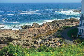
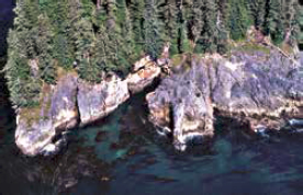
Exposed Rocky Shores (ESI 1A)
SOURCE: NOAA (2019a). Exposed Rocky Banks (ESI 1A)
SOURCE: Daderot, CC0, via Wikimedia Commons. |
|
|
|
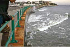
Exposed, Solid Man-Made Structures (ESI 1B)
SOURCE: NOAA (2019a). |
|
|

| Coastal Habitat | Description | Predicted Oil Behavior |
|---|---|---|
|
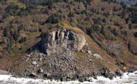
Exposed, Rocky Cliffs with Boulder Talus Base (ESI 1C)
SOURCE: NOAA (2019a). |
|
|
|
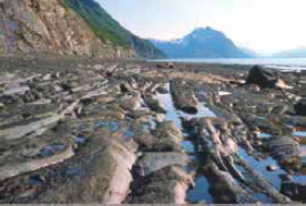
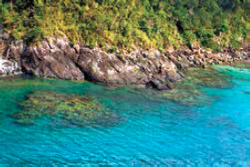
Exposed, Wave-Cut Platforms (ESI 2A)
SOURCE: NOAA (2019a). Shelving Bedrock Shores (ESI 2A)
SOURCE: NOAA (2019a). |
|
|
|
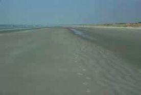
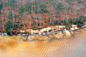
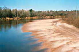
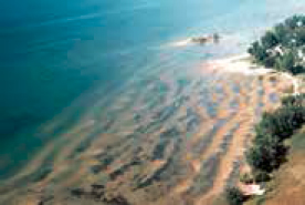
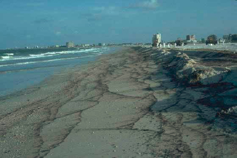
Fine- to Medium-Grained Sand Beach (ESI 3A) Fine-Grained
SOURCE: NOAA (2019a).
SOURCE: NOAA (2019a). |
|
|

| Coastal Habitat | Description | Predicted Oil Behavior |
|---|---|---|
|
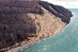
Scarps and Steep Slopes (Sand) (ESI 3B)
SOURCE: NOAA (2019a). |
||
|
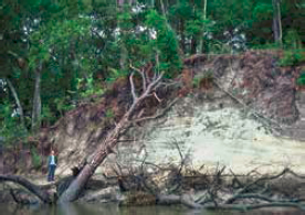
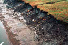
Eroding Scarps (Unconsolidated Sediment) (ESI 3B)
SOURCE: NOAA (2019a). |
||
|
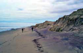
Exposed, Eroding Banks (Unconsolidated Sediment) (ESI 3B)
SOURCE: NOAA (2019a). |
||
|
Tundra Cliffs (ESI 3C)
SOURCE: NOAA (2019a). |
|
|
|
Coarse-Grained Sand Beaches (4)
SOURCE: NOAA (2019a). |

| Coastal Habitat | Description | Predicted Oil Behavior |
|---|---|---|
|
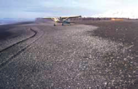
Sand Bars and Gently Sloping Banks (ESI 4)
SOURCE: NOAA (2019a). |
||
|
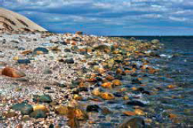
Mixed Sand and Gravel Beaches (ESI 5)
SOURCE: NOAA (2019a). Mixed Sand and Gravel Bars and Gently Sloping Banks (ESI 5)
SOURCE: NOAA (2019a). |
|
|
|
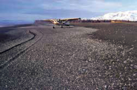
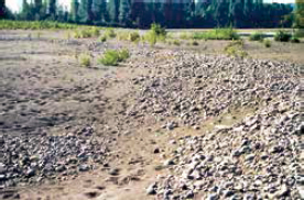
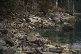
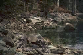
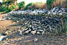
Gravel Beaches (ESI 6A)
SOURCE: NOAA OR&R. Gravel Beaches (Granules and Pebbles) (ESI 6A)
SOURCE: NOAA (2019a). |
|
|
| Coastal Habitat | Description | Predicted Oil Behavior |
|---|---|---|
|
Gravel Bars and Gently Sloping Banks (ESI 6A)
SOURCE: NOAA (2019a). |
||
|
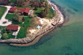
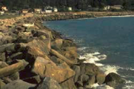
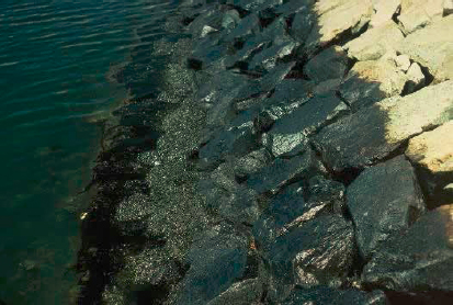
Riprap (ESIs 6B, 6C)
SOURCE: NOAA (2019a).
SOURCE: NOAA (2019a). |
|
|
|
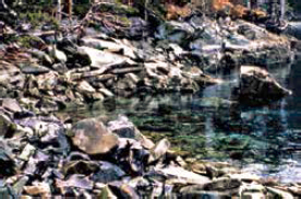
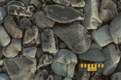
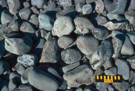
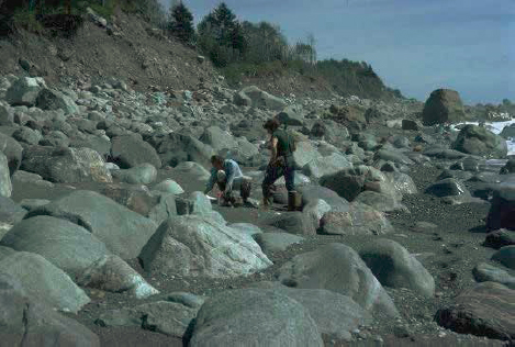
Gravel Beaches (Cobbles/Boulders)—used in Alaska (ESI 6B)
SOURCE: NOAA OR&R. Boulder Rubble (ESI 6D)
SOURCE: NOAA (2019a). |


| Coastal Habitat | Description | Predicted Oil Behavior |
|---|---|---|
|
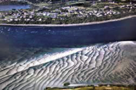
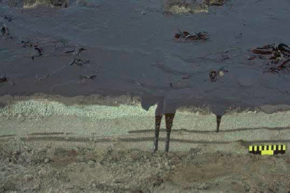
Exposed Tidal Flats (ESI 7)
SOURCE: NOAA (2019a).
SOURCE: NOAA (2019a). |
|
|
|
Sheltered Scarps (Bedrock/Mud/Clay) (ESI 8A)
SOURCE: NOAA (2019a).
SOURCE: NOAA (2019a).
SOURCE: NOAA (2019a). |
|
|
| Coastal Habitat | Description | Predicted Oil Behavior |
|---|---|---|
|
Sheltered, Impermeable, Rocky Shores (ESI 8A)
SOURCE: NOAA (2019a). |
||
|
Sheltered, Solid Man-Made Structures (ESI 8B)
SOURCE: NOAA (2019a). Sheltered Riprap (ESI 8C)
SOURCE: NOAA (2019a). |
|
|
|
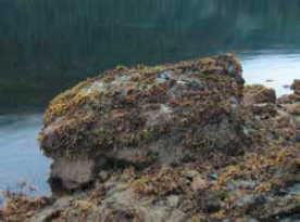
Sheltered, Rocky Rubble Shores (ESI 8D)
SOURCE: NOAA (2019a).
SOURCE: Gillham (1978). |
|
|


| Coastal Habitat | Description | Predicted Oil Behavior |
|---|---|---|
|
SOURCE: Chrisseufert (2008). |
||
|
Vegetated, Steeply Sloping Bluffs (ESI 8F)
SOURCE: NOAA (2019a). |
|
|
|
Sheltered Tidal Flats (ESI 9A)
SOURCE: NOAA (2019a). Sheltered Sand and Mud Flats (ESI 9A)
SOURCE: NOAA (2019a). |
|
|
|
Vegetated Low Banks (ESI 9B)
SOURCE: NOAA (2019a). |
|

| Coastal Habitat | Description | Predicted Oil Behavior |
|---|---|---|
|
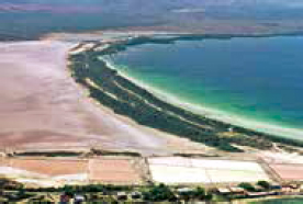
Hyper-Saline Tidal Flats (ESI 9C)
SOURCE: NOAA (2019a). |
|
|
|
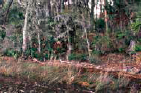
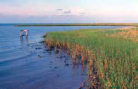
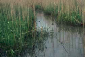
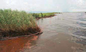
Salt and Brackish Marshes (ESI 10A)
SOURCE: NOAA (2019a). Freshwater Marshes (ESI 10B)
SOURCE: NOAA (2019a). Swamps (ESI 10C)
SOURCE: NOAA (2019a). Scrub and Shrub Wetlands (ESI 10D)
SOURCE: NOAA (2019a). |
|
|

| Coastal Habitat | Description | Predicted Oil Behavior |
|---|---|---|
|
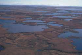
Inundated Low Lying Tundra (ESI 10E)
SOURCE: Strang (2013). |
|
|
|
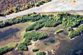
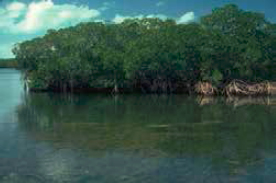
Mangroves (ESI 10F)
SOURCE: NOAA (2019a). |
|
|
| Subtidal | ||
|
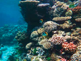
Coral Reefs
SOURCE: Wise Hok Wai Lum, CC BY-SA 4.0, via Wikimedia Commons. |
|
|
|
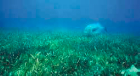
Seagrasses
SOURCE: NOAA. |
|
|
| Coastal Habitat | Description | Predicted Oil Behavior |
|---|---|---|
|
Kelp
SOURCE: NOAA. |
|
|
|
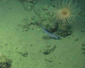
Soft Bottom
SOURCE: USGS. |
|
|
|
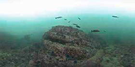
Mixed and Hard Bottom
SOURCE: NOAA. |
|
|
| Ice | ||
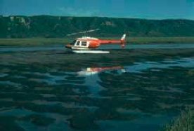
|
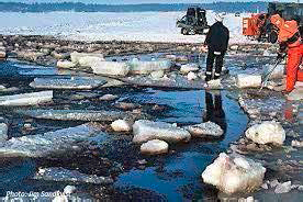
Accessible and Inaccessible Ice
SOURCE: Sandkvist (n.d.).
SOURCE: USCG photo by Petty Officer 1st Class Sara Francis, Public domain, via Wikimedia Commons. |
|
|


| Coastal Habitat | Description | Predicted Oil Behavior |
|---|---|---|
| On-Water | ||
|
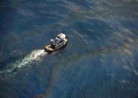
Offshore
SOURCE: NOAA OR&R. |
|
|
|
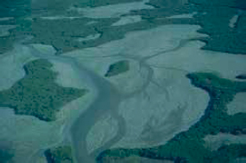
Bays and Estuaries
SOURCE: Bruce A. Davis, U.S. Department of Homeland Security. |
|
|
NOTE: ESI = Environmental Sensitivity Index Code as described in NOAA, 2019a.
SOURCES: NOAA (2017). For detailed descriptions of intertidal areas, see Petersen et al. (2019).
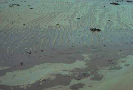
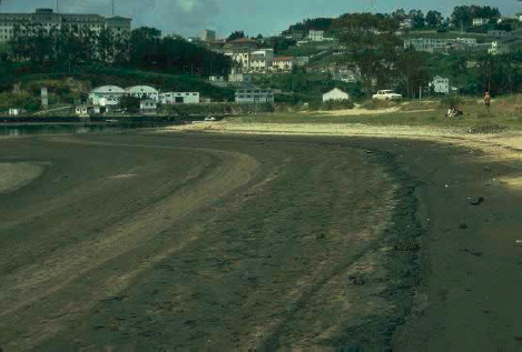
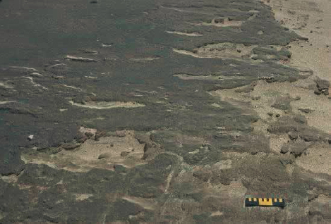
TABLE G.2 Description of Surface Oil Distribution
| T—Trace 1% cover |
|
|---|---|
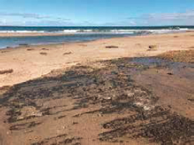
| S—Sporadic cover 1–10% cover, seen here as brown oil bands on a white sand beachface. |
 |
| P—Patchy cover 11–50% cover, seen here as black oil bands on a white sand beachface. |
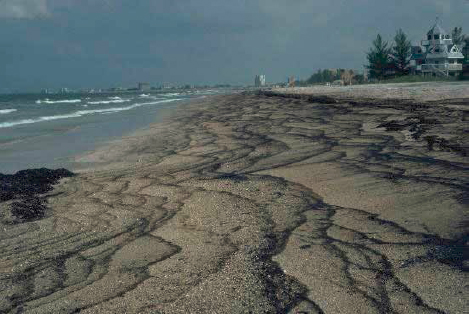 |
| B—Broken cover 51–90% cover, seen here as brown oil on tan sand beach. |
 |
| C—Continuous cover 91–100% cover, seen here as black oil on light sand beach. |
 |
SOURCE: Information and images are from NOAA OR&R: https://response.restoration.noaa.gov/surface-oil-distribution-percent-cover.
TABLE G.3 Surface Oiling Descriptors: Thickness
| FL—Film Transparent or iridescent sheen or oily film. |
 |
| ST—Stain Visible oil that cannot be scraped off with a fingernail. |
 |
| CT—Coat Visible coating of oil less than 0.1 cm thick; can be scraped off with a fingernail. |
 |
| CV—Cover Oil or mousse more than 0.1 cm and less than 1 cm thick. |
 |
| TO: Thick Oil Fresh oil or mousse more than 1 cm thick. |
 |
SOURCE: Information and images are from NOAA OR&R: https://response.restoration.noaa.gov/surface-oiling-descriptors-thickness.
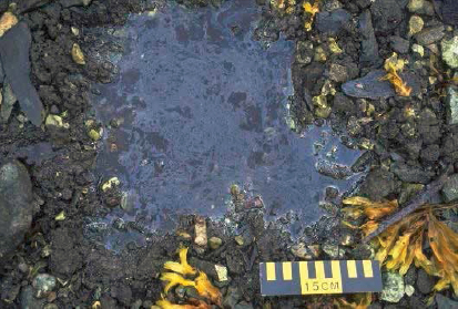
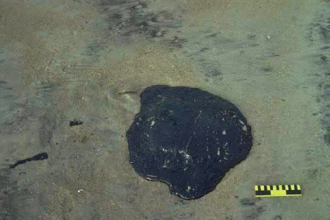
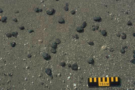
TABLE G.4 Surface Oiling Descriptors: Type
| NO—No Oil No evidence of any type of oil. |
|
|---|---|
| AP—Asphalt Pavements Cohesive, heavily oiled surface sediments. |
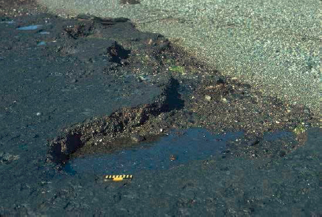 |
| SR—Surface Oil Residue Non-cohesive, heavily oiled surface sediments, characterized as soft incipient asphalt pavements. |
 |
| TC—Tar Highly weathered oil of nearly solid consistency. |
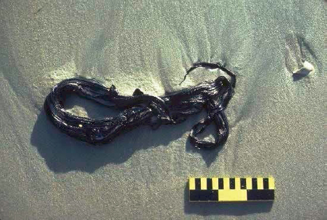 |
| PT—Patties Discrete accumulations of oil more than 10 cm in diameter. |
 |
| NO—No Oil No evidence of any type of oil. |
|
|---|---|
| TB—Tar Balls Discrete accumulations of oil less than 10 cm in diameter. |
 |
| MS—Mousse Emulsified oil. An example of mousse is seen here as orange-brown oil coating cobbles. |
 |
| FR—Fresh Oil Unweathered, liquid oil. |
 |
SOURCE: Information and images are from NOAA OR&R: https://response.restoration.noaa.gov/surface-oiling-descriptors-type.
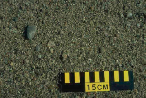
TABLE G.5 Sediment Types
| M—Mud Mud can be composed of silt and/or clay. |
 |
| S—Sand Sand grains measure between 0.06 and 4 mm in diameter. |
 |
| G—Granule Granules measure between 2 and 4 mm in diameter. |
 |
| P—Pebble Pebbles measure between 4 and 64 mm in diameter. |
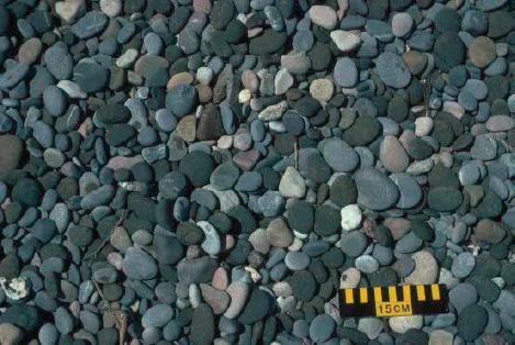 |
| C—Cobble Cobbles measure between 64 and 256 mm in diameter. |
 |
| B—Boulder Boulders measure more than 256 mm in diameter. |
 |
| R—Bedrock Outcrop | 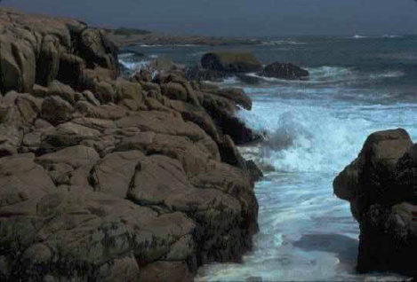 |
SOURCE: Information and images are from NOAA OR&R: https://response.restoration.noaa.gov/sediment-types.
BRIEF DESCRIPTION OF SHORELINES IN THE SCAT (EXCERPTS)
For detailed descriptions of intertidal areas see Petersen et al. (2019).
Rank of 1: Exposed, Impermeable Vertical Substrates. These shoreline types are exposed to large waves, which tend to keep oil offshore by reflecting waves. The substrate is impermeable so oil remains on the surface where natural processes will quickly remove any oil that does strand within a few weeks. Any stranded oil forms a band along the high tide line or splash zone.
Rank of 2: Exposed, Impermeable Substrates, Non-Vertical. These shorelines are exposed to high wave energy. They have a flatter intertidal zone, sometimes with small accumulations of sediment at the high tide line, where oil could persist for several weeks to months.
Rank of 3: Semi-Permeable Substrate, Lower Potential for Oil Penetration and Burial; infauna present but not usually abundant. These types of shorelines include exposed sand beaches on outer shores, sheltered sand beaches along bays and lagoons, and sandy scarps and banks along lake and river shores. Compact, fine-grained sand substrates minimize oil penetration, reducing the amount of oiled sediments to be
removed. Fine-grained sand beaches generally accrete slowly between storms, reducing the potential for burial of oil by clean sand. On exposed beaches, oil may be buried deeply if the oil stranded right after an erosional storm or at the beginning of a seasonal accretionary period.
Rank of 4: Medium Permeability, Moderate Potential for Oil Penetration and Burial; infauna present but not usually abundant. Coarse-grained sand beaches are ranked separately and higher than fine- to medium-grained sand beaches because of the potential for higher oil penetration and burial, which can be as great as 1 m. These beaches can undergo very rapid erosional and depositional cycles, with the potential for rapid burial of oil, even after only one tidal cycle.
Rank of 5: Medium-to-High Permeability, High Potential for Oil Penetration and Burial; infauna present but not usually abundant. The gravel-sized deposits can be bedrock, shell fragments, or coral rubble. Because of higher permeability, oil can penetrate into sand and gravel beaches, making it difficult to remove contaminated sediment without causing erosion and waste disposal problems. These beaches may undergo seasonal variations in wave energy and sediment reworking, so natural removal of deeply penetrated oil may only occur during storms events. Pocket beaches with microenvironments are protected from wave energy; therefore, natural oil removal may be significantly slower.
Rank of 6: High Permeability, High Potential for Oil Penetration and Burial. Gravel beaches have the potential for very deep oil penetration and slow natural removal rates of subsurface oil. Fine-grained gravel beaches are composed primarily of pebbles and cobbles (from 4 to 256 mm), with boulders as a minor fraction. Coarse-grained gravel beaches have boulders dominating the lower intertidal zone. A boulder-and-cobble armoring of the surface of the middle to lower intertidal zone is common on these beaches. Armor may have a very important effect on oil persistence in gravel beaches. Oil beneath the armored surface can remain longer than would subsurface oil on an unarmored beach with similar grain size and wave conditions. Riprap is a man-made equivalent of this ESI class; it is usually placed at the high tide line where the highest oil concentrations are found, and the riprap boulders are sized so that they are not reworked by storm waves.
Rank of 7: High Permeability, High Potential for Oil Penetration and Burial. Exposed tidal flats commonly occur with other shoreline types, usually marshes, on the landward edge of the flat. They can occur as offshore tidal flats separate from the shoreline, particularly at tidal inlets and in tidal rivers. Oil does not readily adhere to or penetrate the compact, water-saturated sediments of exposed sand flats. Instead, the oil is pushed across the surface and accumulates at the high tide line. Even when large slicks spread over the tidal flat at low tide, the tidal currents associated with the next rising tide pick up the oil and move it alongshore. However, oil can penetrate the tops of sand bars and burrows if they dry out at low tide.
Rank of 8: Sheltered Impermeable Substrate; epibiota usually abundant. Oil can coat rough rock surfaces in sheltered settings, and can persist long-term because of the low-energy setting. While solid rock surfaces are impermeable to oil, rocky rubble slopes can trap oil beneath a veneer of coarse material. Sheltered seawalls and riprap are the manmade equivalents, with similar oil behavior and persistence patterns. In riverine settings, terrestrial vegetation along the river bluff indicates low energy and thus slow natural removal rates. Peat shorelines include peat scarps, eroded peat, and peat slurries; this shoreline type is most common along the Bering Sea.
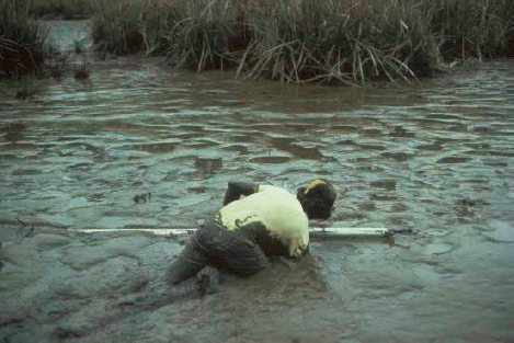
Rank of 9: Sheltered, Flat, Semi-Permeable Substrate, Soft; infauna usually abundant. The soft substrate and limited access makes sheltered tidal flats difficult once oil reaches these habitats, natural removal rates are very slow. They can be important feeding areas for birds and rearing areas for fish, making them highly sensitive to oil-spill impacts.
Rank of 10: Vegetated Emergent Wetlands. Marshes, mangroves, and other vegetated wetlands are the most sensitive habitats because of their high biological use and value, difficulty of cleanup, and potential for long-term impacts to many organisms. They occur along the high-water line, where oil also often strands. Oil readily adheres to the vegetation. Medium to heavy oils do not readily adhere to or penetrate into the fine-grained soils but can pool on the surface or in animal burrows and root cavities, and soak into accumulated organic matter, such as wrack. Oil persistence under these conditions can be very long term, and cleanup activities can damage the vegetation or mix the oil deeper into the soils.
This page intentionally left blank.


