


Below is the uncorrected machine-read text of this chapter, intended to provide our own search engines and external engines with highly rich, chapter-representative searchable text of each book. Because it is UNCORRECTED material, please consider the following text as a useful but insufficient proxy for the authoritative book pages.
32 Chapter 4. Sources of Data for the Development of Safety Frameworks As noted in Section 1.2, the main objective of this research was to develop Safety Frameworks that could be used by agencies to assess the relationship between distraction and infrastructure elements. A number of existing public and private databases were identified that could be used in the development of the Safety Frameworks. These databases are summarized in the sections below. Each data set was examined to determine its feasibility for use in BTS-09 as well as its use by other researchers who may want to apply the Safety Frameworks developed under this project. Existing data sets were identified because collection of additional data was beyond the scope of BTS-09. None of the data sets identified are focused on the collection of OVD data. Four categories of data were identified, as described in the sections below: NDS, crash, infrastructure, and simulator data. Data sets are summarized below, and the feasibility of their use in assessing infrastructure-related-distractions is discussed. For a select few, several analyses were also conducted to further assess their efficacy. Data sets that were and were not considered to be feasible for the purposes of BTS-09 are included as a reference for other researchers who may want to consider their viability. 4.1 Naturalistic Driving Studies Naturalistic driving studies are on-road studies where naïve drivers are observed during regular driving. In most cases, the subject driverâs own vehicle is instrumented with a data acquisition system (DAS). In other cases, subject drivers are provided with test vehicles that they drive as their regular vehicle for the duration of their participation. Data are typically collected for intervals ranging from a few hours to several years of driving. Since drivers tend to acclimate to the test equipment rather quickly, this allows data about driver behavior to be collected rather unobtrusively. The DAS varies depending on the purpose of the research study. In most cases, the instrumentation package includes a variety of sensors such as radar, GPS, and video cameras. Many systems also record the data stream from the vehicleâs onboard diagnostic (OBD) port or controller automated network (CAN) interface, which provides internal vehicle control information such as throttle position, engine revolutions per minute, acceleration or deceleration, and activation of safety features such as traction control, seatbelt tensioners, and antilock brakes. Using the sensor arrays, information about vehicle kinematics (e.g., speed, acceleration, position) are recorded or extracted. The camera arrays typically include a forward roadway view and a driver face camera as a minimum. As a result, environmental conditions, current road conditions, and traffic characteristics (e.g., density, headway) can be determined along with driver behaviors such as cell phone use and eating while driving. Eye tracking systems are sometimes included to determine glance location, with distraction inferred based on extended glances away from the forward roadway. Vehicle position is typically collected by including a GPS in the instrumentation package. As a result, a vehicleâs position during a particular driving trace can be linked with roadway databases or aerial imagery. (A driving trace is defined as one vehicle trip through a particular roadway
33 segment.) This allows roadway and roadside characteristics to be determined, such as driveway density, land use, or objects in the right-of-way. NDS data offer a unique opportunity to view actions prior to and during safety-critical events (SCEs), which include crashes, near-crashes, or conflicts, as well as normal driving. This provides insight into the characteristics present for different outcomes (e.g., a crash versus running off the road and then returning to the correct lane position). Additionally, the data sets include a wide variety of roadway types and driving environments (rural, suburban, urban, etc.), along with various combinations of horizontal and vertical curvature, lane width, shoulder type, and so on. The main advantage of NDS data for the purposes of BTS-09 is that driver behavior can be linked to actual events (normal or safety critical) and roadway characteristics. The main disadvantage in the use of this type of data is that finding events of interest can be a âneedle in a haystackâ problem because these events may represent a few seconds out of the hundreds of hours of data collected. Several naturalistic driving studies have been conducted in North America, Europe, and Australia. Many have been field operational tests (FOTs) conducted to test specific automotive safety systems. Studies were included in this review when they were of sufficient size that they would likely have enough samples for their use to be reasonable for BTS-09. The studies were identified through a combination of the research teamâs knowledge of previous studies, an exhaustive internet search, and discussions with the database owners. Because the term NDS is used in this report to broadly describe field studies where the driving behavior of naïve drivers is observed during on-road driving, the data sets described below result from two types of NDS: purely observational studies and FOTs. Purely observational studies are those where the drivers are simply passively observed for a set period of time. FOTs are typically conducted similarly to purely observational tests, but at some point a technological intervention is introduced to evaluate how drivers respond. For instance, drivers are provided with an instrumented vehicle that they drive for a baseline period, after which a lane departure warning system is turned on and the drivers are observed for another period of time to observe how they react to the intervention. Table 4 summarizes the naturalistic driving studies presented in this report and their strengths and weaknesses for the purposes of this project. Each NDS data set is described in more detail in the following sections.
34 Table 4. Summary of NDS data sets. Data Set Source Sample Size Source of Distraction Advantages Disadvantages SHRP2 Naturalistic Driving Study Virginia Tech Transportation Institute (VTTI) secure data enclave ⢠3,500 drivers. ⢠35 million vehicle miles. Driver face video ⢠Several curated data sets are available. ⢠Team has familiarity. ⢠Roadway Information Database (RID) also available. ⢠Costly if curated data sets not feasible. ⢠Only passenger vehicles. Onboard Monitoring System FOT VTTI ⢠156 large trucks and buses. Driver face video ⢠Includes commercial vehicles. ⢠Only baseline data could be used. ⢠Roadway data not readily available. ⢠Databases not readily accessible. Safety Pilot Model Deployment University of Michigan Transportation Research Institute (UMTRI) ⢠300 passenger vehicles. ⢠Transit buses. ⢠Motorcycles. Driver face video ⢠Large sample. ⢠Includes commercial vehicles. ⢠Additional resources needed to obtain and reduce driver face video. Integrated Vehicle-Based Safety System FOT UMTRI ⢠108 passenger vehicle drivers. ⢠18 commercial vehicle drivers. Driver face video ⢠Includes commercial vehicles. ⢠Additional resources needed to obtain and reduce driver face video. Volpe Forward Collision Warning FOT Volpe National Transportation Systems Center ⢠38 passenger vehicle drivers. ⢠3 weeks. Driver face video ⢠None noted. ⢠Small sample size. Automotive Rear-End Collision System FOT UMTRI ⢠66 passenger vehicle drivers. ⢠101,000 miles. Driver face video ⢠Recorded SCEs. ⢠Small sample size. ⢠Only 1 week of baseline.
35 Data Set Source Sample Size Source of Distraction Advantages Disadvantages Berkeley DeepDrive 100k University of Californiaâ Berkeley ⢠100,000 40- second videos. None available ⢠None noted. ⢠No driver data available. ⢠Small sample size. European Naturalistic Driving and Riding for Infrastructure & Vehicle Safety and Environment (UDRIVE) European Union 100,000 hours. Driver face video ⢠Collected 50 roadway variables. ⢠Reduced some driver behaviors. ⢠Not available to third-party researchers. ⢠Resource- intensive for BTS-09. 4.1.1 SHRP2 Naturalistic Driving Study SHRP2 conducted the largest NDS worldwide to date, involving more than 3,000 male and female volunteer passenger vehicle drivers (ages 16 to 98) who participated for one to two years. The study included drivers from six U.S. states (Florida, Indiana, New York, North Carolina, Pennsylvania, and Washington). VTTI oversaw the data collection and curated the data collected for the various states, and VTTI continues to house the data in a secure data enclave. Data were collected in-vehicle from October 2010 to November 2013 (Dingus et al. 2014). The DAS included a camera array, accelerometer, radar, GPS, and CAN bus to extract engine variables. Vehicle kinematic data such as speed, acceleration (forward and lateral), brake status, and gas pedal position were recorded or extracted. Vehicle kinematic data can be provided in a data file with variables correlated to 0.1-second intervals. The video views include forward roadway, rear roadway, driverâs face, and over the driverâs shoulder. A RID was collected in conjunction with the SHRP2 NDS. A description of the RID is provided below in the Roadway and Infrastructure Inventories section of this report. The GPS data can be used to link vehicle position with the RID, which can be used to identify driving activity in the vicinity of infrastructure elements of interest. Additionally, other roadway characteristics from the RID can be extracted (e.g., grade, speed limit, roadway type). Some roadway variables can also be extracted from the forward roadway view. The forward roadway view can also be used to confirm the presence and characteristics of desired roadway elements that correspond to the vehicle activity of interest. VTTI identified and coded information for around 8,790 crashes, near-crashes, or conflicts. A crash is defined as any event where the subject vehicle makes contact with a moving or fixed object in which kinetic energy is measurably transferred or dissipated or the subject vehicle leaves the roadway with at least one tire. A NC includes events involving a rapid evasive maneuver by the subject vehicle or a conflicting vehicle, pedestrian, cyclist, or animal in order to
36 avoid a crash. A conflict is an event that requires an evasive maneuver that is less urgent than that required for a NC but more urgent than the maneuvers required for normal driving. Coded information includes pre-event and post-event vehicle maneuvers, an assessment of fault, severity, driver actions in response to the event (e.g., passing on the right), precipitating event, vehicle contributing factors, and driver state (e.g., impairment, emotional state). Distraction is also coded (in terms of the beginning and end time for the distraction and the type of distraction) for up to three activities. Roadway surface condition, basic roadway characteristics (e.g., number of lanes, presence of traffic control, alignment), and a measure of traffic flow are also included in the data. Time series data and a forward roadway video clip are available for each SCE and are housed on the SHRP2 NDS website, InSight (https://insight.shrp2nds.us/). Other information can be extracted for SCEs if needed. For instance, the presence of relevant infrastructure items can be coded using the forward video or the RID. Additionally, other events of interest can be requested. For instance, if a series of billboards is identified, driving traces in the vicinity can be provided. The SHRP2 NDS data were utilized to demonstrate two different analyses, as described in Chapters 8 and 9. 4.1.2 Onboard Monitoring System Field Operational Test VTTI conducted an FOT of an onboard monitoring system using 156 instrumented large trucks and buses with 317 commercial drivers over 18 months. The objective of this study was to assess the effects of driving time, fatigue, and distraction on crash risk (FMCSA 2019). An onboard monitoring system was included as an intervention and provided real-time feedback to commercial truck and motor coach drivers in an effort to reduce crashes and near-crashes. The vehicle warning system included forward collision warning and lane departure warning systems (Hallquist 2012). Data were collected for fleets in eight cities across seven states (Los Angeles, California; Baton Rouge, Louisiana; Selma, North Carolina; Coraopolis, Pennsylvania; Williamsport, Pennsylvania; Escanaba, Michigan; Pembroke, New Hampshire; and San Antonio, Texas). The DAS included video cameras (including a forward roadway view), a GPS, an accelerometer to assess swerving and hard braking, and a speed sensor. SCEs were coded, but roadway data do not appear to have been coded with the identified events. Data were collected for one month prior to activation of the onboard monitoring system, then for nine months when the system was active, then for a two-month period after the system was deactivated (Boyle et al. 2016). The main advantage of the data set in terms of the evaluation of IRDs is that it includes large trucks. The main disadvantage is that only the baseline data can be utilized because the intervention of the onboard monitoring system would be expected to impact driver behavior in a different manner than normal driving. Other challenges in using this data set include limited sample size and the lack of coded roadway data. 4.1.3 Safety Pilot Model Deployment The University of Michigan Transportation Research Institute (UMTRI) conducted an NDS to assess connected vehicles. The NDS, called the Safety Pilot Model Deployment, collected
37 vehicle and traffic data using vehicles equipped with vehicle-to-vehicle and vehicle-to- infrastructure communication devices. Dedicated short-range communication equipment communicated basic safety messages such as speed, location, and direction at a specified frequency. Data were collected in Ann Arbor, Michigan, beginning in 2012. The study included around 3,000 passenger vehicles, several transit buses, and four motorcycles, as well as 30 pieces of roadside equipment covering 75 miles of roadway. Data from some test vehicles were collected with an additional DAS, and a few vehicles were also equipped with cameras to record data both internal and external to the vehicle. Several data sets were reduced, such as driving data acquired using two types of DAS, basic safety messages generated from equipped vehicles, basic safety messages and signal timing and curve speed warning messages transmitted by roadside equipment, weather information for the time periods that corresponded to data collection, and a network data set with traffic count data. Several of these data sets are readily available, with the most recent version able to be downloaded from the Safety Pilot Model Deployment data webpage (U.S. DOT 2019). However, forward video is not readily available due to the possibility that it may contain personal identifying information. The main advantage of the Safety Pilot Model Deployment data set in terms of the evaluation of IRDs is that different modes of transportation are included. The main limitation is the limited number of roadway miles on which data were collected. It was confirmed with UMTRI that, with additional resources, forward video data can be requested with personal identifying information removed and glance location coded. As a result, the data set may provide a useful source of information on the relationship between infrastructure and distraction for future analyses based on the Safety Frameworks described in Chapters 8 and 9. 4.1.4 Integrated Vehicle-Based Safety System Field Operational Test UMTRI conducted an FOT of an integrated vehicle-based safety system that incorporated several crash avoidance systems, including forward collision, lane departure, lane change, and curve speed warning systems. The DAS included cameras (forward roadway), CAN buses to collect vehicle data, a GPS, an accelerometer, and a device to measure steering angle (Sayer et al. 2010). The study included 16 passenger vehicles that were driven by 108 volunteer drivers who used the instrumented vehicle as their personal vehicle. The study was conducted in southeastern Michigan for a 40-day period, which included a 12-day baseline period and 28 days with the safety systems active (Sayer et al. 2010). Approximately 6,000 hours and over 213,000 miles of driving were included in the light duty vehicle data set. The study also included 10 instrumented heavy trucks with 18 volunteer commercial drivers. The data set for this portion of the study included a two-month period of baseline driving followed by an eight-month intervention period when the safety systems were enabled (Nodine et al. 2011). A structured database was developed during the course of the project that included all the channels and associated properties collected by the DAS, as well as additional data elements that were appended to the database from outside sources (Sayer et al. 2010). The latter included information such as roadway characteristics, location of curves, and similar items. Triggered events were also logged by the DAS.
38 Relevant data collection variables included lateral position, lane line types, road shoulder width, roadway curvature, and lane position. Lateral position was measured as the offset between the estimated lane center and the center of the vehicle. Around 12,760 lane departure events were recorded in the light vehicle data set during steady state driving. Vehicle trajectory data and maximum lane incursion distance were recorded for the lane departure events. The main advantage of this data set in terms of the evaluation of IRDs is that both passenger and heavy vehicles are included. The two main drawbacks to this data set are the small sample size and the lack of an easy method to determine driver distraction. For the first drawback, only 108 passenger vehicles were included for a 40-day data collection period. Although the data collection period was longer for the heavy truck portion of the study, only 10 instrumented vehicles were included. Additionally, only the baseline data can be utilized for the purpose of evaluating IRD because the intervention of the safety system would be expected to impact driver behavior in a different manner than normal driving. For the second drawback, use of the data set would require resources to reduce driver glance location; it was confirmed by UMTRI that no reduced data sets were available that could be readily utilized. If glance location is coded, these data may be a source for other researchers who conduct analyses based on the Safety Frameworks developed in Chapters 8 and 9. 4.1.5 Volpe Forward Collision Warning System Field Operational Test The U.S. Department of Transportationâs (U.S. DOTâs) Volpe National Transportation Systems Center conducted an FOT in the greater Washington, DC, area to evaluate a forward collision warning and automatic braking system. Twenty-four 2013 Cadillac SRX passenger vehicles were instrumented with a DAS and the safety system. A total of 38 drivers participated for three months, nine months, or one year (Nodine et al. 2019). Baseline data were collected for three weeks prior to the safety system being turned on. Vehicle variables such as position, speed, lateral acceleration, longitudinal acceleration, steering wheel angle, and distance to forward objects were recorded. Camera views were also recorded, including forward roadway and driver views. Roadway data elements do not appear to have been collected in conjunction with the study but could be derived from the forward camera and vehicle position data. The main disadvantage of this study in terms of the evaluation of IRD is the small sample size, in that only 38 participants drove the instrumented vehicles for a duration of three months to one year and only passenger vehicles were included. Additionally, only the three weeks of baseline data can be utilized because the intervention of the safety system would be expected to impact driver behavior in a different manner than normal driving. 4.1.6 Automotive Rear-End Collision Avoidance System Field Operational Test UMTRI instrumented 10 passenger vehicles with a DAS to assess an automotive rear-end collision avoidance system, which included a forward collision warning system and adaptive cruise control. The FOT included 66 drivers from March 2003 to November 2004, primarily in Michigan. Each driver drove one of the instrumented vehicles for one week as a baseline, followed by three weeks with the safety system active. Around 163,000 km (101,000 miles) of
39 driving were recorded. A forward roadway view video was included in the DAS. Relevant variables collected include lateral acceleration, steering wheel angle, compass heading, location, and speed (Najm et al. 2006). Crash, conflict, and low-conflict events were identified using numerical data processing algorithms. Conflict and NC events were further coded. Variables coded included ambient light conditions, weather, type of roadway (coded as freeway or nonfreeway), and traffic density. The main disadvantage of this study in terms of the evaluation of IRD is the small sample size, in that only 66 drivers drove the instrumented vehicles for four weeks. Additionally, only the single week of baseline data can be utilized because the intervention of the safety system would be expected to impact driver behavior in a different manner than normal driving. 4.1.7 Berkeley DeepDrive 100k The Berkeley DeepDrive 100k (BDD100k) data set contains over 100,000 high-definition video sequences that are each 40 seconds long. The data were collected in New York as well as in Berkeley, San Francisco, and other parts of the San Francisco Bay Area in California by the University of CaliforniaâBerkeley. In addition to video data collection, road object detection was conducted where objects such as cars, buses, pedestrians, and traffic signs were annotated for over 100,000 images. This information was collected to help train machine visioning algorithms to identify roadway images. The data appear to have been collected with naïve drivers, and no driver face video is available. The data are readily available for download. Although they provide an interesting and varied data set, the Berkeley DeepDrive 100k data do not include driver face video and would not be useful for the purposes of evaluating IRD. In contrast, driver face video is available for all of the other NDS data sets discussed in this report. 4.1.8 UDRIVE UDRIVE is the largest NDS conducted in Europe. Several vehicle types were included in the study (passenger vehicles, trucks, and powered two-wheelers), and data were collected in six European Union countries (Spain, France, the Netherlands, Poland, Germany, and the United Kingdom). UDRIVE was conducted to assess road user behavior during normal driving and SCEs, with a particular focus on the prevalence and impact of driver behavior such as distraction and inattention. Data were collected from January 2015 to May 2017 and resulted in around 100,000 hours of vehicle data. The DAS recorded data from the CAN interface and video from eight cameras. About 270 variables were recorded or extracted. Additionally, nearly 50 roadway attributes were added to the data, including variables such as speed limit, curve radius, traffic signs, and number of lanes. The UDRIVE data set includes initial analyses that were conducted soon after the study was concluded. The summaries include some information about the extent to which a subset of driver behaviors was present in a given scenario. For instance, Bargman et al. (2017) evaluated speeding by time of day and gender, number and type of distractions, interactions with pedestrians, and eco-driving.
40 The UDRIVE data are ultimately intended to be available to third-party researchers. However, currently no protocol for accessing the data is available for third-party users; access requires partnerships with UDRIVE partners who have access to the data. Moreover, use of the data set would entail manually identifying and coding infrastructure elements (e.g., wind turbines or bridges). Given the resources needed to obtain infrastructure elements, UDRIVE is not likely to be feasible for evaluation of IRD. Additionally, European infrastructure differs in some ways from U.S. infrastructure, and the results of any analyses using UDRIVE data may not be transportable to the U.S. situation. However, in the future, data are likely to be more available and may be a source for similar analyses. 4.2 Simulator Data Sets A large number of research institutions collect data using driving simulators. These simulators range from low fidelity (e.g., a steering console and computer screen with no motion base) to high fidelity (e.g., an immersive experience with multiple degrees of freedom). The latter type of simulator is used by the University of Iowa. Simulation provides the ideal mechanism for exploring research that is infeasible, too costly, or unsafe in the real world, including assessing cognitive or physical ability, understanding driver performance and behavior, testing vehicle designs in virtual proving grounds, and training drivers. Simulation technologies have enabled testing of collision warning safety technologies using human drivers in a variety of vehicle types and driving conditions. Many research groups (mainly universities) collect simulator data at various levels of fidelity but collect them for a particular project and maintain them in house. As a result, many simulator data sets are not publicly available. Additionally, these data sets are not collected with consistent standards. The University of Iowa simulator data sets are the only viable option for the purposes of this project and are therefore the only simulator data sets described below. 4.2.1 University of Iowa Simulator Data Sets Located at the University of Iowa, the NADS is best known for its high-fidelity ground vehicle driving simulator, the NADS-1. The NADS-1 utilizes an actual vehicle cab housed within a dome. The vehicle cab is mounted on four independent actuators that provide vibration associated with driving on various road surfaces. The entire dome is mounted on a motion base that can independently provide yaw, roll, pitch, turning, lateral, and longitudinal cues to the driver, providing a motion envelope with 13 degrees of freedom. The NADS-1 uses 16 high-definition LED projectors to display seamless imagery on the interior walls of the dome, resulting in a 360-degree horizontal and 40-degree vertical field of view. The driver feels immersed as a result of seeing projected scenery through the windshield, side windows, rear window, rear view mirror, and side view mirrors. The LED projectors provide rich saturated colors that result in realistic traffic signals and signs and accurate reproduction of daytime and nighttime driving environments. LED projectors with dimming technology are particularly well suited to displaying low-contrast objects in lowlight and nighttime driving environments.
41 The NADS-1 captures hundreds of performance-based variables related to steering wheel position, brake pedal activation, lane position, and so on. The apparatus also has the ability to capture eye glance location using a head-mounted eye tracking system. These data are sampled at between 60 and 240 Hz. In addition, the data include continuous video recordings of the driverâs face, over-the-shoulder views, forward views of the simulator scenario, and foot position. These video data are synchronized with the simulator data via frame numbers. These data give an opportunity to view actions prior to and during simulated safety-critical (crash, NC, or conflict) events as well as during normal driving events and provide insight into the characteristics present for different outcomes. Additionally, the data include a wide variety of roadway types, including rural versus urban, Interstate versus residential, various horizontal or vertical curves, and so on. The main advantage of using the University of Iowa simulator data for the purposes of BTS-09 is that the data are recorded from many individuals under identical driving conditions. This allows for the direct assessment of the impact of certain variables on performance. These events are marked in the data and are therefore easy to find and analyze. The main disadvantage is that the data are collected in an artificial environment and therefore may not replicate the complex conditions of real-world driving. The University of Iowa simulator data set that was utilized for the Safety Frameworks was collected as part of the Driver Monitoring of Inattention and Impairment Using Vehicle Equipment (DrIIVE) program. These data form a valuable database of nearly 250 drivers in controlled scenarios at different times of day and under different types of impairment. This data set includes data from several studies. The goal of the program was to develop and evaluate a system of algorithms to identify signatures of alcohol (108 participants involved), drowsiness (72 participants involved), and distraction-related impairment (56 participants involved) using data available from the vehicle. Each of these conditions included baseline drives, from which the data used in the Safety Frameworks were gathered. Drivers participated in a standard set of scenarios referred to as the IMPACT database. The driving scenarios started with an urban environment composed of a two-lane roadway through a city with posted speed limits of 25 to 45 mph with signal-controlled and uncontrolled intersections. This was followed by an Interstate highway that consisted of a four-lane divided expressway with a posted speed limit of 70 mph. After merging onto the Interstate segment, drivers made lane changes to pass a few slower-moving trucks. The drive ended in a rural environment that included dark, lighted, straight, curved, gravel, and paved sections. In the scenarios that examined drowsy or fatigued driving, a final 10-minute drive on a section of straight rural roadway was included to increase the likelihood of drowsy lane departures. These scenarios provided a common set of events that every driver experienced, making it possible to compare driving performance across drivers and types of impairment. Additionally, the drive was segmented into 19 âeventsâ that were used to characterize driving performance in various road scenarios, such as urban curves, yellow light dilemmas, Interstate merges, rural dark roads, and so on. Event durations varied from around 30 seconds to several minutes. Light traffic was present during the urban and Interstate sections of the drive.
42 As can be seen in Figure 6, these scenarios featured interesting roadside infrastructure such as buildings, billboards, lights, planters, signage, and so on, in addition to other roadway vehicles and vulnerable road users. Figure 6. Scenes from University of Iowa simulator data sets.
43 4.3 Crash Data Analysis of crash data is a potential method for understanding the factors that contribute to OVD crashes and may be useful in identifying situations where IRD has occurred. This section summarizes crash databases that may be feasible for achieving the objectives of BTS-09 or that can be utilized by researchers who wish to evaluate IRDs. Some of these sources, most notably NHTSAâs Fatality Analysis Reporting System (FARS), are a derived subset of state motor vehicle crash reports. It is important to note that while several of these sources include information about crashes said to involve OVDs, this information includes all types of distractions; in other words, the distractions involve not only infrastructure but also people, animals, previous crashes, and so on. Table 5 summarizes the available crash data sets presented in this report and their advantages and disadvantages in terms of their usefulness for the projectâs objectives. The various crash data sets identified are described in more detail in the following sections. Table 5. Summary of crash data sets. Data Set Source Sample Size Source of Distraction Advantages Disadvantages State crash data sets State DOTs Varies ⢠Coded crash form. ⢠Crash narrative. ⢠Depends on state. ⢠Depends on state. FARS NHTSA Varies, but only includes fatal crashes ⢠Coded crash form. ⢠National coverage. ⢠Large sample size. ⢠OVDs not consistent between states. ⢠Crash narrative not available. Crash Report Sampling System (CRSS) NHTSA Varies ⢠Coded crash form. ⢠Geographically stratified. ⢠Detailed crash information. ⢠Includes all crash types. ⢠Crash narrative not available. Federal Motor Carrier Safety Administration (FMCSA) Crash File FMCSA Varies; only includes commercial motor carriers but includes all crashes ⢠Coded crash form. ⢠Focuses on commercial vehicles. ⢠Crash narrative not available. ⢠Distraction information not robust. Comprehensive Loss Underwriting Exchange (CLUE) LexisNexis Risk Solutions Varies, but includes all crash types ⢠Unknown. ⢠None noted. ⢠Not readily available. ⢠No additional information that adds value to project objectives.
44 Data Set Source Sample Size Source of Distraction Advantages Disadvantages ISO Risk Analyzer Environmental Module Verisk ZIP code-level analysis of traffic generators, traffic variables, or other characteristics that may impact crash rate ⢠None. ⢠None noted. ⢠Not readily available. ⢠No additional information that adds value to project objectives. Highway Loss Data Institute (HLDI 2019) Insurance loss statistics ⢠None. ⢠None noted. ⢠Not readily available. ⢠No additional information that adds value to project objectives. 4.3.1 State Crash Databases Motor vehicle crash records created and maintained by transportation and law enforcement agencies are a potential source of information about IRDs. These records are generated primarily to provide case-specific information required by crash-involved road users, the insurance industry, law enforcement, and the judiciary. Engineering and safety research is generally treated as a secondary use of the data. In some jurisdictions, official crash report forms include a checkbox that allows the responding officer to identify the crash as having involved an external or outside-the-vehicle distraction. This category includes both infrastructure and non-infrastructure OVDs. Freeform text in the narrative section of the crash report allows the responding officer to provide additional details about the nature of the distraction, though the decision about which details to include (if any) is usually made on a case-by-case basis at the officerâs discretion. The institutional arrangements for crash reporting vary considerably from state to state. For example, in Illinois, the primary responsibility for maintaining crash reports resides with the responding law enforcement agency. Although Illinois law requires each agency to submit a copy of the report to the Illinois DOT within 10 days, this is mainly for statistical tabulation; the primary record is generally a handwritten paper crash report form maintained by the responding agency. An important research challenge in states with decentralized crash reporting systems is obtaining relevant data from multiple agencies. For example, the 2012 Census of Governments reports that Illinois has 102 counties and 2,729 localities (cities, villages, towns, and townships). Many roads in Illinois are laid out along boundaries derived from the 19th century Public Land Survey System, and, as a result, it is not unusual for a single intersection to be located in four or more jurisdictions.
45 In contrast, neighboring Iowa leads a 15-state coalition that has developed a centralized electronic reporting portal called Traffic and Criminal Software (TraCS). The Iowa instance of TraCS is jointly maintained by the Iowa DOT and the Iowa State Patrol. As of March 2019, the system was used by 368 state, county, and municipal enforcement agencies in Iowa, with 99.2% of crash reports generated electronically. The centralized recordkeeping, searchability, and greater uniformity made possible by automated systems such as TraCS facilitate roadway safety research. The Iowa TraCS obtains the location of each crash from the GPS data in the responding officerâs mobile data terminal, eliminating the need for manually coding crash locations when linking crash reports with physical features of the roadway or roadside environment. One potential source of such physical features data is the Iowa DOTâs Geographic Information Management System (GIMS) database, which includes a number of physical attributes for freeways, expressways, and primary two-lane highways. (No central database is available for the attributes of secondary highways or municipal streets.) TraCS dataâstripped of crash narratives and personal identifying informationâis freely available through the online Iowa Crash Analysis Tool. The data set could potentially be further refined by searching for specific terms in crash narratives, though access to the latter requires special authorization from the Iowa DOT. As noted in the working definitions for infrastructure and distractions, the format of crash reports varies considerably from state to state. Crash report content, however, has been partially standardized through national efforts such as the MMUCC (NHTSA 2012 and 2017). The recommended data model for external distractions was refined in the MMUCCâs fifth edition, which introduced a two-part data model (distraction source and distraction action). It is important to note, however, that MMUCC is a voluntary standard that has not been implemented in all states. Many states (including Iowa) currently base their current crash reporting systems on the MMUCCâs fourth edition. 4.3.2 National Crash Databases NHTSA and the FMCSA have developed several databases that provide some information on OVDs. Identifying OVD crashes may narrow the search for IRD. Some of the key national crash databases in the U.S. are summarized below. FARS NHTSAâs FARS database includes an excerpt of state crash reports for cases that resulted in one or more deaths. FARS includes all known fatal crashes in the United States, with encoded information about vehicle characteristics, driver condition, and road conditions. A major limitation of the data set is that it does not contain data on serious injury crashes, which is often a more robust indicator of problematic sites or features than fatalities. Additionally, although the system offers a way to tabulate the number of reported external distractions by state, a preliminary review of the data indicates that the extent to which external distractions are reported is not consistent from state to state. In fact, some states evidently do not report external
46 distractions at all. In addition, FARS does not provide access to crash narratives, so no details are available to determine which external distractions were infrastructure related. CRSS NHTSAâs CRSS, previously known as the General Estimates System (GES), is a geographically stratified data sample that provides information about crashes of all severities. These crash reports are chosen from 60 selected areas across the United States (Figure 7) that NHTSA statisticians believe reflect the geography, population, miles driven, and crashes in the United States. Source: NHTSA (https://www.nhtsa.gov/crash-data-systems/crash-report-sampling-system). Figure 7. Geographical distribution of CRSS data collection sites. CRSS samplers review crash reports from hundreds of law enforcement agencies within the 60 sites, randomly sampling tens of thousands of crash reports each year. The CRSS samplers obtain copies of the reports and send them to a central location for coding. No other data are collected beyond that in the selected crash reports. Thus, CRSS represents a small but rather robust sample of the more than 5 million motor vehicle crashes that occur each year in the United States. Like in FARS, the information about distraction-involved crashes in CRSS is limited to the crashesâ categorization as involving a road user who was âDistracted by An Outside Person,
47 Object, or Event.â Since crash narratives are not provided, there is no straightforward way to determine which distractions are infrastructure related. The 2015 GES file includes just under 100,000 crash-involved âunitsâ (motor vehicles, motorcycles, bicycles, or pedestrians), of which just over 800 (0.8%) reportedly experienced an external distraction. Note that the number of crashes is substantially less than 800 because many crashes involve two or more units. Crash locations are suppressed from the publicly available CRSS files. Even if this information could be obtained, linking CRSS crashes to roadway or roadside features would require an extraordinarily resource-intensive process to acquire and analyze infrastructure data from scores of state and local jurisdictions. NHTSA Specialty Databases NHTSA specialty databases include the National Motor Vehicle Crash Causation Survey, Large Truck Crash Causation Study, and Motorcycle Crash Causation Study. FMCSA Crash File The FMCSA Crash File contains data from state police crash reports involving commercial motor carriers and their drivers operating in the U.S. A publicly available data file includes the two most recent years of data, comprising about 138,000 motor carrier crashes per year. The 21 fields in the publicly available data file do not include any distraction-related information. A second version of the file with 80 data fields is maintained for internal use by the FMCSA. Since this information is derived entirely from state crash reports and is limited to crashes involving commercial motor carriers, it has limited utility for investigating IRD. 4.3.3 Proprietary Crash Databases At least two proprietary crash data sources have been created to serve the data needs of insurance industry underwriters, as described below. CLUE Auto CLUE Auto is a driver-focused database that provides claims reports generated by LexisNexis Risk Solutions, a consumer reporting agency (Washington State OIC 2020). Each report generally contains up to seven years of personal automobile claims history. This information includes the policyholderâs name, address, date of birth, date of loss, type of loss, amount the company paid (or refused to pay), and a description of the covered property (e.g., vehicle make and model). While this information helps insurance companies price policies profitably, it may not provide relevant details that can be utilized for evaluating IRD. ISO Risk Analyzer Personal Auto Environmental Module Verisk ISO Risk Analyzer Personal Auto Environmental Module is a data modeling application that helps insurance companies price their products based on factors such as average daily traffic
48 volume, elevation variation, road classification, and the probability of extreme weather. Analysis is carried out at the ZIP code level. Variables reportedly included in the ISO Risk Analyzer Personal Auto Environmental Module include traffic generators (e.g., transportation hubs, shopping centers, businesses, hospitals or medical centers, and entertainment districts), traffic density and driving patterns (commuting patterns and public transportation usage), roadway characteristics (speed limits, average daily traffic, and roadway functional classifications), traffic composition (number of vehicles per household, average age of vehicle operators, and typical vehicle uses), weather and terrain (snowfall, rainfall, temperature, extreme weather event data, and elevation changes), and prior claims experience. While this data model may be of limited use for evaluating IRD, it suggests that insurance actuaries believe the presence of certain traffic generators and terrain characteristics can affect crash rates. In principle, such variables might serve as a proxy for a variety of interrelated infrastructure characteristics, perhaps including roadside distractors. Due to the coarse granularity (ZIP code-level analysis), however, it is unlikely that the effects of specific distractors or distractor categories can be analyzed satisfactorily using the model. Nevertheless, the existence of the ISO Risk Analyzer Personal Auto Environmental Module suggests that the insurance industry has an interest in better understanding the characteristics of driving environments that result in claims. With appropriate nondisclosure agreements, future research projects might be able to obtain access to insurersâ proprietary claims databases. 4.4 Roadway and Infrastructure Inventories Roadway and infrastructure inventories are needed to determine the location of roadway features as well as other related infrastructure items. Available data sets were sought and are summarized below. Some types of crash analyses can be performed based on general land use or roadway characteristics. More detailed studies of crash causation are likely to require accurate geospatial information for roadside features suspected of contributing to crashes. Although some of the databases listed below have asset inventory systems that include some of these features, the teamâs experience indicates that the databases are often incomplete or outdated. In many cases, obtaining information about roadway or roadside features of interest may require additional verification. Table 6 summarizes the available roadway and infrastructure data sets presented in this report along with their advantages and disadvantages in terms of their usefulness for the projectâs objectives. The data sets are described in more detail in the following sections.
49 Table 6. Summary of roadway and infrastructure data sets. Data Set Source Key Items Advantages Disadvantages SHRP2 RID Iowa State University ⢠Most roadway infrastructure elements (e.g., signs, roadway surface type). ⢠High-definition roadway items for 12,500 miles with accompanying video. ⢠Roadway database for six states. ⢠Readily available. ⢠Can be used with SHRP2 or other data sets for associated states. ⢠Low cost to obtain. ⢠Items (e.g., bridge abutments, railroad crossings) may not be coded for all roadways. Agency Roadway Inventories Varies ⢠Most roadway infrastructure elements (e.g., signs, roadway surface type). ⢠Usually low cost. ⢠Relevant items (e.g., bridge abutments, railroad crossings) may not be coded. ⢠Accuracy varies. OpenStreetMap Open source ⢠Barriers. ⢠Buildings. ⢠Common roadway features. ⢠Railroad structures. ⢠Sculptures, murals. ⢠Roadside signs. ⢠Open source. ⢠Features not available from other sources. ⢠Contributions by multiple entities; information may not be consistent. ⢠Not comprehensive (only includes what has been contributed). Company Billboard Inventories Lamar Advertising Company Mixed Media Group, Inc. VisCom Outdoor ⢠Roadside signs. ⢠Good source for one data element. ⢠Amount, quality, and type of data vary by company. ⢠Only available for companies that share. U.S. Wind Turbine Database Federal Aviation Administration (FAA) ⢠Wind turbines. ⢠Good source for one data element. ⢠Readily available. ⢠Location not field verified.
50 Data Set Source Key Items Advantages Disadvantages National Bridge Inventoryâ National Geospatial Data Asset Bridges Federal Highway Administration (FHWA) ⢠Bridges on public highways. ⢠Location, classification, and condition. ⢠Good source for one data element. ⢠Readily available. ⢠Information not consistent. Federal Railroad Administration (FRA) Highway-Rail Crossing Inventory Database FRA ⢠Railroad crossings in U.S. (public and private). ⢠Location, traffic control, trains per day. ⢠Good source for one data element. ⢠Readily available. ⢠An evaluation in Section 8 indicated that the database showed current crossings at a rate of approximately 50%. Google Street View Google ⢠Map. ⢠Panoramic view of roadway and surroundings. ⢠Available for all of U.S. ⢠Readily available. ⢠Comprehensive. ⢠Can be used to field verify other data sets. ⢠Features not coded; would need to manually extract. ⢠Data updated in stages; some areas have older imagery. 4.4.1 SHRP2 Roadway Information Database The SHRP2 RID was developed in conjunction with the SHRP2 NDS. Data were collected and aggregated by the Center for Transportation Research and Education at the Institute for Transportation (InTrans) at Iowa State University. A mobile data collection van was used to collect data for about 12,500 centerline miles in the six SHRP2 NDS states (Washington, New York, Indiana, Pennsylvania, North Carolina, and Florida). Roadway features collected include curve radius, number of lanes, roadway alignment, signing, intersection geometry and type, lane width, grade, shoulder type, and lighting. Other sources of existing data were collected and incorporated into the RID. These data came from several sources, including the SHRP2 NDS statesâ DOTs and the FHWAâs Highway Performance Monitoring System. In addition, supplemental data such as 511, construction project, crash, and traffic volume data were also gathered and aggregated. These supplemental data provide coverage for most of the six SHRP2 NDS study states. However, the supplemental data vary in terms of the data available as well as their accuracy and completeness. The RID also includes the SHRP2 RIDView, which provides high-resolution video logs captured during the SHRP2 mobile data collection efforts. Users can drive roads and gather information on roadway and roadside features for the 12,500 centerline miles contained in the RID. The RID can be used in conjunction with the SHRP2 NDS data, but, because the data are spatially located, it can also be used with any other data set within the six study states. For instance, the RID could be used to extract roadway features for use in a crash analysis. The RID
51 could be used both with the SHPR2 NDS data as well as crash data in the study states to evaluate IRD. 4.4.2 Agency Roadway Inventories Many states and localities have prepared geospatial inventories of their major assets and maintain a roadway inventory database. For instance, the Iowa DOT maintains a data warehouse comprised of a linear referencing system (LRS) and the stateâs Roadway Asset Management System (RAMS). The LRS is the foundational system for integrating data from a multitude of sources and encompasses the entire roadway network for the state of Iowa. It supports multiple concurrent routes from different route systems at any location in the state and manages the data through a geographic information system (GIS) interface. The LRS also has a topological layer that designates network connectivity for all roads in the database. In addition, the Iowa DOT maintains RAMS, which is an LRS-enabled database used to store roadway data for all public roads in the state. These data include traffic, roadway geometrics, pavement condition, bridge structures, and a public rail crossing inventory. These two systemsâthe LRS and RAMSâare key to the integration of data throughout the Iowa DOT and provide valuable knowledge used to recommend actions or guide decision-making (Iowa DOT 2020). Most state roadway inventories contain similar elements, such as lane width, type of shoulder, and so on. However, these inventories generally only contain features within the highway right- of-way. Additionally, the content and format of the databases that store these inventories are unique to each jurisdiction, making it difficult to combine data for multiple jurisdictions. In addition to these roadway inventories, many states have photologs that provide images of the roadway and roadside environment, typically every 0.01 miles. Photologs are useful for confirming the existence of suspected roadside features, but, depending on the state, the camera angles are not always ideal for establishing the location and visibility of potentially distracting infrastructure elements. When crash or other data are used to assess IRD in a particular state, the corresponding agencyâs roadway inventories and photologs are likely to be one of the best sources of infrastructure- related data. 4.4.3 OpenStreetMap OpenStreetMap was built by a community of mappers who contribute data about various public features. The data are open source. OpenStreetMap contains various databases, which include the following relevant features: ⢠Aerial ways (cable cars, gondola). ⢠Barriers (cable barriers, walls, guard rails, curbs, retaining walls). ⢠Buildings. ⢠Highways (roads, paths, streetlights, signs, signals). ⢠Railway structures (tracks, stations). ⢠Land use (broad categories such as commercial, construction, and industrial). ⢠Public art and tourism (sculptures, wall paintings, murals).
52 OpenStreetMap also includes an outdoor advertising devices data set. Coded devices include billboards, outdoor store displays such as gas station signs (Figure 8), advertisements painted or displayed on buildings (Figure 9), and outside advertising (billboards). Source: Segnargsed, Creative Commons Attribution-Share Alike 4.0 International license. Figure 8. Business signing. Source: Segnargsed, the Creative Commons Attribution-Share Alike 4.0 International license. Figure 9. Building advertising. Worldwide, the locations of about 65,000 outdoor advertisements were tagged in OpenStreetMap as of February 2020. Currently, the majority of these sites are in Europe (OpenStreetMap 2020).
53 The highway data sets in OpenStreetMap provide information about various roadway infrastructure attributes, such as number of lanes and whether a highway is divided or undivided. However, much of the roadway data are of lesser quality than what can be obtained from state transportation agency databases. Building location and height diagrams are available for some areas in OpenStreetMap, as shown in Figure 10. Buildings are coded into general categories such as industrial, retail, chapel, house, or hotel (OpenStreetMap 2020). Source: https://osmbuildings.org/, © OSM Buildings. Figure 10. Location and height of buildings in Washington, DC. The main advantage of OpenStreetMap is the unique data that are included, which are not likely available from any other source. The main drawbacks are that information about accuracy is not readily available and multiple data sources are included. As a result, the data collection protocols and the characteristics of the data collected are not known. Another drawback is that the data sets are not comprehensive; they include only those features that have been submitted by contributors. As a result, OpenStreetMap data may be useful in identifying specific features to conduct an analysis of IRD, but the information would likely need to be verified using another source. 4.4.4 Company Billboard Inventories Some outdoor advertising companies provide public websites that feature maps with the locations of their billboards and information such as the latitude and longitude and type of each billboard, including digital billboards. For instance, Lamar Advertising Company, which boasts that it has the largest network of digital billboard displays in the United States, with billboards in 43 states, provides an online map that provides information about the companyâs inventory. This information includes a map with locations geocoded, GPS coordinates for each billboard, the style and size of the billboard, the (cardinal) direction the billboard is facing, the side of the road on which the billboard is located,
54 and whether the billboard is illuminated (Lamar Advertising Company 2020). Other companies, such as Outfront Media, provide a link to the Google Street View image of the location. (Google Street View is described in more detail below.) Other smaller regional companies, such as Mixed Media Group, Inc., which operates in eastern Iowa, the Chicagoland area in Illinois, and Detroit, Michigan (Mixed Media Group, Inc. 2020), or VisCom Outdoor, which has a presence in northern California and Nevada (VisCom Outdoor 2020), also provide maps of their inventory. However, the amount of information available varies by company, and certain information is not publicly available for some companies. For instance, VisCom Outdoor only provides the nearest intersection location and not GPS coordinates for its inventory. Additionally, none of the companies identified include information on the date on which the billboard was installed. These data sets provide a rich source for a specific data element. Although there are disadvantages to using these data, it is anticipated that these data could serve as a starting point for identifying billboards in order to assess their effect on distraction or crashes. 4.4.5 U.S. Wind Turbine Database The U.S. Wind Turbine Database is a database and online map containing location data and specification information for both land-based and offshore wind turbines in the U.S. Data are compiled from the FAA, Lawrence Berkley National Laboratory, American Wind Energy Association (AWEA), United States Geological Survey (USGS), and other online sources. This database is maintained through funding from the U.S. Department of Energy (DOE) Wind Energy Technology Office (WETO), USGS, and AWEA. The location for each wind turbine is not field verified; instead, locations are visually verified using high-resolution aerial imagery. For this reason, a confidence rating of the location of each turbine is included with the location data. Additional information provided for each turbine includes GPS coordinates, the installation year, the height of the turbine, and the length of various components of the turbine. Source data can be downloaded and used in GIS software to correlate wind turbine information to geocoded crash data (USGS 2020). This data set provides a rich source for a specific data element. Although there are disadvantages to using these data, it is anticipated that these data would be useful for identifying wind turbine locations for use in a crash analysis assessing the impact of this feature on IRD. Use of this data set for the purposes of this project is further discussed in Chapter 7. 4.4.6 National Bridge InventoryâNational Geospatial Data Asset Bridges The National Bridge Inventory is a database of over 618,000 bridges on public highways in the United States. The inventory contains information on the location, classification, and condition of each bridge and allows bridges to be spatially located. However, a review of the database by Baughn (2020) indicated the following issues: ⢠GPS coordinates are inaccurate for some bridges. ⢠Some information is missing. ⢠Some states include structures that are not bridges (e.g., ferries and overhead signs).
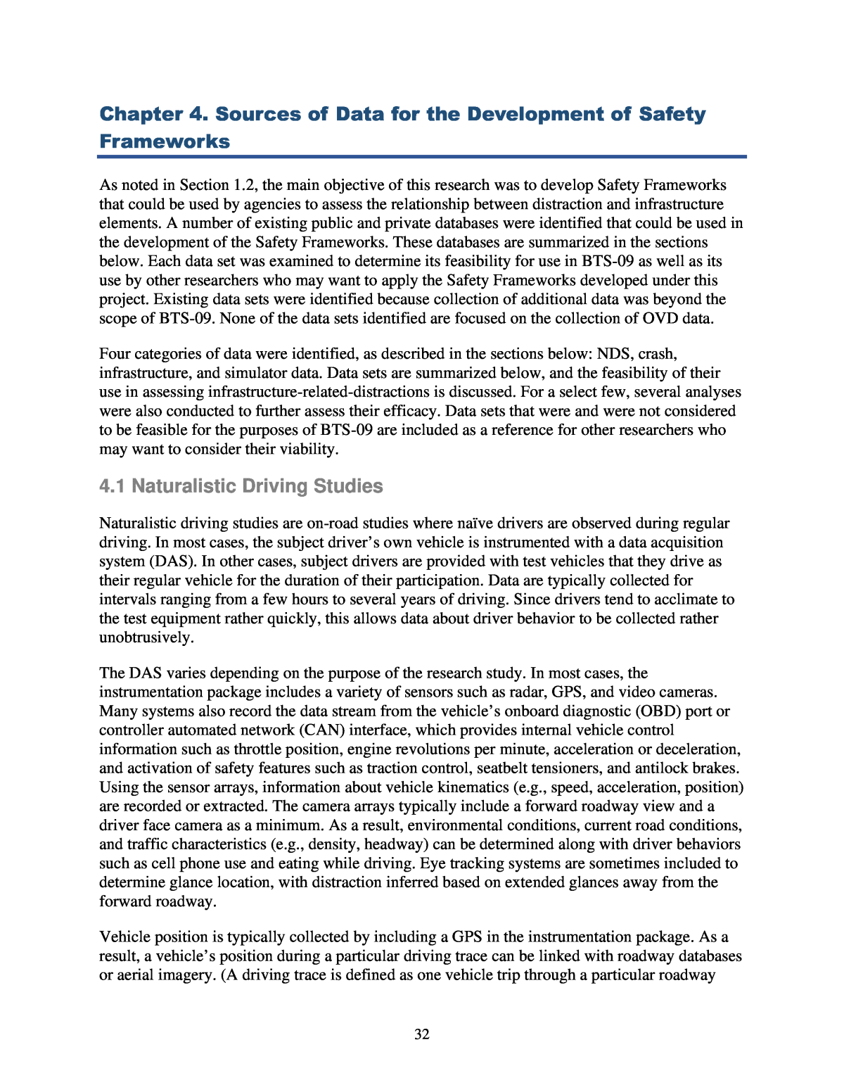
55 This data set provides a rich source for a specific data element. Although there are disadvantages to using these data, it is anticipated that these data can be a rich source of information about bridges that can be used to assess any relationships between bridge structures and distraction. However, it is likely the data would need to be verified using another source. 4.4.7 Federal Railroad Administration Highway-Rail Crossing Inventory Database The FRA maintains a rail crossing inventory that provides information on all railroad crossings in the US, including both public crossings (streets, highways, pedestrian paths, bike trails, etc.) and private crossings (driveways, farm access lanes, private roads, etc.). The database contains information on location, traffic control devices present, number of trains per day, and so on. However, because the data are self-reported, the entries in the inventory are at times incomplete and the accuracy of information is difficult to verify (FRA 2020). Additionally, ArcGIS maintains a spatially located grade crossing inventory that originates from the FRA inventory. The ArcGIS data set also contains Amtrak stations and Amtrak routes (ArcGIS 2020). This data set provides a rich source for a specific data element and includes sufficient data for use in identifying rail crossings. Some evidence has been found of a potential relationship between railroad structures and distraction, and this data set would be useful in assessing that relationship. Use of this data set for the purposes of this project is further discussed in Chapter 8. 4.4.8 Google Street View Launched in 2007, Google Street View provides an interactive panorama from positions along many streets in the world. Street View is available as a component of Google Maps or Google Earth and allows images of roadway and roadside features on the majority of paved streets and highways in the United States and several other countries to be viewed (Figure 11).
56 Source: © 2020 Google. Figure 11. Example image from Google Street View. Data are primarily collected by Google, although a mechanism exists for individual contributions. By May 2017, Google had captured more than 10 million miles of Street View imagery in 83 countries (Wikipedia 2020). If data have been collected multiple times, Street View provides the option to look through older imagery via its âtime hopâ feature. The main advantage of this data set is that Street View is available for many roadways in the United States. The main disadvantage is that images are subject to fisheye lens distortion and, in some cases, unintentional blurring. The systemâs algorithmic privacy protection features, designed to blur faces and text on license plates, sometimes unintentionally obscure infrastructure details such as the text of traffic signs, which could impact the usability of Street View as a method for establishing the location and visibility of potentially distracting infrastructure. Image quality and freshness also vary, especially in rural areas, where some of the imaging has not been updated for many years (Figure 12).
57 Source: © 2020 Google. Figure 12. Older imagery from Google Street View (April 2009 view of an intersection in Kokomo, Mississippi, retrieved in February 2020). The best application of Street View is to confirm the location and characteristics of assets. Street View was utilized in this study to verify various features examined in the Safety Frameworks.
