
4
VOLCANO MONITORING
The previous chapters reviewed the hazards to property and life from Mount Rainier and outlined research needed to provide for better understanding of their nature and frequency of occurrence. This chapter describes monitoring activities that are essential in order to identify anomalous behavior on or around the volcanic edifice that could serve as an early warning of these hazards. Such a monitoring program is necessary to assure that early signs of hazardous activity can be recognized and that its significance for future activity can be evaluated. To be effective, monitoring of the volcano must be carried out at a number of different time and distance scales, using a variety of techniques. Some of the more important techniques are discussed in this chapter.
The use of monitoring techniques to detect anomalous activity presupposes the existence of adequate baseline data that can be used to evaluate such behavior. Ideally, these baseline data would comprise long, continuous series of observations collected at regular intervals during periods when no anomalous activity is occurring. These data series are needed to establish background or average values of behavior that would allow anomalous activity, which would rise above these background values, to be clearly identified.
Adequate baseline data to support monitoring efforts at Mount Rainier are generally lacking. Consequently, an essential aspect of monitoring efforts must involve the acquisition of such data through a program of regular sampling and analysis. The collection of these data could proceed hand in hand with the monitoring activities outlined below.
There are five basic areas for which monitoring and collection of baseline data are important:
-
seismicity;
-
ground deformation;
-
hydrothermal activity;
-
changes in surface appearance of the volcanic edifice; and
-
stream- and debris-flow detection.
The monitoring techniques discussed in this chapter fall into two groups: continuous monitoring, for which measurements are made at regular intervals of seconds to minutes, and intermittent monitoring, for which measurements or observations are made at irregular intervals of days to years. These techniques, developed and tested over the past several decades at active volcanoes around the world, are summarized in Table 4.1 and discussed in the following sections.
Seismicity Monitoring
Seismic monitoring of Mount Rainier can be used to detect the movement of magma beneath or within the edifice that could signal an imminent volcanic eruption. Seismic monitoring can also be used to detect the movement of glaciers on the volcanic edifice or movement of the edifice itself, which could signal impending glacier outburst floods, rockfalls, or slope failures.
Since 1962, one seismometer has operated on Mount Rainier as part of a worldwide seismic station network (WWSSN station LON at Longmire, Washington). Three additional seismometers currently operate within Mount Rainier National Park, and three others in the immediate vicinity function as part of the Washington Regional Seismograph Network operated by the University of Washington. This group of seven instruments (Figure 4.1) is capable of locating an earthquake of magnitude 1.0 or larger within or beneath Mount Rainier.
In the last decade, these seismometers have recorded several thousand events beneath or within the volcano. A few hundred events were clearly earthquakes; this number of events makes Mount Rainier the second most seismically active volcano in the Cascade Range north of Califor-

TABLE 4.1 Examples of Monitoring Techniques Applicable to Mount Rainier
|
Continuous (telemetered) |
Intermittent |
|
Seismic network |
Visual observations |
|
Stream gages |
Photography |
|
Acoustic or vibration network |
Infrared survey |
|
Tiltmeters |
GPS campaign |
|
Continuous GPS |
EDM survey |
|
Slope-stability meters |
Radar interferometry |
|
Gas monitors |
Radar survey of ice thickness |
|
|
Gas chemistry |
|
|
Stream chemistry |
nia, after Mount St. Helens. The other events were probably caused by the movement of glaciers or by rockfalls on the flanks of the volcano. Earthquakes currently are centered beneath Mount Rainier at depths of 5 km or less as well as away from the mountain at depths of 10 to 20 km. A broad zone of earthquakes occurs about 15 km west of Mount Rainier. Since 1972, the largest earthquake in that area was a magnitude-4.1 earthquake that occurred on July 29, 1988 (University of Washington Geophysics Program, 1993). The relation between this zone of nearby earthquakes and volcanic activity at Mount Rainier is unknown.
With the present array of seismometers, it is difficult to distinguish between surface seismic events caused by glacier movements on the edifice and shallow earthquakes beneath Mount Rainier (Weaver, 1976; Malone and others, 1991). This distinction is important, because shallow earthquakes might reflect the movement of magma to shallow levels in the volcano and could signal an impending eruption. On the other hand, an
increase or change in surface seismic events could presage a glacier outburst flood or rockfall, either of which could produce a lahar. Clearer distinction and more reliable detection of shallow earthquakes and surface seismic events could be made if two or three additional seismometers were placed in operation on the upper slopes of the volcanic edifice, especially if these seismometers were three-component instruments capable of detecting ground motion with high resolution.
Monitoring of Ground Deformation
Two common precursors of volcanic eruptions are uplift and lateral distension of the ground surface caused by upward movement of magma beneath and into the volcano. Such tumescence may involve a portion of the volcano, the entire volcano, or a broad region around it. Similarly, a common precursor to large landslides is the slow creep or slumping of a portion of the volcanic edifice. The detection and measurement of these movements using the techniques described below could provide days to months of warning of impending eruptions or edifice failures. Such movements may be no larger than a few centimeters in magnitude; consequently, high measurement precision is required to detect them.
Topographic and road-building surveys conducted around Mount Rainier in the early 1900s provided the first geodetic control of the region. No systematic pattern of ground movement has yet been recognized based on comparisons with these early surveys. The first surveys specifically designed to measure ground deformation of Mount Rainier were made in 1982 (Dzurisin and others, 1983; Chadwick and others, 1985; see Figure 4.2). Measurements to determine horizontal positions of about a dozen stations around the volcano have been repeated three times and indicate no horizontal ground movement within the precision of the measurements except for one clearly unstable benchmark (Iwatsubo and Swanson, 1992).
The elevation of the summit of Mount Rainier was measured in 1988 using GPS (DeLoach, 1989), which utilizes satellites to determine ground positions to within a few centimeters over distances of a few hundred kilometers. This system is useful for the study of active volcanoes,

because measurements can be made in remote or rugged terrain and in poor weather conditions. The survey data can, in some configurations, be telemetered to a central point for recording and interpretation.
Good geodetic control of Mount Rainier could be obtained through real-time continuous GPS monitoring or frequent GPS surveys of the existing geodetic stations in the region and by the establishment of additional stations at higher elevations on the edifice. Frequent measurements of many points are needed to distinguish between changes in elevation due to magma movement and changes due to the seasonal accumulation and melting of snow on the edifice.
To be most effective in detecting ground deformation, the local network of GPS stations on Mount Rainier must be integrated into the regional network that extends about 100 km from the volcano. An active volcano is part of a larger system of the Earth's crust in which regional contraction or extension may promote the movement of deep-seated magma into the edifice. Only since the advent of GPS has it been practical to search for a relation between regional and local activity around active volcanoes.
Measurements of strain changes on time scales of both years (from geodetic surveys) and seconds (from seismometers) are needed, both on the volcano and in surrounding areas. Strain buildup may persist for weeks prior to an eruption, and creep presaging massive landsliding may last for days or even months. Continuous monitoring needed to track such rates of deformation requires tiltmeters, strainmeters, dilatometers, and GPS. Some of this instrumentation (e.g., seismometers, geodetic benchmarks) is currently in place, but additional instrumentation needs to be developed and installed to provide continuous real-time monitoring of the edifice and surrounding areas. Of particular importance is the development and installation of instrumentation to continuously monitor the stability of the flanks of the volcano, because flank failure is a potentially significant hazard to life and property, as discussed in previous chapters.
Deformation of the edifice might also be measurable using a new technique, radar interferometery, that is under development as part of the Earth Observing System of the National Aeronautics and Space Administration. This technique, which utilizes satellite radar to determine differen-
tial vertical movements as small as 1 cm, has been used to detect and measure the displacement field associated with the 1992 earthquake in Landers, California (Massonnet and others, 1993). This satellite-radar system could be used at Mount Rainier as a complement to GPS measurements and to foster development of the technique. This radar system may also be useful for monitoring ice cover on the edifice, as described in a later subsection.
Monitoring of Hydrothermal Activity
Another potential precursor of volcanic activity is a change in the composition or rate of emission of gases and hydrothermal fluids from the volcano. The detection of such changes is facilitated by long-term records of baseline measurements acquired through a program of regular sampling and analysis. At present, such measurements do not exist, but they will be required for evaluating the nature, magnitude, and significance of future changes unless the changes are large.
Thermal springs, fumaroles, and warm ground are found on and near Mount Rainier (Frank, in press), primarily in the summit area (see Figure 3.3). Studies of these hydrothermal features have focused on measurements of temperature and fluid composition, utilizing samples collected at infrequent intervals. The fumaroles in the summit area emit mostly warm air with trace amounts of hydrogen sulfide, rather than gases of dominantly magmatic origin (Frank, in press).
Future activity at Mount Rainier will likely include the emission of a visible gas plume, which would probably appear as a light gray to brown haze extending downwind from the volcano. This plume will probably contain gases such as sulfur dioxide and hydrogen sulfide, which are usually detectable by odor, as well as carbon dioxide, halogens, and other species. The remote measurement of such plume gases would be invaluable for determining the presence of shallow magma bodies that could feed volcanic eruptions. Correlation spectrometry (COSPEC) and infrared spectrophotometry (MIRAN) measurements from the ground or from
airplanes or even satellites could be used to detect and measure sulfur dioxide and carbon dioxide in the plume.
Measurement of stream-water chemistry could be used to detect subglacial hydrothermal or fumarolic activity that could produce catastrophic melting of snow and ice on the volcanic edifice. Such measurements would be particularly important when changes in glacial morphology were observed or when high rates of glacier-related seismicity were detected. Chemical measurements must be obtained at sufficiently frequent intervals to determine ''normal" background values. At a minimum, sampling of fluids during each season of the year would contribute to an understanding of the influences of snowpack and rainfall on fumarole gas, condensate chemistry and temperature, stream chemistry, and stream discharge. Such monitoring proved useful during the thermal event at Mount Baker during the mid-1970s (Frank and others, 1977).
Monitoring Changes in Surface Appearance
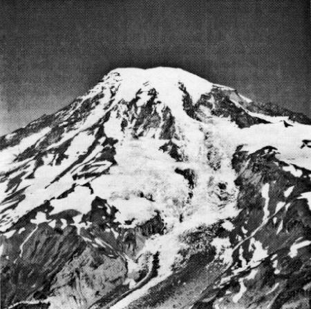
The distribution of snow and ice cover on Mount Rainier is controlled by seasonal and climatic changes and, on a local scale, by heat flow from the volcano. Longer-term (decadal) climatic changes mainly control the volume of glacier ice on the edifice (Figure 4.3). Shorter-term seasonal changes mainly affect the annual accumulation and melting of the snowpack. Very short-term changes (much less than 1 year), due to increases in hydrothermal or fumarolic activity or transient heating events, could affect both the volume of glacier ice and the distribution of the winter snowpack. A short-term, nonseasonal change in snowpack or ice volume might signal increased thermal activity that could produce catastrophic outburst floods, debris flows, or, possibly, eruption.
Several techniques could be usefully employed to monitor changes in snow or ice cover on the volcanic edifice:
-
Visual Observation. The staff of Mount Rainier National Park is familiar with the volcano and is therefore likely to recognize subtle nonseasonal changes in the distribution of snow and ice that might
-
not be apparent to visiting scientists or the general public. Observations of changes in glacier or snow morphology by park staff and frequent visitors need to be reported to scientists responsible for monitoring the volcano, both to alert them to the observations as well as to help interpret the records and data from other monitoring activities.
-
Photogrammetry. Existing oblique air photos of Mount Rainier and its glaciers date back to the 1930s (Frank, 1985). Vertical air photos are also available but are of limited use for mapping purposes because of inadequate control of ground points. High-quality aerial photography is needed for the volcano, including surveys of the snow and ice cover. These images can be used to monitor the volcano and to assist with detailed geologic mapping, identification of potential landslide areas, and preparation of detailed elevation charts.
-
Infrared Heat Emission. Since the 1960s, hot spots around the summit area have been mapped occasionally using infrared sensors (Moxham and others, 1965; Frank, 1985). These hot spots define the margin of the main summit crater. Continued thermal infrared imagery of this area and of selected areas on the slopes of the volcanic edifice would provide the baseline information necessary for revealing a significant change in the pattern of heat flow related to a change in the pathways of warm water through the volcano. The appearance of new hot spots on the slopes might be the only clear indicator that a rocky prominence is being weakened by percolating groundwater and is thus susceptible to failure.
-
Radar Imagery. The use of radar to measure ice thickness has been successful on permanent ice sheets but may not always work well in temperate settings such as Mount Rainier. Glacial ice on Mount Rainier generally contains varying but significant amounts of liquid water, which would limit the penetration of radar signals. However, many of the glaciers on Mount Rainier are thin enough to allow radar signals to penetrate to the underlying bedrock and thus could be used in repeat surveys to detect and measure gross thickness changes. Driedger and Kennard (1986) successfully used
-
radar imagery to determine ice volumes at Mount Rainier and three other Cascade volcanoes.
As with the previously discussed monitoring activities, the key to success in detecting changes on the surface of the volcanic edifice lies in frequent observations combined with the acquisition of baseline data through a program of regular sampling and analysis.
Detection of Stream Flow and Debris Flows
The rapid melting of even a small portion of the extensive cover of snow and ice on the edifice could generate large floods, which could entrain a large amzount of volcanic debris to produce lahars in streams draining the volcano. Catastrophic floods and lahars would doubtless be generated by a major volcanic eruption of the edifice. Major floods and lahars also could be generated by transient thermal events, which might have no obvious surface expression. Such events could occur without warning. Consequently, it is essential to monitor the edifice for floods and debris flows after they have formed and are moving downslope.
Several hours generally pass between the initiation of a major lahar from Mount Rainier and runout of the lahar onto the lower slopes and floodplains surrounding the volcano (Scott and others, 1992). The vibrations set up by moving lahars can be detected by seismometers and acoustic sensors. Modified seismic systems could provide inexpensive yet robust debris-flow detectors and could be linked to the existing network of seismometers designed to record earthquakes. Such systems have provided warning at Redoubt Volcano, Alaska, and Mount Pinatubo, Philippines (Hadley and Lahusen, 1991).
The streams and rivers around Mount Rainier are fed by water from rainstorms as well as from melting of the ice and snow on the edifice. The addition of more weather stations and the operation of a network of stream gages to record changes in water discharge are first steps in revealing the complex water budget of Mount Rainier. Stream-flow monitors
high on the volcano can also detect the sudden changes in water level that may precede a lahar.
Recommendations
A program of volcano monitoring should be established at Mount Rainier to identify anomalous activity that could serve as an early warning of the occurrence of volcanic hazards such as eruptions, edifice collapses, and lahars. This monitoring program should include plans for the collection of adequate baseline data-long, continuous series of observations acquired at regular intervals when no anomalous activity is occurring-in order to provide a background of values with which to contrast anomalous behavior. Efforts to collect these baseline data should proceed hand in hand with the regular monitoring activities.
Monitoring should utilize the following techniques:
-
Seismic monitoring, to detect the movement of magma, glaciers, and rock on or beneath the volcano. The present network of seismometers (Figure 4.1) is sufficient to detect small-magnitude earthquakes associated with magma movement, glacier movement, and rockfall, but it is inadequate to locate these events in space precisely. This network should be upgraded with additional three-component seismometers located on the slopes of the volcanic edifice. A minimum of two seismometers should be added to this network.
-
Ground-deformation monitoring, to detect magma movement and edifice creep. The present network of geodetic stations in the region (Figure 4.2) should be expanded, with additional stations established at higher elevations on the edifice; this local network should be integrated into the regional network surrounding the volcano. This expanded network should be monitored using real-time, continuous GPS, or resurveyed at frequent intervals using GPS, so that seasonal changes in shape due to the annual accumulation and melting of snow and ice can be detected, characterized, and distinguished from hazard-related ground movement. Tiltmeters, strainmeters, and dilatometers should be installed on and around the volca-
-
nic edifice to monitor creep and deformation. Efforts to monitor deformation should include the development of techniques to monitor the stability of the volcano flanks. Satellite radar interferometry is recommended as potentially useful for such monitoring.
-
Monitoring hydrothermal activity, to detect changes in the composition or rates of emission of gases and fluids from the edifice. A program of fluid and gas sampling should be initiated to detect changes in the hydrothermal system within the volcanic edifice. This program should include monitoring for gas plumes if the volcano shows signs of anomalous behavior, such as increased seismicity or significant ground deformation. Samples should be collected and analyzed on a periodic basis from streams, thermal springs, and fumaroles in order to establish a baseline against which to recognize future changes. For geochemical measurements of springs and streams, data analysis should take into account the effects of precipitation and stream discharge.
-
Monitoring changes in surface appearance, to detect changes in snow and ice cover on the volcano. A program to monitor changes in snow and ice cover on the volcano should include visual observation, photogrammetry, infrared heat emission, and radar imagery. Staff at Mount Rainier National Park, who live and work on the volcano and are most likely to recognize anomalous changes in the ice and snow cover, should be enlisted to provide regular visual observations of the volcanic edifice. These visual observations should be augmented with high-resolution, vertical photogrammetry to map the distribution of snow and ice cover on the volcano. This imagery should be supplemented with radar imagery to map the thickness of the snow and ice cover on the edifice. Infrared thermal emission images should also be collected to monitor the distribution of hot spots on the volcano.
-
Stream monitoring, to detect floods and debris flows. A network of sensors should be installed in the major drainages on the edifice to detect the formation and movement of debris flows after they have formed and are moving downslope toward populated areas. These sensors should be tied into the existing seismic network. Additional weather stations and stream gages should be installed in the park to interpret the data from this sensor network and to establish the water budget for the volcano.


