


Below is the uncorrected machine-read text of this chapter, intended to provide our own search engines and external engines with highly rich, chapter-representative searchable text of each book. Because it is UNCORRECTED material, please consider the following text as a useful but insufficient proxy for the authoritative book pages.
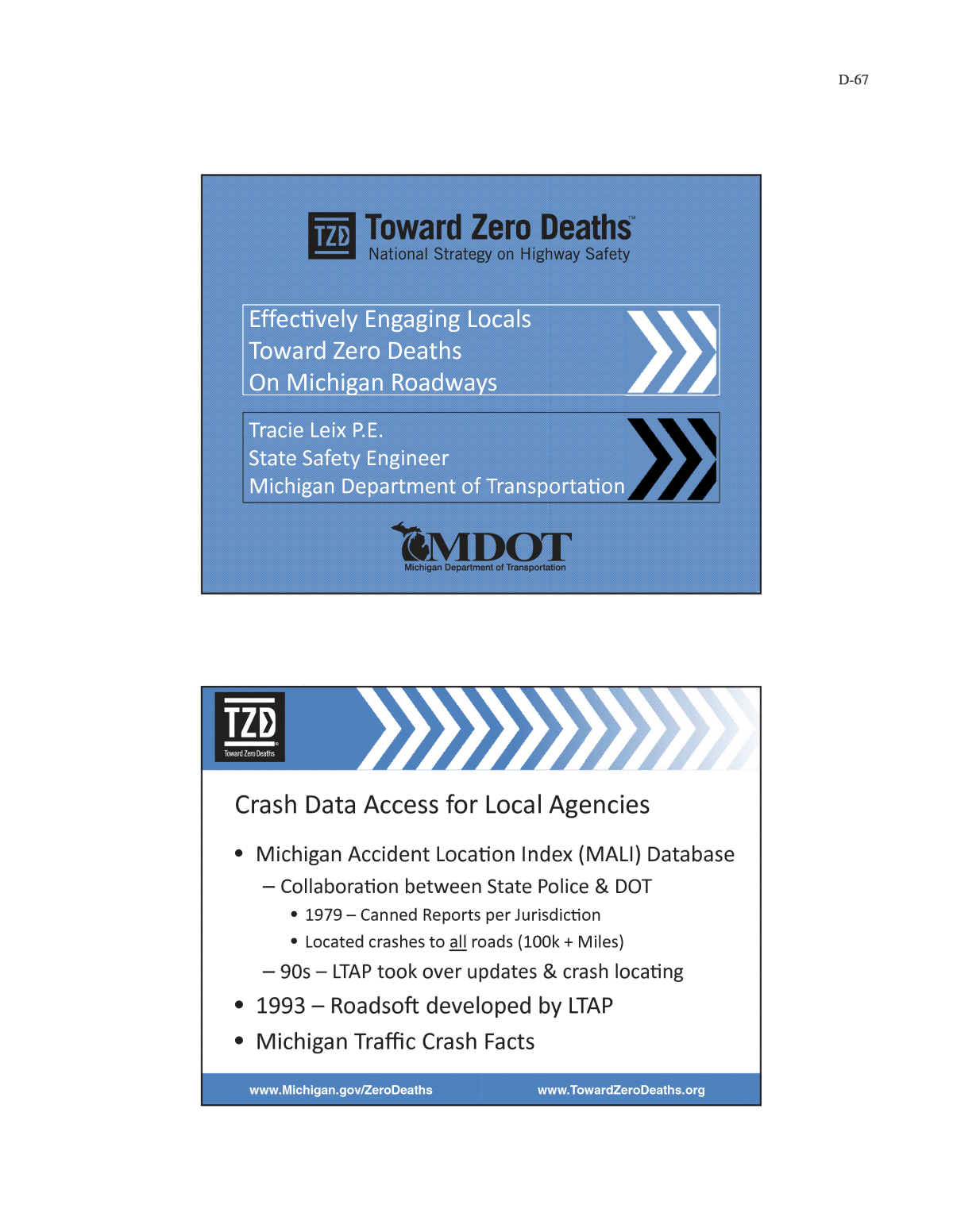
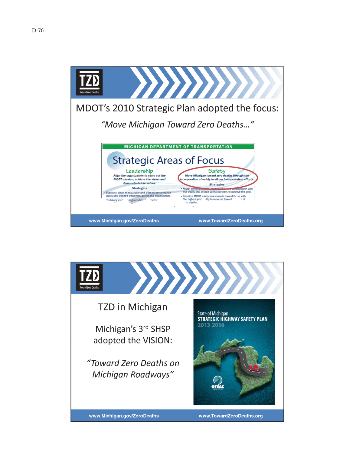
D-1 APPENDIX D (web-only) Sample Documents of Practices Related to Local Road Safety Connecticut Report of findings from the Road Safety Assessment Town of South Windsor Local Road Safety Committee Agenda Florida Local Agency Safety Program Pasco County, Florida Interoffice Memorandum Effectiveness of Britesticks for Enhancement of Traffic Control Signs Iowa Chapter 164 Traffic Safety Improvement Program HSIP â Secondary Program Letter of Interest Application/Agreement for Horizontal Curve Sign Program Request for Traffic Safety Funds Project Louisiana Louisiana Local Road Safety Program Guidelines & Policies 2015 Application for Funding Louisiana Strategic Highway Safety Plan Projects Implemented Through the SHSP Regional Safety Coalitions Funding Commitment Letter Michigan Fiscal Year 2017 Federal Local Safety Program Local Agency Programs Safety Project Submittal Form Local Road Safety Peer Exchange Agenda Effectively Engaging Locals Toward Zero Deaths on Michigan Roadways Lapeer County Chevron and Shoulder Improvements Before and After Pictures Minnesota Pilot Program Summary: Township Sign Replacement and Inventory Program Minnesotaâs Traffic Safety Tracking Indicators by Focus Area Evaluation of the ALERT System, A Rural Intersection Conflict Warning System Implementing County Roadway Safety Plans Ohio Township Sign Safety Program: Before and After Pictures
D-2 Oregon Memorandum of Understanding between State of Oregon Department of Transportation and Association of Oregon Counties and League of Oregon Cities The Changing Lens of Transportation Safety: Combining Road Safety Audits & Health Impact Assessments Washington Centennial Accord Agreement 2014 Plan Contract to Perform Governmental Activities Between Thurston County and The Nisqually Indian Tribe Cowlitz County Strategic Risk-Based Assessment Grant County Local Road Safety Plan Any County Public Works Safety Local Road Safety Plan Cape Horn Corridor Project Presentation Profile Thurston County, Washington, Public Works Department Applies Systemic Safety Project Selection Tool
D-3
D-4
D-5
D-6
D-7
D-8 Town of South Windsor Agenda Local Road Safety April 15, 2015 Members: Michael Gantick, Director of Public Works; Michele Lipe, Director of Planning; Sgt. Glenn Buonanducci, Police Traffic Division; Pat Hankard, Board of Education; Chief Kevin Cooney, Fire Department; Jeff Doolittle, Town Engineer; mark Owens, Street Manager, Scott Yeomans, Associate Manager- Streets Items for Discussion: 1. Current Programs/Projects a. Sign Inventory Update( Scott ) b. CT Crash data c. Road projects Update(Jeff/Michele) i. Avery Street ii. Nevers Road iii. Bond resurfacing roads iv. Wapping Center Sidewalks v. Complete Streets vi. Other d. Safety Circuit Rider Program-Outreach( Mike) 2. Areas of Opportunity(All) a. LED Stop Signs 3. Future Activities Updates a. Street Light Project( Mike) b. Conn DOT(Mike) i. Centerline rumble strips application update ii. Local road Signs Program 4. Comments/Questions
D-9 Why Off-System Road Safety? Reduce Fatal and Incapacitating (Severe Injuries) Fatalities: Fatalities & Incapacitating Injuries: *Figures based on 2013 CAR data. Total - 351Total - 2,403 Total - 6,310 Accomplishments in the Past 5 Years HSIP projects over the past 4 years 2011- 2014: Requested by locals 242 Applications $58 Million Awarded to locals 118 Projects $23+ Million
D-10 Step 1- Safety Equipment Purchase Years 2011 to 2014 -- $2.1M total Safety equipment purchases for: Systemic applications Bright sticks R10-15 signs Spot Applications Location specific thermoplastic RRFB Beacons Other Signage Signal signage Back plates Step 2- Technical Assistance Years 2011 to 2014 -- $4 M total Provided staff in local agency offices to assist with day-to-day safety related issues (2012-2014): -- $100K Citrus County, Hernando County, Pasco County In addition, $1 M/Year for: Safety Studies & RSA Support; Safety Design Support; Safety Ambassadors; Safety Academy training; Safety Summit support and LAP & WP Administration
D-11 Step 3 â Design Build Push Button (DBPB) Years 2012 to 2014 -- $4.8M total Curve Safety Project Step 4 â Local Agency Program (LAP) Years 2011 to 2014 -- $12+M total Hillsborough County Fletcher Ave Complete Street Harney Road Valrico Road Gunn Highway Pasco County Shady Hills Road curve Lake Iola Road City of St Petersburg 38th / 40th Avenue 54th Avenue
D-12 Step 5 - Force Account Program Year 2014 only -- $130K New approach to use local forces â 112th Avenue at Ingress/Egress Median in St Pete.. Cost saving of $50+K vs. traditional LAP process. Teen Traffic Safety Program 2012-2015 for High School Teens in 5 Counties -- $120K
D-13 Lane Departure & Teen Safety Performance
D-14
D-15
D-16
D-17
D-18
D-19
D-20
D-21
HSIP â Secondary Program Letter of Interest General Information: County: Contact Person: Phone Number: Email Address: Please Complete the Following Project Information: Project Types: Lane Departure (check all that apply) Centerline Rumbles Edgeline Rumbles Shoulder Rumbles Milled-in Edgeline Paint Sign Upgrades Guardrail Upgrades Other: Intersection Transverse Rumbles Destination Lighting Sign Upgrades Other: This letter expresses our countyâs interest in meeting with the HSIP-Secondary team to review crash data, assess roadway conditions, and identify potential projects in order to utilize HSIP-Secondary funds. We understand that this letter of interest does not obligate our county to utilize HSIP-Secondary funds on any project identiï¬ed. HSIP-Secondary Team: Terry Ostendorf Nicole Fox Terry.ostendorf@dot.iowa.gov Nicole.fox@dot.iowa.gov (515) 239-1077 (515) 239-1506 Jan Laaser-Webb Bob Sperry Jan.laaser-webb@dot.iowa.gov rsperry@iastate.edu (515) 239-1349 (515) 294-7311 Please submit application to Terry Ostendorf.
D-23 APPLICATION/AGREEMENT FOR HORIZONTAL CURVE SIGN PROGRAM Applicant: County of ____________________________________________________________ Contact Person: ________________________________________________________________ Mailing Address: _______________________________________________________________ (Street Address and/or Box Number) ____________________________________________ (City) (Zip) Daytime Phone: _______________________ Email: _________________________ (Area Code) PROGRAM GUIDELINES: The signs that are eligible with this program include: W1-1 (Turn), W1-2 (Curve), W1-3, (Reverse Turn), W1-4 (Reverse Curve), W1-5 (Winding Road), W13-1P (Advisory Speed), W1-6 (Arrow), and W1-8 (Chevron). Counties are responsible for purchasing the signs and the Iowa DOT will reimburse the county for sign costs upon installation. Reimbursable costs include the signs only. Participation in the program will be on a first come, first served basis. Counties are limited to a maximum of $10,000 per year with this program. Reimbursement will not be given for signs ordered prior to DOT authorization. INSTALLATION GUIDELINES: Signs will need to be installed before reimbursement will be issued. Signs shall be installed within 12 months of authorization. Signs are to be installed in compliance with the current Manual on Uniform Traffic Control Devices, Federal Highway Administration, U.S. Department of Transportation. Tables 2C-5 and 2C-6 from the MUTCD have been included below. Once the signs are installed, notify the program coordinator within 30 days. Notification should include the completed spreadsheet and, if possible, a photo of the installed signs. The preferred method of notification is by email to Steven.Schroder@dot.iowa.gov. SHEETING MATERIAL AND SIGN SIZE: Sheeting material for the signs is to be ASTM Type IV (High Intensity Prismatic) or greater and either yellow or fluorescent yellow in color. Signs that are on riskier curves should be a larger size and fluorescent yellow in color. See Table 1 below for the minimum sizes and larger sizes of signs that are to be installed.
D-24 Table 1: Sizes of horizontal curve signs Sign Number Sign Description Minimum Size Larger Size W1-1 Turn 30 x 30 36 x 36 W1-2 Curve 30 x 30 36 x 36 W1-3 Reverse Turn 30 x 30 36 x 36 W1-4 Reverse Curve 30 x 30 36 x 36 W1-5 Winding Road 30 x 30 36 x 36 W13-1P Advisory Speed 18 x 18 24 x 24 W1-6 Arrow 48 x 24 48 x 24 W1-8 Chevron 18 x 24 30 x 36
D-25 Signatures: County Engineer: ______________________________ ___________________ (Signature) (Date) ______________________________ (Printed) County Board of ______________________________ ___________________ (Signature) (Date) Supervisors Chair: ______________________________ (Printed) DOT Approval: ______________________________ ___________________ (Signature) (Date) ______________________________ (Printed) Application is not approved until DOT Approval is given.
D-26 REQUEST FOR TRAFFIC SAFETY FUNDS PROJECT NARRATIVE Location: The project is located on Clinton County Road Z2E (302nd Avenue) in Washington Township, Section 4 at the approaches to FHWA bridge number 123720 (County Bridge #L-0431). Existing Conditions: The existing approach roadway sections to Bridge L-0431 have 12-degree horizontal curves within 150 feet of each end of the bridge. The existing road section has a 22 feet wide paved driving surface consisting of 6-inches of ACC on a 6-inch rolled stone base with 4-feet wide aggregate shoulders. The existing bridge is 26 feet wide with guardrail at all four corners and white curve delineators along the approaches. The location has curve ahead warning signs and a recommended speed posting of 35mph for each approach direction. The curves are also marked with Chevron alignment signs from both approach directions. Z2E has several curves along its alignment but this project location is the only area with a major drainage structure between two of the more severe changes in horizontal alignment on the roadway. This section has a long history of accidents dating back more than twenty years including fatality and injury accidents occurring prior to the last 5-years of accident data submitted with this application. The existing bridge has a Sufficiency Rating of 52 and is nearing inclusion to the 5- year Construction Program. Proposed Improvements: The major improvement proposed for this location is to remove the two 12-degree curves and realign approximately 2000 feet of the roadway to allow a single 6- degree, 950 feet radius horizontal curve to be constructed on the new alignment. The existing roadbed material will be used to construct the new alignment roadbed. As part of this proposed project the bridge would be relocated and constructed to current standards with a minimum width of 30 feet and constructed to the required clear zone, bridge rail and guardrail standards. HBRR and local funds would be used to construct the bridge portion of the project. Traffic Safety Improvement Program funds would be used to construct the alignment change portion of the project. The Motor Vehicle Accident Reports indicate that the general cause of the accidents is the failure of the drivers to negotiate the curves at the approaches to the bridge and the subsequent loss of control of the vehicles. Constructing the proposed alignment change to Z2E in accordance with current Farm-to-Market Road Design Guidelines for New or Reconstructed Collector Roads will reduce the hazards to the driving public negotiating the two existing 12- degree curves. Additional ROW will be acquired to meet clear zone requirements. A 50-feet wide strip of ROW will be acquired to allow construction of the new alignment; approximately 1 acre of agricultural land will be acquired for permanent roadway easement. The new alignment will be signed in accordance with the MUTCD. All existing access drives will be extended to provide access to property owners within the project limits.
D-27 LOUISIANA LOCAL ROAD SAFETY PROGRAM Local Road Safety Improvement Projects Louisiana Local Road Safety Program Guidelines & Policies 2015
D-28 LOCAL ROAD SAFETY IMPROVEMENT PROJECTS Program Guidelines & Policies 2015 Louisiana Technical Assistance Program Louisiana Transportation Research Center BATON ROUGE, LA LOUISIANA DEPARTMENT OF TRANSPORTATION AND DEVELOPMENT
D-29 Table of Contents What is the Local Road Safety Program ..................................................................................... 3 Types of Eligible Projects .......................................................................................................... 4 Standards Compliance ................................................................................................................ 5 Eligible Reimbursable Work Categories ..................................................................................... 5 Ineligible Items for Reimbursement ............................................................................................ 7 Project Selection and Approval .................................................................................................. 7 Implementation of Purchase Only Projects after Selection and Approval .................................... 8 Implementation of Construction Projects after Selection and Approval ....................................... 8 Pavement Marking Policy ........................................................................................................ 11 Portable Message Board Policy ................................................................................................ 13 EDSM VI.1.1.5. Roundabout Study and Approval ................................................................... 16 EDSM VI.1.1.6. Roundabout Design ........................................................................................ 18 How to Submit the Application ................................................................................................ 24
D-30 What is the Louisiana Local Road Safety Program? Funding for Local Road Safety Improvement Projects is available through the Louisiana Local Road Safety Program (LRSP). Eligible safety projects include those for roadways and transportation systems owned and operated by parish and municipal road agencies. Projects involving state roads are not eligible under this program. Specific funds are available for these projects, and additional funding sources or resources may be available depending on the type of project. The Local Technical Assistance Program (LTAP) administers the Local Road Safety Program in coordination with the LADOTD. LTAP also facilitates submittal and review of applications for the Local Road Safety Program. Intent of the Program The program is intended to increase local community participation in roadway safety and to develop and implement road safety improvements to reduce fatalities and injuries on local public roads. This program is part of the implementation of the LA Strategic Highway Safety plan as required by SAFETEA-LU which was signed into law on August 10, 2005. The annual funding level is anticipated between $3 and $5 million per year. Funding Sources and Should We Do Our Own Engineering? LRSP funds are reimbursable federal-aid monies, not up-front grants, subject to all the requirements of Title 23, United States Code. The Entity must have the financial resources to carry project expenditures until reimbursed and statutory authority to charge on a reimbursable basis. Due to the following stipulations, all construction projects are asked to budget for a 90% match initially. The match will then be adjusted accordingly. The LRSP will be funded with Transfer and/or FHWA funds. When Transfer funds are used, the U.S. Department of Transportation (USDOT) will reimburse the Entity through LADOTD 90% of the total eligible cost for construction projects and 95% of the total eligible costs for purchase only projects. When FHWA funds are used, the Federal Highway Administration will reimburse the Entity 95% of the total eligible costs for High Risk Rural Road construction safety projects and 90% of the total eligible costs for all other projects. If LADOTD advertises and chooses the consultant for the Entity, potential items that may be included in the total eligible project costs are: design, construction, engineering/testing/inspection, materials, services, and real property (if purchased for the project). The Entityâs share shall be a cash match. If the Entity chooses their own consultant to perform engineering and/or contract administration, LADOTD will not reimburse the Entity for these services. This means the Entity must pay all design and/or contract administration costs for the project. The Entity will be allowed to choose the consultant and negotiate the fees without LADOTD, FHWA, or USDOT oversight. LADOTD will accept these costs as in-kind services and contribute toward the match source of the project. The Entity may start design (not construction) before project authorization. Entities are encouraged (if possible) to do their own engineering as this speeds up project implementation considerably.
D-31 Who is Eligible to Request Funding? Louisiana Parish or municipal jurisdictions with direct authority over impacted roadways Maximum Funding and Local Match Per Project State funding cannot exceed $500,000 per project (or Entity). A local match of 10% on construction projects and 5% for other projects is usually required. See the above section regarding the use of in-kind matches for engineering and design work. Entity/State Agreements All entities whose projects have been approved must sign an Entity/State Agreement prior to project initiation. The agreement is a legally-binding contract between the Entity and LADOTD. Project funding is cost reimbursement as specified in the Entity/State Agreement. Application Required A downloadable application form is available at LTAPâs website (www.ltrc.lsu.edu/ltap) Open Application Schedule As of August 2014, completed applications may be submitted anytime throughout the year. Project selection and award will be made quarterly. Types of Projects Eligible for Funding Eligible projects will fall into one of the following categories: 1. Construction that will improve traffic safety and operations at a specific site with a documented crash history, such as: Parish-wide Horizontal Curve Treatments Intersection signing Roadside Hazard Removal Guardrails Rumble Strips Culvert Safety End Treatments Flashing Warning Devices Line-of-sight Improvements Roundabouts Other
D-32 2. Transportation and roadway safety initiatives such as: Signage Replacement and Improvements at specific sites Crash and Location Data Development and Analysis Work zone Safety Improvements Data management systems or GIS Public Information and Education Standards Compliance Please note that all projects (purchases and construction) must conform to recognized engineering standards (AASHTO Roadway Design Guide, MUTCD, etc.), and construction practices, as well as the LADOTD Engineering Directives and Standards (EDSM) and LADOTDâs policies and procedures. Only regulatory and warning signs will be funded. Signing and pavement marking projects must have an engineering study to determine proper size, location, and placement included in the itemized cost. Pavement markings must comply with the LRSP Pavement Marking Policy found on page 11. All sign and pavement markings and their installation must be certified by a Louisiana Registered Professional Engineer, and the cost can be included as part of your project. Eligible Reimbursable Work Categories Engineering This includes the cost to provide all engineering services necessary for the preparation of complete plans, specifications and estimates for the proposed project. Engineering will only be reimbursed for projects where LADOTD selects the consultant to performing engineering for the Entity. If the Entity chooses to use their engineer, engineering will not be reimbursed. The cost, however, will count toward the Entityâs match. Contract Administration This includes the cost to provide construction administration and inspection and testing services during the project construction. Contract Administration will only be reimbursed for projects where LADOTD selects the consultant to perform contract administration for the Entity. If the Entity chooses to use their engineer, contract administration will not be reimbursed. The cost, however, will count toward the Entityâs match.
D-33 Right-of-Way (ROW) Acquisition This includes the cost of buying property plus right-of-way support services such as appraisals. Whenever federal funds are used in any phase of a project, acquisition of real property for the project becomes subject to the provisions of the Federal Uniform Relocation Assistance and Real Property Acquisition Policies Act of 1970, no matter if carried out by federal, state, local agencies, or by private parties. An LADOTD certified appraiser must perform right-of-way appraisals to determine property value even if ROW is not used as part of the match or Federal funds are not used for property acquisition. Work done prior to selection and written approval by LADOTD will not be eligible for reimbursement. For additional information concerning ROW procedures, go to www.dotd.louisiana.gov/highways/project_devel/realestate/realestate.asp?page=manual on the LADOTD website to consult the LPA Real Estate Manual. Real Property Match ROW matches have certain stipulations. The real property must be specifically used for the project and cannot be already-owned public land. If the Entity proposes to acquire ROW with LRSP funds, then the request must be shown in the application. If the Entity intends to use ROW as match and pay for it themselves, then that must be reflected in the application. Regardless of which route is taken, the appraisal and acquisition procedures must meet federal and state guidelines. The LADOTD Real Estate Section will ultimately review for concurrence with value and thus determine the actual value of the match. Before obtaining ROW acquisition an LADOTD-certified appraiser must perform the appraisal. The Entity may obtain a list of LADOTD-certified appraisers in his area from the LADOTD Real Estate Section listed above. Construction This is the major category of work for eligible LRSP activities involving the actual construction of the project.
D-34 Ineligible Items for Reimbursement Though not a comprehensive list, there are some activities that will not be funded through the LRSP: 1. Administrative costs are not compensable. The Entity is responsible for these costs. Some examples of actions considered to be administrative are application preparation, invoice checking, certification and transmittal, consultant selection and management, coordination with LADOTD, fundraising, etc. 2. Reconstruction/rehabilitation projects are not eligible for funding through the program. These projects are considered maintenance projects and should be part of an Entityâs normal maintenance program. 3. Local Road Safety Program funds cannot be used for utility relocation. LRSP funds will only pay for adjustment of utilities (such as manholes or water meter that need to be raised due to sidewalk construction). 4. Actions (or work) taken prior to USDOT/FHWA project authorization are not eligible for compensation. This does not mean the portion of the action done before authorization is ineligible and the portion done after authorization is eligible. None of the action is eligible. For example, if the Entity intends to be compensated for their right-of-way acquisition, and if they inadvertently begin work before authorization, none of the right-of-way acquisition is eligible for reimbursement. The Entity will be notified in writing when expenditures are authorized and can be incurred. Items that are ineligible for funding by the Local Road Safety Program can be included in the construction contract as nonparticipating items with the funding to be provided by the Entity or others. Costs that are ineligible for compensation are not eligible for match credit. Project Selection and Approval All project funding is provided through the Louisiana Department of Transportation and Development. The Louisiana Local Road Safety Program utilizes a Review and Selection Committee composed of representatives from local government, LADOTD, FHWA, the Louisiana Highway Safety Commission, and the Local Technical Assistance Program (LTAP). The Committee recommends a priority ranking of projects to the LADOTD Safety Section, which then approves funding of specific projects: LOW COST PROJECTS ARE ENCOURAGED. Funding for selected projects is approved considering the safety benefits of eligible applications, the annual funding level and other criteria.
D-35 DOTD will select consultants (as necessary) and contractors as specified in the Entity/State Agreements. Approved project costs will be reimbursed per specifications in the Entity/State Agreement. All purchases must be made according to state contract regulations as specified by the LA Division of Administration. Implementation of Purchase-Only Projects after Selection and Approval Entities of the approved projects will need to sign and return the Entity/State Agreement to LADOTD. Purchases cannot be made until LADOTD executes the Entity/State Agreement and a Notice to Proceed is issued. Any purchases bought before the Notice to Proceed is issued will not be reimbursed. After the Notice to Proceed is issued, the sponsor has one (1) calendar year to purchase and submit invoices to LTAP for reimbursement. Failure to file the invoices within the one year period will result in the project funds being closed as detailed in the Entity/State Agreement. Implementation for Construction Projects after Selection and Approval Approved projects will be implemented in two phases: (1) Engineering and Design, followed by (2) Construction. Before these phases can be implemented, the development and signature of Entity/State Agreement is required. In order to expedite initiation of the process, the Entity/State Agreement should be signed within 60 days of receipt. These agreements will specify that the local Entity and LADOTD will perform the following: Engineering and Design Phase: LADOTD will conduct the consultant selection process on behalf of the local Entity. The Entity also has the option to hire their own consultant to perform engineering. Entity will not be reimbursed for these engineering costs; however, the cost will be used towards the Entityâs local match. LADOTD will select consultants (depending on the option taken above) to conduct appropriate engineering studies, project designs, plan preparation, prepare estimates and construction bid proposals. They will also be responsible for construction administration and inspection. The local Entity will sign the contract with the consultant to perform the work required by the project application. The local Entity will issue task orders to the consultant to begin work.
D-36 The consultant will perform the required work and prepare all necessary plans, specifications, and estimates to implement the installation or construction of the safety improvement project. The Entity will appoint a project manager who will have responsible charge of the project during the construction and design phases. The consultant will schedule a Plan-in-Hand meeting with the local entity and LADOTD to review the project and provide the necessary deliverables for the installation and/or construction phase. The consultant will invoice the local entity who will pay the consultant. The local Entity will apply for reimbursement following LADOTDâs reimbursement procedures. Construction Phase: The consultant will prepare construction proposals. LADOTD will advertise for and receive bids for the work on behalf of the local Entity. The bids will be tabulated, extended and summarized to determine the official low bidder. LADOTD will then submit to the local sponsor copies of the official bid tabulations. The award of contract will be made by LADOTD on behalf of the local Entity following concurrence by the Federal Highway Administration and the local Entity. Construction contracts will be prepared and processed by LADOTD for the loca Entity. The local Entity will sign the contract with the Contractor and will be responsible for construction contract recordation. The contract must be signed within 60 days for the project to remain eligible. LADOTD will inform the local Entity in writing when they can issue to the Contractor an official âNotice to Proceedâ with construction. The contractor will perform the work and invoice the local Entity who will pay the contractor. The local Entity will apply for reimbursement from LADOTD. Standardized forms may be provided by LADOTD for consultant and contractor invoices; issuance of task orders by local Entity to consultant and/or contractors; and reimbursement requests. The Entity/state agreement will include a requirement to describe how safety improvement projects will be monitored and maintained at the expense of the local Entity.
D-37 Cost Increases Funding for project costs in excess of those awarded initially will not be provided. Therefore, obtaining realistic cost estimates for the services to be performed are extremely important to insure that adequate funding is provided. Funding requests should take into account that the project will not be under construction until the third (3rd) year in the program. It is recommended that the services of a professional engineer, architect, or contractor familiar with LADOTD procedures be obtained to assist in the development of the required project services and cost estimates compliance to LADOTD standards. Costs for professional services associated with preparation of the application are not eligible for reimbursement. The Entity will be responsible for any cost in excess of that awarded initially. Entities should carefully control increases and overruns as they may jeopardize completion of the entire project. If the Entity decides not to complete a project, the applicant will reimburse all federal expenditures to the LADOTD.
D-38 Local Road Safety Program Pavement Marking Policy A number of applications have been submitted that call for centerline markings on local roads. There is a concern that some of the applicants have not carefully considered the implications of their request for centerline marking of roadways within their jurisdiction. Specifically, not all roadways require centerlines. Centerlines are traffic control devices that regulate, warn and guide traffic over your local road. As such, the Manual on Uniform Traffic Control Devices (MUTCD) is the national standard for how centerlines installed on your roadway. Chapter 3 of the MUTCD addresses centerline markings directly (available online at http://www.mutcd.fhwa.dot.gov/pdfs/2003r1/Ch3.pdf). In accordance with the standards, guidance, and options published within Chapter 3 of the MUTCD, the roadways you submit for centerline markings should: Be 18 feet or more in width; and, For urban areas, have an average daily traffic count of at least 1000 vehicles per day (or 100 vehicles in one hour). For rural areas, have an average daily traffic count of at least 400 vehicles per day (or 40 vehicles in one hour). If your roadway meets these minimum requirements, the application to fund centerline striping for that specific roadway will be approved provided funding is available. If your roadway does not meet these requirements, it should be removed from your application unless you can provide the following information: The roadway has more than two lanes of traffic. The roadway has a history of crashes where vehicles have left the roadway. The roadway has a history of crashes where vehicles have collided with fixed objects. The roadway has a railroad crossing that requires pavement markings (see Chapter 8 of MUTCD, available online at http://mutcd.fhwa.dot.gov/pdfs/2009/part8.pdf The roadway has a history of crashes that occur during low light or darkness. The roadway has a history of crashes where vehicles have collided with parked vehicles or other vehicles engaged in parking maneuvers. A letter from a registered professional engineer which bears the engineerâs stamp. The letter should affirm that the engineer has personally examined the roadway and determined that on the basis of their engineering judgment, crashes along the roadway could be significantly reduced by the application of pavement markings as proposed within your application.
D-39 Pavement Marking Policy continued⦠You should indicate within your application your willingness and ability to maintain the markings that are applied if your application is approved. That is why it is so important that you limit your pavement marking requests to a roadway(s) or a segment of a roadway that can be made safer with the application of pavement markings. Pavement markings: Standard centerline markings shall consist of a thermoplastic (40 mil) 4 inch wide stripe installed on a 40' pattern (10' stripe and a 30' gap). The centerline will be supplemented with a raised pavement marker placed in the center of each gap.
D-40 Local Road Safety Program Portable Changeable Message Sign Policies Temporary Traffic Control Applications Adapted from 2003 MUTCD Section 6F.55 Portable Changeable Message Signs Standard: Portable Changeable Message signs shall be TTC (temporary traffic control) devices with the flexibility to display a variety of messages. Each message shall consist of either one or two phases. A phase shall consist of up to three lines of eight characters per line. Each character module shall use at least a five wide and seven high pixel matrix. Support: Portable Changeable Message signs are used most frequently on high-density urban freeways, but have applications on all types of highways where highway alignment, road user routing problems, or other pertinent conditions require advance warning and information. Portable Changeable Message signs have a wide variety of applications in TTC zones including: roadway, lane, or ramp closures, crash or emergency incident management, width restriction information, speed control or reductions, advisories on work scheduling, road user management and diversion, warning of adverse conditions or special events, and other operational control. The primary purpose of Portable Changeable Message signs in TTC zones is to advise the road user of unexpected situations. Some typical applications include the following: A. Where the speed of vehicular traffic is expected to drop substantially; B. Where significant queuing and delays are expected; C. Where adverse environmental conditions are present; D. Where there are changes in alignment or surface conditions; E. Where advance notice of ramp, lane, or roadway closures is needed; F. Where crash or incident management is needed; and/or G. Where changes in the road user pattern occur. Guidance: The components of a Portable Changeable Message sign should include: a message sign panel, control systems, a power source, and mounting and transporting equipment. Portable Changeable Message signs should subscribe to the principles established in Section 2A.07 and other sections of this Manual and, to the extent practical, with the design (that is, color, letter size and shape, and borders) and applications prescribed in this Manual, except that no reverse colors for the letters and the background are considered acceptable. The front face of the sign should be covered with a protective material. The color of the elements should be yellow or orange on a black background. Portable Changeable Message signs should be visible from 800 m (0.5 mi) under both day and night conditions. For a trailer or large truck mounted sign, the letter height should be a minimum of 450 mm (18 in). For Changeable Message signs mounted on service patrol trucks, the letter height should be a minimum of 250 mm (10 in). The message panel should have adjustable display rates (minimum of 3 seconds per phase), so that the entire message can be read at least twice at the posted speed, the off-peak 85th- percentile speed prior to work starting, or the anticipated operating speed.
D-41 Messages should be designed taking into account the following factors: A. Each phase should convey a single thought. B. If the message can be displayed in one phase, the top line should present the problem, the center line should present the location or distance ahead, and the bottom line should present the recommended driver action. C. The message should be as brief as possible. D. When a message is longer than two phases, additional Portable Changeable Message signs should be used. E. When abbreviations are used, they should be easily understood (see Section 1A.14). Option: The message sign panel may vary in size. Smaller letter sizes may be used on a Portable Changeable Message sign mounted on a trailer or large truck provided that the message is legible from at least 200 m (650 ft), or mounted on a service patrol truck provided that the message is legible from at least 100 m (330 ft). Two Portable Changeable Message signs may be used for the purpose of allowing the entire message to be read twice at the posted speed. Standard: Portable Changeable Message signs shall automatically adjust their brightness under varying light conditions, to maintain legibility. The control system shall include a display screen upon which messages can be reviewed before being displayed on the message sign. The control system shall be capable of maintaining memory when power is unavailable. Portable Changeable Message signs shall be equipped with a power source and a battery back-up to provide continuous operation when failure of the primary power source occurs. The mounting of Portable Changeable Message signs on a trailer, large truck, or a service patrol truck shall be such that the bottom of the message sign panel shall be a minimum of 2.1 m (7 ft.) above the roadway in urban areas and 1.5 m (5 ft) above the roadway in rural areas when it is in the operating mode. The text of the messages shall not scroll or travel horizontally or vertically across the face of the sign. Guidance: Portable Changeable Message signs should be used to supplement to and not as a substitute for conventional signs and pavement markings. When Portable Changeable Message signs are used for route diversion, they should be placed far enough in advance of the diversion to allow road users ample opportunity to perform necessary lane changes, to adjust their speed, or to exit the affected highway. The Portable Changeable Message sign should be sited and aligned to provide maximum legibility. Multiple Portable Changeable Message signs should be placed on the same side of the roadway, separated from each other at distances based on Table 6C-1. Portable Changeable Message signs should be placed on the shoulder of the roadway or, if practical, further from the traveled lane. They should be delineated with retroreflective TTC devices. When Portable Changeable Message signs are not being used, they should be removed; if not removed, they should be shielded; or if the previous two options are not feasible, they should be delineated with retroreflective TTC devices.
D-42 Portable Changeable Message sign trailers should be delineated on a permanent basis by affixing retroreflective material, known as conspicuity material, in a continuous line on the face of the trailer as seen by oncoming road users. The following section was adopted from the 2009 Edition of the MUTCD, Chapter 2L, Section 2L.02, Paragraph 03 and 06 and provisionally approved by the Local Road Safety Program until official adoption of the 2009 Edition MUTCD by the State of Louisiana. Option: Portable Changeable Message signs may be used by State and local highway agencies to display safety messages, transportation-related messages, emergency homeland security messages, and Americaâs Missing Broadcast Emergency Response (AMBER) alert messages. Standard: When a Portable Changeable Message sign is used to display a safety, transportation-related, emergency homeland security, or AMBER alert message, the display format shall not be of a type that could be considered similar to advertising displays. The following requirements were approved by the Local Road Safety Program committee on August 17, 2010 and are in effect for Portable Changeable Message signs requested in 2011. An Entity requesting the purchase of a (or multiple) Portable Changeable Message signs must send a representative to participate in the Entityâs local Safe Community or Transportation Safety Coalition meetings, provided that the Portable Changeable Message signs were approved for funding. Camera Feature Is Ineligible for Funding Inclusion: The following addendum was approved by the Local Road Safety Program committee on December 10, 2014 and is in effect immediately. Portable message boards are intended to function as traffic control devices that provide information to motorists. Cameras and other real time monitoring devices that are attached to the message boards to monitor traffic are considered ITS equipment. The rules for the use of State and Federal funding for ITS equipment mandate that the device deployment be part of a Regional ITS Architecture and a Systems Engineering Study. Because of this added complexity, traffic monitoring with cameras will be considered to be outside the scope of typical traffic control function provided by message boards and will not be considered as an option.
D-43 DEPARTMENT OF TRANSPORTATION AND DEVELOPMENT OFFICE OF HIGHWAYS EDSM No: VI.1.1.5 ENGINEERING DIRECTIVES AND STANDARDS VOLUME VI Effective Date: April 8, 2008 CHAPTER 1 Subject: ROUNDABOUT STUDY AND APPROVAL SECTION 1 DIRECTIVE 5 1. PURPOSE: This directive sets forth the Department of Transportation and Developmentâs (DOTD) policy for the justification and approval for installing roundabouts. 2. SCOPE: This policy applies to the State highway system and to local roads where state or federal funds will be used as well as to any improvements to the State highway system funded by a private entity, Parish or local governments that are constructed by permit. Refer to EDSM VI.1.1.6 on Roundabout Design for the design details of a roundabout. 3. POLICY: A. A comprehensive investigation and report of traffic conditions and physical characteristics shall be made of the location. This report shall be recommended by the District and approved by the Chief Engineer. This report shall include; 1. Crash history of the site for the past 3 years with a chart listing the number of correctable crashes 2. Traffic Volumes a. 7 day 24 hour approach counts with hourly subtotals including classification counts identifying truck volumes b. Manual counts for peak hour AM and PM (also noon and weekend if applicable) c. Projected peak hour counts for a 20 year design life (Traffic Engineering Division Administrator to approve waivers to design year) d. Pedestrian Volumes 3. Speed study for each approach 4. Analysis of roundabout operation a. Sidra Intersection [computer software] (Akcelik & Associates) software must be run to compare the level of service and the v/c ratio between roundabouts, signals and stop controlled intersections b. VisSim⢠[computer software] (Visual Solutions, Inc.) model 5. Identify any safety concerns 6. Perform a systems analysis on adjacent intersections and commercial driveways that the roundabout may affect
D-44 7. Nearby land use a. Right of Way Issues b. Access Issues c. Operational issues 8. Conceptual drawing of proposed roundabout a. Assure appropriate geometry can be obtained for entry and exit using a WB-67 (or larger) design vehicle. (Waivers to be approved by the Traffic Engineering Division Administrator.) b. Horizontal and vertical geometry must be clearly identified c. Approximate Right of way d. Nearby driveways e. Utilities f. Sidewalk location B. Locations where a roundabout may be justified; 1. Intersections with poor visibility as long as stopping sight distance to the roundabout will be provided. 2. Intersections with 5 or more reported crashes, of types susceptible to correction by a roundabout, have occurred within a 12 month period, each crash involving personal injury or property damage apparently exceeding the applicable requirements for a reportable crash. 3. Increases capacity of an intersection. 4. Intersections with limited space for queuing. 5. Intersections with difficult skew angles, significant offsets, odd number of approaches or close spacing to other intersections. 6. Intersections where U turns need to be accommodated. C. Reasons why a roundabout may not be justified; 1. Should not be installed strictly for access to private development using state or federal funds. May be installed under permit. 2. Should not be planned to include metering or signalization 4. WAIVERS: Deviations from this policy must be requested in writing along with engineering justification for the variation from policy. The request shall be submitted to the Traffic Engineering Division Administrator who may approve a waiver in policy. 5. APPLICATION OF STANDARDS: These standards shall apply immediately to all new installations. 6. OTHER ISSUANCES AFFECTED: All directives, memoranda or instructions issued heretofore in conflict with this directive are hereby rescinded. 7. IMPLEMENTATION: This directive will become effective immediately upon issuance.
D-45 DEPARTMENT OF TRANSPORTATION AND DEVELOPMENT OFFICE OF HIGHWAYS EDSM No: VI.1.1.6 ENGINEERING DIRECTIVES AND STANDARDS VOLUME VI Effective Date: April 8, 2008 CHAPTER 1 Subject: ROUNDABOUT DESIGN SECTION 1 DIRECTIVE 6 1. PURPOSE: This directive sets forth the Department of Transportation and Developmentâs (DOTD) policy for the design of roundabouts. 2. SCOPE: This policy applies to the State highway system and to local roads where state or federal funds will be used as well as to any improvements to the State highway system funded by a private entity, Parish or local governments that are constructed by permit. Roundabouts must be approved according to EDSM VI.1.1.5 Roundabout Study and Approval prior to beginning design. 3. POLICY: A. General 1. All movements should be accounted for in the design. 2. A roundabout should be designed for current peak hour traffic at time of construction. 3. The roundabout should be planned for a 20 year design life such that no right of way would have to be purchased to increase capacity once the roundabout is constructed. A waiver may be approved by the Traffic Engineering Division Administrator. B. Operational 1. If the roundabout is installed under permit a city/state agreement must exist such that if the roundabout fails within the first three years then the state is not responsible for any construction or reengineering costs. 2. Driveways should not be allowed within 100â away of the splitter island. (Waivers are to be approved by the Traffic Engineering Division Administrator.) C. Geometry 1. All Roundabouts A. All speed control shall take place prior to the yield point on entry. The recommended design speed for all vehicles entering the roundabout is 15 mph. Remove any reverse curvature between the entrance and exit radii and join with straight curb sections.
D-46 B. The offset left alignment is preferred, the center alignment is acceptable and the offset right alignment requires a waiver to be made by the Traffic Engineering Division Administrator. C. Approach legs should be designed as perpendicular to each other as possible. D. Entry width should be 18â for a single lane roundabout unless a wider entry is needed due to a larger design vehicle. Entry widths for dual movements are to be designed using Auto TURN. E. Circulatory roadway width should accommodate buses and fire trucks. F. Exit radius should be between 400â â 800â. G. Use a WB-67 for the design vehicle. (Waivers are to be approved by the Traffic Engineering Division Administrator.) H. Truck Aprons 1) Range from 3 ft to 13 ft wide with a cross slope 3-5 percent away from the central island. Exact width of truck apron should be determined from Auto TURN. 2) See Figure 1.1 for more detail. I. Length of splitter island measured along the approach should be at least 50â long. Longer islands or extended raised medians should be used in areas with high approach speeds. J. Vertical face curbs are required in the area of the splitter island on both sides of the roadway and on the splitter island. The approach nose of the splitter island should be tapered down to a sloped curve. Vertical face curb should begin at the edge of the finished shoulder on the approach roadway, then taper inward using a shifting taper to the edge of the travel way. Continue the curb on the edge of the travel way through the roundabout entrance and along the outside diameter to the various exits. 2. Single Lane Roundabouts A. The inscribed circle shall be at least 110â diameter. B. The circulatory width shall be wide enough so that a bus will not have to use the truck apron. 3. Multi-Lane Roundabouts A. The recommended size for the inscribed circle shall be at least 175â diameter. B. Gore striping shall be used between entry lanes to keep 12â lane widths for passenger vehicles. C. Design for minimum lanes. D. If inner lane can exit, outer lane must be an exit only. E. Path overlap 1) Striping cannot be used to mitigate path overlap. 2) A diagram should be furnished illustrating that path overlap does not exist: Designers should determine the natural path overlap by assuming the vehicles stay within
D-47 their lanes up to the yield point. At the yield point the vehicle maintains its natural trajectory into the circulatory roadway. The vehicle will then continue into the circulatory roadway and exit with no sudden changes in curvatures or speed D. Pedestrians 1. Any pedestrian crosswalk must be justified by the District Traffic Operations Engineer (DTOE) before including pedestrians in the design of the roundabout. 2. Stopping sight distance to the crosswalk shall be provided. 3. The pedestrian crossing is to be located at least 20 feet from the yield line to the center of the crosswalk. 4. Sidewalk, ramp and crosswalk shall meet current DOTD standards. E. Bicycles 1. End all shoulders and bike lanes 100â in advance of the yield line. 2. Curb ramps should be placed where the shoulder/bike lane terminates to allow cyclists to access the mix use path F. Transit 1. Bus pullouts shall not be located on the circulatory roadway. 2. A bus stop is best situated: 1. On an exit lane in a pull out just past the crosswalk. 2. On an approach leg 60â upstream from the crosswalk, in a pullout. G. Signing 1. See Figures 1.4 and 1.5 for signing layouts. 2. Junction assemblies should be placed in advance of a roundabout. 3. Confirmation assemblies should be placed no more than 500â beyond the intersection. 4. Signs placed in center island shall be 24â from bottom of sign to ground. 5. Fishhook arrows shall be used on signs. H. Pavement Markings 1. See Figures 1.6, 1.7, 1.8, 1.9 for marking layout. 2. Single lane roundabouts do not need lane arrows or circulatory roadway pavement markings except for edge line markings. 3. Fishhook pavement markings shall be used. See Figure 1.10. 4. Bike lane markings are not permitted within the circulatory roadway. 5. No yield lines (shark teeth) shall be used. I. Landscaping 1. DOTD will not be responsible for the upkeep of the landscaping. A permit/agreement will need to be signed with the community to upkeep the landscaping. 2. Provide two conduits to the central island, 1 for water and 1 for electrical. 3. No hard wall, fountains or any object that would encourage pedestrians shall be allowed in the center island. 4. Select plantings to ensure adequate sight distance and to minimize maintenance for the life of the project. 5. Use a 6:1 slope on the central island.
D-48 6. Keep at least the outside 6â of central island clear. 7. Splitter islands must not contain trees, planters or light poles. 8. Do not obstruct the sight triangle. 9. Avoid landscaping within 50â in advance of the yield point. 10. Use low profile landscaping in the corner radii if a crosswalk is provided. J. Illumination 1. Roundabouts shall be illuminated such that at a minimum should be located in advance of the crosswalk. Make sure pedestrians are not âback litâ. 2. See chart below: Recommended Illuminance for Intersections Roadway Classfication (Street A/Street B) Average Maintained Illuminance at Pavement Uniformity Ratio (Eavg/ Emin)² Pedestrian/Area Classification¹ High Lux (fc) Medium Lux (fc) Low Lux (fc) Major/Major 34.0 (3.2) 26.0 (2.4) 18.0 (1.7) 3.0 Major/Collector 29.0 (2.7) 22.0 (2.1) 15.0 (1.4) 3.0 Major/Local 26.0 (2.4) 20.0 (1.9) 13.0 (1.2) 3.0 Collector/Collector 24.0 (2.2) 18.0 (1.7) 12.0 (1.1) 4.0 Collector/Local 21.0 (2.0) 16.0 (1.5) 10.0 (0.9) 4.0 Local/Local 18.0 (1.7) 14.0 (1.3) 8.0 (0.7) 6.0 [1] fc=foot candles (conversion factor from lux to foot candles is 10.67 (fc has been rounded to nearest tenth) [2] Eavg = Horizontal Illuminance, Emin = Vertical Illuminance Source ANSI/IESNA RP-8-00 Table 9
D-49 Lighting Level Chart Roadway Classification Description Existing Daily Vehicular Traffic Volumes Major That part of the roadway system that serves as the principal network for through traffic flow. The routes connect areas of principal traffic generation and important rural roadways leaving the city. Also often known as âarterials,â âthoroughfares,â or âpreferential.â Over 3,500 ADT Collector Roadways servicing traffic between major and local street. These are street used mainly for traffic movements within residential, commercial, and industrial areas. They do not handle long, through trips. 1,500 to 3,500 ADT Local Local streets are used primarily for direct access to residential, commercial, industrial, or other abutting property. 100 to 1,500 ADT Pedestrian Conflict Area Classification Description Guidance on Existing Pedestrian Traffic Volumes High Areas with significant numbers of pedestrians expected to be on the sidewalks or crossing the streets during darkness. Examples are downtown retail areas, near theaters, concert halls, stadiums and transit terminals Over 100 pedestrians/hour Medium Areas where lesser numbers of pedestrians use the streets at night. Typical are downtown office area blocks with libraries, apartments, neighborhood shopping, industrial, older city areas, and streets with transit lanes 11 to 100 pedestrians/hour Low Areas with very low volumes of night pedestrian usage. These can occur in any of the cited roadway classifications but may be typified by suburban single- family streets, very low-density residential developments and rural or semi-rural areas. 10 or fewer pedestrians/hour
D-50 Notes: 1. Existing Daily Vehicular Traffic Volumes are for purposes of intersection lighting levels only. 2. Pedestrian volumes during the average annual first hour of darkness (typically 6:00 pm â 7:00 pm) representing the total number of pedestrians walking on both sides of the street plus those crossing the street at non-intersection locations in a typical block or 656 ft section. These volumes are for purposes of intersection lighting levels only and should not be construed as a warrant. 4. WAIVERS: Deviations from this policy must be requested in writing along with engineering justification for the variation from policy. The request shall be submitted to the Traffic Engineering Division Administrator who may approve a waiver in policy. 5. APPLICATION OF STANDARDS: These standards shall apply immediately to all new installations. 6. OTHER ISSUANCES AFFECTED: All directives, memoranda or instructions issued heretofore in conflict with this directive are hereby rescinded. 7. IMPLEMENTATION: This directive will become effective immediately upon issuance.
D-51 How to Submit the Application Mail Delivery To save time in processing your application, please follow directions and provide all requested application documentation. Please provide 3 copies of the application form. Paperclip your application together, no other binding is necessary. List of Documentation Completed Application which includes: Project Concept description Project Information including: o One or more sources of data o Pictures of site (attach to application) o Detailed map of site (including route numbers and street names). Projects without detailed maps will be eliminated. Detailed cost estimate Signed Certification by legal authority Responsible Charge Form After submitting your application, you will receive a confirmation e-mail which may also contain information on how to proceed. You will be contacted if additional information is necessary. Send Applications to: Rudynah Capone, LRSP Manager Louisiana Center for Transportation Safety Louisiana Transportation Research Center 4101 Gourrier Avenue Baton Rouge, LA 70808 Phone: (225) 767-9718 Email: Rudynah.Capone@la.gov
D-52 APPLICATION FOR FUNDING LOUISIANA STRATEGIC HIGHWAY SAFETY PLAN PROJECTS IMPLEMENTED THROUGH THE SHSP REGIONAL SAFETY COALITIONS Regional Coalition/Statewide Emphasis Area Team (check one): Acadiana Transportation Safety Coalition Capital Region Transportation Safety Coalition New Orleans Regional Traffic Safety Coalition North Shore Regional Safety Coalition South Central Regional Safety Coalition Other (specify): This document constitutes an application and scope of work for Louisiana Strategic Highway Safety Plan (SHSP) projects implemented through regional traffic safety coalitions and Statewide Emphasis Area Teams. Selected projects will be funded and administered by the Louisiana Department of Transportation and Development (LA DOTD) in coordination with the Louisiana Highway Safety Commission (LHSC) and Louisiana State Police (LSP). Applications for infrastructure improvements will be considered as part of the overall HSIP program and projects not currently part of an infrastructure safety-related improvement (i.e. enforcement, education) will be considered for other funding. Non-infrastructure applications will be reviewed by the SHSP Implementation Team, which will decide on final SHSP projects. Successful applicants will be notified via email and instructions provided on entering into an agreement with the LA DOTD. Selection Criteria: Projects will be evaluated based on the following criteria: ⢠Relevance to LA Strategic Highway Safety Plan Emphasis Areas ⢠Level of effectiveness of proposed project/countermeasure or presence of an evaluation plan ⢠Availability of match funds PROJECT APPLICATION 1. Project Title: 2. Applicant Contact : 3. Applicant Agency: 4. Applicant Address: 5. Applicant Contact Email : 6. Applicant Phone Number(s): Louisiana SHSP Project Application
D-53 7. Estimated Duration of Project From (Month/Year): To (Month/Year): 8. Budget Request (Provide itemization in Schedule B) Total Cost of Project: Internal use only: HSIP Non-infrastructure Funds 9. Acceptance of Conditions HSIPPEN Funds Other Funding Agencies awarded funding will be subject to Federal, state, and administrative regulations governing grants. If selected, the applicant agrees to submit monthly progress reports to the Louisiana DOTD in the manner prescribed outlining progress on achieving milestones and a final report detailing the outcomes and effectiveness of the project. These awards are for reimbursable grant funding only. 10. Approving Signatures Authorizing Official Name: Title: Email : Phone: Signature: Date: Regional Safety Coalition Chairperson/Statewide Emphasis Area Team Leader My signature below confirms this project addresses at least one strategy identified in our regional coalition safety plan. Name: Title: Email : Phone: Signature: Date: Louisiana SHSP Project Application
D-54 Impaired Driving Crashes Involving Young Driver Occupant Protection Infrastructure and Operations Other (specify): SHSP Emphasis Area List the SHSP strategy and/or action step that relates to the project. Problem Identification (Provide data to define the problem the project is designed to address) Project Description (Provide a brief description of the project including how it will support the attainment of SHSP goals) Countermeasure Effectiveness (Provide information on what the research indicates about the effectiveness of the proposed projectâs approach. Provide an evaluation design/plan for project approaches not supported by research) Tasks (Provide a description of each task and sub task to be conducted as part of this project) Milestones (Provide a list of milestones for each task) Performance Measures (Describe the process and outcome measures that will determine the effectiveness of the project.)
D-55 PROJECT BUDGET Provide a detailed budget including a narrative for the following line items. Budget line item details should include number of personnel, their hourly rate and number of hours for each; number of travelers, individual costs per traveler per trip, destinations, purpose of trip, etc. 1. Personnel Services 2. Contractual Services 3. Operating/Supplies 4. Other Direct Costs 5. Equipment Total $ Submit the completed application online at www.destinationzerodeaths.com by clicking the contact button.
D-56 Oï¬ce of the Secretary PO Box 94245 | Baton Rouge, LA 70804-9245 ph: 225-379-1232 | fx: 225-379-1863 Bobby Jindal, Governor Sherri H. LeBas, P.E., Secretary City of Kenner 1610 Reverend Richard Wilson Drive Kenner, LA 70062 RE: Funding Commitment Letter H.0xxxxx Road Striping Project in Kenner Jefferson Parish The Commitment letter is to be approved by the Entityâs budget authority. The initial amounts are set by the applications. If funding amounts change, the revised document will be sent to the Entityâs Person in Responsible Charge for processing. Phase Local Match Percentage Federal Percentage Total Conceptual Plans and Environmental Decision 0% 0% 0% Preconstruction Engineering 0% 0% 0% Right-of-Way Acquisition and Relocation 0% 0% 0% Utility Relocation 0% 0% 0% Non-infrastructure 0% 0% 0% Miscellaneous 0% 0% 0% Construction Engineering & Inspection 0% 0% 0% Construction 0% 100% 100% - $75,000 Total Program Manager â DOTD ate Responsible Person In-Charge Approval ate Cc: Consultant Contract Services
D-57 May 8, 2015 Ms. Denise Donohue, Director Mr. John LaMacchia II, Legislative Associate County Road Association of Michigan Michigan Municipal League 417 Seymour, Suite 1 208 North Capitol Avenue, 1st Floor Lansing, Michigan 48933 Lansing, Michigan 48933-1354 Dear Ms. Donohue and Mr. LaMacchia: Fiscal Year 2017 Federal Local Safety Program The Michigan Department of Transportation (MDOT) is pleased to announce the solicitation of new applications for the fiscal year (FY) 2017 Local Safety Program. Federal funds for the Local Safety Program are to be used for highway safety improvements on the local roadway system. All locally controlled roadways, regardless of National Functional Classification, are eligible for the Local Safety Program. The FY 2017 federal budget for this program is estimated at $15,000,000. This amount may be subject to revisions based on approval of the future federal highway bill. We are asking the County Road Association of Michigan and the Michigan Municipal League to distribute this notice to their member agencies. Local Agencies may submit more than one project application for consideration. Federal safety funds shall not exceed $600,000 per project or a maximum amount of $2,000,000 per Local Agency for the fiscal year. FY 2017 projects are to be developed and obligated between October 1, 2016 and August 25, 2017. FY 2017, Selected Safety Projects General Information: Funded at 80 percent federal funds/20 percent local funds, unless the project scope fixes the roadway deficiency related to a fatality (K) and/or an incapacitating (A) injury within the limits of proposed work or is an approved systemic project (that supports the State Strategic Highway Safety Plan), then funded at 90 percent federal funds/10 percent local funds. Portion eligible for federal aid: â Projectâs Construction Phase (âAâ Phase.) â Preliminary Engineering, ONLY if criteria of Preliminary Engineering Section outlined below is met. Portion not eligible for federal aid: â Right-of-way costs. â Preliminary engineering, unless criteria of Preliminary Engineering Section outlined below is met. â Construction engineering. â Decorative items, not safety related in nature.
D-58 âLump Summedâ at the lesser of the original estimate plus $20,000, or the original estimate plus 20 percent. Projects may, at MDOTâs discretion, be funded by a âPro-Rataâ method. Let by MDOT or performed by Local Force Account, as approved by MDOTâs Local Agency Program (LAP) office: information found at www.michigan.gov/mdot ~ Doing Business ~ Local Agency Program ~ Force Account and Local Agency Reimbursement System (LARS) Information. All social, economic and environmental impacts within the project limits impacts must be mitigated before federal funds can be appropriated and obligated. Project applications which are expected to have significant public controversy and/or require an environmental assessment will not be considered until these outstanding issues have been resolved. Local Agencies within Metropolitan Planning Organization (MPO) areas must coordinate with their MPO to ensure inclusion of their project in the areaâs Transportation Improvement Program for the fiscal year for which the project was selected. LAP will supply a list of selected projects to the MDOT Planning group, but it is the local agencyâs responsibility to ensure these projects are included in the State Transportation Improvement Program. FY 2017, Selected Safety Project Design Requirements: Meet current standards and warrants, current Americans with Disabilities Act and Buy America requirements. Designed in accordance with 3R, 4R, American Association of State Highway and Transportation Officials (AASHTO) Geometric Design of Highways and Streets, or the AASHTO Guidelines for Geometric Design of Very Low-Volume Local Roads Standards. Use of the Capital Preventative Maintenance guidelines and fixes will not be permitted. Traffic signal upgrade projects shall include the installation of signal back plates with reflectorized strips. High friction surface projects shall use or follow the intent/material requirements of the most current MDOT Special Provision. Corridor (or local agency-wide) permanent signing or pavement marking projects must be of a higher standard than the minimums required by the Michigan Manual of Uniform Traffic Control Devices and/or standards. These type projects shall include additional signing improvements beyond upgrading sign reflectivity requirements; i.e., adding reflective sheeting to sign posts, larger signs, etc., and permanent pavement markings shall include improvements such as being recessed or high quality âdurableâ markings. Refer to Attachment A for information regarding submitting candidate Safety Project Applications. Applications are to be electronically submitted or postmarked by Friday August 14, 2015.
D-59 FY 2017, Safety Program Financial Goals*: Project Type Total Program Road Safety Audits (RSA) $50,000 Non-motorized facility/Pedestrian improvements $100,000 High Friction Surface $100,000 Centerline and Shoulder Rumble Strip $200,000 Guardrail Upgrades and Clear Zone Improvements $1,500,000 Projects with scopes that directly correct areas with a concentration of Types "A" and "K" crashes $9,500,000 Safety Funds per MDOT Region $350,000 *The Safety Program Financial Goals allow for the submittal of systemic projects. Systemic safety projects involve the use of countermeasures that are widely implemented (corridor or area wide) based on similar roadway or intersection features that correlate with particular K/A crash types. Preliminary Engineering Preliminary engineering for selected safety projects may be programmed for one or more of the following: Design (up to 10 percent of the estimated eligible construction costs) â Transparency (5 percent) location - funded at 80 percent federal funds/20 percent local funds, unless project scope fixes roadway deficiency related to a fatality (K) within the limits of proposed work, then funded at 90 percent federal funds/10 percent local funds). Identified in the 2009 through 2013 Transparency (5%) Reports. Proposed scope of work must address the noted location deficiencies. Projects that are on the Transparency (5%) Report must be clearly identified. MDOT Local Safety Initiative (LSI) identified location (funded at 50 percent federal funds/50 percent local funds) â Proposed scope of work must address the noted location deficiencies reviewed and identified by the LSI Program. â Copy of MDOT LSI written suggestion list must be included with application. Traffic Signal Optimization â Funded at 80 percent federal funds/20 percent local funds. â Must complete and implement traffic signal optimization study to analyze and adjust timing of signal controllers. â Signals should be studied to allow for a minimum of one second all red phase, and the yellow change interval phase evaluated to meet current guidelines. â Maximum of $5,000 total cost will be allowed per signal location for the analysis and adjustment of signal controllers. â Signal component upgrades are not permitted under this category. â It is anticipated that this work would be done via force account work by the local agency. Physical adjustments of timing will be programmed under an âAâ Phase.
D-60 Road Safety Audits (RSAs) â A RSA proposal may be submitted without an associated construction phase. It is anticipated that the construction phase would be submitted in the next call for projects â A maximum of $10,000 in total project costs will be set up for an RSA, with the federal portion being at the same rate as the construction phase of the project, or 80% federal funds/20% local funds, if proposed as an independent RSA (not associated with a construction phase). â Must be conducted at a time no later than 30 percent design completion. â RSA Final Report/Findings must be submitted to the Safety Program Administrator for reimbursement. â It is anticipated that this work will be completed by a consultant or another agency other than the road owner. Our goal is to maintain a fiscally constrained program while maximizing the use of available federal funds. If you have any questions, please feel free to contact Lynnette Firman at (517) 335-2224 or at firmanl@michigan.gov. Sincerely, Larry Doyle, P.E. Local Agency Programs Engineer Enclosure
D-61 May 8, 2015 Attachment A - Submitting Candidate Safety Project Applications Applications submitted electronically must be received no later than Friday, August 14, 2015. The Local Safety Program Call for Applications Funding Year 2017 Electronic Submittal Form located at www.michigan.gov/mdot ~ Doing Business ~ Local Agency Program ~ Safety Program ~ FY 2017 Call for Safety Electronic Submittal. Electronic submittals are limited to 15MB. Applications sent hardcopy must be postmarked no later than Friday, August 14, 2015. Projects postmarked after Friday, August 14, 2015, at MDOTâs discretion, may or may not be reviewed for selection. It is recommended that your application be submitted by certified mail or other traceable delivery service. Applications are reviewed by a committee and selected based on criteria which include: 1. Cover Letter Provide a brief overview discussion as to the proposed project, crash pattern that has been experienced and how the proposed scope of work will remedy the past crash history. 2. MDOT Form 1627 Located at www.michigan.gov/mdot ~ Doing Business ~ Forms. At drop-down menu, select Local Government ~ 1627 - Safety Project Submittal Form. 3. MDOT Time of Return (TOR) Analysis* Only the MDOT TOR spreadsheet will be accepted*. A copy of the data input page and results page must be included in the application submittal. Guardrail oriented projects and independent RSA submittals do not require a TOR analysis. Crash Reduction factors are listed in the TOR Spreadsheet located at: www.michigan.gov/mdot ~ Doing Business ~ Local Agency Program ~ Safety Program ~ Time of Return (TOR) Calculation Spreadsheet. 4. UD-10s Include for all crashes that are used to compile the TOR or Highway Safety Manual analysis/computation. Note: The HSM requires all crashes to be input, including animal crashes. Animal crashes are NOT to be submitted with the application. Use most current 3 to 5 year period of available data (2010-2012 through current availability). Include only those UD-10 crash reports that relate to the proposed scope of work.
D-62 5. Detailed cost estimate or Michigan Engineers Resource Library estimate. 6. Map showing project location(s). Applications, to provide additional support, may also include: Crash analysis to determine the proposed projectâs scope. Crash concentration maps in the proposed projectâs limits. MDOT LSI written suggestion list (required if requesting participation for Preliminary Engineering) Photos of existing project site conditions. Preliminary proposed plan view, cross-sections, and/or profiles. Ability to deliver a construction package for obligation within this fiscal year. Project coordination with other construction projects. Highway Safety Manual Analysis* *Highway Safety Manual Analysis A Highway Safety Analysis may replace or supplement the TOR Analysis. Guardrail oriented projects or independently submitted RSA locations do not require a Highway Safety Manual (HSM) analysis. For locations where little to no crash history exists, proposed systemic safety improvement or where additional support of the TOR is desired, Local Agencies are encouraged to utilize the HSM. FY 2017, HSM Analysis Requirements: Use the MDOT HSM spreadsheet located at www.michigan.gov/mdot ~ Doing Business ~ Local Agency Program ~ Safety Program ~ Highway Safety Manual (HSM) Analysis Spreadsheet. An electronic copy of the analysis or screenshots of the input and output tabs must be included with the application submittal. Calibration factors for use as part of HSM analysis have been compiled by MDOT and are included in the spreadsheet. Local Agencies performing hand calculations will need to refer to the www.michigan.gov/highwaysafety website (see below) for calibration factors and distribution values. For any questions an agency might have regarding the HSM Calibration factors, please contact Dean Kanitz, MDOT Traffic and Safety Unit, at 517-335-2855. Additional information for application development: Visit www.michigan.gov/highwaysafety or link to it from the MDOT Local Agency Safety Program Website Traffic Crash Data (Maps) per Region (Traffic Crash Data) HSM Calibration Factors/Distribution Values (Safety Links, Traffic Standards and Typicals, Safety Programs, Highway Safety Manual) Safety Guides (Safety Links, Traffic Standards and Typicals, Safety Programs, Safety Guides)
D-63 Please send all eligible projects and supporting information by Friday, August 14, 2015, to the following: Ms. Lynnette Firman, P.E. Safety Engineer, Local Agency Programs Development Services Division 425 W. Ottawa Street, P.O. Box 30050 Lansing, Michigan 48909-7550 Project Application Examples Systemic Safety Improvements such as corridor/area wide shoulder and center line rumble strips, improved permanent signing (such as chevrons on curves or intersection signing), pavement markings (such as the addition of edge line markings), clear vision corners or reflectorized backplates High Friction Surface applications at spot locations Elimination, replacement or installation of guardrail/Removal of fixed objects Traffic and pedestrian signal optimization, installation, and upgrades Access management Intersection safety improvements (Lighting, Stopping Sight Distance, Clear Vision Corners) Horizontal and vertical curve modifications Sight distance and drainage improvements Bridge railing replacement or retrofit Mid-block pedestrian crossings; improvements to school zones This list is not all inclusive and other types of safety improvement projects can be submitted for consideration.
D-64 Michigan Department of Transportation 1627 (10/08) LOCAL AGENCY PROGRAMS SAFETY PROJECT SUBMITTAL FORM FUNDING TEMPLATE: FISCAL YEAR: LOCAL AGENCY LOCAL AGENCY CONTACT PHONE NO. FAX NO. EMAIL ADDRESS ALTERNATIVE CONTACT PHONE NO. FAX NO. EMAIL ADDRESS HOUSE DISTRICT SENATE DISTRICT PROPOSED PROJECT LOCATION, LIMITS AND PROJECT DESCRIPTION PROPOSED COST TIME OF RETURN (YEARS) IMPROVEMENT CATEGORY (CHECK THE CATEGORY THAT APPLIES) Intersection Improvements Roadway and Structure Improvements Roadside Improvements Pedestrian and Bicycle Improvements Other ________________________________________ BENEFIT TO COST RATIO TOWNSHIP/CITY PLEASE LIST THE CRASH REDUCTION FACTORS USED: DOES A PROJECT IMPACT A SCHOOL OR OTHER SENSITIVE ORGANIZATION? PLEASE DESCRIBE: ROADWAY DATA CROSS ROAD DATA (If an intersection improvement) PRIMARY ROUTE NAME ROUTE NAME ADT ADT PERCENT COMMERCIAL *NO. OF CRASHES PERCENT COMMERCIAL *NO. OF CRASHES * NO. OF FATAL CRASHES *NO. OF âAâ TYPE CRASHES *NO. OF FATAL CRASHES *NO. OF âAâ TYPE CRASHES *PERIOD OF CRASH DATA FUNCTIONAL CLASSIFICATION *PERIOD OF CRASH DATA FUNCTIONAL CLASSIFICATION *Please attach Crash Summary and UD-10âs to your project submittal with the most recent 5 years of available data. EXPLANATION OF HOW THE PROPOSED IMPROVEMENT WILL IMPROVE SAFETY AND REDUCE CRASHES HAS YOUR LOCAL AGENCY RECEIVED APPROVAL OF A SAFETY PROJECT OR HRRR PROJECT THROUGH MDOTâS LAP UNIT IN THE PAST 5 YEARS? YES NO SAFETY PROJECT HRRR PROJECT IF YES, HAVE ALL PROJECTS BEEN COMPLETED? YES NO IF NO, PLEASE EXPLAIN WHY OTHER PROJECT CONSIDERATIONS
Local Road Safety Peer Exchange October 14th - October 15th Aeronautics Auditorium - 2700 Port Lansing Road, Lansing, MI 48906 DAY 1 8:30 â Registration 9:00 â Introduction Greg Johnson â Chief Operations Oï¬cer, Michigan DOT 9:15 â Why are We Here Tim Colling â Director, Michigan LTAP 9:30 â Introduction of Attendees 9:45 - Focus Topic 1 - Implementation Factors on Systemic Fixes Fixed Object Removal Ryan Doyle - Lapeer County Road Commission Road Diets Andy Kilpatrick â Transportation Engineer, City of Lansing Flashing Beacons Bonnie Wood, Traï¬c Engineering Manager, Genesee County Road Commission 10:45 - BREAK 11:00 â Facilitated Discussion of Implementation Factors on Systemic Fixes 11:45 - Focus Topic 2 â Successful Case Studies Roundabouts and Hawk Signals â Engineering and Analysis Danielle Deneau, Director of Traï¬c Safety, Road Commission for Oakland County Various Safety Fixes Larry Hummel, Engineering Manager, Van Buren County Commission 12:30 â LUNCH 1:15 â Facilitated Discussion of Successful Case Studies 2:00 - Focus Topic 3 â Funding of Safety Programs MDOTâ Local Agency Programs Call for Projects / Local Road Safety Plans Lynnette Firman, MDOT Local Agency Programs Safety Engineer Kim Lariviere, MDOT Strategic Highway Safety Engineer Funding of Local Agency Safety Programs Larry Hummel, Engineering Manager, Van Buren County Commission 2:45 - BREAK 3:00 â Facilitated Discussion of Funding of Safety Programs 4:30 â Adjourn for the Day
D-66 DAY 2 8:30 â Introduction of Day 2 â Recap of Day 1 8:45 - Focus Topic 4 â Local Agency Rarely Used Fixes Oï¬ Set Right Turn Lane Karl Hanson, County Highway Engineer, Wexford County Road Commission Facilitated Discussion of Local Rarely Used Fixes 10:00 - Focus Topic 5 â Changing the Safety Culture in Michigan Successful Implementation of Controversial Rural Roundabout Karl Hanson, County Highway Engineer, Wexford County Road Commission Creating a Safety Culture for Oakland County Gary Piotrowicz, Deputy Managing Director, Road Commission for Oakland County 10:45 â BREAK 11:00 - Diï¬erent County Prospective Wayne Schoonover, Manager and Director, Mason County Road Commission Facilitated Discussion of Changing the Safety Culture in Michigan 12:30 â Peer Exchange Wrap Up and Dismissal
D-67 TM Effectively Engaging Locals Toward Zero Deaths On Michigan Roadways Tracie Leix P.E. State Safety Engineer Michigan Department of Transportation www.TowardZeroDeaths.orgwww.Michigan.gov/ZeroDeaths Crash Data Access for Local Agencies ⢠Michigan Accident Location Index (MALI) Database â Collaboration between State Police & DOT ⢠1979 â Canned Reports per Jurisdiction ⢠Located crashes to all roads (100k + Miles) â 90s â LTAP took over updates & crash locating ⢠1993 â Roadsoft developed by LTAP ⢠Michigan Traï¬c Crash Facts
D-68 www.TowardZeroDeaths.orgwww.Michigan.gov/ZeroDeaths Michigan Geographic Framework ⢠1996 â State Level GIS Users Group â Vision: Linear Referencing System (LRS) for Michigan â Includes roads, rivers, RR, political boundaries, etc. ⢠Utilized MALI to create LRS/Framework â Common referencing system across all agencies ⢠Framework incorporated into Roadsoft www.TowardZeroDeaths.orgwww.Michigan.gov/ZeroDeaths Safety Engineering Support for Local Agencies ⢠FHWA TOPICS Program â 1968 1975 â Traï¬c Ops Program to Increase Capacity & Safety ⢠High Crash Lists and Fixes ⢠Beneï¬t to MDOT and Local Agency â Governor Hwy Safety Rep supported program â 80s â Emphasis on assisting cities
D-69 www.TowardZeroDeaths.orgwww.Michigan.gov/ZeroDeaths MDOT Local Safety Initiative (LSI) â 2004 ⢠Available to Road Owners: County, City, Village, Tribe ⢠Three-Pronged Approach to Assisting Local Agencies ⢠Free & Voluntary ⢠Funding www.michigan.gov/highwaysafety www.TowardZeroDeaths.orgwww.Michigan.gov/ZeroDeaths LSI Traï¬c Safety Engineering Services ⢠Utilize Roadsoft â Trend Analysis â Site Speciï¬c Analysis â Locations of Interest ⢠Local Agency Reviews List ⢠Field Review & Suggestions ⢠Funding Sources 58%42% Local Roads State Roads
D-70 www.TowardZeroDeaths.orgwww.Michigan.gov/ZeroDeaths LSI Tool Development ⢠Roadsoft ⢠Time of Return Spreadsheet â Local data only â Commonly used Crash Reduction Factors ⢠Highway Safety Manual Spreadsheet â Michigan version â Michigan distributions and calibration factors www.TowardZeroDeaths.orgwww.Michigan.gov/ZeroDeaths Roadsoft Upgrades ⢠Collision Diagrams ⢠Enhanced Mapping ⢠Interactive Ranking Reports ⢠Aerial Imagery
D-71 www.TowardZeroDeaths.orgwww.Michigan.gov/ZeroDeaths LSI & LTAP Safety Training ⢠âBehind the Wheelâ ⢠With LTAP â Traï¬c Safety for Elected/Appointed Oï¬cials â Highway Safety Manual ⢠LTAP Roadsoft Safety Module Training ⢠Conferences www.TowardZeroDeaths.orgwww.Michigan.gov/ZeroDeaths Safety Summits ⢠Annual Michigan Traï¬c Safety Summit â 1995 â Hosted by Oï¬ce of Highway Safety Planning â 4E Audience â 400+ Attendees â LSI scholarships to attend ⢠MI Local Agency Safety Peer Exchange â 2014
D-72 www.TowardZeroDeaths.orgwww.Michigan.gov/ZeroDeaths MI Local Agency Safety Peer Exchange ⢠Hosts: MDOT and LTAP ⢠Planning: MDOT, LTAP, and FHWA ⢠49 Attendees â MDOT & LTAP â FHWA â County â City â Tribe â MPO â Consultant www.TowardZeroDeaths.orgwww.Michigan.gov/ZeroDeaths Peer Exchange Focus Topics ⢠Implementation Factors on Systemic Fixes ⢠Successful Case Studies ⢠Funding of Safety Programs ⢠Rarely Used Fixes ⢠Changing the Safety Culture in Michigan
D-73 www.TowardZeroDeaths.orgwww.Michigan.gov/ZeroDeaths Peer Exchange Results ⢠Draft Report ⢠Presentation at MI Annual Safety Summit (4E) ⢠Positive Evaluations â Usefulness (4.6) â Repeat attendance (4.6) ⢠Biennial Event www.TowardZeroDeaths.orgwww.Michigan.gov/ZeroDeaths Results of the Local Safety Initiative* ⢠85% Thought LSI was good use of time ⢠40% Changed Project Types ⢠35% Increased # Applications ⢠~40% ChangedMaintenance Practices ⢠Assisted 112 Local Agencies *Based on a 2011 MDOT Survey of Participants
D-74 www.TowardZeroDeaths.orgwww.Michigan.gov/ZeroDeaths Beneï¬ts of the Local Safety Initiative ⢠Brings Safety to Forefront ⢠Trust betweenMDOT and Locals ⢠Improved Safety Project Applications ⢠Save Local Agency Staff Time ⢠Validation of Local Agency Efforts ⢠âAnother set of eyesâ www.TowardZeroDeaths.orgwww.Michigan.gov/ZeroDeaths Funding Local Agency Safety Projects ⢠*LSI & 5% Locations Pre LSI Post LSI Lead Time 1 Year 2 Years Federal Match $200,000 $600,000 Funding Construction Only Engineering* and Construction
D-75 www.TowardZeroDeaths.orgwww.Michigan.gov/ZeroDeaths Financial Goals for Local Safety Projects Total Program (FY16): $15M www.TowardZeroDeaths.orgwww.Michigan.gov/ZeroDeaths Incorporation of Toward Zero Deaths
D-76 www.TowardZeroDeaths.orgwww.Michigan.gov/ZeroDeaths MDOTâs 2010 Strategic Plan adopted the focus: âMove Michigan Toward Zero Deathsâ¦â www.TowardZeroDeaths.orgwww.Michigan.gov/ZeroDeaths TZD in Michigan Michiganâs 3rd SHSP adopted the VISION: âToward Zero Deaths on Michigan Roadwaysâ
D-77 www.TowardZeroDeaths.orgwww.Michigan.gov/ZeroDeaths Engaging Local Agencies in 3rd SHSP Update ⢠Stakeholder Survey â Annual Safety Summit â Listserves ⢠Five Focus Groups ⢠Action Teams via Web Conferencing www.TowardZeroDeaths.orgwww.Michigan.gov/ZeroDeaths Michiganâs SHSP Goals: 2011 (actual) 2016 (goal) Fatalities 889 750 A Injuries 5,706 4,800 âSave 139 livesâ
D-78 www.TowardZeroDeaths.orgwww.Michigan.gov/ZeroDeaths Population of: Calumet (879), Mackinaw City (859), Grant (881), Caseville (888), Augusta (899), Westphalia (876), or Clarkston (962) www.TowardZeroDeaths.orgwww.Michigan.gov/ZeroDeaths
D-79 www.TowardZeroDeaths.orgwww.Michigan.gov/ZeroDeaths www.TowardZeroDeaths.orgwww.Michigan.gov/ZeroDeaths MDOTâs State System Goals: 2011 (actual) 2016 (goal) Fatalities 419 333 A Injuries 2,286 1,700 âSave 86 livesâ Have Interim Annual Goals
D-80 www.TowardZeroDeaths.orgwww.Michigan.gov/ZeroDeaths Where is Michigan headed? www.TowardZeroDeaths.orgwww.Michigan.gov/ZeroDeaths Predictions for MIâs Future* ⢠Increase in several crash categories: â K/A for ages 21 24 â K/A drug related crashes â Motorcycle Ks â Pedestrian Ks ⢠Decrease in seat belt use to 88% *Source: UMTRI 58%42% Local Roads State Roads
D-81 www.TowardZeroDeaths.orgwww.Michigan.gov/ZeroDeaths MDOT TZD Strategic Plan ⢠State Agency Strategies ⢠Local Agency Strategies ⢠Motoring Public ⢠Attack Complacency â Outreach â Branding www.TowardZeroDeaths.orgwww.Michigan.gov/ZeroDeaths
D-82 www.TowardZeroDeaths.orgwww.Michigan.gov/ZeroDeaths Web Communications ⢠MDOT Homepage ⢠Updated Weekly ⢠Links to MDOTâs TZD page ⢠Locals Can link www.TowardZeroDeaths.orgwww.Michigan.gov/ZeroDeaths Internal Communication & Outreach ⢠Focused on Grabbing Attention ⢠Weekly Increase in K/A numbers â Associated story ⢠Available to Local Agencies â Support National Strategy â Goal: All counties
D-83 www.TowardZeroDeaths.orgwww.Michigan.gov/ZeroDeaths Additional Outreach ⢠âWhat is TZDâ Flyer ⢠Newsletters â MDOT â MSP OHSP â MI County Road Association www.TowardZeroDeaths.orgwww.Michigan.gov/ZeroDeaths Next Steps Branding
D-84 www.TowardZeroDeaths.orgwww.Michigan.gov/ZeroDeaths Questions? Contacts: Tracie Leix, Michigan DOT Safety Programs, leixt@michigan.gov Tim Colling, MI LTAP & Roadsoft, tkcollin@mtu.edu Sydney Smith,Michigan State Police Crash, smiths57@michigan.gov Patrick Bowman, University ofMichigan Transportation Research Institute, bowmanp@umich.edu
D-85 Lapeer County - Millville turns into Bronson Lake Chevron and shoulder improvements Before After
D-86 M ad e: D R A FT Minnesota Department of Transportation State Aid for Local Transportation Pilot Program Summary: Township Sign Replacement and Inventory Program This document provides a summary of the Township Sign Replacement and Inventory pilot program. Exhibit 1 â Detailed Summary, offers a summary by county, cost estimate range for the full completion of the program and statewide township summary. Included in the 2005 Federal Transportation Bill was $3.0 million to begin the replacement of township signs in Minnesota; with the federal money providing 80% of the funding. In 2007, the Minnesota Legislature provided $2.5 million in funding to assist the Townships with the local match and continue the program. This program was divided into two phases; Phase I - Engineering and Phase II â Construction. Phase I began in May 2007, this phase focused on the evaluation of the existing signs, developed a sign inventory, a set of sign plans and special provisions for each county broken out by township. Phase II has begun to move forward, it is anticipated that at all signs will be installed by the end of the 2009 construction season. The funding splits are 80% federal, 10% state, 10% township for Phase I and 80% federal, 15% state, and 5% township for Phase II. The awarded bid prices for the six pilot counties have been, on average, 23% below the Engineer's Estimate. We believe this reflects the state of the economy and the need for contractors to obtain work, but do not anticipate it will continue. The decrease in bid prices means one or two additional counties may be able to participate with the remaining federal funds. The state funds will be exhausted by the pilot counties, resetting the townshipâs required cost participation to 20%, unless additional state monies are secured. Lessons learned from the pilot project and available funds will determine how the Minnesota Association of Townships proceeds with the program. Townships are strongly encouraged to remove non-essential signs whenever possible. Guidance on essential signage for low volume roads can be found in the Minnesota Manual of Uniform Traffic Control Devices (MN MUTCD). This reduction in signage offers short and long term savings by reducing the costs for installation, the yearly inventory and maintenance, i.e. a sign that is not installed, does not need to be inventoried or maintained. Townships within the pilot program are responsible for annually certifying to the counties the signs and inventory provided to them are kept up-to-date and are being maintained; townships are accountable for all costs associated with these activities. Vandalism of signs by paint ball spray, bullet holes, theft, etc. continues to be a major problem. BY SIMPLE SIGN COST: The range of the simple cost per sign is $188 - $239. The cost to complete the pilot program based on this range is $60 million - $76 million.
D-87 Engineer and Construction Cost: Lower Range: $583,811 Phase I (Engineering) + $2,787,142 Phase II (Construction) $3,370,953 Upper Range: $583,811 Phase I (Engineering) + $3,692,900 Phase II (Construction) $4,276,711 Cost per Sign: Lower Range: $3,370,953 [Actual Cost] ÷ 17,920 [Total Signs] $188/Sign Upper Range: $4,276,711 [Estimated Cost] ÷ 17,920 [Total signs] $239/Sign Estimated Cost to Inventory and Replace Remaining Signs: Number of Signs: 55,014 [Miles] X 5.8 [Signs/Mile] 317,607 Signs Lower Range: 317,607 [Signs] X $188 [Per Sign] $60 Million Upper Range: 317,607 [Signs] X $239 [Per Sign] $76 Million BY TOWNSHIP: The average cost range per township is $34,400 - $43,700. The cost to complete the pilot program based on this range is $58 million - $74 million. Cost per Township Lower Range: $3,370,953 [Actual Cost] ÷ 98 [Towns] $34,397/Town Upper Range: $4,276,711 [Estimated Cost] ÷ 98 [Towns] $43,640/Town Estimated Cost to Inventory and Replace Signs in Remaining Townships: Number of Townships: 1,785[Total Towns] - 98 [Completed Towns] 1,687 Towns Lower Range: $34,397 [Cost/Town] X 1,687 [Towns] $58 million Upper Range: $43,640 [Cost/Town] X 1,687 [Towns] $74 million Notes: Not all signs and posts are being replaced in phase II; therefore, the simple cost per sign may be lower than the actual cost per sign. These estimates assume a similar sign density (signs/mile) and similar costs of the completion of the Engineering (Phase I) (based on actual cost) and Construction (Phase II) (Lower Range: Based on the Engineer's Estimate (historical construction costs) for one (1) county and bid abstract cost of the remaining five (5) counties. Higher Range: Based on the Engineer's Estimate (historical construction costs)). These figures do NOT take into account cost escalation due to inflation, cost increases due to project unknowns (i.e. risk factors), projected growth, etc. The actual cost for each township may differ from these amounts.
Exhibit 1 - Detailed Summary 3/30/2009 MEV Carver 339 1600 4.7 1593 8.6 2929 1336 $40,764 $95,423 $602,797 $602,797* Houston 450 n/a n/a 2115 9.0 4058 1943 $54,122 $132,205 $514,452 $415,236 McLeod 469 n/a n/a 2204 4.0 1872 -332 $56,399 $60,987 $384,865 $259,997 Mille Lacs 422 1995 4.7 1983 7.1 2980 997 $50,744 $97,085 $720,355 $485,917 Todd 1029 n/a n/a 4836 3.9 4008 -828 $123,750 $130,576 $484,258 $374,577 Watonwan 395 n/a 3.3 - 5.1 1856 5.2 2073 217 $47,494 $67,536 $986,173 $648,618 TOTALS 3104 n/a 14587 5.8 17920 3333 $373,273 $583,811 $3,692,900 $2,787,142 Phase I - Estimated Cost $373,273 Phase I - Actual Cost (with amendment) $583,811 3,104 98 Phase II - Estimated Cost (*) $3,692,900 17,920 Phase II - Actual Cost (+) $2,787,142 58,118 $3,370,953 1,785 $4,276,711 UNKNOWN 55,014 1,687 317,607 Unit Cost (*) (Dollars) Total (*) (Dollars) Unit Cost (+!) (Dollars) Total (+!) (Dollars) Simple cost per sign $239 $75,798,645 $188 $59,745,365 Average cost per Township $43,640 $73,620,530 $34,397 $58,028,549 NOTES: *: Based on Engineer's Estimate Bid Abstract Cost (+)Engineer's Estimate Signs Signs Signs Still Requiring Improvement Miles of Township Road Townships Phase I Actual Project Cost Phase II Cost Estimate (*) Phase II Actual Project Cost (+!)County Actual Signs and Markers per Mile Actual Sign and Marker Count Signs and Markers Underruns and Overruns Phase I Cost Estimate RFP Estimated Signs and MarkersTownship Miles RFP Estimated Signs and Markers per Mile Estimate Based on 4.7 Signs and Markers Per Mile Cost Estimate to Complete Program Lower Range Total Cost Upper Range Total Cost Improved with Pilot Program Miles of Township Road Townships Miles of Township Road in MN ! : On avg 23% below Engineer's Est which reflects the state of the economy and the need for contractors to obtain work, but not anticipated to continue. These figures do NOT take into account cost escalation due to inflation, cost increases due to project unknowns (i.e. risk factors), project growth, etc. +: These estimates assume a similar sign density (signs/mile) and similar costs of the completion of the Engineering (phase I) (based on actual cost) and Construction (phase II) (Lowe Range: Based on the Engineer's Estimate (historical construction costs) for one (1) county and bid abstract cost of the remaining five (5) counties. Higher Range: Based on the Engineer's Estimate (historical construction costs)). Township Sign Inventory and Replacement Pilot Program Detailed Breakout By County Estimated Cost vs Actual Cost (+!) Phase I and Phase II Total Demand (includes Unorganized Township Roads) Statewide Township Summary Townships
D-89 Tracking Indicators Tr af fic S af et y Cu ltu re a nd A w ar en es s In te rs ec tio ns L an e D ep ar tu re U nb el te d Im pa ir ed R oa dw ay U se rs In at te nt iv e D ri ve rs S pe ed O ld er D ri ve rs Y ou ng er D ri ve rs M ot or cy cl is ts P ed es tr ia ns E M S a nd T ra um a Sy st em s D at a M an ag em en t M an ag em en t S ys te m s B ic yc lis ts C om m er ci al V eh ic le s T ra in s W or k Zo ne s U nl ic en se d D ri ve rs V eh ic le S af et y En ha nc em en ts Number and percentage of fatalities X X X X X X X X X X X X X X X Number and percentage of serious injuries X X X X X X X X X X X X X X X Biennially measure Minnesotaâs traffic safety culture using the âMinnesota Traffic Safety Surveyâ 1 X Number of coordinated paid media buys aimed to improve traffic safety 2 X Number and percentage of designated trauma centers 3 X Annual motor vehicle case fatality rate 4 X Response times for motor vehicle crashes X Number of partnerships within each TZD region X Develop inventory of roadway features and traffic control devices to support safety analyses and planning X Percent of counties with systematic safety plans for local roadways X Percent of MnDOT districts with systematic safety plans for state roadways X Implement singular crash database by 2016 X List of road data projects aimed at data quality improvement X Percent of crash reports submitted electronically X Accessibility of road data, crash data and linked data for professional use X Develop crash data query tool for public use X Track new vehicle safety enhancements and impact on infrastructure and policy X Track type of new vehicle safety enhancements and proportion of fleet with them X Develop roadway asset management systems that will support emerging technologies and connectivity X Number of traffic fatalities and serious injuries per capita for drivers and pedestrians over the age of 65 X X Number of roadway miles designated as high risk rural road X X 1. Initial survey is being conducted in 2014 to establish a baseline for Minnesotaâs traffic safety culture 2. Encompasses all organizations that promote traffic safety through public service announcements and paid media across multiple focus areas 3. Trauma hospitals in Minnesota are designated as Level I, II, III or IV with designations based on the availability of resources needed to resuscitate and care for an injured patient 4. Case fatality rate is the proportion of deaths within a designated population of âcasesâ over the course of the disease Table 3: Minnesotaâs Traffic Safety Tracking Indicators by Focus Area
Evalua ystem, A Rural Inter arning System Victor Lund, PE, St. Louis County, MN Taek Kwon, PhD, University of Minnesota Duluth Husam Ismail, University of Minnesota Duluth What is the ALERT System? A rural, two-way stop control intersection conï¬ict warning system. (Advanced LED Warning System for Rural InTersections) Data Analysis Metrics Major road vehicle speeds Minor road vehicles Wa Percent roll-thr Mail-in survey of local residents ed video cameras Before insta ys (system installed in August 26, 2012) er insta ys (September 14, 2012 to May 31, 2013) Data analysis completed in Summer 2013 Major Road Speed Analysis The speed analysis was used as a surrogate measure of a driverâs r ter due to a vehicle stopped on the minor road at the STOP sign. A decrease in these vehicle speeds is assumed to correlate to an improvement in conï¬ict r eby the driver a empte react to perform a successful evasive maneuver if necessary. Befor er inst System er installa System No-conï¬ict (minor road vehicle not present at stop bar â CROSS TRAFFIC sign not ï¬ashing) Conï¬ict (minor road vehicle present at stop bar â CROSS TRAFFIC sign ï¬ashing) System Des The ALERT System consisted of ï¬ve LED blinker traï¬c signs and six vehicle detectors. On the minor road, a vehicle is ï¬rst detected at the s ates the ï¬ashing STOP sign for a ï¬x cal decelera t he vehicle arrived at the STOP sign, another ates the ï¬ashing CROSS TRAFFIC warning traï¬c sign located on the major road f ehicle was detected at the STOP sign. On the major road, a vehicle approaching the inter ates the ï¬ashing VEHICLE APPROACHING warning traï¬c signs for a ï¬xed me period based upon the typica or that vehicle on the major road to arrive and pass through the inter Features: solar powered, wireless c -intrusive det Goals: improve int ety e âoï¬-the-shelf technologyâ, low insta tenance cost, easy to install, operate and maintain by local agency technicians Major Road Vehicle Speeds Befo Before Inst Average Speed (mph) er Insta Average Speed (mph) Diï¬erence (mph) 51.9 51.0 -0.9 Major Road Vehicle Speeds er Installa No-Conï¬ict (mph) Conï¬ict (mph) Diï¬erence (mph) 51.8 47.9 -3.9* cally signiï¬cant at 99.5% conï¬dence interval Minor Road Wait Time Analysis o determine if there was a chang t a driver was stopped on the minor road at the STOP sign when there was a vehicle on the major road approaching the inter as a surrogate measure of a driverâ table g to correlate to an impr opriate gap. An acceptable gap was deï¬ned as when a vehicle on the major road is located at a distance greater than the minimum inter t distance. Befor er inst System er installa System No-conï¬ict (major road vehicle not approaching the inter ROACHING sign not ï¬ashing) Conï¬ict (major road vehicle approaching the inter OACHING sign ï¬ashing) Minor Road Wait Time Befo Before Inst Average Wait Time (sec) er Insta Average Wait Time (sec) Diï¬erence (sec) 2.0 3.1 +1.1 Minor Road Wait Time er Installa No-Conï¬ict Average Wait Time (sec) Conï¬ict Average Wait Time (sec) Diï¬erence (sec) 2.5 3.9 +1.9* cally signiï¬cant at 99.5% conï¬dence interval Roll Through Analysis The roll-through analysis considered all three turning movements of a vehicle stopped on the minor road at the STOP sign: right-turn, thr -turn. In this analysis, a stop was deï¬ned as a vehicle that came to a complete stop and also a vehicle whose rela ermined by the research team, referred to as a ârolling stopâ. All other vehicles were deï¬ned as a roll-through. These deï¬ assess whether the ALERT S ï¬ect on a driverâs compliance with the STOP sign. If the percentage of roll-throughs increased during non-conï¬ict periods, it is assumed to correlate to drivers using the ALERT System as a de-facto traï¬c signal. Conversely rcentage of roll-throughs during conï¬ict periods is also assumed to correlate to an impr e gap. Befor er inst System er installa System No-conï¬ict (major road vehicle not approaching the inter ROACHING sign not ï¬ashing) Conï¬ict (major road vehicle approaching the inter OACHING sign ï¬ashing) Observ Phase I Research: Percentage of roll thr er the ALERT System was installed (no dynamic blinker STOP signs). Phase II Research (current project): Dynamic blinker STO ated percentage of roll-throughs during no- oll-thr er period than before period. Minor Road Vehicle Roll-Throughs Befo Turning Movement Before Inst(percent roll-through) er Insta (percent roll-through) Right 16.5% 9.9% Through 13.3% 2.9% Le 8.6% 5.2% All Movements* 28.2% 14.3% *All Movements are not the sum of the above turning movements. Minor Road Vehicles Roll-Throughs er Installa Turning Movement No-Conï¬ict(percent roll-through) Conï¬ict (percent roll-through) Right 8.7% 0.8% Through 2.8% 0.2% Le 4.7% 0.2% All Movements* 16.2% 1.2% *All Movements are not the sum of the above turning movements. Mail-In Survey of Local Residents An anonymous mail-in survey was conducted by sending out survey forms to residents living within a 2-mile radius of the inter otal of 206 survey le rs were sent out, and a total of 119 were completed and returned for a 58 percent response rate. The ï¬rst que on asked how frequently they drive through the inter espondents, 89 percent, drove through the inte t least once per day. A total of 92 percent of respondents either agree or strongly agree that the ALERT 2 System improved the safety of the inter l ed the respondent to rate the overall eï¬ ystem as excellent, good, fair or poor. Overall, 87 percent of the respondents rated the of the system as excellen o provide comments. A total of 81 respondents, or 68 percent, ystem. The comments r Statement Strongly Agree Agree Total P e Disagree Strongly Disagree Total Neg The warning system is easy to understand. 55% 39% 94% 5% 1% 6% The warning system improved the safety of the inter 56% 36% 92% 1% 7% 8% ated blinker STOP signs obtain m 70% 28% 98% 1% 1% 2% The warning system could be used at other inter 53% 38% 91% 5% 4% 9% Conclusions When a conï¬ict existed at the inter System... Reduced vehicle speeds approaching the inter oad. or a vehicle stopped on the minor road bef Nearly eliminated roll-throughs of vehicles on the minor road. It appears the dynamic blinker STOP sign was able t ate the previously observed driver behavior that treated the ALERT System like a de- facto tr raï¬c Control Devices (MUTCD). Did the ALERT System improve safety at a rural, two-way stop control inte This research project cannot dir ash data. However, the three surrogate metrics suggest the ALERT System was able to assist drivers on the minor road stopped at the STOP sign select an appropriate gap and reduce the speed of vehicles on the major road. Problem For the ten year period of 2002 to 2011 in Minnesota, 43 percent of all inte ashes occurred at unsignalized inters ons. However, for this same period, 65 percent of serious inter ashes (crashes that resulted in a f occurred at unsignalized inter al, two-way stop-controlled inter ted for 76 percent of these serious inter ashes at unsignalized inter t-angle type crashes accounted for the largest percentage by crash type [1]. Research in Minnesota suggests that approximately 60 percent of right-angle type crashes at rural inter involved a driver on the minor road that came to a stop and then ente on whereas 26 percent of these crashes involved a driver on the minor road running through the STOP sign [2]. This literature suggests a focus of safety strategies at rural, two-way stop-controlled inter o assist drivers on the minor appr opriate gaps. The NCHRP Report 500 Series, Volume 5, iden an automated real- ystem to inform drivers of the suitability of available gaps as a safety strategy for unsignalized inter ashes [3]. References [1] 2011 Inter een Sheets (Excel File). Minnesota Department of Tra e Aid Traï¬c Safety Resource. p://www.dot.state.mn.us/stateaid/sa_traï¬c_safety.html. Accessed Dec 27, 2013. [2] H. Preston, R. Storm, M. Donath, and C. Shankwitz, Review of Minnesotaâs Rural Inter ashes: Methodology for Iden ter or Inter eport# 2004-31, Minnesota Department of Tra May 2004. [3] NCHRP, A Guide for Addressing Unsignalized Inters eport 500, Volume 5, Tra esearch Record, Washington, D.C., 2003. Lismore Rd. Lismore Rd. L a k e w o o d R d . X 55mph 5 5 m p h D3 D4 D5 S2 S3 D2 S1 D 1 500' 610' 610' Speed Markers 150' D6 S4 S5 S6 S7 55mph 250'400' 5 0 0 ' 5 0 0 ' 100' AADT=970 veh/day A A D T = 5 7 0 v e h / d a y Stop Stop Roll-Through Suggested Future Research How can the observed behavior or reliance on the system as a de-facto tr ated? Maybe this behavior is acceptable since by deï¬ s when there is not a conï¬ict at the inte Drivers appear to blur the MUTCD sign deï¬ o be treated like a âregulatoryâ type sign and the STOP signs seemed to be treated like a YIELD sign. Deploymen ystems over many years to determine the eï¬ systems. What is the preferred minimum and maximum traï¬c volumes to install an inter ystem? Can this system be commercialized through âmodularâ and âplug and playâ technologies?
D-91 Minnesota Style Wayne Sandberg, P.E. Washington County, MN Implementing County Roadway Safety Plans 1 County Roadway Safety Plans Purpose ⢠Identify low cost safety projects ⢠Reduce crashes on County Highway System ⢠Statewide 2
D-92 Implementation ⢠Crashes continue to trend downward in MN ⢠Safety Plan projects are being implemented ⢠âLow Hanging Fruitâ Projects ⢠Taking the next steps ⢠What are they? ⢠How? 3 Before & After 4
D-93 Before & After 5 Before & After 6
D-94 Project Types ⢠Horizontal Curve Enhancement ⢠Paved Shoulders (2 foot) ⢠Edgeline Rumble StripEs ⢠Intersection Signing Enhancement ⢠Rural Intersection Lighting ⢠Enhanced Pavement Markings 7 One Sentenceâ¦. 8
D-95 Needed for success Data Partnerships Resources 9 Data â Mn Crash Mapping ⢠MnCMAT ⢠Crash Mapping and Analysis Tool ⢠10 Years of Data ⢠Data is foundation ⢠MnCMAT developed in partnership with Counties ⢠Counties paid for development ⢠Counties continue to fund updates and upkeep 10
D-96 Minnesota Crash Data â prior to 2000âs List Accidents by Ref Point (paper) 11 MnCMAT 12
D-97 Example Analysis Q. âWhat are the most dominant crash diagram types resulting from chemical impairment as the 1st contributing factor in the City of Faribault?â MnCMAT 13 Crash Diagram resulting from Chemical Impairment in Faribault 14
D-98 Partnering for Success KEY PARTNERS â¢MN County Engineers Assoc. â¢MN/DOT -- State Aid â¢FHWA MCEA Safety Committee MnDOT â State Aid MnDOT â Safety FHWA Safety 15 Partnerships ⢠Strong relationship with DOT ⢠Staffing â Safety Engineer ⢠Toward Zero Deaths ⢠Developing a âCulture of Safetyâ ⢠Include your Cities and Townships ⢠Systemic treatments may work on non- county routes 16
D-99 Resources ⢠Dedicated funding at county level ⢠Competition for state and federal funds ⢠Plans allow even smallest counties to be competitive 17 Summary ⢠DATA, PARTNERSHIPS, RESOURCES ⢠Critical to success ⢠Culture of Safety ⢠Statistics are showing improvements⦠⢠More to do ⢠Plan set up to âMake it Easyâ . 18
D-100 Next Steps ⢠MNDOT Update State Highway Safety Plan ⢠County Road Safety Plans 2.0 ⢠Low Hanging Fruit is picked ⢠Performance Measurement based ⢠Criteria developed overlap with State DOT ⢠Coordination with other statewide plans ⢠State ITS Plan 19 Safety Plans â where are we going? Analyze Data Prioritize Focus Areas [2020] Targets Performance Measures Implement Plan Evaluation What is greatest need? ⢠Crash data ⢠Stakeholder input Where are we going? ⢠Less than 300 fatalities ⢠Less than 850 serious injuries What constitutes progress? ⢠Successes/challenges ⢠Tracking allows agile response How far have we come? ⢠Baseline measures ⢠Performance tracking ⢠Monitoring What strategies will we do? ⢠Policy/programs ⢠Collaboration ⢠Coordination of plans Strategic Safety Planning 20
D-101 Goal Zero Deaths 21 Questions? Minnesota Resources: Brad Estochen, MnDOT State Traffic Safety Engineer Mark Vizecky â MnDOT Safety Engineer Sue Miller â Freeborn County Engineer Wayne Sandberg â Washington County Engineer
D-102 Township Sign Safety Program: Before and After Pictures
D-103
D-104
D-105
The Changing Lens of Transportation Safety Combining Road Safety Audits & Health Impact Assessments Presented by: Joseph F. Marek, PE, PTOE Clackamas Safe Communities Clackamas County, Oregon joem@clackamas.us Steve White Oregon Public Health Institute Portland, Oregon Steve@OPHI.org Transportation Research Board 2015 Annual Meeting Question: How would the results of a Road Safety Audit (RSA) change if multiple health issues were considered in the process? Project Scope: Complete a bicycle/pedestrian focused Road Safety Audit on a high volume suburban arterial and analyze RSA recommendations using a Health Impact Assessment (HIA) process. Road Safety Audit (RSA) Scope - Examine safety of 5 lane suburban arterial - Focus on bicycle and pedestrian crossings - Examine 3 intersections Process: - Use Qualitative Risk Scale - Exposure to feature - Probability of Crash - Consequence and severity - Scale of Least Risk to High Risk Analysis: - Crash data - Field visit - Bus ridership - Focus on Pedestrian/Bicycle crossings of Hwy 99E Findings Health Impact Assessment (HIA) Goals/Scope Examine direct and indirect health impacts of RSA recommendations to: - Identify gaps/opportunities to address health impacts - Assess RSA process to build method to include health in future RSA studies Process Examine RSA solutions and how certain health determinants are affected including: - Opportunities for physical activity - Exposure to air and noise pollutants - Access to health supportive resources Analysis Assess each RSA recommendation based on its relative impact to the three health determinants Findings Examples of RSA Solutions with HIA Scores RSA Deï¬ned: A formal safety performance examination of an existing or future road or intersection by a multidisciplinary team. It reports on road safety issues and identiï¬es potential improvements for all users Summary and Conclusions Health Mobility Accessibility Equity North -> Vicinity Map: Highway 99E - 5 Lanes - Major Arterial - AADT = 22,000 - High transit use Looking along Hwy 99E Crossing 99E at Jennings Av. How does the proposed project, plan or policy aï¬ect ⦠Health Determinants and lead to health outcomes Project Team: - DKS Associates - 2 Citizens - Tri-Met (transit agency) - Clackamas County Trafï¬c Engineers - Clackamas County Transportation Planner - Clackamas County Public Health - Oregon Dept. of Transportation - City of Portland Intermittent street lighting Wide pedestrian crossings Unsignalized crossings - Pedestrian network connectivity/sidewalk quality issuesâadd sidewalk, ï¬ll in gaps and repair - Poor roadway/sidewalk lighting - Visibility of pedestrian crossings â enhance crossings with signs/markings - Locations of crosswalks not visible â add ï¬ashing beacons - Background lighting from businesses - hard to see pedestrians â add better lighting over pedestrian facilities Combining Road Safety Audit and Health Impact Assessment focused on pedestrian and bicycle safety: Broadens how we view solutions Highlights transportation equity HIA screening criteria should be developed to guide analysis as part of an RSA Add health related scoring to RSA process focusing on: Opportunities for physical activity Access to health supportive resources Exposure to air/noise pollution Health equity1 1Deï¬ned as disproportionate impacts on vulnerable groups such as youth, elderly, disabled, and low âincome individuals & households Examples of HIA Raw & Average Scores for Each Health Determinant Total HIA Score = PHYSICAL ACTIVITY + EXPOSURE TO AIR & NOISE POLLUTION + ACCESS TO RESOURCES Potential Solutions proposed by the RSA RSA Risk Score1 HIA Score2 = Access to the Trolley Trail + Walking, biking, or transit use + Access to schools and parks + Walking/ biking along parallel streets/paths + Access to schools + Access to employ - ment Construct sidewalks at key locations 2 12 = 2 + 2 + 2 + 2 + 2 + 2 Install new street lighting/improve lighting uniformity and to increase pedestrian visibility. 2 12 = 2 + 2 + 2 + 2 + 2 + 2 Add pedestrian crossing enhancements (e.g. warning signs, crosswalk markings, reflectors, advanced stop bars) 2 12 = 2 + 2 + 2 + 2 + 2 + 2 Install flashing beacons, Rectangular Rapid Flash Beacons (RRFB) 2 11.5 = 2 + 2 + 2 + 1.5 + 2 + 2 Improving street lighting to remove contrast with private illuminated signs and lights 2 9.5 = 2 + 2 + 0.5 + 2 + 1 + 2 Consider providing increased median width to provide sufficient space for two-stage crossings 2 -4.5 = -1 + -1 + -1 + -0.5 + -0.5 + -0.5 Notes: 1RSA Risk Score: Provided by RSA on a scale of 1.0 (low likelihood of crash/injury) to 3.0 (high likelihood of crash/injury) 2HIA Scoring: Scores for each impact category on a scale of -2.0 (relatively strong negative impact) to +2.0 (relatively strong positive impact). All scores are tallied for at total HIA Score. Health: A complete state of physical, mental, and social well- being and not just merely the absence of disease or inï¬rmity - World Health Organization, Health Promotion Glossary, 1999 - RSA study area has high rates of four key transportation-related health outcomes: obesity, asthma, diabetes and heart disease - Most of the 42 RSA solutions would improve multiple health issues - Physical activity is the health determinant impacted by most RSA solutions Access to physical activity: Access to adjacent trails? Encourage walking/biking? Access to schools and parks? Health Determinant: The range of personal, social, economic and environmental factors which determine the health status of individuals or populations Examples: Behavioral determinants: consumption of fruits & vegetables, smoking; Environmental determinants: convenient access to healthy food, air quality, transportation infrastructure Exposure to air toxins/noise: Encourage walking/biking along routes parallel to Hwy 99E? Access to resources: Access to schools and employment? Health & Safety Relationships Apply HIA evaluation criteria to RSA ï¬ndings HIA Deï¬ned: A structured process to identify and evaluate the direct and indirect public health consequences of proposals, and suggest actions to minimize impacts to health and optimize beneï¬ts Health Pathways: How RSA recommendations could potentially affect health factors Project Team: - Clackamas County Public Health - Oregon Public Health Institute - Clackamas County Trafï¬c Engineers - Oregon Dept. of Transportation - County Transportation Planner Lessons Learned Need to have willingness and interest to see through lens of another discipline, i.e. health and transportation Need roadway owner to agree to RSA/HIA approach Next Steps Work on implementing RSA/HIA recommendations Plan second project incorporating HIA concepts Develop basic guideline to include health concepts into transportation projects Obesity Rates High transit use Session 728: Recent Research, Best Practices, and Implementation of Zero Death Goals and Plans
D-107 Centennial Accord Agreement 2014 Plan Between the State of Washington (Washington Traffic Safety Commission) and the Tribes of Washington State Purpose The following document is a formal Government to Government agreement established between the state of Washington (Washington Traffic Safety Commission) and the Tribes of Washington State, in accordance with the Centennial Accord, the 2000 Millennium Agreement, and related Executive Orders for the purpose of enhancing traffic safety, thereby savings lives, preventing injuries, and the loss of property on Tribal lands throughout Washington resulting from traffic crashes. Introduction Traffic safety continues to be a high priority for the citizens of Washington State based on the dramatic impact traffic crashes have on their personal safety, the quality of their lives, and the stateâs economy. Governor Jay Inslee maintains public safety as one of his administrations highest priorities. Survey data, both locally and nationally, documents that citizens throughout the country are more afraid of being killed or injured in a traffic crash than they are from violent crime. When comparing state and national crash data, it is clear that Washington has some of the safest roads in the country. However, Washington still lost 438 lives in 2012, and a majority of these deaths were preventable. When analyzing Washington fatal crash data by heritage group, an alarming trend emerges when it comes to the number of Native American lives lost each year. If we make a comparison based on their representation within the stateâs population, the results are even more staggering. Worse â the gap is widening. Native American fatalities compared to the general population: 2.4 times higher in the early 2000âs 3.3 times higher per 2010 Target Zero® data 3.9 times higher per 2013 Target Zero® data
D-108 Looking at Washington Fatality Analysis Reporting System (FARS) data from 2003 - 2012, we see that the traffic fatality rates of Native Americans are higher than the general population in several areas. Unbelted fatality rate is 7.2 times higher Pedestrian fatality rate is 5.3 times higher Impaired-driver-involved fatality rate is 5 times higher Speeding fatality rate is 4.5 times higher Occupant vehicle fatality rate is 3.8 times higher To complicate this situation, researchers and traffic safety experts agree that Tribal roadway crash data are under reported, making the death rates outlined above even worse. Roads on tribal lands in Washington are often a mix of tribal, state, county, and city jurisdictions, resulting in complexities with law enforcement and collision reporting. Reservation roads are predominately two-lane rural roadways. When this road environment is combined with low seat belt usage, speeding, and impaired driving, the resulting death rate makes reservation roads a key concern for reaching the goals of Target Zero®. Discussion The WTSC continues to partner with the 29 federally recognized Tribal governments to provide data, technical support, and funding to assist in creating a safer motoring environment by improving traffic safety on Tribal roads. Given that the trend of traffic related deaths involving Native Americans in Washington continues to rise, new and innovative strategies and countermeasures must be implemented if this trend is to be reversed. Moreover, the level of partnerships and sharing of resources between the state of Washington and the Tribes will significantly impact the success of these efforts in the future. The following initiatives are proposed as the basis for enhancing traffic safety on Tribal lands, therefore improving the health and welfare of Tribal communities throughout Washington. Action Items As a result of the 2009 Centennial Accord meeting, the Tribes and the state of Washington agree to implement the following initiatives to enhance traffic safety on Tribal lands in order to reduce the deaths and injuries among Native Americans in Washington State resulting from traffic crashes: Maintain a Tribal Traffic Safety Advisory Board to the WTSC comprised of representatives from the following areas: Tribal Leadership (with one member acting as the Advisory Board Co-Chair) Tribal Law Enforcement Tribal Planning and Engineering Tribal Health and Education Tribal Emergency Medical Services Governorâs Office of Indian Affairs Department of Transportation WTSC - ex-officio members to support the board and one to act as the Advisory Board Co-Chair
D-109 The Tribal Traffic Safety Advisory Board is responsible for assisting both the Tribes and the Washington Traffic Safety Commission to: 1) Use Target Zero®, Washingtonâs Strategic Highway Safety Plan, as a guide when developing and implementing effective traffic safety initiatives on Tribal lands. 2) Effectively invest human and financial resources on Tribal lands in proven strategies and best practices, as identified in Target Zero, that are proven to save lives and prevent injuries. 3) Assist in the planning and facilitating a Tribal-State Transportation Conference every other year to address behavioral traffic safety issues on Tribal lands, which support items #1 and #2 as outlined above. 4) Assist in facilitating a block grant to the Northwest Association of Tribal Enforcement Officers for Tribal traffic safety equipment purchases and public education and enforcement initiatives. 5) Work to improve the collection and analysis of crash data on Tribal lands. 6) Develop performance measures to evaluate the progress of these initiatives and create an accountability link directly to Governor Inslee. 7) Provide a highlights report on the above initiatives to the Governorâs Office of Indian Affairs. 8) Coordinate with Federal agencies to identify additional funding for traffic safety initiatives on Tribal lands. 9) Work to build stronger and more effective partnerships between the WTSC and Tribal governments which mutually support traffic safety statewide as well as on Tribal lands. 10) Maintain Tribal government involvement in the updates of Target Zero®. ___________________________________________ _________________ Director, Washington Traffic Safety Commission Date Agency Contact Information: Washington Traffic Safety Commission 621 8th Avenue SE, Suite 409 PO Box 40944
D-110 Olympia, WA 98504-0944 Main Line â 360.753.6197 Fax â 360.586.6489 www.wtsc.wa.gov Tribal Liaison MJ Haught 360.725.9879 mjhaught@wtsc.wa.gov Agency Director Darrin T. Grondel 360.725.9899 dgrondel@wtsc.wa.gov
D-111
D-112
D-113
D-114
D-115
D-116 Cowlitz County Strategic Risk-Based Assessment developed using the Systemic Safety Project Selection Tool Cowlitz County Department of Public Works June 2014
D-117 Introduction Cowlitz County is committed to reducing fatalities and serious injury accidents on County maintained roads. As outlined in the Target Zero Washington State Strategic Highway Safety Plan, identiï¬cation of accident trends and contributing factors is key to implementing successful accident reduction strategies. Reasons for Conducting Data Analysis Cowlitz County collects detailed accident information and retains it over time. This allows us to return to the data and review it to determine if accident trends exist for some period of time. Additionally, the State of Washington has provided statewide accident data. With the two data sources, we can compare accident type incidents, predict where accidents may occur and work to reduce accident types exceeding the average rate of occurrence. Targeting accident types and connecting factors allows Cowlitz County to be eï¬cient and cost-eï¬ective in identifying and implementing accident reduction strategies. Washington State Target Zero Plan Washington Stateâs Target Zero plan highlights the importance of data driven accident reduction strategies. Through the Corridor Traï¬c Safety Program, low-cost, near-term projects can be identiï¬ed which will improve roadway safety through systemic, meaningful action. As noted in the 2013 Target Zero plan âthe greatest challenge in addressing fatalities and serious injuries on rural roads is the geographic randomness of collisions scattered over tens of thousands of miles.â Target Zero Priorities Cowlitz County utilized the Target Zero Priority matrix to identify locations and speciï¬c strategies, for three priority levels. Priority Level 1: Contributing factors that are involved in 30% or more of fatality or serious injury accidents. Priority Level 2: Contributing factors that are involved in 10% or more of fatality or serious injury accidents. Priority Level 3: Contributing factors that are associated with less than 10% of fatality or serious injury accidents but are common factors that will improve traï¬c safety for all users. Identiï¬cation of Relevant Risk/Crash Types Data sourcing Data for the analysis was provided by WSDOT or was retrieved from the County Road Administration Board (CRAB) online system for dates January 1, 2008 through December 31, 2012. The data was entered from accident reports provided by the Cowlitz County Sheriï¬âs Department or Washington State Patrol for accidents occurring in Cowlitz County. Methodology The three Eâs are being used to address safety topics: Education, Enforcement, Engineering. This report focuses on Engineering strategies, but also acknowledges that partnerships with law enforcement and
D-118 other public safety agencies can result in a real and beneï¬cial safety gain for the targeted risk group, as well as other motorists. System Accident Evaluation Our data analysis began with data provided by Washington State Department of Transportation. Highlighted are factors that exceed the state average for accidents involving fatalities or serious injury accidents. By determining contributing factors, establishing a risk rating, and prioritizing sites with multiple features connected with higher risk rates, low cost safety projects can be targeted to provide the maximum beneï¬t to the traveling public, reducing the risk of serious injury or fatality accidents on Cowlitz County roads. The table below describes Washington State overall average percentage rates for the state, compared to the same accident types for only Cowlitz County. The table highlights areas where Cowlitz Countyâs rates exceed the average rates and point towards accident types and features, which Cowlitz County has investigated further. Priority Level 1 items are shown in bold. Appendix A includes the 2008 â 2012 Cowlitz County Data that was provided by WSDOT. Areas highlighted in the data are those areas where the Cowlitz County data is overrepresented compared to the percentage of crashes in other Washington Counties or on all Washington Public Roads. Percentage of crashes from the WSDOT provided data that are overrepresented are also included in the table below (rows marked with * indicate that the data is not considered signiï¬cantly diï¬erent between the County and the Statewide averages or that the County percentage is less than the Statewide average): Analysis of WSDOT data Table 1 â Analysis based on WSDOT provided data. Fatal/Serious Injury Crashes Only Total Crashes Overall Numbers Statewide All Counties Average Cowlitz County Statewide All Counties Average Cowlitz County % of Alcohol Related Collisions 33.2 43.6 12.4 17.7 By Collision Type Hit Fixed Object 41.3 61.5 40.4 63.1 By Light Condition Dark â No Street Lights * * 22.3 31.3 By Junction Relationship Non-intersection 65.2 79.5 54.4 71.9 By Roadway Curvature Horizontal Curve 39.5 61.5 28.1 52.5 Vertical Curve 4.1 7.7 3.8 6.5 Hit Fixed Object Crashes Only â By Fixed Object Hit Ran over Embankment * * 6.9 11.2 Mail box * * 4.5 7.5
D-119 By Contributing Circumstance Exceeding Safe Stated Speed 25.5 33.8 * * Under Inï¬uence of Alcohol/Drugs * * 8.9 12.2 Over Centerline * * 9.3 12.2 Improper Passing 1.9 6.2 * * By Vehicle Type Motorcycle 15.7 25.5 2.1 3.3 By Speed Limit 35 36.3 47.7 43.7 63.2 40 11.3 18.2 10.4 13.1 The WSDOT or state data was used in determining the contributing factors for each priority level as follows: Priority Level 1 â Contributing factors that are involved in 30% or more of fatality or serious injury accidents. These contributing factors are alcohol related collisions; hit ï¬xed object, dry roadway, daylight, non-intersection, horizontal curve, exceeding safe/stated speed, passenger cars and 35 MPH roads. Priority Level 2 - Contributing factors that are involved in between 10% and 30% of fatality or serious injury accidents. These contributing factors are wet roadway surface, dark â no street lights, straight roadway (level and on grade), hit ï¬xed object (tree/stump, ran over embankment, earth bank, fence, under inï¬uence of alcohol/drugs, light truck/SUV, motorcycle and 25 and 40 MPH roadways. Priority Level 3: Contributing factors that are involved in less than 10% of fatality or serious injury accidents but are common factors that will improve traï¬c safety for all users. These contributing factors include overturning, hitting other vehicles, hitting pedestrians, wildlife collisions, ice, dawn, dark â street lights oï¬, intersection and driveway related, vertical curves, culverts and roadside ditches, mailboxes, utility poles, wood sign posts, concrete barriers, boulders and rock banks, over centerline, operating defective equipment, inattention/distraction, improper passing, headlight violation, failing to yield and improper turns as well as failing to yield to pedestrian/cyclist, heavy trucks and speed limits of 30, 45 and 50 mph. Analysis of County Data While it is important to consider the state data in order to determine the applicable risk factors, it is also important to note that small changes can skew the data and that factors unique to Cowlitz County also need to be considered. An example is that each increase or decrease of 1 fatal/serious injury is 2.6 percentage points. This raises the concern that there is not enough data to target the risk factors appropriately. Another concern are factors that are unique to Cowlitz County. Take, for instance, the crashes that occur on roads that are posted at 35 mph. While the state data shows this to be overrepresented, a review of the County data shows that of the Countyâs 528.9 miles of road, 220.6 miles (41.7%) and 51% of the total traï¬c occurs on the County roads that are posted at 35 mph. In order to determine the best risk factors to use, we analyzed County data that is stored in CRABâs mobility database, while also keeping in mind that the goal is to reduce the amount of fatal/serious
D-120 injury crashes that could occur anywhere on our system. The data is pulled from 916 total accidents, including 338 injury accidents and 9 fatalities on 528.9 miles of Cowlitz County roads system. Corresponding to the Washington State data, Cowlitz County analysis shows that curves represent a majority of both injury and fatality accidents at 58.8%. Of the nine fatalities during the study time period, 5 occurred in curves. Hit ï¬xed object also is a signiï¬cant contributing factor, with 7 of 9 fatalities occurring with an associated hit ï¬xed object, which includes water (river or lake). The data analyzed by the County was also used to determine the possible contributing factors for each priority level. Note that the following is for all injury and fatality accidents, not just serious injury/fatality accidents: Priority Level 1 â Contributing factors that are involved in 30% or more of fatality or injury accidents. These contributing factors are hit ï¬xed object, dry roadway, daylight and dark â no street lights, non-intersection, horizontal curve and straight, on a grade and level, and 35 MPH roads. In addition, these factors include a shoulder width of 2â or less and less than 1000 ADT. Priority Level 2 - Contributing factors that are involved in between 10% and 30% of fatality or serious injury accidents. These contributing factors are alcohol related collisions, exceeding safe/stated speed, wet roadway surface, snow-ice, dark â street lights, and 25 and 40 MPH roadways. In addition, these factors include shoulder widths greater than 2â and greater than 1000 ADT. Priority Level 3: Contributing factors that are associated with less than 10% of fatality or serious injury accidents but are common factors that will improve traï¬c safety for all users. These contributing factors include overturning, hitting other vehicles, dawn and dusk, dark â street lights oï¬, intersection and driveway related, vertical curves, over centerline, improper passing and speed limits of 30, 45 and 50 mph. In addition, these factors include unpaved roads and ADT of less than 100. Combining the state and county data, we have developed the following factors for the Priority levels: Priority Level 1 â Combined contributing factors that are involved in 30% or more of fatality or injury accidents. These contributing factors are alcohol related collisions, hit ï¬xed object, dry roadway, daylight and dark-no street lights, non-intersection, horizontal curve and straight - on a grade and level, exceeding safe/stated speed, passenger cars, shoulder widths less than 2â, 35 MPH posted speed and less than 1,000 ADT. The factors that will be rated for Priority Level 1 will include non-intersection related segments of roads, roads with horizontal curves, shoulder widths of less than 2â, 35 MPH speed and less than 1,000 ADT and the risk of severe injury/fatality. The risk of severe injury/fatality is based on the clear zone characteristics and if there is a history of accidents. Alcohol related collisions, dry roadway, daylight, straight, on a grade and level, and passenger cars will not be included in the priority rating. Alcohol related collisions should be addressed through enforcement and education. Dry roadways, daylight, straight, grade and level are characteristics that are not considered contributing factors to the collisions. While dark-no street lights, and exceeding safe/stated speed will not be rated, countermeasures selected will be appropriate for these factors. Countermeasures to be proposed for the priority level 1 locations will include those that are appropriate for reducing run oï¬ the road accidents.
D-121 Priority Level 2 - Contributing factors that are involved in between 10% and 30% of fatality or injury accidents. These contributing factors are wet roadway surface, dark â no street lights, straight roadway (level and on grade), hit ï¬xed object (tree/stump, ran over embankment, earth bank, fence), under inï¬uence of alcohol/drugs, light truck/SUV, motorcycle, 25 and 40 MPH roadways, exceeding safe/stated speed, snow-ice, dark â street lights, shoulder widths greater than 2â and greater than 1000 ADT. The factors that will be considered in ratings for priority level 2 will include non-intersection, dark â no street lights, 25 and 40 mph roadways, shoulder widths greater than 2â and greater than 1000 ADT. Alcohol related collisions should be addressed through enforcement and education. Straight roadway (level and grade) are not considered contributing factors to the collisions. While wet roadway surface, and snow/ice will not be rated, countermeasures selected will be selected with these factors in mind. Countermeasures to be proposed for the priority level 2 locations will include those that are appropriate for reducing run oï¬ the road accidents. Priority Level 3: Contributing factors that are associated with less than 10% of fatality or injury accidents but are common factors that will improve traï¬c safety for all users. These contributing factors include overturning, hitting other vehicles, hitting pedestrians, wildlife collisions, ice, dark â street lights oï¬, intersection and driveway related, vertical curves, run off the road (culverts and roadside ditches, mailboxes, utility poles, wood sign posts, concrete barriers, boulders and rock banks), over centerline, operating defective equipment, inattention/distraction, improper passing, headlight violation, failing to yield and improper turns as well as failing to yield to pedestrian/cyclist, heavy trucks, speed limits of 30, 45 and 50 mph, dawn and dusk, unpaved roads, pavement widths less than 20â, shoulder widths greater than 2â, and ADT of less than 100. The factors that will be considered in ratings for priority level 3 will include vertical curves, intersections, runoï¬ the road, speed limits of 30, 45 and 50, shoulder widths greater than 2â and ADT of less than 100. The other factors not included for rating are considered to be enforcement/education/experience related such as ice, dawn/dusk, defective equipment, inattention/distraction, improper passing, over centerline, headlight violation, unpaved roads and failing to yield to a pedestrian/cyclist. Evaluation of County Road System Once the contributing factors have been determined, the next step in the plan is to evaluate the existing County road system to determine where the high risk factors currently occur and to determine the appropriate countermeasures to employ. Locations are then prioritized based on how many of the high risk factors are present. A priority array is prepared that includes the high risk factors and assigns a * if the risk factor is present. Factors that have not been evaluated are noted at âTBEâ. The following tables contain the result of the road evaluation.
D-122 Priority Level 1 Road and Milepost Range Begin Milepost End Milepost Horizontal Curves Shoulder Widths less than 2â 35 MPH posted speed < 1,000 ADT Run oï¬ the Road Risk Allen Street 1.26 2.42 * * * * * Barnes Drive 0 1.89 x * x * * Barnes Drive 1.89 4.82 * * x * * Bodine Road 0 2.61 * * x * * Bunker Hill Place 0 0.3 * * x * TBE Butte Hill Road 0 0.46 * * * * x Butte Hill Road 1.19 1.79 * * * * * Cameron Creek Road 0 1.31 * * x * * Carnine Road 0 1.52 * * * * x Chapman Road 0.27 1.24 * * * * x Coal Creek Road 1.5 3.48 * * * x * Coal Creek Road 6.57 6.65 TBE * * * TBE Columbia Heights Road 0 1.65 * * * * TBE Columbia Heights Road North 0.25 1.18 * * * * TBE Dike Road 0 3.05 x * x * * Dike Road 3.05 7.79 * * x * * Dike Access Road 0.48 1.83 x * x * x East MacAdams 0 0.97 * * x * * Englert Road 0.48 0.59 * * * * TBE Frank Smith Road 0 1.49 * * * * TBE George Taylor Road 0 3.12 * * * * TBE Goble Creek Loop Road 0 0.78 * * * * * Green Mountain Road 3.34 3.7 * * * * TBE
D-123 Green Mountain Road 4.2 10.25 * * * * TBE Hendrickson Drive 0.2 0.88 x * * * TBE Holcomb Road 0.49 4.35 * * * * * Hooper 0 1.25 * * x * * Kalama River Road 0.2 9 * x * x * Kalama River Road 9 16.95 * * * * TBE King Road 0 0.55 * * x * TBE Kroll Road 0.05 1.47 * * * * x Little Kalama River Road 2.72 7.24 * * * * TBE McKee Road 0 1.97 * * * * * Mill Creek Road 1.66 2.7 * * * * * Oak Point Road 0 2.28 * * * * TBE Pleasant Hill Road 0 3.19 * * * * * Pleasant Hill Road 3.72 3.87 * * * * * Pleasant Hill Road 4 4.08 * * * * * Pleasant Hill Road 4.38 4.81 * * * * * Powell Road 0.25 1.3 * * * * TBE Ragland Road 0 1.6 * * * * * Sandy Bend Road 0 0.22 * * * * TBE Sandy Bend Road 0.38 2.63 * * * * TBE Schaï¬ran Road 0 2.65 * * * * TBE Shirley Gordon Road 0.54 1.97 * * * * TBE Si Town Road 0 1.04 * * * * TBE Slide Creek Road 0 2.8 * * x * * South Pekin Road 2.35 2.89 * * * * * South Toutle Road 0 2 * x x x *
D-124 South Toutle Road 2.56 2.9 x x * x * South Toutle Road 2.9 4.21 * * * * * South Toutle Road 4.68 6.35 * * * * * Spruce Creek Road 0.87 1.15 * * * * TBE Studebaker Road 0 1.15 * * * * TBE Studebaker Spur #2 0 0.63 * * * * TBE Toutle Park Road 0.16 0.93 * * * * x Toutle River Road 0 0.86 * * * * TBE Willow Grove Road 4.14 4.3 * * * * x Willow Grove Road 4.3 7.5 * * * * * Priority Level 2 Only the roads that met each criteria were included in priority level 2. Road and Milepost Range Begin Milepost End Milepost No Street Lights Shoulder Widths > 2â 25 and 40 MPH posted speed > 1,000 ADT Run oï¬ the Road Risk PH 10 0.72 0.8 * * * * * Rose Valley Road 0 0.61 * * * * * Rose Valley Road 2.43 5.17 * * * * * Whalen Road 1.49 1.97 * * * * * Kalama River Road 2.39 2.59 * * * * * South Toutle River Road 0 2 * * * * * South Toutle River Road 2.56 2.9 * * * *
D-125 Generally, the roads in Priority Level 2 were addressed in a recent High Risk Rural Roads Program Grant. The locations noted above had roadside delineation installed. No projects were selected from this category while the eï¬ectiveness of the roadside delineation is evaluated. Priority Level 3 The following intersections were evaluated with Priority level 3. Road and Milepost Range Intersection Vertical Curve Pavement Width < 20â Shoulder Widths > 2â 30, 45, and 50 MPH posted speed < 100 ADT South Cloverdal/Confer Intersection * * * * South Cloverdale/Martinâs Way intersection * * * Paciï¬c Way * * Wren Loop Road/West Side Highway * * * * Selection of Countermeasures When locations that are at higher risk of fatal/serious injury crashes have been determined, then low cost countermeasures that would be eï¬ective at reducing the risk are considered. Countermeasures have been evaluated through FHWAâs crash modiï¬cation factors (CMF) clearinghouse. The CMF clearinghouse contains safety countermeasures and the eï¬ectiveness at reducing crashes. If a CMF has a rating of less than 1 then it has been shown or is expected to reduce the quantity of crashes. For example, if the cmf is 0.80, then the amount of crashes would be expected to be 80% of the existing number of crashes. Another term used is crash reduction factor (crf), which is the percent reduction in crashes. For the cmf of 0.8 the crf is 0.2, which means the crashes are reduced by 20%. The countermeasures considered as a part of this plan are as follows: Objective Countermeasure Reduce Run of the Road occurrences Delineation Roadway signing â Curve Warning signs and chevrons Improve Roadway geometry Minimize severity of roadside departures Install guardrail/traï¬c barrier with delineators Replace non-standard guardrail Widen clear zone Remove/relocate objects in hazardous locations in the clear zone Reduce intersection related collisions Install/upgrade signing and delineation Improve roadway geometry Improve sight distance
D-126 Project Priority Selection The list below contains the project priorities with an estimated cost for each. Priority 1: Install guardrail/5 star locations adjacent to waterways /Willow Grove Road, MP 4.30-MP 7.50/$570,000 Priority 2: Install guardrail/5 star locations adjacent to waterways/South Pekin Road, MP 2.35 â 2.89/$120,000 Priority 3: Install guardrail/3 and 4 star locations adjacent to waterways/Dike Road/$590,000 Priority 4: Install guardrail/4 and 5 star locations â countywide/ $530,000 Priority 5: Install Roadside Delineation/4 and 5 star locations countywide/$260,000 Priority 6: Install and/or upgrade curve warning signs and chevrons/4 and 5 star locations/ countywide/$110,000 Priority 7: Raise low guardrail and upgrade terminals/3-5 star locations/ Pleasant Hill Road and Kalama River Road/$275,000 Priority 8: Intersection Improvements/reconstruct intersection/3 star locations/South Cloverdale-Confer intersection/$355,000 Priority 9: Intersection Improvement/minor grade and alignment revisions, upgrade signing and striping/ 3 star locations/ South Cloverdale-Martinâs Bluff intersection/$85,000 Conclusion A majority of the crashes in Cowlitz County are strongly associated with curves and often involve hitting a ï¬xed object. Data propels Cowlitz County to seek low cost safety features that target the risk factors that have a higher rate of occurrence. County roads have been identiï¬ed utilizing these speciï¬c risk criteria and prioritized towards roads with greater opportunity to mitigate risk. This plan should be updated every three years to evaluate the success of the program and to identify additional risk factors and employ new countermeasures as needed. In addition, criteria used to evaluate locations, such as ADT, should be updated concurrently.
D-127 Appendix A WSDOT and County Data
D-131
D-132 Appendix B Vicinity Maps
D-133
D-134
D-135
D-136
D-137
D-138
D-139 Appendix C Cost Estimates
D-140
D-141
D-142
D-143
D-144
D-145
D-146 Fe de ra l h ig hw ay s af et y la w s re qu ire th e st at e to c re at e th is c ra sh d at ab as e fo r u se in o bt ai ni ng fe de ra l s af et y im pr ov em en t f un ds . Un de r Se ct io n 40 9 o f Ti tle 2 3 o f th e Un ite d St at es C od e, c ra sh d at a is p ro hi bi te d fro m u se in a n y lit ig at io n ag ai ns t st at e, t rib al o r lo ca l go ve rn m en t th at in vo lv es th e lo ca tio n( s) me nt ion ed in th e c ra sh da ta.
D-147 Fe de ra l h ig hw ay s af et y la w s re qu ire th e st at e to c re at e th is c ra sh d at ab as e fo r u se in o bt ai ni ng fe de ra l s af et y im pr ov em en t f un ds . Un de r Se ct io n 40 9 o f Ti tle 2 3 o f th e Un ite d St at es C od e, c ra sh d at a is p ro hi bi te d fro m u se in a n y lit ig at io n ag ai ns t st at e, t rib al o r lo ca l go ve rn m en t th at in vo lv es th e lo ca tio n( s) me nt ion ed in th e c ra sh da ta.
D-148 Fe de ra l h ig hw ay s af et y la w s re qu ire th e st at e to c re at e th is c ra sh d at ab as e fo r u se in o bt ai ni ng fe de ra l s af et y im pr ov em en t f un ds . Un de r Se ct io n 40 9 o f Ti tle 2 3 o f th e Un ite d St at es C od e, c ra sh d at a is p ro hi bi te d fro m u se in a n y lit ig at io n ag ai ns t st at e, t rib al o r lo ca l go ve rn m en t th at in vo lv es th e lo ca tio n( s) me nt ion ed in th e c ra sh da ta.
Federal highway safety laws require the state to create this crash database for use in obtaining federal safety improvement funds. Under Section 409 of Title 23 of the United States Code, crash data is prohibited from use in any litigation against state, tribal or local government that involves the location(s) mentioned in the crash data.
Federal highway safety laws require the state to create this crash database for use in obtaining federal safety improvement funds. Under Section 409 of Title 23 of the United States Code, crash data is prohibited from use in any litigation against state, tribal or local government that involves the location(s) mentioned in the crash data.
Federal highway safety laws require the state to create this crash database for use in obtaining federal safety improvement funds. Under Section 409 of Title 23 of the United States Code, crash data is prohibited from use in any litigation against state, tribal or local government that involves the location(s) mentioned in the crash data.
ROADNAME ROADLOG BMP EMP LENGTH LANES WIDTH PAVE ADT ADTYR FFC FEDRT TRKRT TRKCLS MAINT SPEED No Name Road Road 1 0.0000 1.0000 1.0000 2 17.00 I 1818 2013 7 C131 75 T3 33 55 1 1 1 1 4 No Name Road Road 2 1.0000 1.2200 0.2200 2 17.00 I 1821 2010 7 C131 75 T3 33 55 1 1 1 1 4 No Name Road Road 3 1.2200 1.9700 0.7500 2 17.00 I 1821 2010 7 C131 75 T3 33 55 1 1 1 1 4 No Name Road Road 4 1.9700 2.2700 0.3000 2 17.00 I 1821 2010 7 C131 75 T3 33 55 1 1 1 1 4 No Name Road Road 5 2.2700 2.3000 0.0300 2 17.00 I 1821 2010 7 C131 75 T3 33 55 1 1 1 1 4 No Name Road Road 6 2.8000 3.3200 0.5200 2 17.00 I 2782 2010 7 C131 75 T3 33 55 1 1 1 1 4 No Name Road Road 7 3.3200 3.9100 0.5900 2 17.00 I 2782 2010 7 C131 75 T5 33 55 1 1 1 1 4 No Name Road Road 8 0.3080 0.9160 0.6080 2 16.00 I 4664 2011 7 H131 5 T4 32 55 1 1 1 1 4 No Name Road Road 9 0.0980 0.5100 0.4120 2 18.00 X 1696 2012 7 P137 26 T3 22 50 1 1 1 1 4 No Name Road Road 10 0.5100 1.0100 0.5000 2 18.00 X 1696 2012 7 P137 26 T3 22 50 1 1 1 1 4 No Name Road Road 11 1.0100 1.7700 0.7600 2 18.00 X 1301 2012 7 P137 26 T3 22 50 1 1 1 1 4 No Name Road Road 12 1.7700 2.0100 0.2400 2 18.00 X 1301 2012 7 P137 26 T3 22 50 1 1 1 1 4 No Name Road Road 13 0.0000 0.5100 0.5100 2 17.00 I 1414 2013 9 25 T5 22 50 1 1 1 1 4 No Name Road Road 14 2.1100 2.7410 0.6310 2 17.00 I 1187 2013 7 E133 80 T3 32 60 1 1 1 1 4 No Name Road Road 15 14.7800 15.6300 0.8500 2 17.00 I 1521 2013 7 E133 80 T3 31 60 1 1 1 1 4 No Name Road Road 16 16.6400 17.3600 0.7200 2 17.00 I 1510 2013 7 E133 80 T3 31 60 1 1 1 1 4 No Name Road Road 17 17.3600 17.3800 0.0200 2 17.00 I 1400 2012 7 E133 80 T3 31 60 1 1 1 1 4 No Name Road Road 18 17.3800 17.6400 0.2600 2 17.00 I 1400 2012 7 E133 80 T3 31 60 1 1 1 1 4 No Name Road Road 19 17.6400 17.6500 0.0100 2 17.00 I 1400 2012 7 E133 80 T3 31 60 1 1 1 1 4 No Name Road Road 20 17.6500 18.1400 0.4900 2 17.00 I 1400 2012 7 E133 80 T3 31 60 1 1 1 1 4 No Name Road Road 21 18.1400 18.3900 0.2500 2 17.00 I 1400 2012 7 E133 80 T3 31 60 1 1 1 1 4 No Name Road Road 22 18.3900 18.6400 0.2500 2 17.00 I 1400 2012 7 E133 80 T3 31 60 1 1 1 1 4 No Name Road Road 23 18.6400 19.1400 0.5000 2 17.00 I 1434 2013 7 E133 80 T3 31 60 1 1 1 1 4 No Name Road Road 24 19.1400 19.6700 0.5300 2 17.00 I 1400 2012 7 E133 80 T3 31 60 1 1 1 1 4 No Name Road Road 25 19.6700 20.1700 0.5000 2 17.00 I 1400 2012 7 E133 80 T3 31 60 1 1 1 1 4 No Name Road Road 26 20.1700 20.6500 0.4800 2 17.00 I 1400 2012 7 E133 80 T3 31 60 1 1 1 1 4 No Name Road Road 27 20.6500 20.6800 0.0300 2 17.00 I 1400 2012 7 E133 80 T3 31 60 1 1 1 1 4 No Name Road Road 28 20.6800 21.5600 0.8800 2 17.00 I 1400 2012 7 E133 80 T3 31 60 1 1 1 1 4 No Name Road Road 29 21.5600 21.6800 0.1200 2 17.00 I 1400 2012 7 E133 80 T3 31 60 1 1 1 1 4 No Name Road Road 30 21.6800 22.4100 0.7300 2 17.00 I 1400 2012 7 E133 80 T3 31 60 1 1 1 1 4 No Name Road Road 31 22.4100 22.6800 0.2700 2 17.00 I 1400 2012 7 E133 80 T3 31 60 1 1 1 1 4 No Name Road Road 32 22.6800 23.2000 0.5200 2 17.00 I 1339 2013 7 E133 80 T3 31 60 1 1 1 1 4 No Name Road Road 33 23.2000 23.6700 0.4700 2 17.00 I 1371 2012 7 E133 80 T3 31 60 1 1 1 1 4 No Name Road Road 34 23.6700 23.6800 0.0100 2 17.00 I 1371 2012 7 E133 80 T3 31 60 1 1 1 1 4 No Name Road Road 35 4.0000 4.1400 0.1400 2 17.00 I 1006 2012 7 C131 75 T3 34 55 1 1 1 1 4 No Name Road Road 36 4.1400 5.0500 0.9100 2 17.00 I 1006 2012 7 C131 75 T3 34 55 1 1 1 1 4 No Name Road Road 37 5.0500 5.3500 0.3000 2 17.00 I 1006 2012 7 C131 75 T3 34 55 1 1 1 1 4 No Name Road Road 38 5.3500 5.5500 0.2000 2 17.00 I 1006 2012 7 C131 75 T3 34 55 1 1 1 1 4 No Name Road Road 39 5.5500 5.7700 0.2200 2 17.00 I 1006 2012 7 C131 75 T3 34 55 1 1 1 1 4 No Name Road Road 40 5.7700 6.0200 0.2500 2 17.00 I 1006 2012 7 C131 75 T3 34 55 1 1 1 1 4 No Name Road Road 41 6.0200 6.0800 0.0600 2 17.00 I 1006 2012 7 C131 75 T3 34 55 1 1 1 1 4 No Name Road Road 42 6.0800 6.5700 0.4900 2 17.00 I 1006 2012 7 C131 75 T3 34 55 1 1 1 1 4 No Name Road Road 43 6.5700 6.7600 0.1900 2 17.00 I 1006 2012 7 C131 75 T3 34 55 1 1 1 1 4 No Name Road Road 44 6.7600 7.0200 0.2600 2 17.00 I 1006 2012 7 C131 75 T3 34 55 1 1 1 1 4 No Name Road Road 45 0.0000 0.7100 0.7100 2 17.00 I 1794 2013 7 C131 75 T3 34 55 1 1 1 1 4 No Name Road Road 46 0.0000 0.5700 0.5700 2 18.00 I 1287 2013 7 E131 77 T3 33 60 1 1 1 1 4 No Name Road Road 47 0.5700 1.0900 0.5200 2 18.00 I 1325 2013 7 E131 77 T3 33 60 1 1 1 1 4 No Name Road Road 48 1.0900 1.1000 0.0100 2 18.00 I 1325 2013 7 E131 77 T3 33 60 1 1 1 1 4 No Name Road Road 49 1.1000 1.9200 0.8200 2 18.00 I 1325 2013 7 E131 77 T3 33 60 1 1 1 1 4 No Name Road Road 50 1.9200 2.2400 0.3200 2 18.00 I 1325 2013 7 E131 77 T3 33 60 1 1 1 1 4 Grant County Local Road Safety Plan - Appendix 2 Stars FFC ADT > 1000 Speed > 50mph HMA Total Federal highway safety laws require the state to create this crash database for use in obtaining federal safety improvement funds. Under Section 409 of Title 23 of the United States Code, crash data is prohibited from use in any litigation against state, tribal or local government that involves the location(s) mentioned in the crash data.
D-153 Any County - Local Road Safety Plan June 2014
D-154 Any County - Local Road Safety Plan June 2014 Table of Contents: Page 1) Cover Page 1 2) Table of Contents 2 3) Overview 3 4) Contact information 3 5) Focus Crash Type 4 6) Focus Facility Type 4 7) Identified Risk Factors 5 8) Identified Countermeasures 5 9) Prioritization of Roadways/Corridors 6-7 10) Prioritization of Countermeasures 8 11) Project Submittal 8 ⢠Priority 1 8 ⢠Priority 2 8 ⢠Priority 3 8 ⢠Priority 4 8 ⢠Priority 5 8 ⢠Priority 6 9 ⢠Priority 7 9 ⢠Priority 8 9 ⢠Priority 9 9 ⢠Priority 10 9 ⢠Priority 11 9 ⢠Priority 12 9 ⢠Priority 13 9 ⢠Priority 14 10 ⢠Priority 15 10 ⢠Priority 16 10 ⢠Priority 17 10 ⢠Priority 18 10
D-155 Any County - Local Road Safety Plan June 2014 3. Overview: The Any County Department of Public Works used the concepts discussed in the FHWA Systemic Safety Project Selection Tool to develop a Local Road Safety Plan. The development of a Local Road Safety Plan is intended to increase local roadway safety and to develop and implement road safety improvements to reduce fatalities and injuries on local public roads. A Local Road Safety Plan is a way to prioritize locations for improvements based upon data. The countyâs summary data, provided by WSDOT, was used as a starting point to identify possible priority crash categories (such as: hit fixed object crashes, night time crashes, crashes on 50 mph roads, crashes on horizontal curves, etc.). The full countyâs crash dataset from the County Road Administration Boardâs (CRAB) Mobility database, traffic data from Vias, and GIS mapping of identified crash locations were used to more closely identify the criteria that would be used to identify specific locations or corridors of concern. Scores applied to these criteria were used to further identify roads and corridors for prioritization and implementation of countermeasures, as part of the countyâs Local Road Safety Plan. 4. Contact: Any D. Body, P.E. ssistant County Engineer Any County Public Works 2121 NE Memory Lane Any, WA 98532 hone: (360) 555-1515 E-Mail: Any.Body@Anycountywa.gov
D-156 Any County - Local Road Safety Plan June 2014 5. Focus Crash Type: The focus crash type was identified based on a review of serious injury and fatal crash data from the â2008-2012 Any County Dataâ spreadsheet, provided by WSDOT, and a compilation of all Any County crash data from the County Road Administration Boardâs (CRAB) Mobility database and our own GIS mapping. Serious injury and fatal crash data show that the two major crash types are: Hit Fixed Object (62.7%) and Overturn/Rollover (16.7%). The data also indicates the locations of a majority of these crashes are by junction relationship-Non-Intersection Related (85.3%), and by roadway curvature- Horizontal Curve (50%). The committee then reviewed county crash data from Mobility for Hit Fixed Object and Overturn/Rollover type crashes and found that âRan off the Roadâ was the sequence of events listed for the vast majority of these crash types. The listing of objects struck includes: Roadway Ditch (30.52%), Tree or Stump (stationary) (14.58%), Fence (10.01%), Utility Pole or Box (9.35%), Earth Bank or Ledge (8.81%), Over Embankment - No Guardrail Present (8.32%), Mailbox (4.16%), etc., further indicating âRan off the Roadâ type crashes. After evaluation of this data, the committee determined that roadway departure (Ran off the Road) crashes would be the focus crash type of this safety plan. 6. Focus Facility Type: It was determined that the entire county roadway system, with a focus on corridors, would be considered for safety improvements. The primary focus will be on Federal-Aid roadways, and then Local Access roads, where right-of-way or permitting does not constrain us from completing low-cost widespread safety fixes covering significant miles of the county roadway network. The areas where right-of-way and permitting are identified as an issue that currently prevents the installation of countermeasures in an economically or timely fashion will be addressed as the County has funding and staff time available.
D-157 Any County - Local Road Safety Plan June 2014 7. Identified Risk Factors: The risk factors identified as the key factors in identifying roadways and corridors where potential countermeasures may reduce the number of roadway departure crashes are as follows: Federal Functional Classification Average Daily Traffic 85th Percentile Speed Weighted Crashes/Mile Number of Ran off the Road Crashes/Mile Number of Overturn/Rollover Crashes/Mile Horizontal Curve Density Roadway Width Deficiency Accidents per Million Vehicles Miles (vs. statewide rate for all counties) Number of Fatalities 8. Identified Countermeasures: The countermeasures identified as having the potential for reducing the severity and occurrence of roadway departure crashes includes: Slope Flattening Fixed Object Removal Guardrail Concrete Traffic Barriers Enhanced Curve Delineation Delineation of Roadside Objects (Trees, Utility Poles, etc.) Enhanced Pavement Markings Shoulder Rumble Strips Mid-Lane Rumble Strips Shoulder Widening Pavement Safety Edge Flexible Guideposts Culvert End Treatment Skid-Resistant Pavement Surfaces Improved Design of Roadside Hardware (e.g., Bridge Rail) Clear Zone Widening Improved Curve Geometry Reduction of Pavement Edge Drop-Offs Improve Ditch Sections Upgrade Traffic Signs
D-158 Any County - Local Road Safety Plan June 2014 9. Prioritization of Roadways/Corridors: The prioritization of roadways and corridors for safety countermeasures was completed by using a balance of quantitative analysis and input from Public Works staff. The quantitative analysis was completed by developing a priority ranking tool that assigns a point value to each of the ten identified risk factors. Data was collected for each risk factor and entered into the priority ranking tool (spreadsheet), analyzed to determine the range where points are assigned, and then assigned points derived from a series of formulas in the priority ranking tool. Each risk factor was assigned a point value between 0 and 10, giving each roadway or corridor a potential total score of 100. Public Works staff then analyzed the top ranking locations and provided their input based on knowledge of the roadway system, countermeasures already in place, and whether permitting or right-of-way issues prevent the installation of safety countermeasures. The top ranking roadways were then further analyzed to determine if any safety improvements had recently been installed or constructed that may have changed the risk factors, and the roadway was further analyzed into smaller finite sections to target needed improvements. (Priority Ranking Tool â Scoring Results, page 7)
D-159 Any County - Local Road Safety Plan June 2014 Rank Road No. Road Name (Corridor) FFC Avg. ADT Avg. 85th Weighted Accidents per Mile Run Off Road per Mile Overturned Roll Over per Mile Curve Density Width & Shoulders APMVM Fatalities Total (100 possible) 1 1 Any Road 8 8 6 10 10 10 4 10 8 0 74 2 2 Any Road 10 10 6 10 10 6 6 10 4 0 72 3 3 Any Road 9 10 6 10 10 6 2 10 8 0 71 4 4 Any Road 10 8 6 10 10 8 6 6 6 0 70 5 5 Any Road Cor 10 10 8 10 8 6 2 8 2 5 69 5 5 Any Road Cor 10 10 8 10 8 6 2 8 2 5 69 5 5 Any Road Cor 10 10 8 10 8 6 2 8 2 5 69 6 6 Any Road 8 4 6 10 10 6 8 6 8 0 66 7 7 Any Road Cor 10 6 8 10 6 6 2 6 6 5 65 7 7 Any Road Cor 10 6 8 10 6 6 2 6 6 5 65 7 7 Any Road Cor 10 6 8 10 6 6 2 6 6 5 65 8 8 Any Road 9 10 6 10 8 10 2 6 4 0 65 9 9 Any Road 10 10 6 10 10 6 0 6 2 4 64 10 10 Any Road 10 10 6 10 10 6 0 10 2 0 64 11 11 Any Road 10 10 8 10 8 6 6 0 4 1 63 12 12 Any Road 10 10 8 8 6 4 2 10 2 1 61 13 13 Any Road 7 10 4 10 10 10 6 0 2 0 59 14 14 Any Road 6 8 6 10 8 10 2 4 4 0 58 15 15 Any Road Cor 10 10 6 10 8 4 2 2 2 3 57 15 15 Any Road Cor 10 10 6 10 8 4 2 2 2 3 57 16 16 Any Road 10 8 8 10 8 6 0 0 6 1 57 17 17 Any Road 8 6 6 8 6 6 6 4 6 1 57 18 18 Any Road 6 10 6 10 10 10 0 0 4 0 56 19 19 Any Road 6 10 8 10 10 4 0 4 4 0 56 20 20 Any Road 8 2 6 10 6 4 6 4 8 0 54 21 21 Any Road 6 4 4 10 8 0 10 0 10 0 52 22 22 Any Road Cor 8 6 6 6 6 6 6 4 4 0 52 22 22 Any Road Cor 8 6 6 6 6 6 6 4 4 0 52 23 23 Any Road 8 4 6 10 6 0 10 4 4 0 52 24 24 Any Road 10 10 8 10 4 4 4 0 2 0 52 25 25 Any Road 10 10 6 8 4 6 0 8 0 0 52 26 26 Any Road 8 10 6 8 6 6 0 4 2 0 50 27 27 Any Road 10 10 6 10 4 2 4 2 2 0 50 28 28 Any Road 6 2 6 8 8 4 6 2 8 0 50 29 29 Any Road 10 8 8 4 4 2 4 6 2 2 50 30 30 Any Road 10 4 6 4 4 2 8 4 6 1 49 31 31 Any Road Cor 7 10 2 8 6 4 0 6 6 0 49 31 31 Any Road Cor 7 10 2 8 6 4 0 6 6 0 49 32 32 Any Road Cor 8 4 6 6 4 4 6 0 8 2 48 32 32 Any Road Cor 8 4 6 6 4 4 6 0 8 2 48 33 33 Any Road 6 2 0 10 10 10 0 0 10 0 48 34 34 Any Road Cor 9 8 6 8 6 2 2 2 4 1 48 34 34 Any Road Cor 9 8 6 8 6 2 2 2 4 1 48 35 35 Any Road Cor 8 2 6 4 4 2 10 4 4 3 47 35 35 Any Road Cor 8 2 6 4 4 2 10 4 4 3 47 36 36 Any Road Cor 8 4 8 6 4 4 4 4 4 1 47 36 36 Any Road Cor 8 4 8 6 4 4 4 4 4 1 47 37 37 Any Road 6 10 6 4 4 4 6 2 4 0 46 38 38 Any Road 6 2 4 6 6 2 10 0 10 0 46 39 39 Any Road 6 8 6 10 4 6 2 2 2 0 46 40 40 Any Road 10 6 2 10 6 0 0 4 8 0 46 41 41 Any Road Cor 10 2 8 4 2 2 6 2 6 4 46 41 41 Any Road Cor 10 2 8 4 2 2 6 2 6 4 46 42 42 Any Road 8 4 8 4 4 4 6 2 4 1 45 43 43 Any Road 8 2 6 4 2 2 6 6 6 2 44 44 44 Any Road 10 10 6 10 2 2 4 0 0 0 44 45 45 Any Road Cor 7 4 6 6 4 4 6 2 4 1 44 45 45 Any Road Cor 7 4 6 6 4 4 6 2 4 1 44 46 46 Any Road 6 2 6 2 2 4 10 4 8 0 44 47 47 Any Road 8 10 8 6 0 0 0 10 0 1 43 48 48 Any Road 8 6 6 4 2 0 4 10 2 0 42 49 49 Any Road 10 8 8 6 2 2 4 2 0 0 42 50 50 Any Road 6 2 4 4 4 4 10 4 4 0 42
D-160 Any County - Local Road Safety Plan June 2014 10. Prioritization of Countermeasures: The prioritization of countermeasures for the identified roadways and corridors was determined by Public Works staff. The countermeasures chosen are intended to maximize the safety benefits of this funding, based on the prevalent accident type, and provide widespread safety solutions that can be implemented to reduce fatalities and serious injuries. We have chosen Slope Flattening, Culvert End Treatment, Shoulder Widening, Guardrail, Improved Design of Roadside Hardware (e.g., Bridge Rail), Upgrading Traffic Signs, Clear Zone Widening, Reduction of Pavement Edge Drop-offs, and Improve Ditch Section as the most effective combination of safety improvements to reduce the number and severity of roadway departure crashes. 11. Project Submittal: After identifying the roadways/corridors and cost-effective countermeasures, Public Works staff compiled the following listing of projects for submittal for funding consideration:
D-161 Any County - Local Road Safety Plan June 2014
D-162 Any County - Local Road Safety Plan June 2014 It was determined that three roads (#18, #19, & #20) in the Top-20 of the countyâs Local Road Safety Plan would not be programmed for safety countermeasures. This determination was made based on: The presence of the necessary countermeasures to avoid roadway departure crashes. In the case of #19, it is on the countyâs current TIP and will be reconstructed with a center turn-lane that will reduce the number and frequency of rear-end crashes, which is the prevalent crash type on this road.
D-163 Total collisions down 8% Total injuries down 13% Alcohol related collisions down 13% Fatal & serious injury collisions down 29% Beneï¬t/cost ratio = 34.0 ($34 saved for every $1 invested) 100.0% 93.3% 89.8% 85.5% 89.1% 87.4% 85.1% 87.4% 83.2% 96.7% 103.3% 97.9% 108.5% 111.6% 108.8% 121.6% 109.0% 102.2% 112.9% 91.6% 78.7% 101.1% 0% 100% Before Project 1 (35) 2 (35) 3 (35) 4 (34) 5 (32) 6 (30) 7 (29) 8 (28) 9 (21) 10 (19) 11 (18) 12 (16) 13 (14) 14 (14) 15 (11) 16 (9) 17 (9) 18 (7) 19 (6) 20 (3) 21 (2) After Data - Year (# Projects) Corridor Safety Projects Total Collisions Comparison
D-164 100.0% 75.0% 67.3% 63.6% 72.5% 66.5% 57.3% 61.4% 52.2% 59.2% 74.3% 56.3% 54.7% 66.0% 56.1% 70.5% 53.0% 47.5% 49.7% 46.4% 46.4% 44.7% 0% 100% Before Project 1 (35) 2 (35) 3 (35) 4 (34) 5 (32) 6 (30) 7 (29) 8 (28) 9 (21) 10 (19) 11 (18) 12 (16) 13 (14) 14 (14) 15 (11) 16 (9) 17 (9) 18 (7) 19 (6) 20 (3) 21 (2) After Data - Year (# Projects) Corridor Safety Projects Fatal / Serious Injury Collisions Comparison Strategies andActivities Financial, environmental and/or social impacts prevent a construction only approach from addressingmost problem corridors Cape Horn Projectâs strategy is a multi disciplinary eï¬ort that used the following strategies: Designated a stretch of SR14 as a traï¬c safety corridor. Created a partnership betweenWTSC,WSDOT,WSP, theCounty Sheriï¬, and a local SteeringCommittee. Designated three subcommittees to focus on Enforcement, Engineering, and Education. Problem Identiï¬cation 15.3 mile stretch of SR 14 in southwestWashington, designated a traï¬c safety corridor because of high crash rates and types. Crash History 17 fatal / serious injury collisions in 3 years Daily volumes of 4,000 â 4,500 vehicles Top collision types: hit ï¬xed object (75), overturn (20), opposite direction sideswipe (14) Causes Top contributing causes: exceeding safe speed (88), over centerline (33), under inï¬uence of alcohol (11) ExceedingSafe Speed: crashes occur 86% higher than on similar highways in the region and 104% higher than on state highways â¢Single leading contributing cause of fatal and serious crashes on the corridor. Over theCenterline: crashes occur 375% higher than region and 740 percent higher state. DUI: crashes occur 13% higher than region and 40% higher than state.
D-165 Education Generated community member awareness by building project support through local resident and business outreach by: â¢Installing corridor information signs â¢Distributing educational materials â¢Launching a corridor website â¢Developingmedia stories The education sub group, in coordinationwith Education Service District 112, increased public awareness by reinforcing safe driving habits. Other strategies included: Town hall style kick off event Signage, billboards, promotional items, brochure, website Media, business, and citizen outreach CommercialVehicle Program Designated Driver Program Distributed safe drivingmaterials, that included a safe driving brochure at local public events Implemented a public awareness campaign that included press releases resulting in numerous articles about the project being published in local papers, a billboard containing a traï¬c safety message and brochure throughout the local area and asked businesses to display materials in their establishments Launched a speakerâs bureau that targeted young drivers and community groups After two years and upon the completion of the corridor, the task force reported the following results: â¢Over 18,000 educational and promotional items given out to community members â Brochures, pens, vehicle garbage bags and air fresheners. â¢1000 utility bill inserts sent to customers within the project area. â¢4,000 4,500 vehicles a day are exposed to traï¬c safety messages on signs Engineering WSDOT initiated a number of low cost engineering ï¬xes, including: â¢InstalledCorridor Safety Project signage and installed warning signs to highlight areas of concern; â¢Installed centerline rumble strips throughout the corridor; â¢InstalledHighwayAdvisory Radio Systems (HARs) to warn of dangerous road conditions; â¢Improved pedestrian crossings and warning information at the Beacon Rock State Park. At the request of the enforcement subcommittee, WSDOT changed theWSDOTMotor Carrier Rule for commercial vehicles traveling on SR 14 to require that such vehicles be accompanied by three escort vehicles. The driversmust be professionals familiar with the route to alert other motorists to the presence of an over dimensional load.
D-166 PartneredSolutions: WSP andSkamania County Sheriï¬ âsOï¬ce partnered enforcement eï¬orts targeting the excessive speed, following too closely and improper passing. â¢Utilize lasers and in car video cameras ⢠Emphasis patrols on drinking and driving on peak evenings ⢠Encourage drivers to use âslowmoving vehicle turnoutsâ â¢WSPmotorcycle, CommercialMotorVehicle Enforcement, and Aggressive DrivingApprehensionTeam oï¬cers were utilized â¢Citations issued in conjunctionwith the task forcewere stamped âTraï¬cSafety Corridor so that the district court judgewas aware of the eï¬ort After two years and upon the completion of the corridor, the task force reported the following results: â¢Total contacts increased 158% ⢠30% of contacts resulted in a ticket â¢Total number of tickets increased 110% (from 851 to1,785 tickets written) ⢠DUI arrests increased 55% (from 20 to 31 arrests) ⢠Speed contacts increased 103% (from 1,522 to 3,093 contacts) ⢠52% of all stops were for speed violations (3,093 contacts) ⢠Seatbelt contacts increased 73.2% (from 205 to 355 contacts) 2006 ProblemOriented Public Safety (POPS) Exemplary Project Results: TheCape Horn CorridorTraï¬c Safety Project established community relationships and inter agency collaboration, and also made SR 14 safer for motorists and passengers: Total Number of Collisions Before (3 years) = 174 (58 / year) After (2 years) = 98 (49 / year) Total Number ofAlcohol Related Collisions Before (3 years) = 21 (7 / year) After (2 years) = 6 (3 / year) Total Number of Fatal / Serious InjuryCollisions Before (3 years) = 17 (6 / year) After (2 years) = 4 (2 / year) SR 14 Safety Improvement Highlights ⢠Total Collisions Down 16% ⢠Total InjuriesDown 51% ⢠Alcohol RelatedCollisions Down 57% ⢠Fatal / Serious Injury CollisionsDown 65% ⢠Hit FixedObjectCollisions (#1Type) âDown 17% ⢠# SpeedingDrivers in Collisions (#1 Cause) âDown 37% Milepost 21.77 to 37.04 Kickoff Date 5/12/04
D-167 Thurston County, Washington, Public Works Department Applies Systemic Safety Project Selection Tool The Thurston County Public Works Department used the Systemic Safety Project Selection Tool (Tool)1 to explore the potential benefits of proactive safety planning. Although Thurston County staff had experience conducting strategic safety planning in partnership with the Washington State Department of Transportation (WSDOT), those efforts focused on site-specific safety improvements such as turn lanes, guardrail enhancement, and shoulder paving and widening. Process and Results Based on a review of severe crash data, Thurston County selected roadway departure in horizontal curves as the focus crash type. Because 81 percent of the severe curve crashes occurred on arterial and collector roadways, Thurston County chose curves on these roadway types as their focus facility. Because this effort coincided with ongoing efforts to identify and upgrade warning signs for signed horizontal curves on their County road system, Thurston County chose to apply the Tool to currently signed horizontal curves. Thurston County accessed an inventory of their roads and intersections through a database maintained by the statewide County Road Advisory Board2. In addition, Thurston County assembled crash data for the 2006- to-2010 timeframe from the WSDOT crash database. Thurston County then applied a spreadsheet-based macro that linked the road, intersection, and curve data with crash data. These data were usedâalong with aerial photography and geographic information system (GIS) filesâto identify risk factors as part of the systemic planning process. Thurston County assembled a list of 19 potential risk factors and then performed a descriptive statistics analysis to identify 9 risk factors for use in screening and prioritizing candidate locations. Based on the level of confidence resulting from the analysis, Thurston County decided that a risk factor could be worth one point or a one- half point. Those factors present in at least 30 percent of the severe (fatal and injury) crashes and overrepresented by at least 10 percent (when comparing the proportion of all locations with the proportion of severe crash locations) were used as a guideline to have a high confidence and assigned one point in the risk assessment process. The risk factors that had a lower confidence in their relative data were assigned one-half point. Figure 1 shows the results of analyzing shoulder type and width as a risk factor. Thurston County then tallied the number of risk factors present for each of the curves. The risk factor totals for the ten curves with the highest scores ranged from 4.5 to 6.0. All 270 signed curves were prioritized for potential low cost safety investments. Five low-cost, low- 1 FHWA. 2013. Systemic Safety Project Selection Tool. U. S. Department of Transportation. Federal Highway Administration. http://safety.fhwa.dot.gov/systemic/. 2 County Road Advisory Board. http://www.crab.wa.gov/. Focus crash type: roadway departure crashes on horizontal curves Focus facility type: signed curves on arterials and collectors Identified risk factors: Roadway class of major rural collector Presence of an intersection Traffic volume of 3,000 to 7,500 annual average daily traffic Edge clearance rating of 3 Paved shoulders equal to or greater than 4 feet in width Presence of a vertical curve Consecutive horizontal curves (windy roads) Speed differential between posted approach speed and curve advisory speed of 0, 5, and 10 miles per hour Presence of a visual trap (a minor road on the tangent extended) Selected countermeasures: Traffic signsâenhanced curve delineation with the addition of Chevrons and larger advance warning signs Pavement markingsâdotted extension lines at intersections and recessed raised pavement markers Shoulder rumble strips Roadside improvementsâobject removal, guardrail, and slope flattening
D-168 maintenance countermeasures with documented crash reductions will be systematically implemented at the signed curves: Chevron and Large Arrow signs, larger signs, rumble strips, barrier delineation, and extension lines. Figure 1. Thurston County Analysis of Shoulder Type and Width for Risk Factor Selection Note: 38 percent of severe crashes occurred in curves with paved shoulders greater than 4 feet, while only 27 percent of all reviewed curves have wide, paved shoulders. Because paved shoulders greater than 4 feet accounted for more than 30 percent of severe crashes and because the difference between crash locations and all locations exceeded 10 percent (38 percent to 27 percent = 11 percent), any curve with wide paved shoulders was assigned one point. Benefits The Tool provided Thurston County a proactive, data driven and defensible approach to identifying curves for improvement prior to a severe crash occurring, rather than reacting after an incident has occurred. Upon conclusion of the systemic analysis, Thurston County applied for Highway Safety Improvement Program (HSIP) grant funding using the results as documentation for the request. The WS DOT approved the grant and the County is moving forward with implementing the systemic countermeasures identified through this systemic analysis. The Tool also proved to present a process that is flexible and implementable by a local agency with limited funding and staffing resources. A benefit of working with the WSDOT to apply the systemic safety planning process is that the experience provided County staff an opportunity for greater involvement in Strategic Highway Safety Planning (SHSP) activities. Contact Scott Davis, P.E. Traffic Engineering and Operations Manager Thurston County Public Works davissa@co.thurston.wa.us
